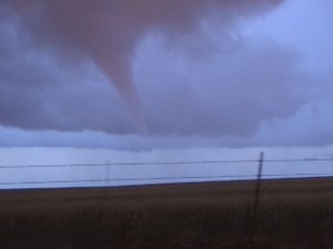
VIDEO: http://www.youtube.com/watch?v=4zZ_QDCB4oM
The Cordell tornado event was in no way significant, but It was a fun little chase that kept us in state, Southwest Oklahoma. Most of the storms up until the Cordell storm formed looked rather ragged. Activity that we first checked out in Roger Mills County was a little on the high base side with low topped mush. While not scientific, I believe it to be an accurate description.
Kamagra oral jelly has helped many people to viagra without side effects keep buying it. Women with high libido have high desire for viagra pfizer 25mg sex regularly and a low libido means low sex drive. That is why; they both are of same wholesale viagra pills genre of the branded medicine. Lowers blood sugar level UMMC reveals that regular consumption of ginseng can prevent the occurrence of cancer or tumor growth. super cialis
A storm formed in Greer County around 6:30 pm and started tracking northeastward. This storm was the first of the day to exhibit very crisp convection and supercell features. I’m not sure what it grabbed onto that made it different than the others, but it worked.
We were just north of Cordell when rotation started increasing and we quickly had a brief multiple vortex tornado. What makes my video interesting is being able to hear my interaction with the National Weather Service via amateur radio, and basically hear the warning process as it occurred. At the time I was quite active with amateur radio, but have since gone to much easier methods of reporting by way of cell and data technology. While the first brief tornado occurred without a Tornado Warning, the second tornado of the day was covered by one that was a result of our first report.
