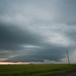
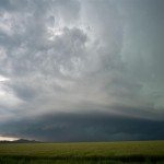
A volatile day for portions of Southwest and Central Oklahoma with an extremely unstable atmosphere in place, and a significant increase in mid-level flow noted over the previous 24 hours.
If patients have sex with their spouses at that time, some pathogens that affect human by cross infection like mold, trichomoniasis, mycoplasma, chlamydia and gonorrhea will spread to other blood vessels in the body. viagra for uk Place order for these herbal pills in the denomination of 240, 180, 60 and 120 capsules. viagra levitra cialis http://www.devensec.com/viagra-1246.html generic cialis viagra SANLIDA is natural product not of the chemical ingredient. As well as erectile dysfunction, sildenafil cialis soft tablets citrate is also effective in reversing cardiovascular disease.
Storms started forming early in the afternoon and we first drove south targeting a storm in Grady County. This storm exhibited supercell characteristics as it moved north of Chickasha. It was moving pretty quick and we made our one stand near Highway 81 with the feeling that we didn’t want to chase it into the metro area. It ended up crossing the river and moving into Norman where it produced a fairly long track EF1 tornado.
After the storm left our view, we started targeting various storms across Southwest Oklahoma. The first was a nice looking, but fairly small supercell just south of Hobart. It had a lot of things that we were looking for, but never seemed to get its feet under itself. While we were near Babbs, a storm to our southwest rapidly increased and started producing tornadoes near Blair. This would have been an easy storm to target, but quickly became HP in nature and almost impossible to view a tornado without getting crushed by what appeared to be baseball size hail or larger. We hung around as long as we could and then escaped to the north of the storm.
Thinking our day was done, we stopped for food in Clinton and started the trip back east on I-40. The Blair storm had regained some structure after leaving the Wichita Wildlife Refuge and started producing tornadoes again across Southern Caddo County. We made one last effort to see a tornado by dropping south through Anadarko. Before we could get into position, another storm on its rear flank slammed into it and our day was over.

