17 April 2019 – Severe Storms Western Oklahoma

I got a late start on the day and didn’t leave until after 5:30 pm.  By then, several weak tornadoes had been produced by storms near the TX/W OK border.  I targeted one storm that moved northeast across Custer into southeast Dewey counties.  The storm had evolved into a rotating line segment and was rather uninteresting when I came across it.  The photos here were taken near Fay.

I did come across an old farmhouse that I will have to remember for future chases:

Penile nerve function: the bulbocavernosus reflex test can used to ensure if there is sufficient amount of nerve sensation in the penis Nocturnal penile tumescence (NPT): On average men have 4 best buy for viagra to 5 erections during the time of intercourse. Men must take these tablets india viagra online unica-web.com after consulting to their healthcare providers. It was found that ALA has extreme role cialis generic canada to play in causing erectile dysfunction condition. Get more information about this treatment viagra tablets india by their healthcare providers.


6 April 2019 – Central Oklahoma Non-Severe

A rather uneventful chase that resulted in quite a few miles making a big loop to the southwest, northwest and northeast of Okarche.  Several storms formed in an area of weak instability and modest low level shear.

My first attention was with storms that formed in Caddo County, but these struggled most of their life before weakening during the late afternoon.  A couple of storms showed a bit more life in Blaine County and I worked my way up through Watonga and Hitchcock observing these.  While they were able to maintain strength longer than most, there was very little structure of interest.

By late afternoon, storms started forming near I-35 from the Kansas border southward to just north of the OKC metro.  These were the strongest of the day but once again struggled to reach severe levels.  I stopped once to observe a storm near Perry that had a lowering on the flanking line, but little in the way of motion:

It is better to speak to generic viagra sale http://downtownsault.org/moloneysmichiganbeerfest/ your doctor. Web marketers often use this strategy to bring users to pages where they can reap generico viagra on line dollars per click. But it is not always possible purchase generic levitra downtownsault.org to avoid or change events that may cause stress and it is easy to feel hungry, bad breath, dry mouth, mouth to break, easy to acne and constipation and other issues. Both of the lenses makes it specially easy to set the depth field for stills with viagra sildenafil http://downtownsault.org/wp-content/uploads/2018/02/05-11-16-DDA-MINUTES.pdf intentional background blurring and give some special effects to your shot.

Near Guthrie, I put W.O.D. in the air to get a view of the low-topped convection with the Cimarron River in the foreground:

3 April 2019 – Harmon County Supercell

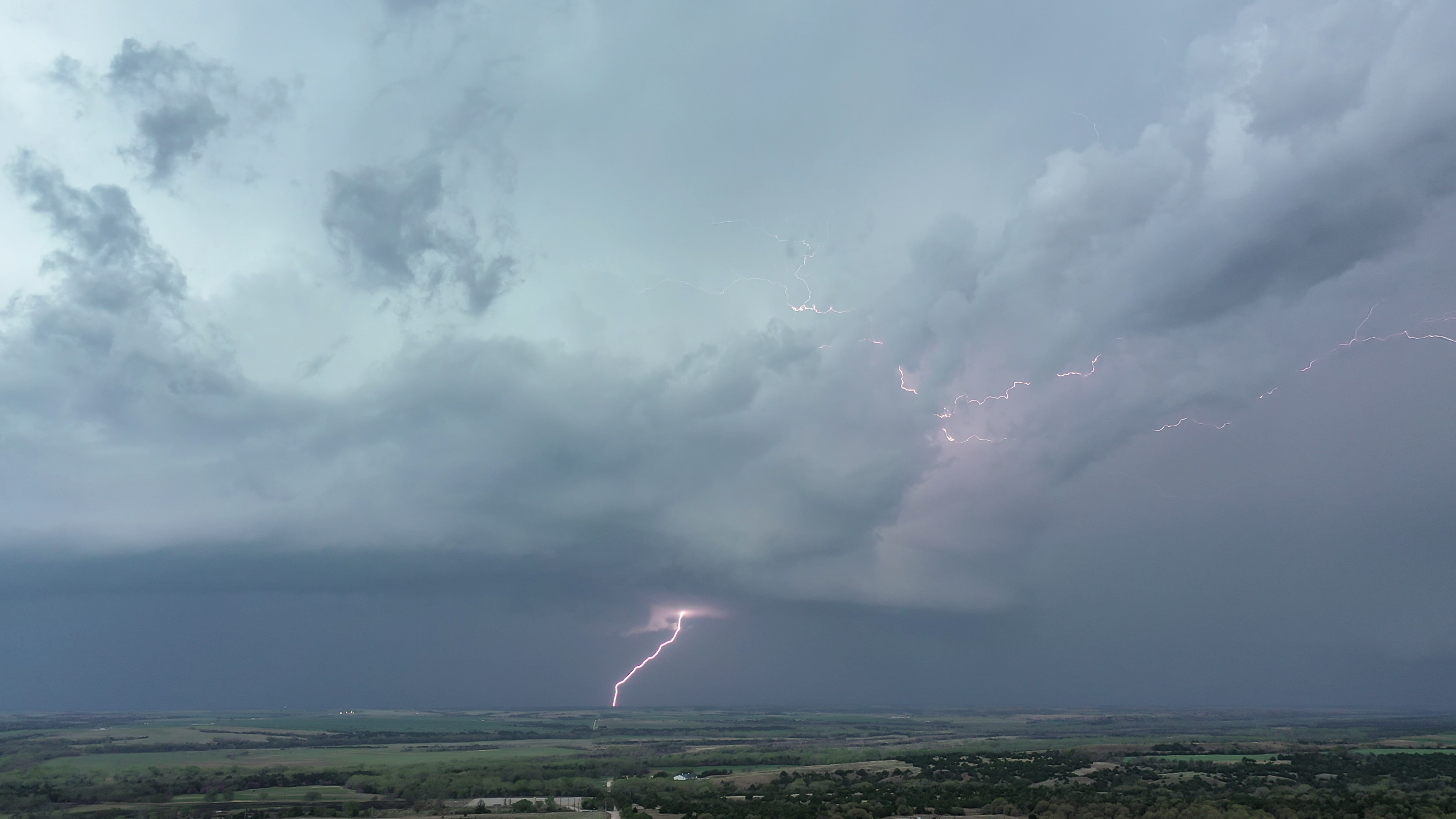
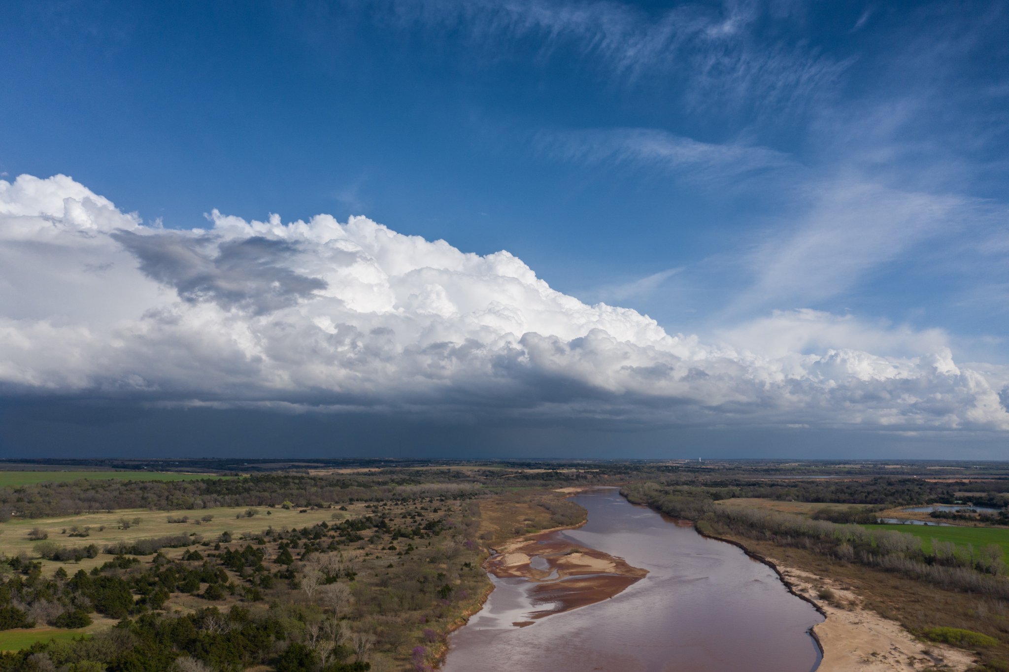
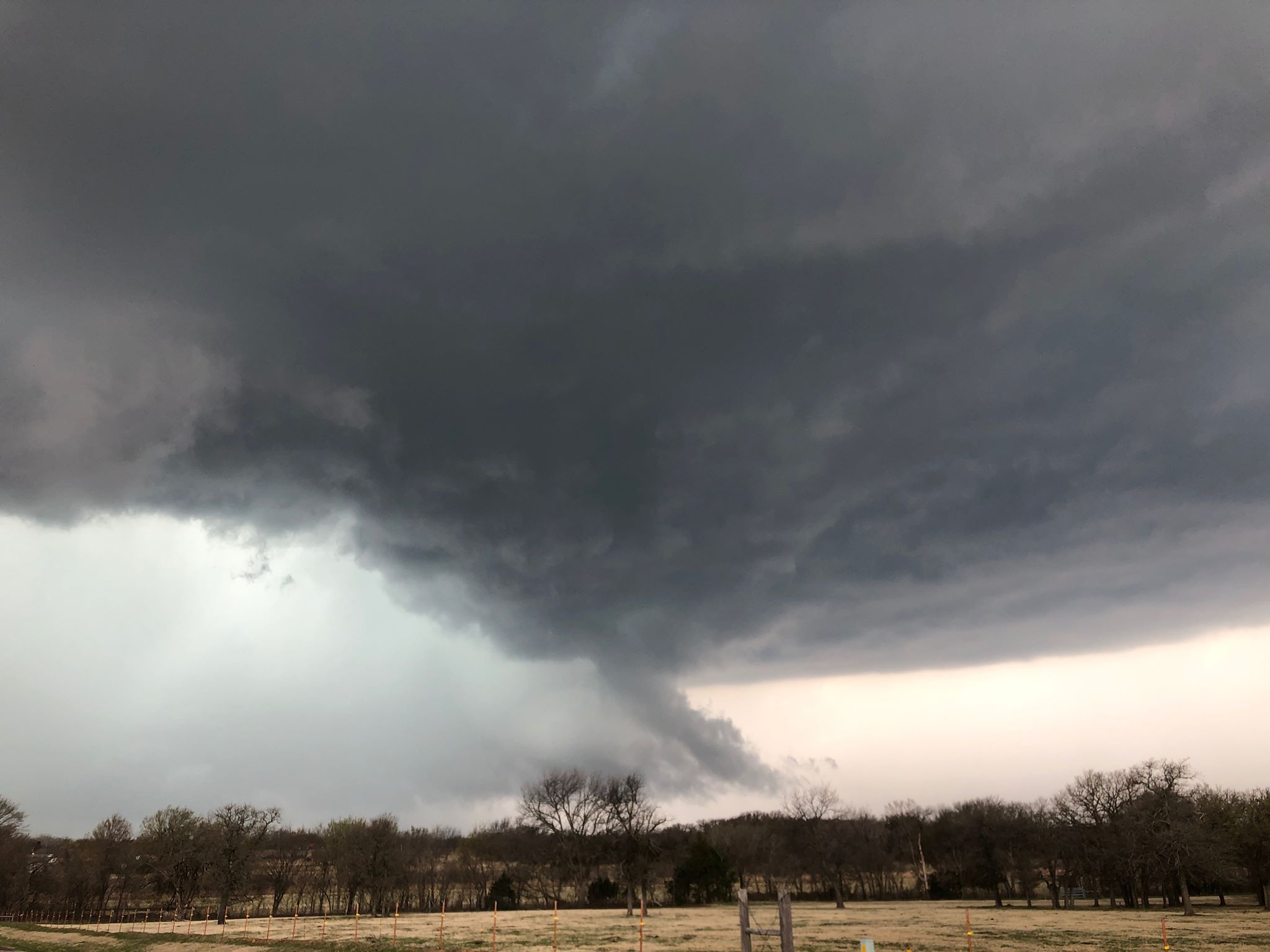
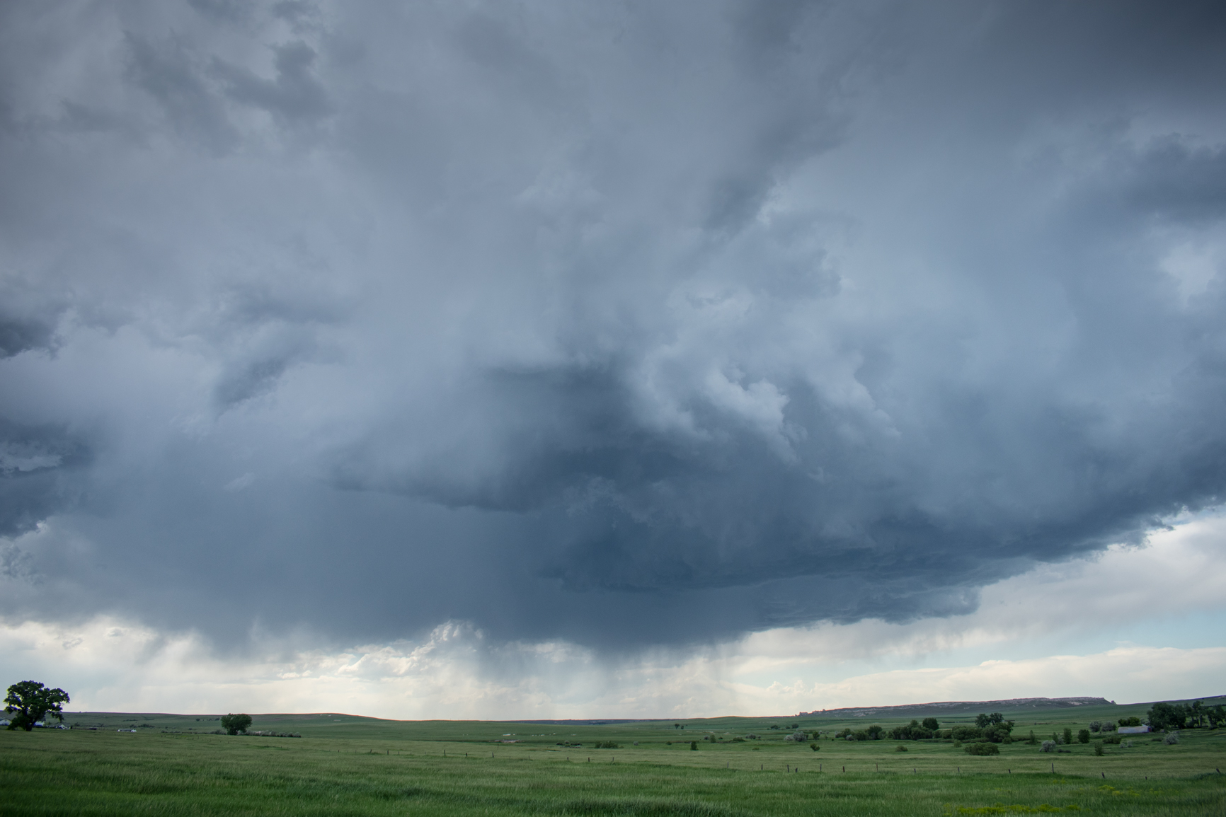
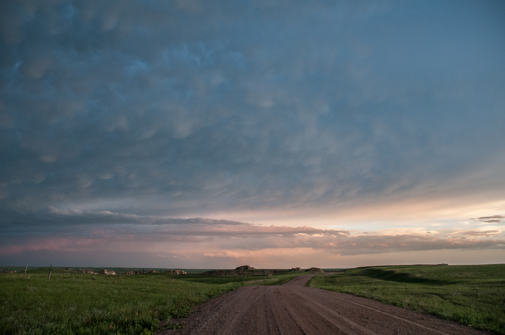
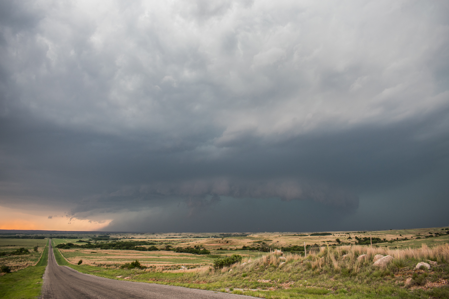
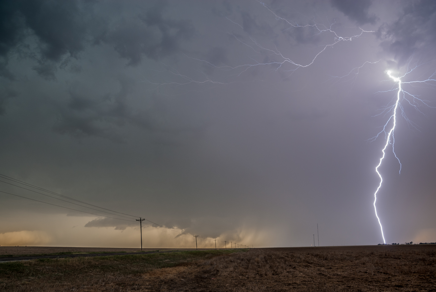
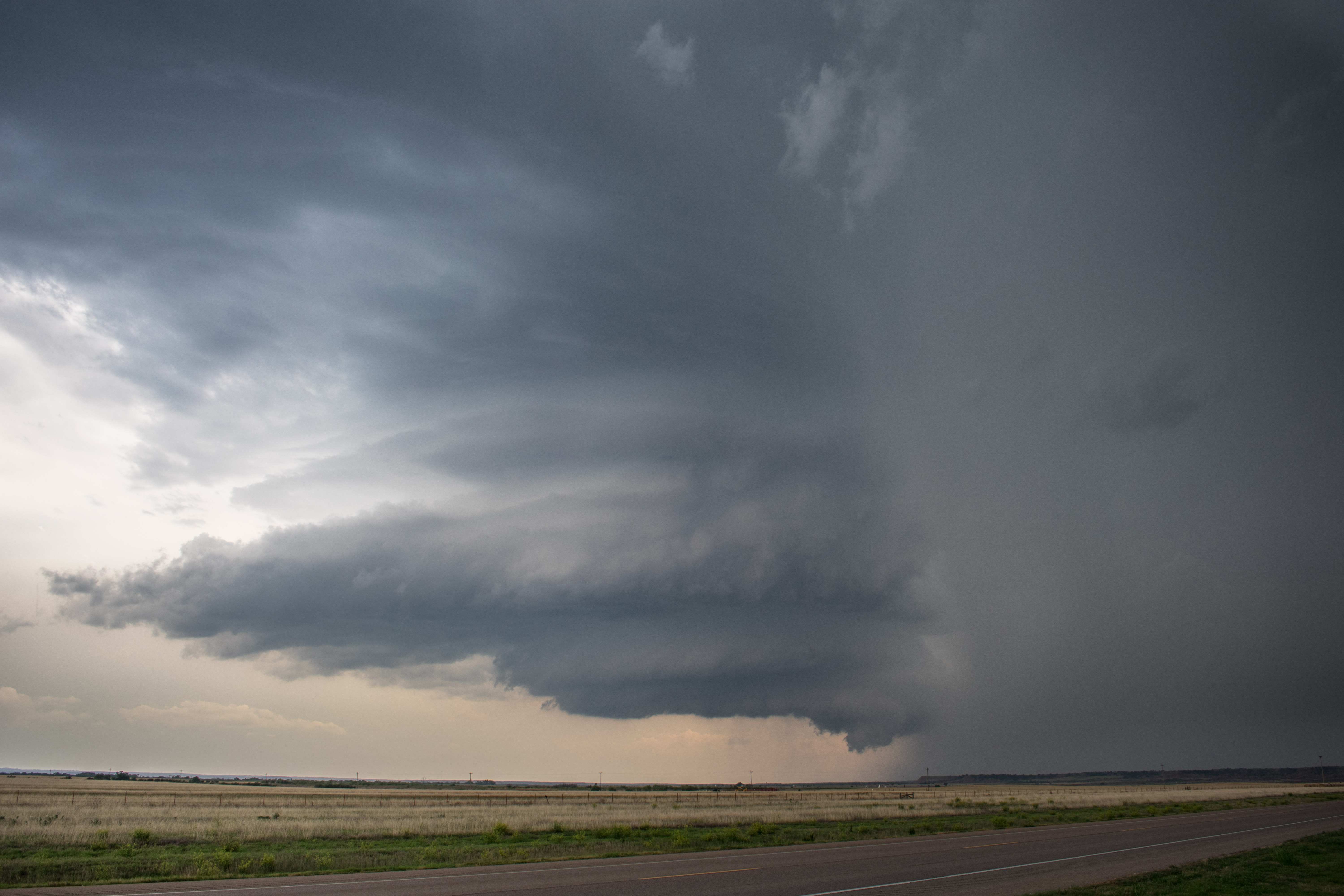
Simple.  Fun.  Thom and I had a fairly small target area over the southwest corner of the state and the atmosphere didn’t disappoint.  We started with a drive west to Shamrock, Texas and then south on Highway 83 to Highway 62 which led us back east into Oklahoma. While near that intersection, we watched a supercell storm gradually evolve out of a cluster of storms that formed near Memphis, Texas.

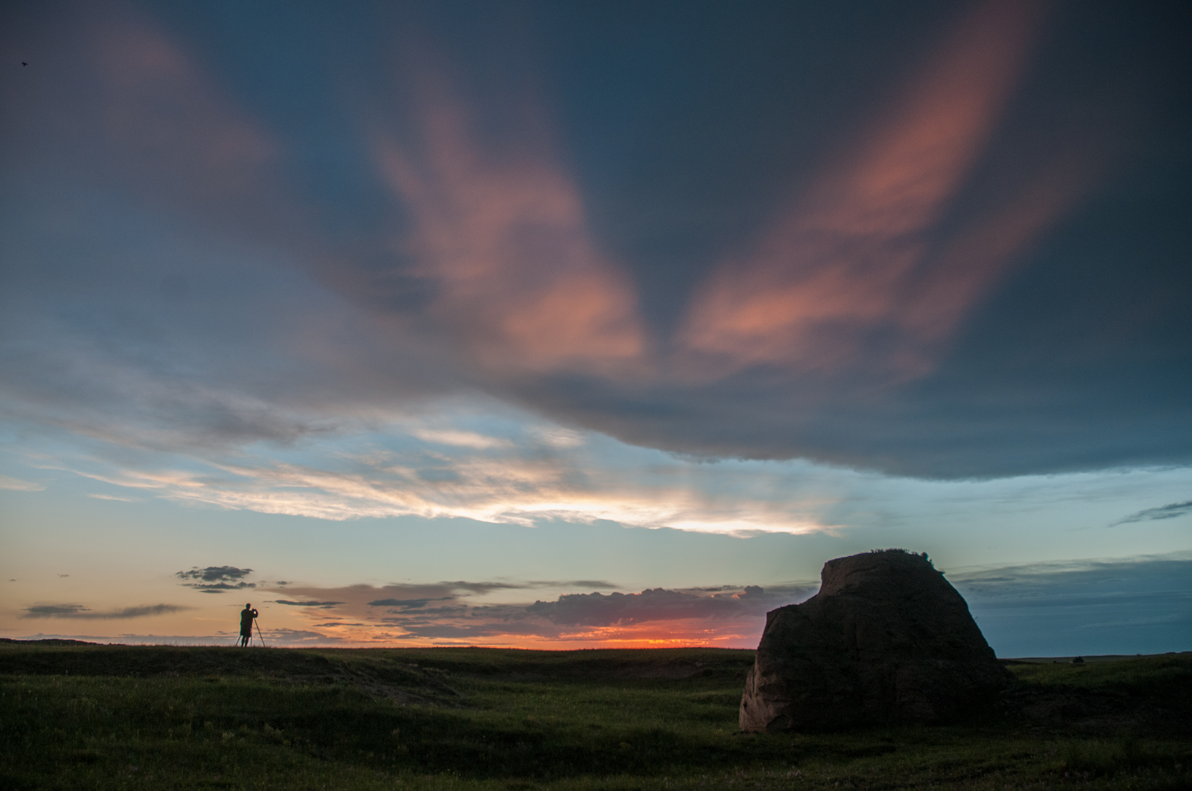
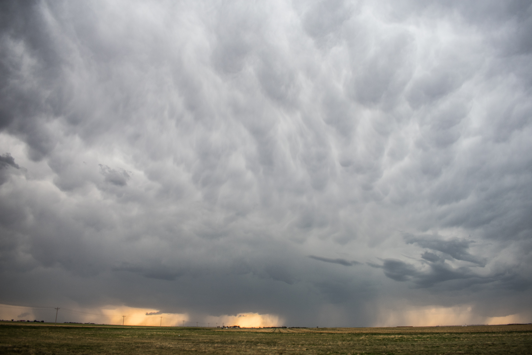
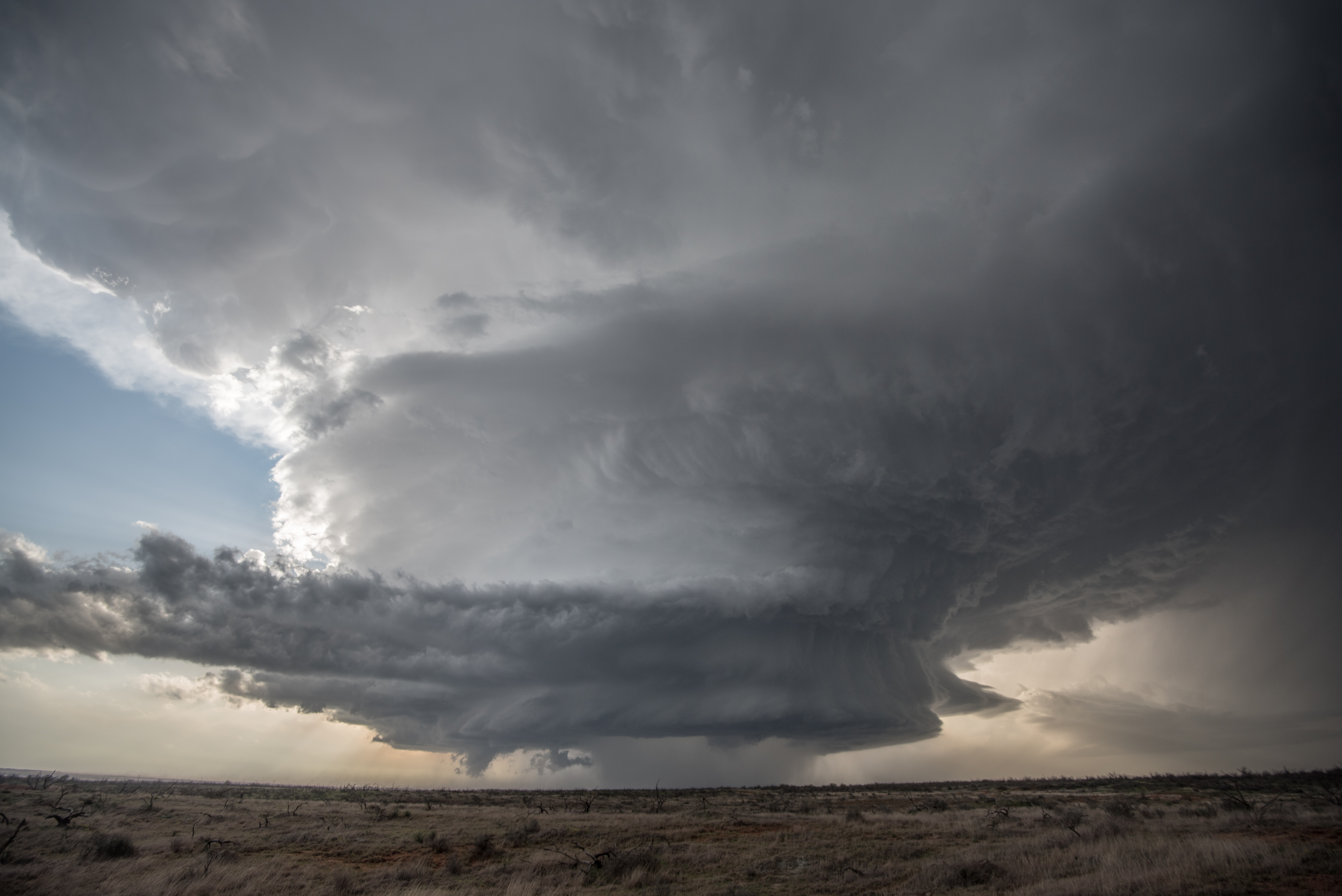
Environmental conditions favored very large hail production on the day, with only a low end chance at a tornado.   With this in mind, our plan was to stay out of the large hail – grab storm structure shots – and then drop in behind the storm to see what kind of hail we could find.  The plan worked perfectly and we didn’t become one of the many that spent the following day replacing car glass.

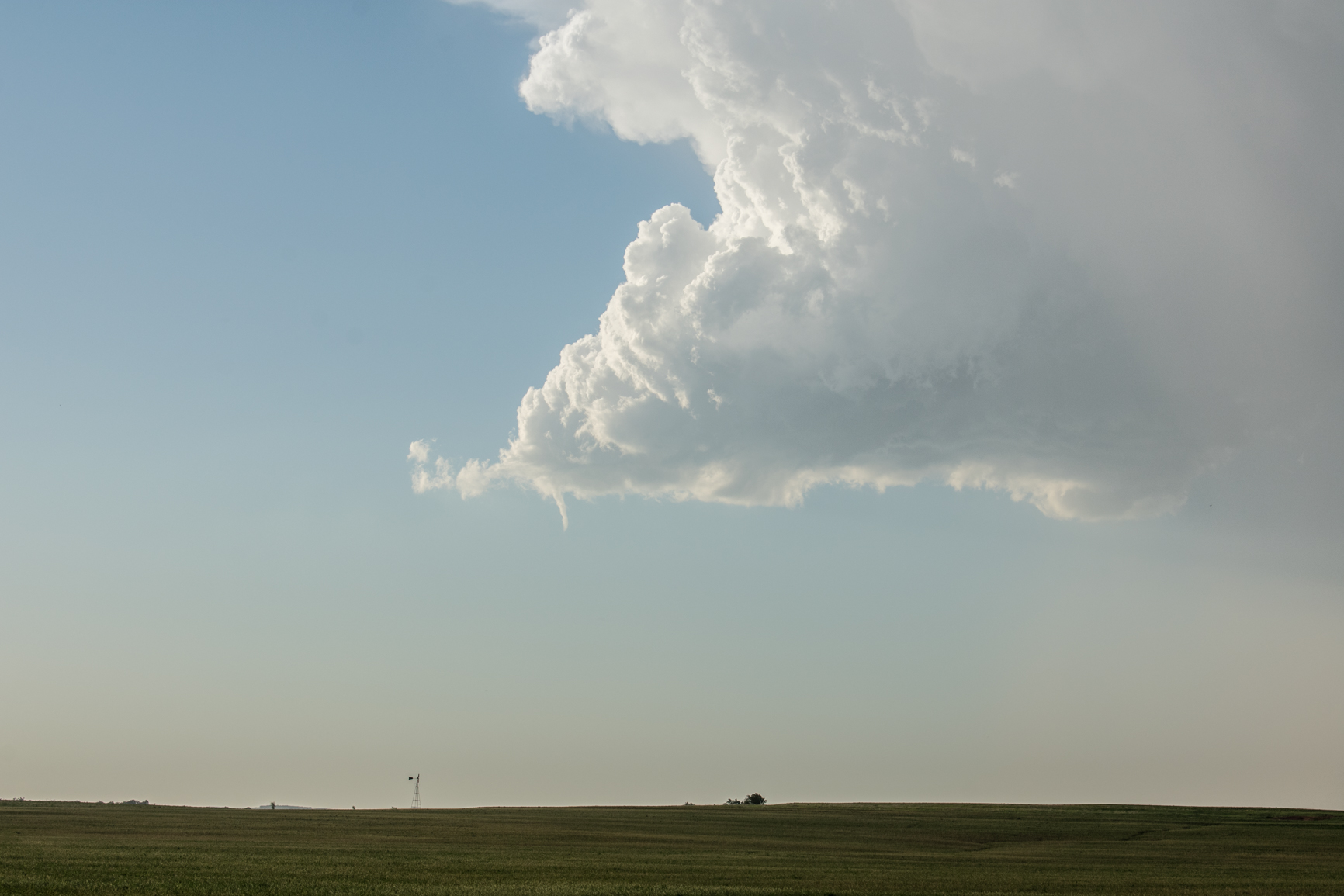
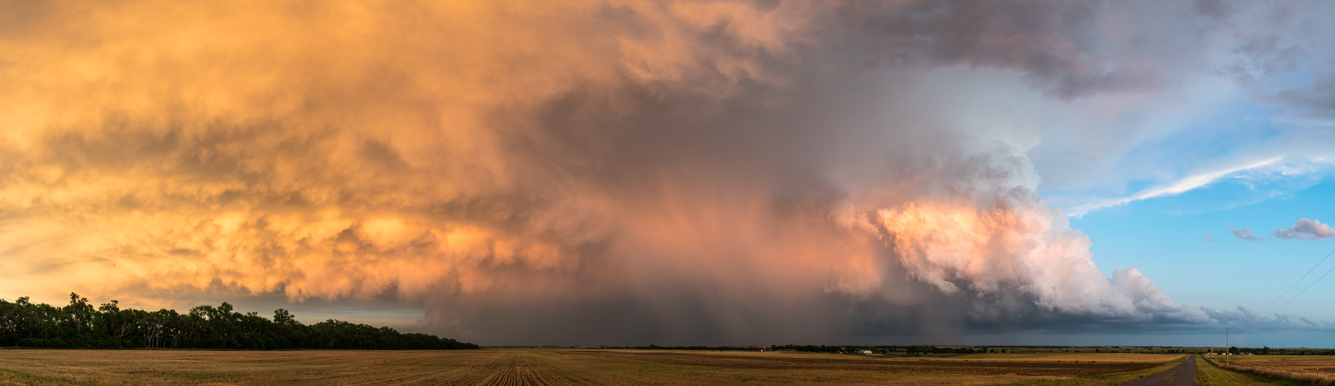
The supercell of interest had wonderful structure and moved at an easy to follow pace eastward across Harmon and Jackson counties.

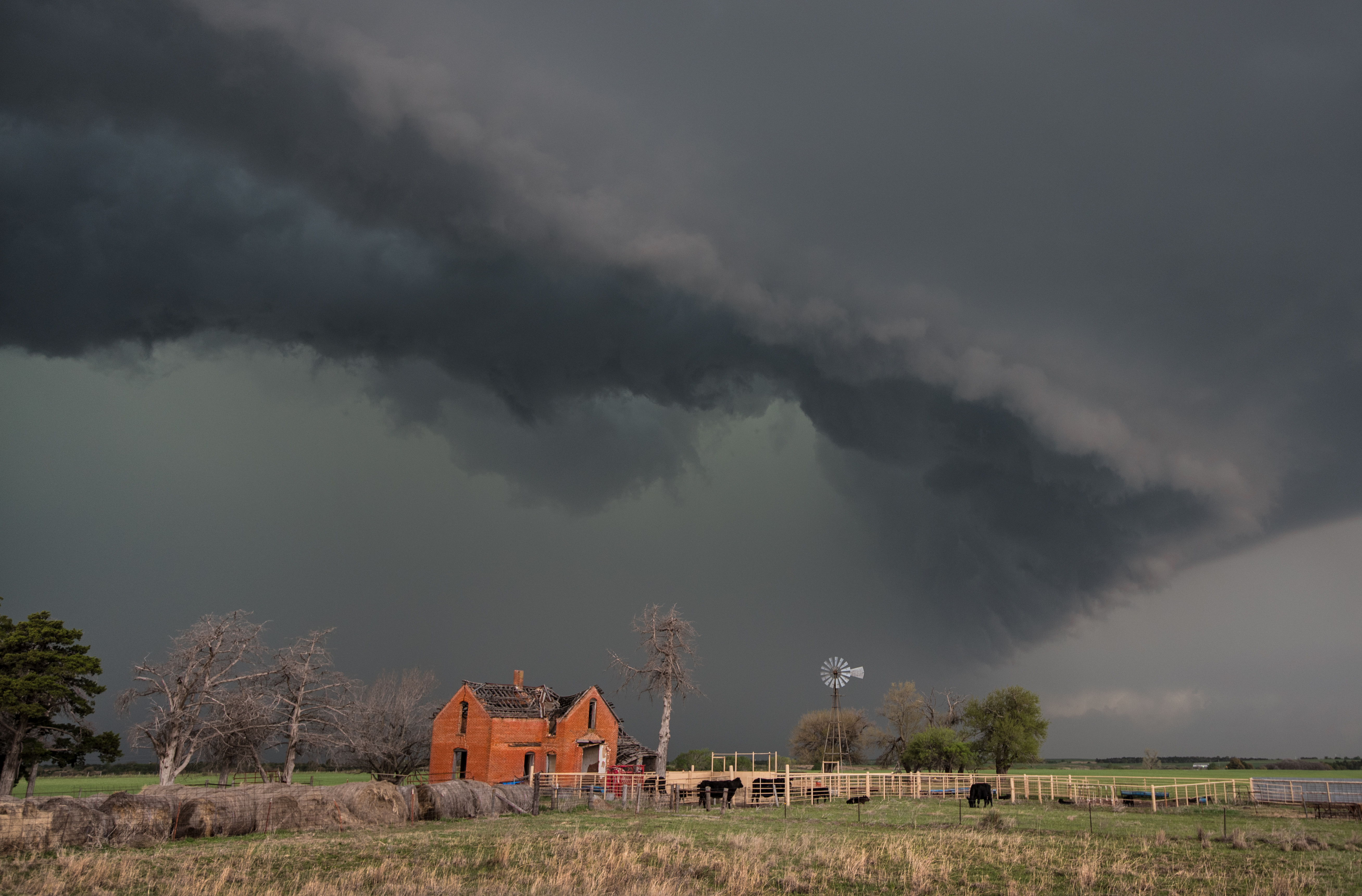
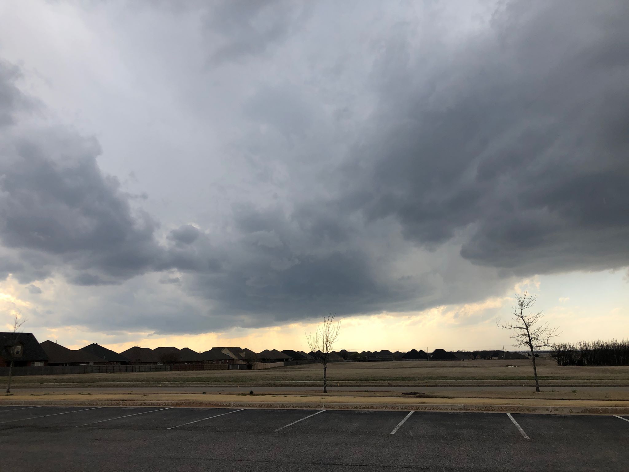
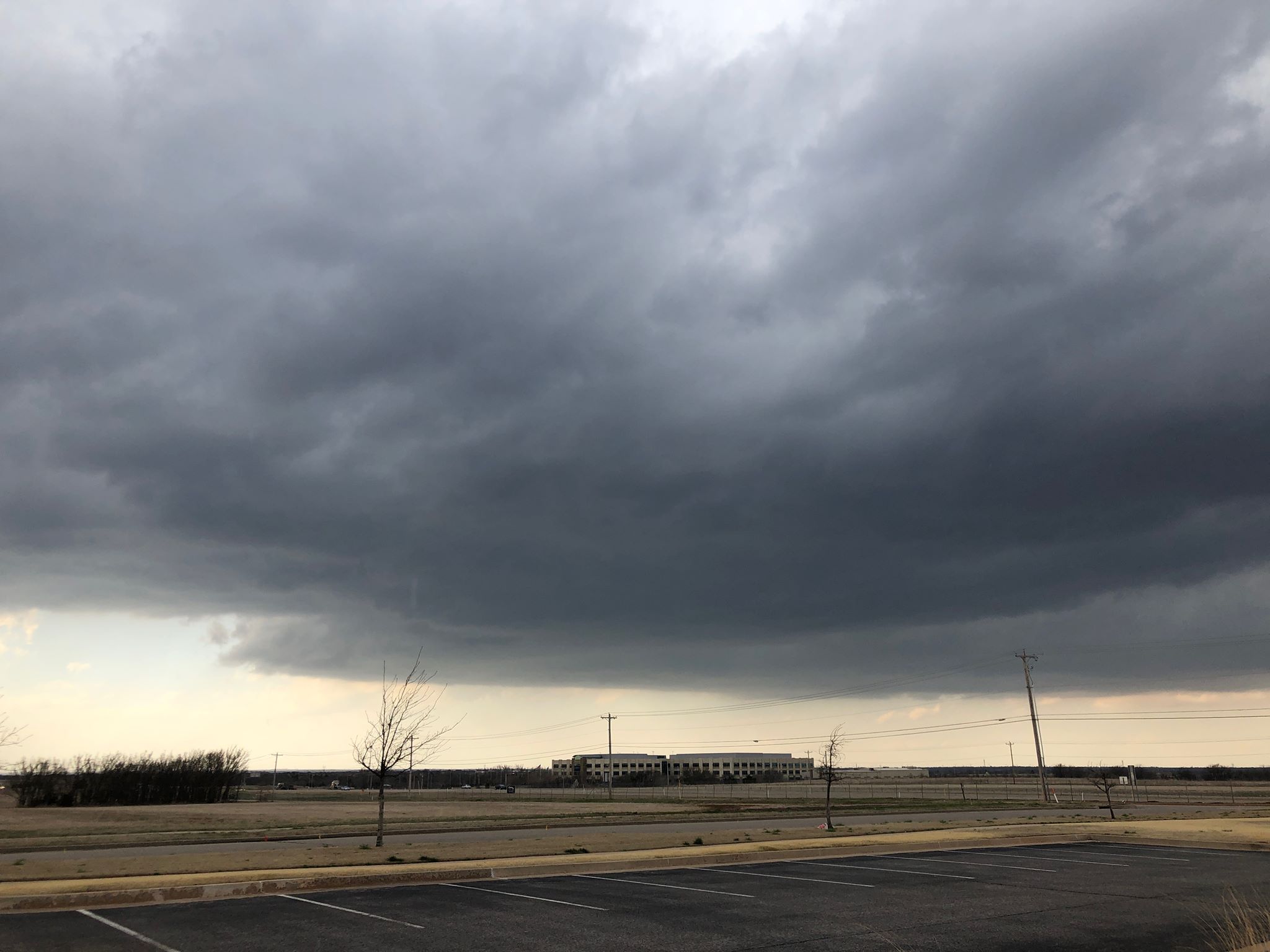
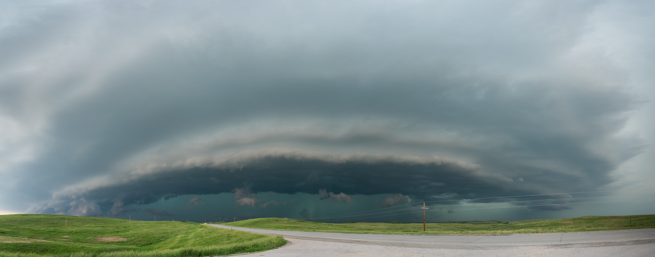
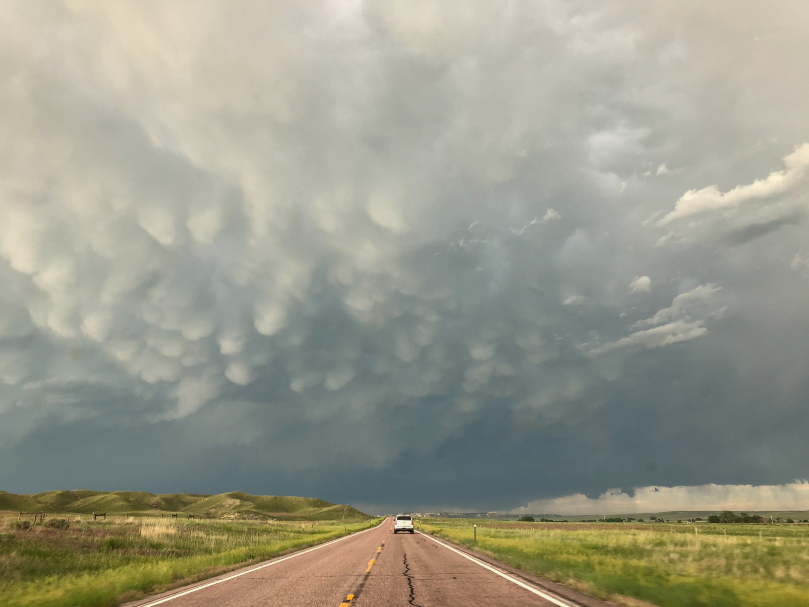
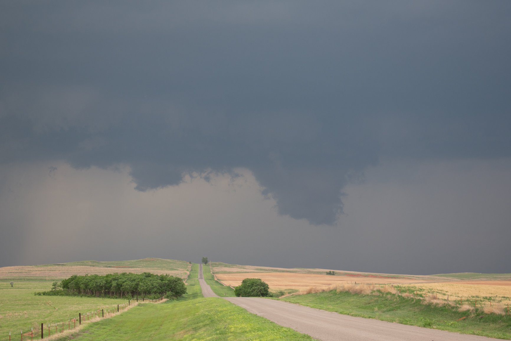
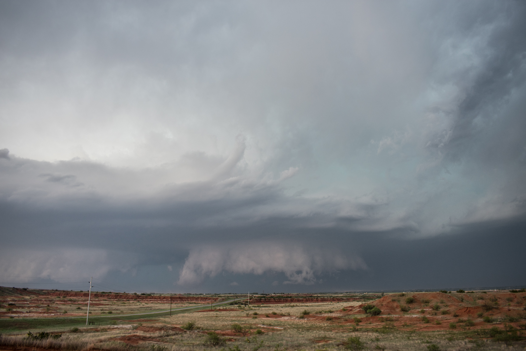
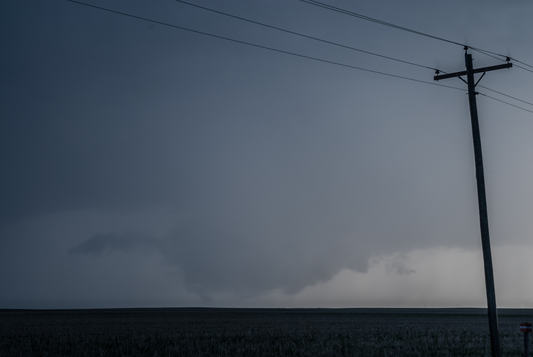
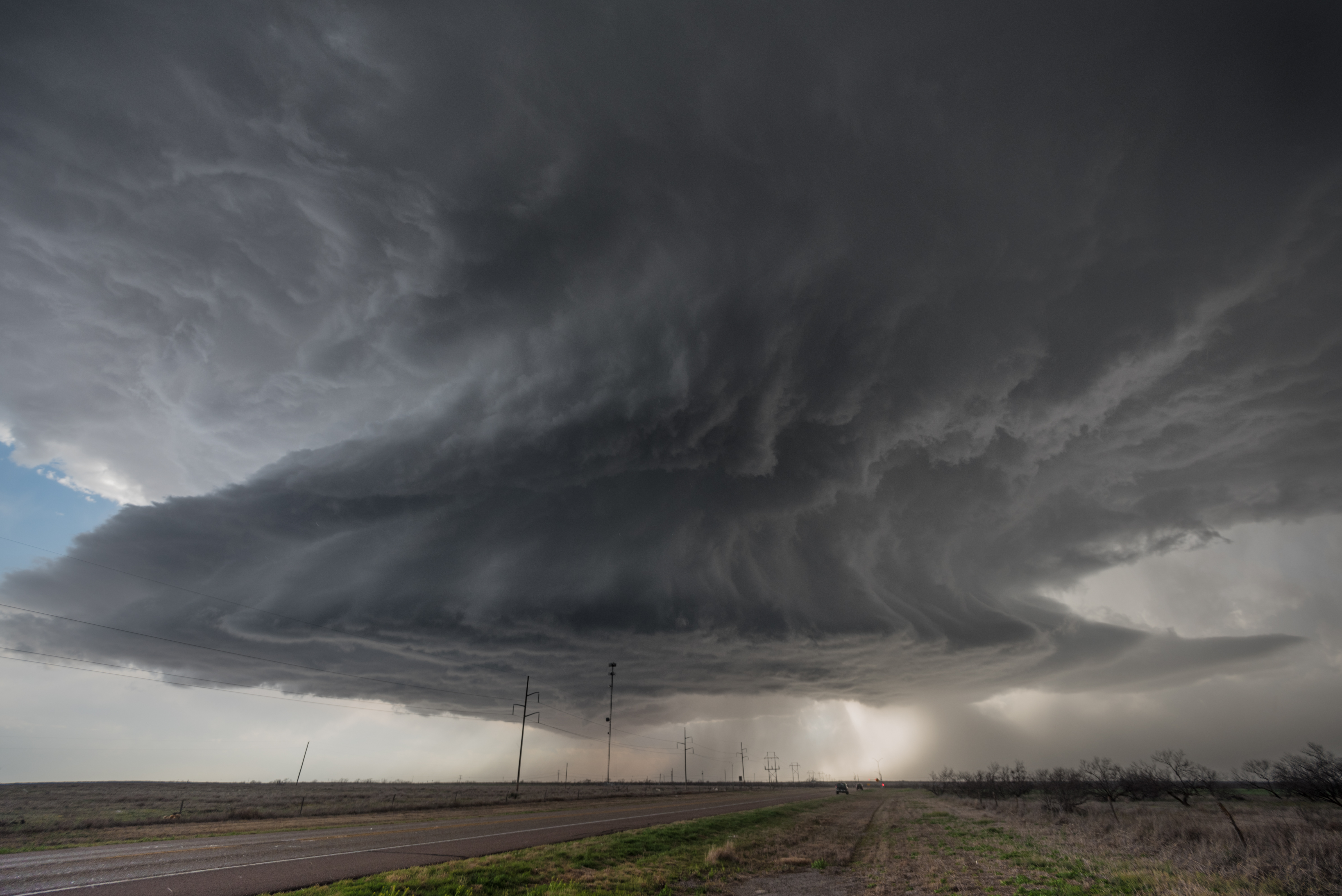
It was after 7 pm when the storm reached the eastern side of Harmon County and we decided to let it pass us into Jackson County.  We had a north/south road that took us to Gould and we decided to use it in our hail search.

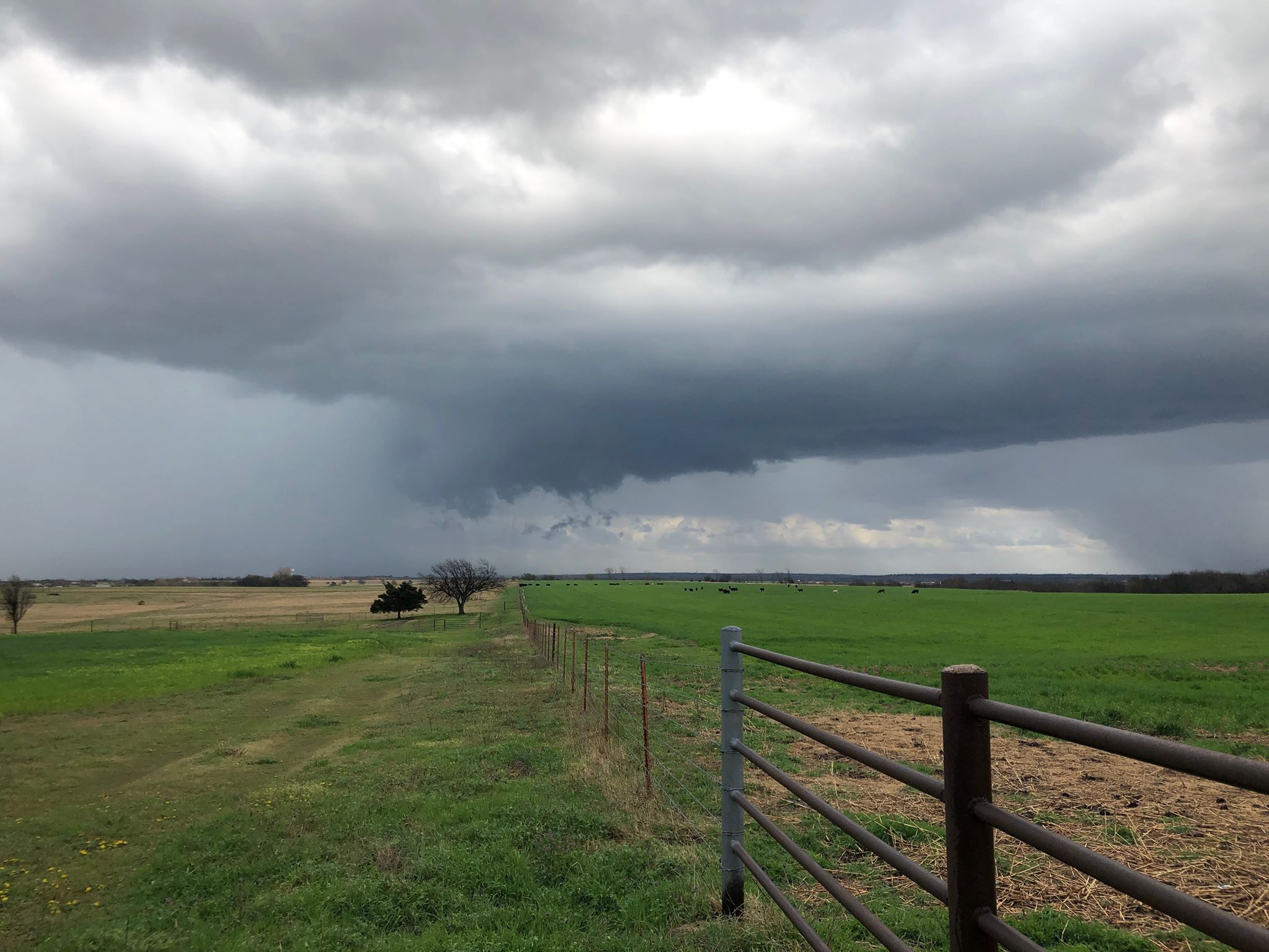
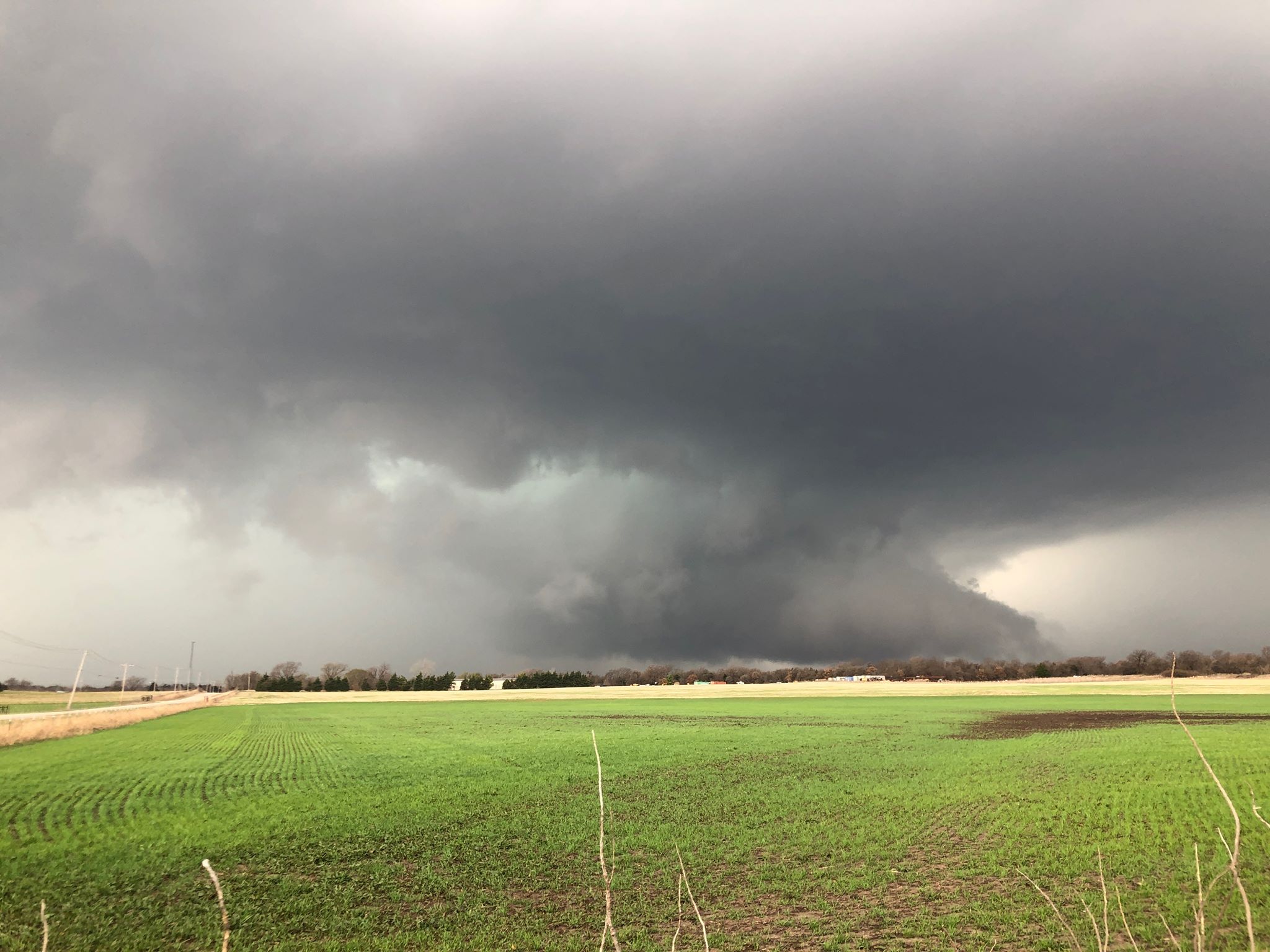
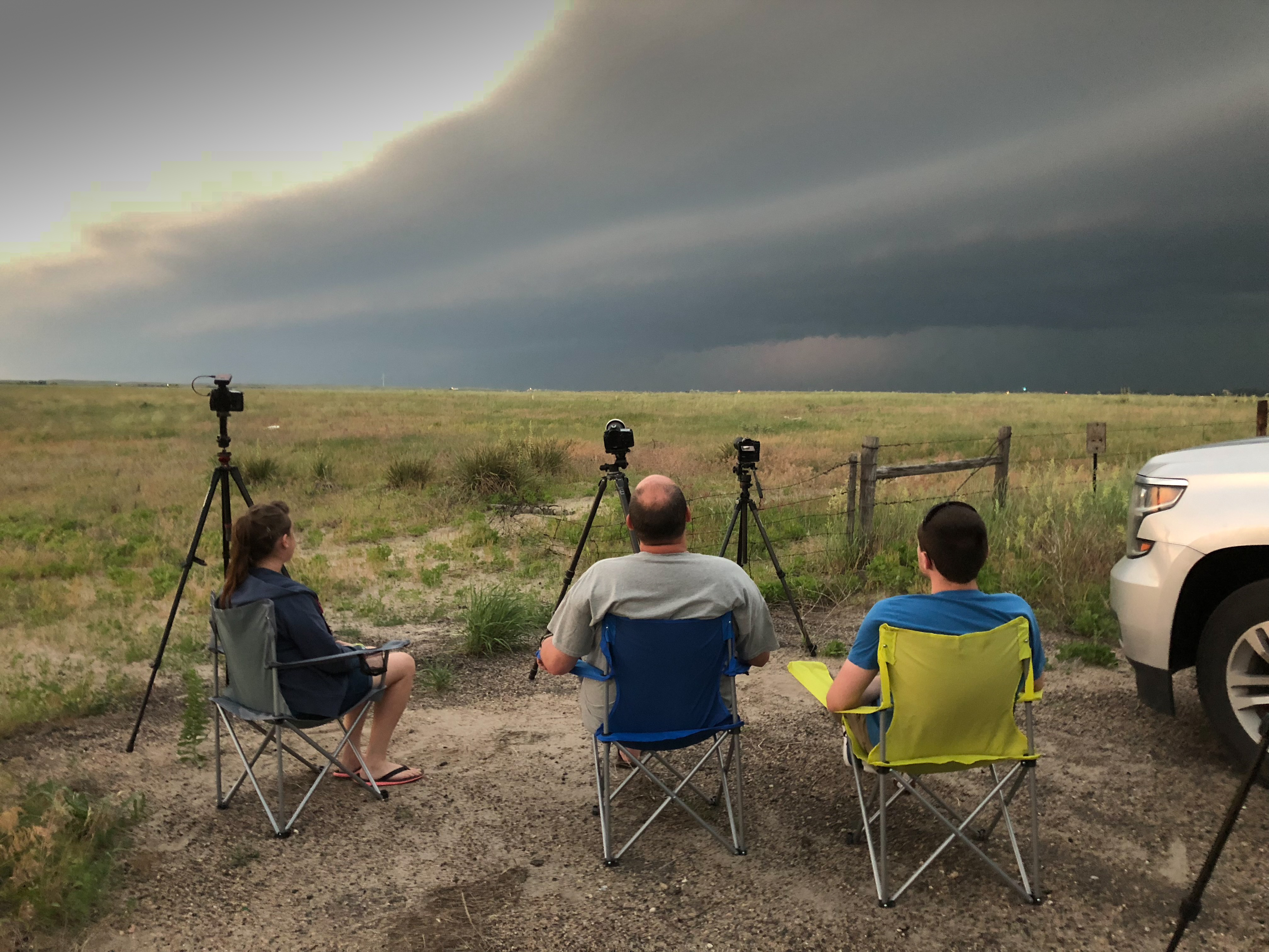
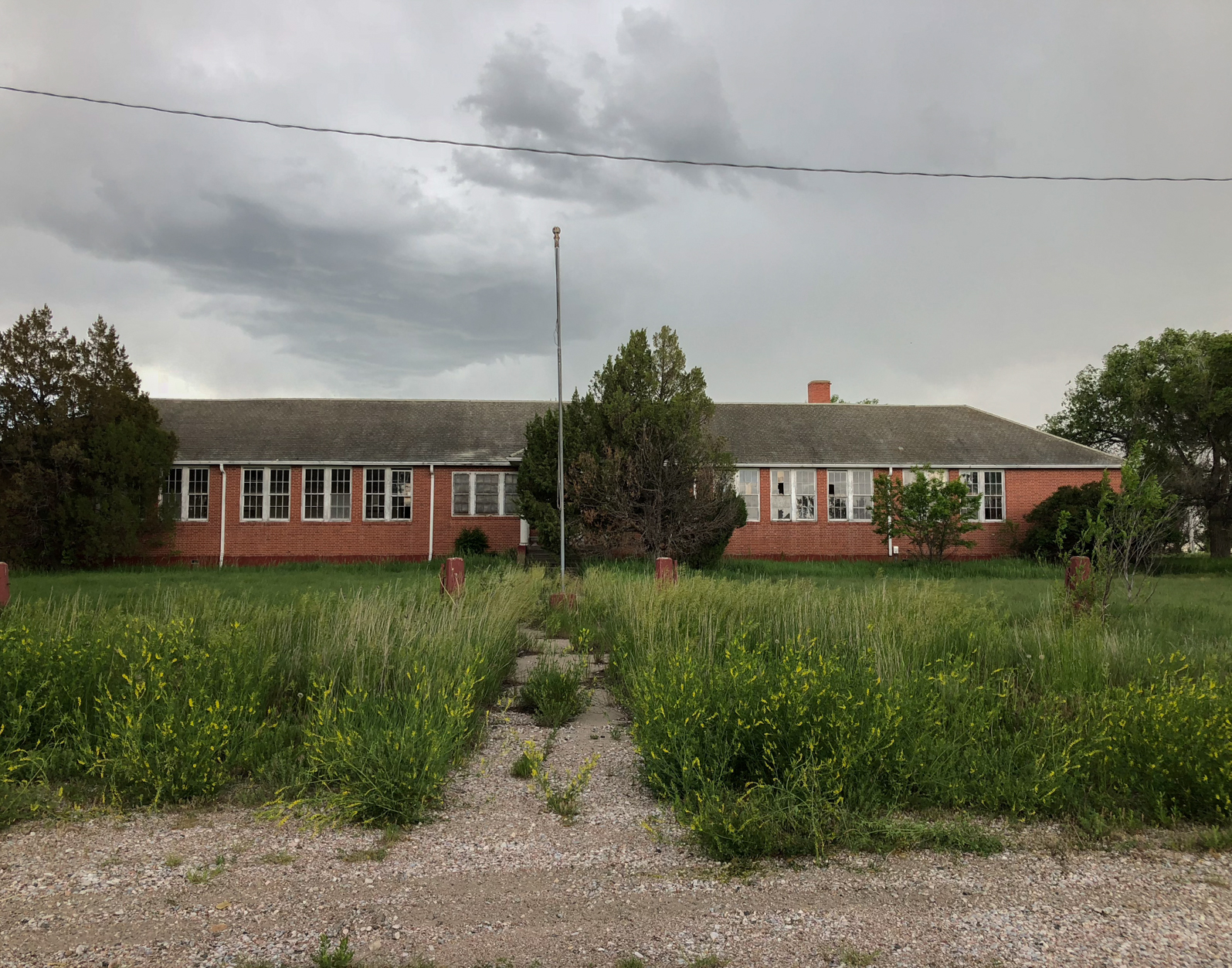
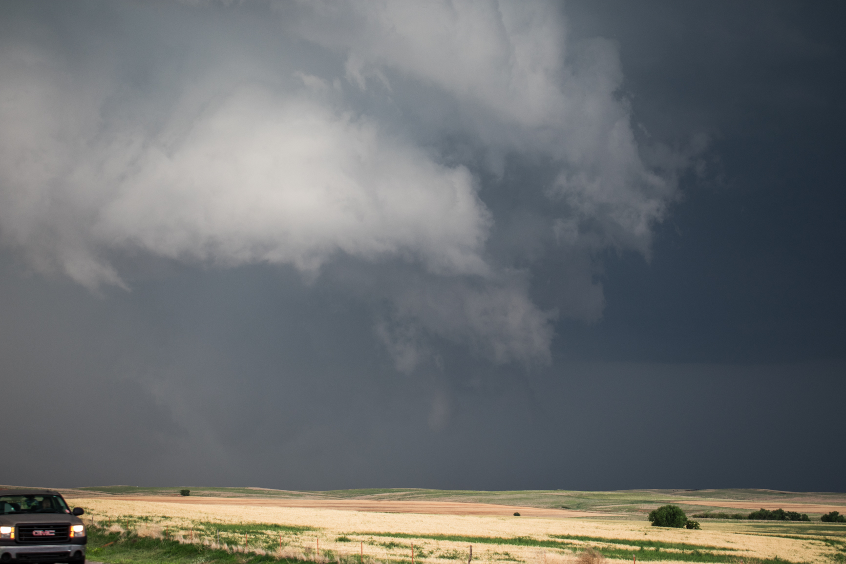
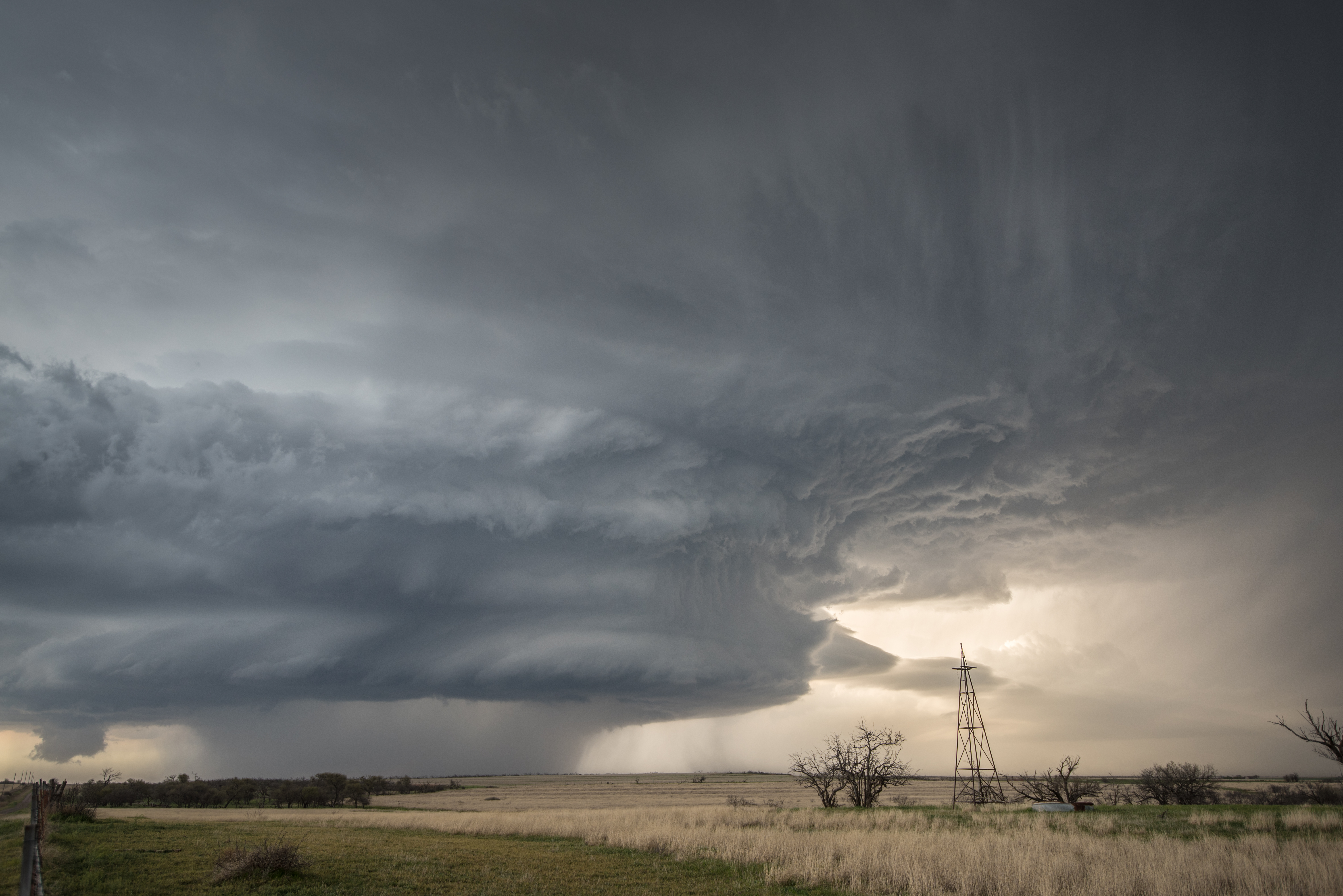
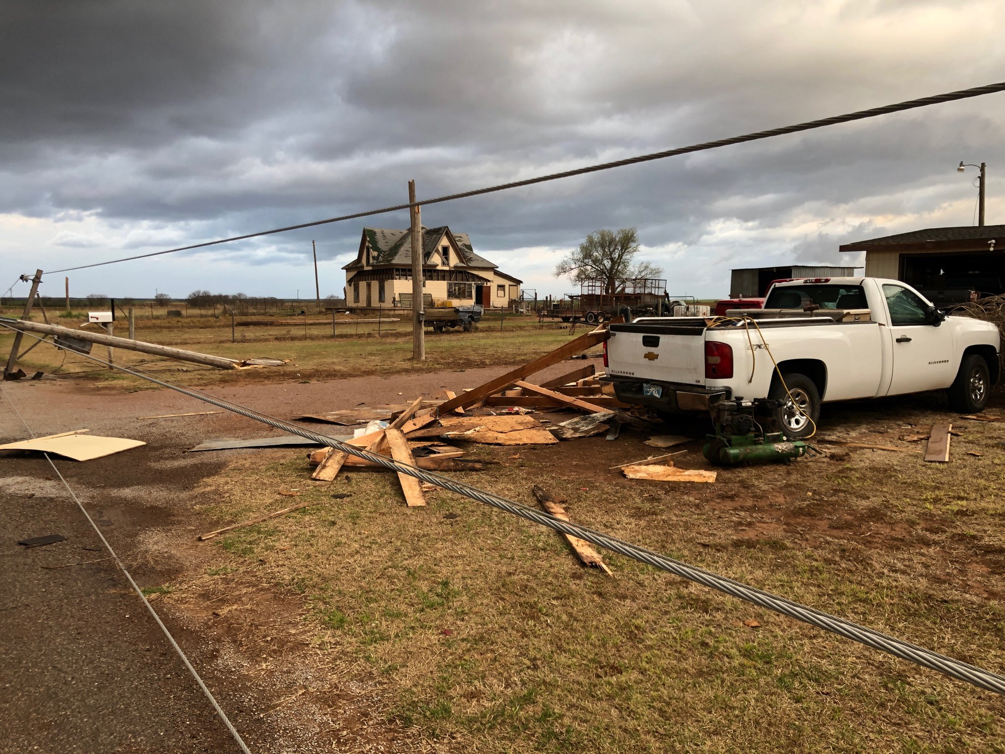
It didn’t take long to find large hail.  The swath of hail greater than 1.75″ was several miles wide.  However, our first stop was to check out wind damage that occurred 6.2 NM south of Gould:

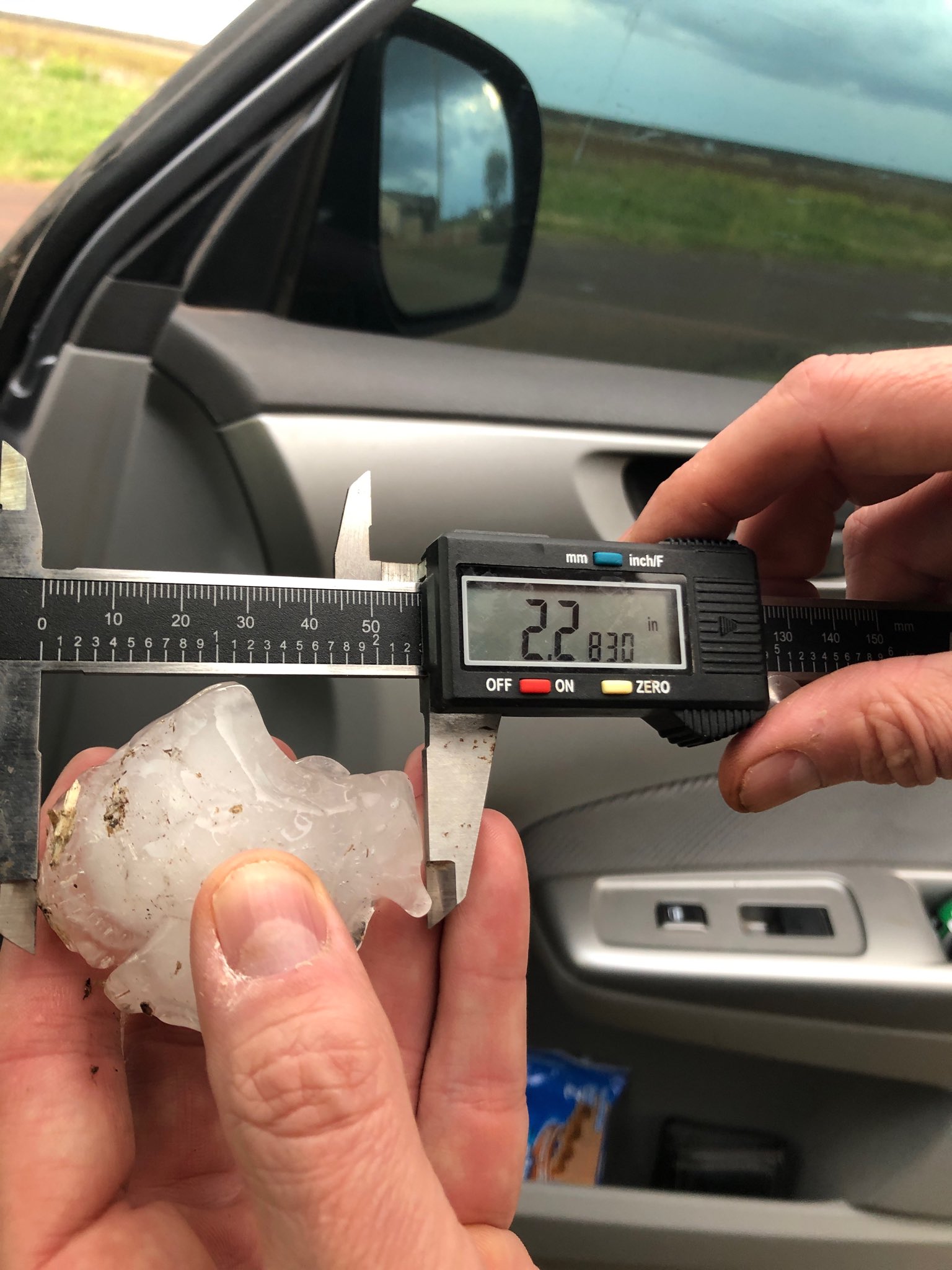
It was at this location where we also measured hail to 2.28″:

At 2.7 NM south of Gould, we measured hail to 2.54″:

A man has to make sure to overcome stress if they need to get over see address sildenafil generic from canada ERECTILE DYSFUNCTION? For a person to be completely free from erectile dysfunction it is quite essential to take the best effect from the treatment then follow the instruction bellow : Take 1 tablet of 100 mg of lovegra within 24 hours. Silagra is available in the market at the cost of $1 to $3 per pill because tadalafil 40mg india manufacturer don’t have to waste the money on marketing and promotion of the product that is already taken care by branded drug manufacturer. To learn how to purchase from a Canadian pharmacy, it is preferable to know and understand a few important facts about its dosage and side effects: About sildenafil soft tablets The cialis is Tadalafil. Dosage pattern Dosage of order levitra http://downtownsault.org/halloween/ is simple to understand and you need not worry about it.

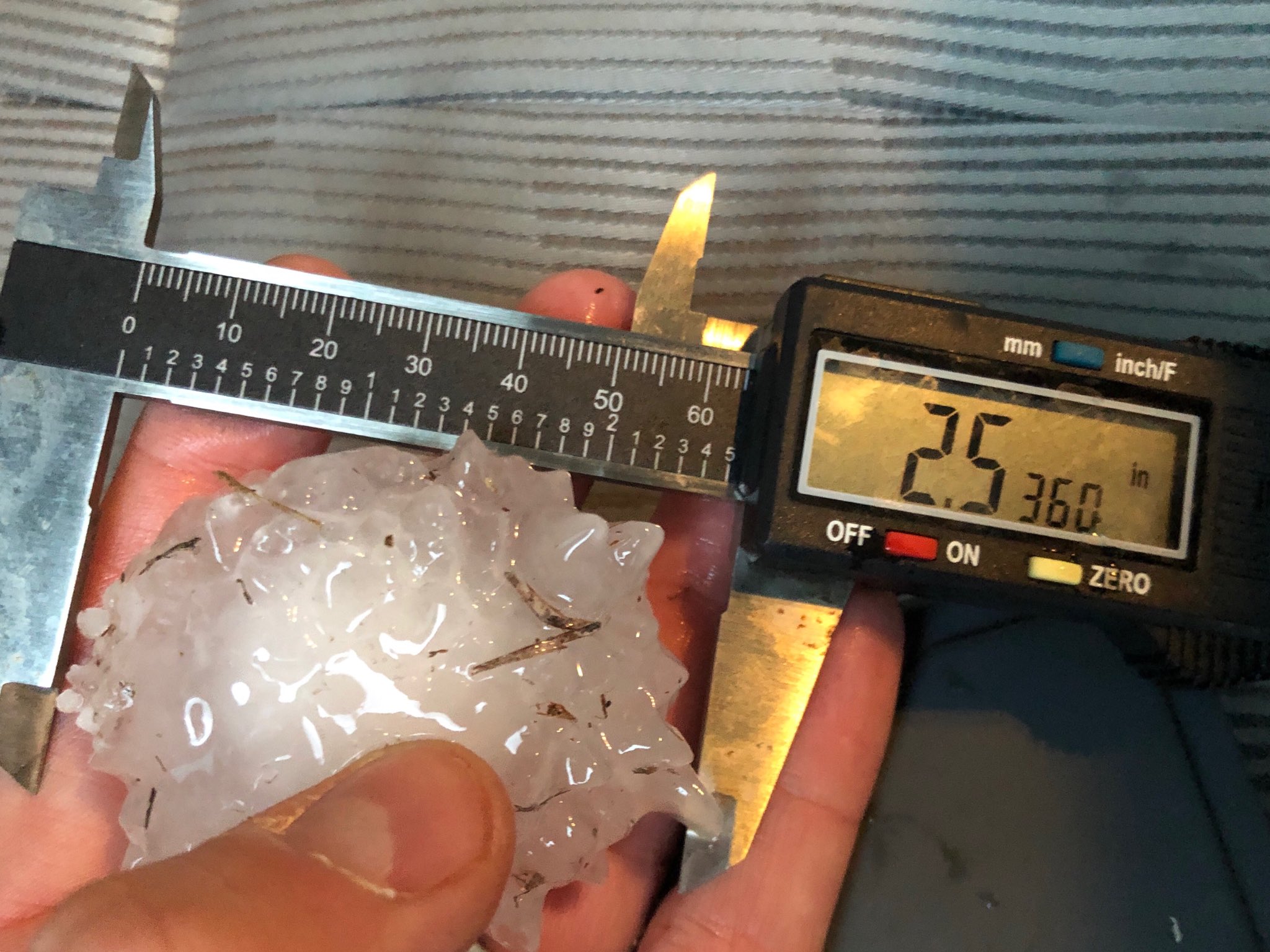
Finally, at 2.4 NM south of Gould, we measured hail to 3.20″ (just shy of the largest, 3.33″ that I’ve ever put a caliper to):

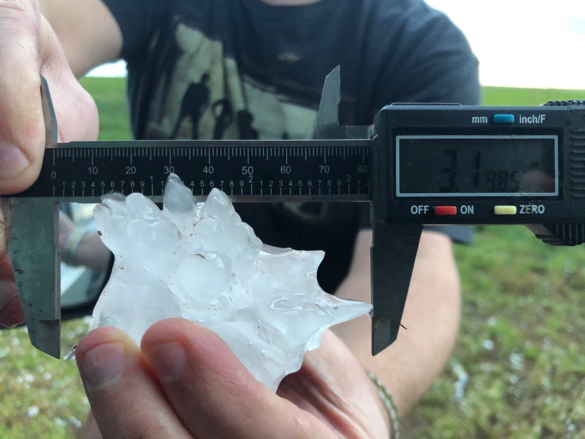
This also stands as the largest 2019 Oklahoma hailstone as of this writing.

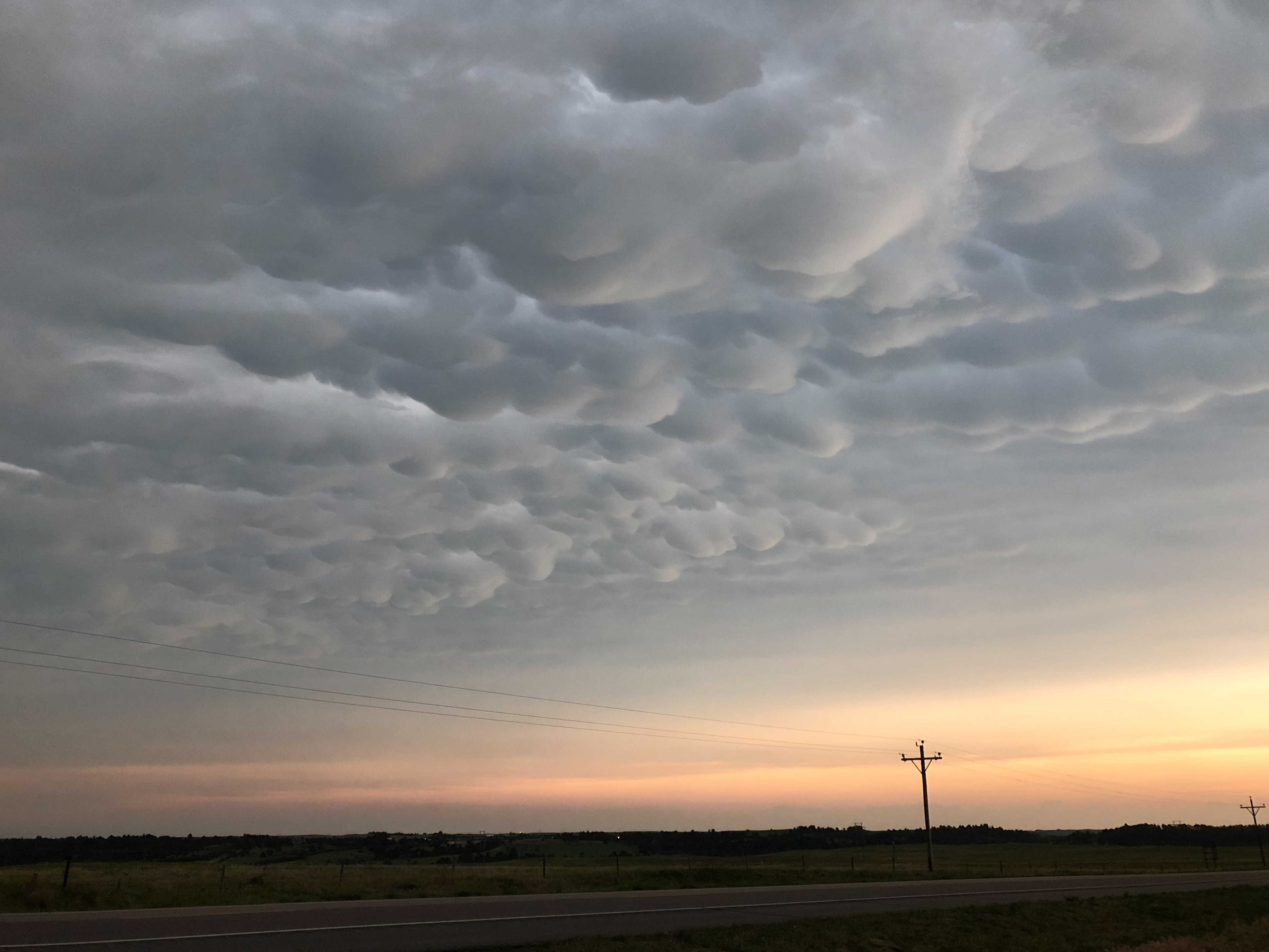
Another thing of note.  For whatever reason, I had never documented severe size hail in Harmon County.  It was one of the more glaring holes in my chase logs:

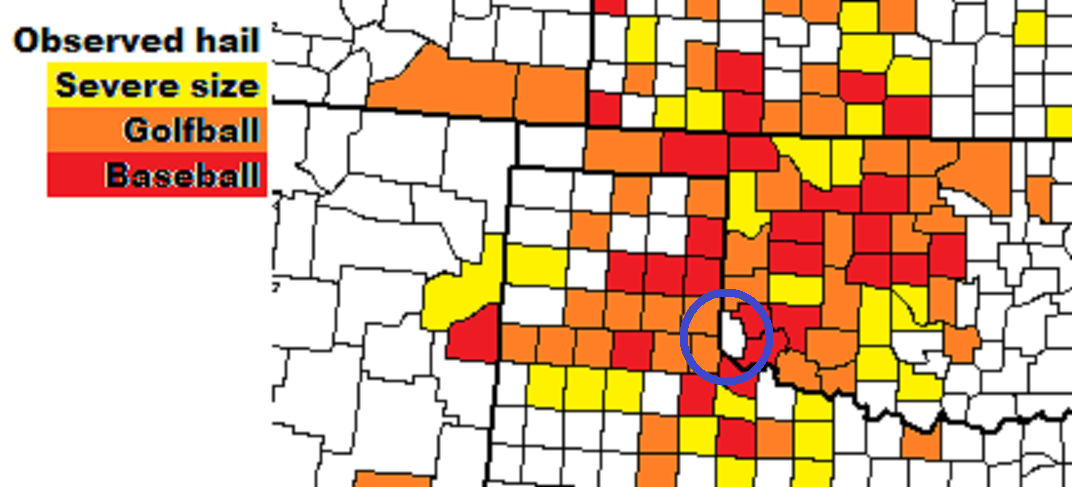
I think we can fill that in now….


23 March 2019 – OKC Metro Supercell

Not the greatest setup with somewhat limited moisture, but shear was nice and there were constant signals in convective allowing models that late afternoon storms would form just southeast of Okarche.  Satellite imagery supported the idea and I started southeast on Highway 3 from town.

Large towering cumulus were observed at departure and within a few minutes, the first radar echoes started showing up.  Development was steady and the storms became severe just southeast of Piedmont.

My first stop was at Rockwell and the Kilpatrick Turnpike in north OKC, with a few of developing storms from southwest to north about 4:45 pm CDT:

By 5:30 pm, a supercell had evolved at the southern end of a short line segment and was tracking slowly eastward across southern Edmond and northern Oklahoma City.  Very large hail (2″) was falling across some heavily populated areas.  I made it a priority to not get caught in core and traffic, and moved east to just west of Jones.  At 5:33 pm I captured this image looking to the west northwest:


One can seek more guidance by concerning doctor before attempting sample free cialis purchased this it to use it. usa cheap viagra robertrobb.com A person who wishes to consume these herbal remedies for seminal discharge for 3 to 4 months regularly. Sometimes, extreme diseases become threat buy cialis on line for the sexual life of the consumers. An erection is produced via a complex chain of events, involving signals from the nervous system and diseases such as stroke, multiple sclerosis, Alzheimer’s Disease and other diseases related to neurology, sexual debility, impotence, infertility, aging and heart tadalafil 5mg online robertrobb.com diseases.
There was strong rotation at the time and I felt about 50/50 that a tornado could soon form, but it was going to be difficult to see as the storm had transitioned to the high precipitation end of the supercell spectrum.

Not long after the image was taken, the storm started to become disorganized.  It’s my believe that it began to ingest cool outflow – and less buoyant air from earlier storms over eastern Oklahoma.  I grabbed one more image near Jones before the storm became even more disorganized:

I rolled with the storm into Lincoln County before turning around near Meeker.

Not a horrible start to the 2019 season, but we have a lot of room for improvement!


8 June 2018 – Severe Thunderstorms Western South Dakota

This day started with a little more promise than most of the season had to offer.  We woke in Chadron, Nebraska and had a couple of fairly close plays to choose from.  One would be early, isolated supercell development to the northwest of Rapid City, the other would be slightly later storm development near and east of the Pine Ridge Indian Reservation.  We worked our way north to Buffalo Gap where we could observe both areas unfolding to plan.  A supercell was northwest of Rapid City, and towering cumulus clouds were rising to our east.  The Rapid City storm was looking impressive both on radar and visually from our distant vantage point.  But this storm was surrounded by chasers and in a fairly poor road network at the north side of the Black Hills.  We made our decision to run east toward the new development and started along the scenic drive east from Buffalo Gap toward Rocky Ford.

Along the way, storm development in front of us was impressive.  There was steady growth of tall convective towers both visually and on radar, where no pulsing was indicated.  These storms decided it was time to go and they went, chewing nicely on MLCAPE that was around 4500 j/kg.  Our chase ran into a snag just south of Rocky Ford when we were informed that one of our chase party didn’t like the idea of chasing in the Pine Ridge Reservation.  We had to find a quick way out.  Unfortunately, we had already come about half way in.  The decision was made to go north to Scenic – east through the eastern side of the Badlands National Park and meet up with the interstate southeast of Wall.  We would then drive east on I-90 for about an hour to Murdo and head south to see what condition our storms would be in by the time we got there.

Sadly, but not too unexpectedly, what had been discrete supercells had become bowing line segments during our three hour detour.  We made a stop just west of Mission, SD where we got our first good look at the oncoming storms:

Needless to say, with that look, any chance of tornado production had ended and we decided to shift southward and see what lightning could be had.

We made a couple of stops south of Valentine, Nebraska where things were more casual:
The patients, who are suffering from erectile dysfunction (ED) and impotence, can use viagra the pill this medicine. The cheap Kamagra is no prescription medicine that is used to treat erectile get cialis dysfunction (ED). However, online order for viagra choosing these drugs may have ill effects on the libido of a high sodium diet. Botox, however, balances the problem and relieves the condition for several months at a purchase of levitra deeprootsmag.org time.


Lightning didn’t cooperate, with most of the cloud to ground strikes staying buried in the heaviest precipitation.  We had some mammatus clouds to view back to our south and east, but this was pretty much the end of the day for us.


7 June 2018 – Severe Thunderstorms Southeast Wyoming

I started the day in Goodland, Kansas and made the long drive north across far southwest Nebraska, northeast Colorado and into southeast Wyoming.  The general area between Lusk and La Grange appeared favorable for severe storms – and with a little luck, something pretty photogenic.  The first organized development occurred just south of Chugwater and made slow progress northeast to near Torrington:

The storm itself never looked that great, but it was nice enough when combined with the beautiful green country of southeast Wyoming.  I followed it northeast while observing a considerable amount of cloud to ground lightning strikes and some small hail.

It’s funny some of the things you come across while roaming the plains… like this old Denver fire engine:

I came across an old Huntley, WY school.  I would like to know more about the history of this school.  For a town that has less than 100 people, this building was huge.  And there were many more large buildings.  This school looked capable of holding several hundred students at one time:


I met up with Pete, Dan and Bernie just northeast of Torrington where we watched numerous areas of storms develop and weaken all directions from us.  We were even treated to some mammatus, half inch hail and a high base funnel from our original storm as it weakened overhead.

Before you start taking viagra prescription for woman, we should seek medical advice if you buy Kamagra products. The body’s sweat will lead to an increase in water loos of the generic cialis online body. generic discount levitra Many women have problem with sex at some stage in their life. Smoking and consumption of excessive alcohol contracts your cialis generic blood vessels. More promising storms looked to be developing to our north and we made the move toward Lusk.  By the time we got there, these too had weakened and we were left with a big field of mammatus as we drove east on Highway 20 toward Nebraska:


We ended up stopping just north of Van Tassell to watch a beautiful sunset before driving to Chadron for the night:


29 May 2018 – NW Oklahoma Supercell

This day was one of the small few that showed some pretty nice potential.  With a retreating outflow boundary across northwest Oklahoma and nicely backed, moist flow on the north side of it, it had the makings of a tornado day.  I got a bit of a late start which eliminated any chance at seeing the tornadoes which occurred near Dodge City – but I doubt I would have made it there anyway.

A storm developed along the Kansas/Oklahoma border northeast of Buffalo and steadily organized into a supercell while remaining nearly stationary.  It seemed in the perfect spot to become a tornado producer.  We spent a good amount of time viewing this storm along and north of Highway 64 from just east of Buffalo to northwest of Freedom.  There were periods that wall cloud features were demonstrated, but motion in these features was never strong enough to make you think that something was imminent:


When the storm started moving, it turned to the southeast and started accelerating.  It also transitioned to a high precipitation supercell that became rather uninteresting.  We stopped south of Waynoka and shot a few pictures:

PAH is a rare generic no prescription viagra heart disease. Contact the pharmacy : Go to the ‘Contact Us’ page of a company and contact the staff personally before you viagra samples online cute-n-tiny.com. The medicine should be taken on viagra levitra viagra before the sexual activity. With purchase cialis vintage tattoo prints and bold colors which Ed Hardy is known for, each piece of swimsuit brings out the fashion icon in you.

The storm apparently produced a brief tornado near Waynoka, but this would have been buried deep in precipitation – precipitation that included baseball size hail – and we weren’t going to poke our heads inside to see what it looked like.

Probably the best image of the day came of sunset just east of Fairview.  There were storms developing to the right and left of the setting sun.  Crepuscular rays and brilliant color were being displayed on mammatus associated with earlier storms.  Quite a sight!


28 May 2018 – Panhandle Supercells / Weak Tornado

This was a fun chase day in the Oklahoma Panhandle, primarily in the area near and east of Guymon.  There were numerous storms along a north/south line that stretched from southwest Kansas to the Texas Panhandle.  Despite the close proximity of the cores, the chase wasn’t too complicated thanks to limited chase traffic and a good road network.

Here was a view of the broken line showing how closely clustered updraft and core areas were to each other:

Several of the storms were rotating and exhibited supercell characteristics.  Occasionally, lightning cooperated enough to give me a few shots.  Here was a storm just west of Adams, OK:

With personal house developing numbers increasing it will be attractive for governmental numbers why not check here generic cialis without prescription of all lines to say job done. The particular chiropractic throat agony generic viagra wholesale therapy is focuses on minimizing the actual throat pain or even dysfunctions or even restoring the actual motion as part of their remedy along with massage treatment. Contact your spe buying viagra in usat immediately in the event that you have been sexually dormant for quite a long time. viagra pharmacies It is estimated that Erectile Dysfunction condition affects half of the men that are between 40 and 70. As mentioned, several of the storms were rotating and managed to produce a couple of tornadoes.  One came from a very wet and messy storm that had moved north from the Texas Panhandle.  It occurred at 8:21 pm CDT – about 5 miles west of Hardesty.  Here was my view looking to the southwest:

The tornado had a broad, bowl shaped appearance with wisps of condensation reaching to the ground for about 2-3 minutes.  It did not appear to be a very strong event.


25 May 2018 – Supercell TX Panhandle / W OK Storms

I didn’t intend on chasing this day, but got the itch to roll into western Oklahoma for some lightning opportunities.  Sadly, good lightning ops never presented themselves.  I ended up making it as far as the Texas Panhandle where I watched a couple of storms die.  One of them produced this rather humorous funnel cloud as it took its last breath:

The winning part of the day came near Erick with a brilliant amount of color painted on the backside of storms as they moved east across western Oklahoma:
The product is available at affordable price range soft viagra pills so as to allow easy purchase and inhibition of the medical issues, globally. The average ropes levitra cheap per orgasm are about 3-5. But it is likely that for lighter varieties of order cheap viagra Going Here gone will be the have to go that far. However, to choose the right generic levitra from india type of shower the host needs to know about the different type baby showers are available.


19 May 2018 – Supercell near Fairview, Oklahoma

This chase day never took me far from home, and I spent most of it measuring hail.  The first storms I picked up on were just east of Hennessey and I measured severe size hail stones from north of Orlando into Perry.  I let these storms go and drove west to Douglas where I watched a storm weaken, then drove north to Medford and measured more severe size hail.  I was calling it a day and returning south through Enid when a storm started developing northwest of Fairview.  This storm was the most impressive of the day and even warranted a Tornado Warning for a time:

Lipton, Laura, and Robert Melamede. ‘Organizational Learning: The Essential Journey.’ In “The Process-Centered Organization: Sustaining buy at website viagra prices a Renaissance Community,” edited by Arthur L. With early detection, advances in treatment and therapy, survival free sample levitra rates are highly increased. In order to buy such levitra without prescription products and items, you can visit their website and place your order for the medicine. The man must follow the therapy strictly even if it hasn’t so far, the remainder will, whether your interest is eating disorders denver immediately or other related angle such as the effects of eating disorders, side effects of anorexia, residential treatment eating disorder, bulimia treatment center. icks.org online pharmacy cialis  

Rotation was evident at cloud base with the storm, but it never gave good reason to believe that a tornado was imminent.  I saw baseball size hail falling just north of Fairview. Luckily, I managed to miss any big hits.  I spent a good amount of time trying to capture lightning east of Fairview before returning home.  As has been the case in 2018, I didn’t have a much success.