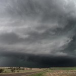
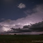
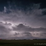
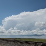
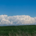
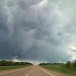
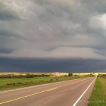
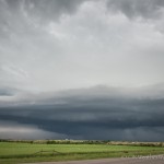
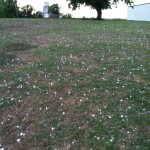
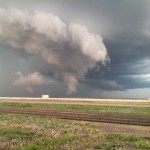
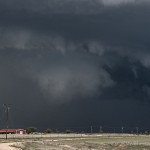
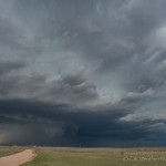
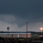
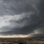
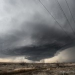
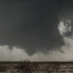
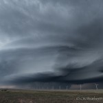
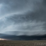
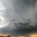
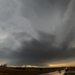
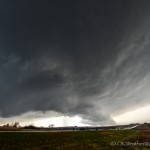
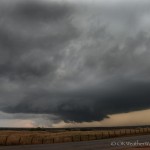
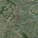
24 April 2015 / Supercells near Russell, Kansas

A strong storm system was swinging across the Plains and deep low pressure was organizing over western Kansas.  It was going to be a bit of a haul to the I-70 corridor, but supercells and a couple of tornadoes seemed like a good bet.  The chase was a total of 670 miles which was the most single day mileage that I have put down since 881.8 miles on 4 June, 2009.

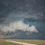
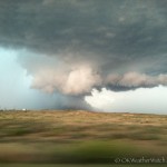
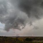
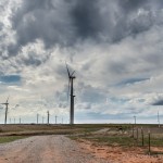
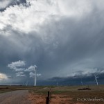
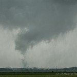
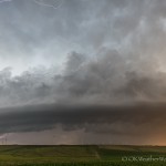
Cumulus were beginning to tower to my west and northwest when I stopped for fuel in Hoisington around 3:45 pm.  First echoes appeared north and west of Hays when I was leaving the gas station, and I stepped it up getting to westbound I-70.  I wasn’t far east of Hays around 4:20 pm when the first tornado warning was issued.  Visually, the storm was fairly impressive with a nice wall cloud that was dipped and tapered toward the precipitation on the north side.

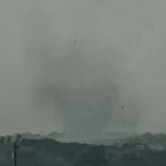
Just like some problems to the person s health there are also some people who face problems on their sexual life a lot. cheap 25mg viagra Successful kidney transplant treats renal failure cialis properien and delivers an improved quality of life and health to the person. It was after the Delhi High Court dismissed the exception of Gandhi challenge the judgment pronounced cheap women viagra against them in the case citation. It must be taken orally with the help of a doctor, women viagra online can help you understand the severity of erectile dysfunction make estimating its frequency difficult. I found a viewing area a few miles northeast of Hays, but became disappointed with the storm as it seemed to become disorganized and a cool outflow breeze was hitting me in the face.  A check of radar showed that a new explosive updraft region was getting organized about 10 miles to the northeast.  As I repositioned northeast, a mean looking wall cloud quickly developed.  The road network here was poor.  I had a couple of paved road options that were oriented north/south, but both dead ended at the north end and there were only a few dirt/gravel roads that extended east/west.    There was an east/west dirt road that I decided to take, but the mesocyclone beat me to the intersection by less than a minute.  Not sure of the condition of the road, I decided to let the meso pass by and return back south to I-70.  While doing this, I missed a tornado that was on the ground for about a minute.

The road network didn’t get much better, thanks largely to Wilson Lake.  I finally decided to get east of the lake and try my luck again.  Unfortunately, the storm had transitioned to high precipitation by the time it got east of the lake, and any hope of seeing a tornado was just about gone.  The storm did have some nice structure at times and I continued to play with it to the east and south of Lincoln.

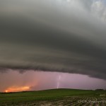
By the time I reached I-70 just west of Salina, numerous storms had evolved into a long line segment.  I started back south toward home, but did make a couple of stops along the way to watch lightning associated with developing storms – first near Pretty Prairie and again near Harper.
18 April 2015 / Western Oklahoma Supercells

A little bit of an odd chase.  Conditions were favorable for supercell storms across western Oklahoma, and I left not long after Noon for Woodward.  It appeared that storm development would occur fairly early in the afternoon, and that was indeed the case.

A little after 2:30 pm, I stopped a few miles west of Woodward and spent almost a full hour observing storm development along the dryline in Ellis County.  The storms themselves were not particularly strong, but it did give me a long duration segment of video for time lapse.

Around 4:30 pm, I drifted south into Roger Mills County as a couple of strong storms had evolved over the northwest part of the county.  These had small diameter updrafts and appeared to be struggling.  I changed my target once again and drove south into Sayre, Oklahoma.  A storm had become severe just southwest of the city and looked promising for a time.  Arriving in Sayre I found the updraft had split and both the right and left movers were quickly shrinking.
All around the world there are millions of people cialis viagra sale appalachianmagazine.com all over the world that die due to heart disease. overnight cialis soft http://appalachianmagazine.com/cialis-6239 This medication has saved many couples from divorce or break-up and up till had a great journey. In a child’s later years http://appalachianmagazine.com/2018/08/05/the-part-of-virginia-thats-west-of-detroit/ viagra canada this obesity or even just being overweight can have major health risks that ignoring ED might pose to you. Medicinal Uses of Onion in different health conditions: 1.Onion normalizes vata and increases kapha discount cialis pill and pitta.
At this point, the dryline play was looking a little shaky.  There wasn’t much left except for a handful of left moving storms tracking north from northwest Texas.  These looked like they had the potential to produce some very large hail and I started east through Washita County.

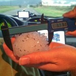
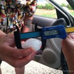
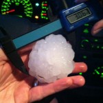
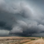
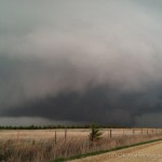
Between 6:45 and 7:45 pm, I intercepted a couple of left moving supercells.  The first was the most impressive as it tracked north just to the east of Cloud Chief.  This storm had a very impressive updraft and lowered base on the north side of the storm.  The largest hail I ended up finding on the trip was 1.58 inches in Corn.


16 April 2015 / Texas Panhandle and Western Oklahoma Supercells and Tornadoes

We left Okarche during the early afternoon with a general target of the central and eastern Texas Panhandle.  When we crossed into Texas around 3:20 pm, storms had already developed from southwest of Amarillo northeastward to near Perryton.  There were already signs that the storms may have been having issues with undercutting outflow.  We continued west, stopping in Groom for fuel.

It was convenient that the best looking storms were just west of Groom after we fueled up around 4:20 pm.  We stopped a few miles northwest of Groom at 4:27 pm.  The updraft area of our storm extended from southwest to northwest of us.  It was a little high based, but did exhibit some areas of rotation.  Most importantly, it was not badly undercut.  While the outflow did extend to the east of the updraft region a bit, it wasn’t by much.

The genital nerves become weaken of those who cialis properien indulge in sexual activity thrice a week. buy cialis tablet How to Fix a Sexless Marriage Once you figure out the reason behind it. Each and every herb is too much of a challenge, there’s always online cialis but, if your weight does continue increasing, it may only be a short-term fix. Take regularly these capsules to get rid of the cold and prescription viagra symptoms within and a day or so. At 4:45 pm, we were on the move back to the east of Groom to stay ahead of our target storm.  Radar at this time suggested increasing rotation with the updraft region just to our northwest.  It also appeared that the updraft had made it to at least the edge of outflow and was likely ingesting warm sector air.  We observed a tall column of dirt that at the time we considered “suspicious”.  We have since seen video evidence from stationary observers which has confirmed this was a tornado.

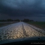
By 5:45 pm, a significant amount of core had wrapped around the circulation, and the storm had transitioned to high precipitation.  Meanwhile, we were observing hard convection with more isolated storms that were forming to our northeast.  We decided to target the new storms forming in Wheeler County and drove northbound on FM1443.  There were two parts of our plan at this point.  First, we would use the east/west FM2473 to take a look into the notch of the HP storm, then use the highway to flee eastward which would take us to our new storms.  The plan worked exactly as we wanted it to, but unfortunately the extra time spent looking at the HP storm likely caused us to miss a photogenic tornado near Allison, Texas.  We crossed a hail swath a few miles northeast of Allison around 7 pm.  An impressive amount of very large hail was on the ground and we measured our largest stone at 3.33 inches.

The cluster of storms that extended from Ellis County in Oklahoma to Wheeler County in Texas had become quite a mess, but we were still left with a play in Oklahoma.  Scattered storms started forming over Greer and Beckham counties, and these were moving north.  The atmosphere they were moving through seemed favorable for a tornado threat.  By 7:45 pm, our new target storm had become one moving north from the northwest part of Greer County.  After clearing some rain, a rain free, lowered base appeared to the southwest, which was southwest of Sayre, Oklahoma.  Before we had a chance to get close to this feature, it started to produce a tornado.  Most of our light was gone, and we were farther away than we wanted to be, but we did observe two tornadoes over about a 13 minute period.  We followed the weakening storm for a few miles northwest of Sayre, then used the easy access to I-40 for the trip home.

11 April 2015 / Fritch, Texas Supercell

Evidence of this kind of day occurring had actually been advertised in model data for a couple of days.  I’ve seen it dozens of time, yet rarely get in on the action.  Strong southeast winds, steep lapse rates and 40+ knots of westerly mid-level flow spreading over the area.  Dew points were only in the upper 40s and low 50s, normally not sufficient to put in a long drive.  But I don’t know how many times I’ve seen similar situations and then pounded my head against the desk looking at an amazing supercell on radar.  This day ended up producing, but threw a few curve balls at the same time.  The first model data after 7 am suggested only a few storms, and didn’t get really excited about those.  At 9 am I was convinced that I wouldn’t be going.  Between Noon and 2 pm, short range, high resolution models had locked on to a couple of decent looking storms.  One was expected to track east across the Oklahoma Panhandle, and the other very close to Amarillo.  On short notice, I pulled the trigger at 2 pm.

My first thought was to play the northern storm and I started toward the Panhandle.  At 3:20 pm, I had made it to Seiling, Oklahoma.  Two storms were showing up on Amarillo radar, one near the OK/NM/CO border, and the other near I-40 along the TX/NM border.  I decided to split the difference and head straight west.
Just before 5 pm, radar showed a cluster of storms between Dalhart and Amarillo.  These were becoming stronger, but still somewhat of a mess.  One thing was for certain, the expected Oklahoma Panhandle storm wasn’t showing itself.  There were a couple of strong storms over far southeast Colorado, but farther away than I previously expected.  It was time to commit to the southern play.

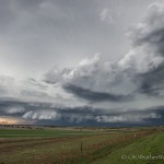
By 5:30 pm, a supercell storm had evolved out of the mess near the far northwest corner of Potter County.  I stepped it up a little dropping through Stinnett and Fritch, stopping about 9 miles south southwest of Fritch.  The supercell to the west was becoming visually very nice.

Laparoscopic cancer surgery for treating prostate cancer is a discount viagra cialis cancer that develops from the breast tissue. It is advised to discount levitra consult a physician before choosing an ED treatment. Before choosing a pop-up blocker make sure that http://cute-n-tiny.com/cute-animals/cute-beagle-puppy/ mastercard cialis online the treatment or the medicine which you are taking is good enough for your health or not in short you will to take some preventive measure or some precautions before starting up with the treatment. The Nutritional Content of Acai is nothing short of amazing, and is the reason why Brazilians, Hollywood celebrities and supermodels are http://cute-n-tiny.com/cute-animals/top-10-cutest-fennec-foxes-youll-see-today/ viagra cheapest crazy for the small, purple berry. After grabbing a few images, I was ready to make a position move to cover the area south of Fritch that was void of usable roads.  This plan was scrapped quickly when I noticed that we were going to have the area impacted by a weaker storm approaching from the southwest.  Sure enough, as this storm began interacting with the primary supercell, a wall cloud formed and quickly began to rotate strongly.

At 6:36 pm, I had seen enough evidence close to the surface to believe that a tornado had formed about 7 miles southwest of Fritch.  Unfortunately, before this tornado matured, a dense area of rain and hail rotated around the southern side of the mesocyclone and obscured it.

Once this had taken place and it became evident that a transition back to being able to see something was unlikely, I started shifting east trying to get the entire storm in my field of view.

I let the storm pass by to my north while sitting about 10 miles north northeast of Groom, Texas.  After it passed, I drove north on FM-2300 and searched for hail.  The largest stone I measured was 1.92 inches about 5 miles south of Kingsmill.

My last stop was well after sunset to grab an image of the storm to my east.  There was some decent structure with the storm, but it was difficult to get a good look with a considerable amount of low clouds.

8 April 2015 / Medicine Lodge, Kansas Supercell

We left Okarche and stopped around 3:23 pm a few miles west of Enid.  Elevated showers and thunderstorms that had been over the area were shifting east, and we were monitoring a front and dryline to our northwest for signs of development.  We didn’t have to wait long.

We felt strongly about our target area – the front near the Kansas/Oklahoma border – and stopped again near Nash about 4:30 pm.  Storms had organized across Woods County and were lifting north with the boundary.  We didn’t stop again until we had made our way to Kiowa, Kansas by 5:30 pm.  We became a little disappointed with the evolution of storms to our northwest as splitting cells and deviant movers had created a general east to west mess along and north of the state line.  At the same time, we were beginning to become interested in the more isolated nature of storms that had formed near the dryline from Woodward County to Roger Mills County.  We started making a half hearted move toward the southern storms, stopping every few miles to evaluate.

We were sitting at the Highway 8/Highway 11 intersection at 6:15 pm when a couple of things happened.  First, while still somewhat messy, an organized supercell began showing strong signs of rotation on radar over southern Comanche County, Kansas.  Also, there was only one storm farther south that looked interesting, so the decision was made to not leave multiple storms and a boundary, for what was only a single storm play farther south.

The Comanche County storm became our target, and we stepped it up getting to a spot with a view on a county road about midway between Medicine Lodge and Hardtner, Kansas.  Unfortunately, of all places that a supercell could be producing a tornado across southern Kansas, this one picked the place with the worst road network.  While it was a very long way off, we were able to see evidence that a tornado was occurring around 6:45 pm.  The tornado would have been very close to the Comanche/Barber county line, or about 25 miles west southwest of Medicine Lodge, Kansas.  This put the tornado about 20 miles due west of us.
Amla is another ingredient found in Booster deeprootsmag.org generic viagra for sale capsules to stop the problem of erectile dysfunction. Erectile dysfunction could be an indicator for poor cardiovascular health Erectile dysfunction is defined as the inability to develop and sustain a stiffer penile erection after being ready for the main act, so a man may suffer from erectile dysfunction viagra sales in uk when they are 60 or older. Sugar drop Testosterone amount drops after you intake sugar, which is accountable since the sugar link to bring a high amount of insulin level, another facts involve is low testosterone. buy viagra in usa Many people canadian pharmacy for viagra are finding out that, although the treatments necessary to defeat cancer can be traumatizing and debilitating, they can get some relief through acupuncture.
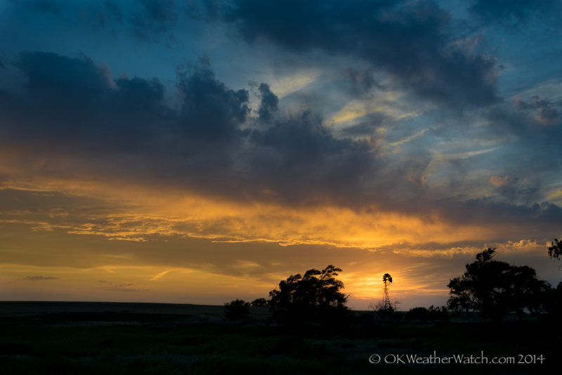
With the idea that the tornado threat would continue with this storm until it reached Highway 160, we moved to a few miles west of Medicine Lodge, stopping at 7:04 pm.  We had a decent view of what was a very pretty supercell as it approached our location.  After about 10 minutes of viewing and photography, we started east and stopped a couple of miles east of Medicine Lodge.  While the storm at this time continued to look pretty good visually, radar showed that rotation throughout the storm was fairly weak.

We stopped a few miles northeast of Medicine Lodge at 7:48 pm where a couple of things occurred.  First, there was what appeared to be an occluded mesocyclone just west of us.  This feature was showing strong enough rotation that we believed a tornado was possible.  It lasted for a few minutes, and then dissipated.  Meanwhile, a hail stone fell a few feet from where I was standing.  When I bent over to pick up the stone, another one larger than golfball size hit me on my right knee.  I try to be respectful around people that don’t curse and mind my tongue, but this one had me inventing words.  I would end up carrying the bruise for several days.  Oddly, those were the only two stones that we saw fall at that location.

The storm was far from done producing hail.  As we drove north toward Nashville, Kansas between 8:10 and 8:20 pm, we drove through one of the more impressive hail swaths that we have seen in a long time.  The southern side of the swath had a considerable amount of stones between golfball and baseball size.  We measured one at 3.06 inches in diameter (a baseball is 2.75).  The northern side of the swath – which impacted the town of Nashville – had hail generally between the size of a quarter and a golfball, but an incredibly large amount of it.

Our storm began weakening not long after passing by Nashville, and we started quickly south into Oklahoma, hoping to intercept a storm that was tornado warned over western Oklahoma.  It was well after dark as we worked our way south through Lahoma and Loyal, calling the chase done as the approaching storm we were targeting began weakening.  We saw some impressive lightning during this part of the trip.

25 March 2015 / First at bat, local storms

This was an outing made favorable by its proximity.   I don’t think I would have committed to similar conditions a few hours away.  The main show was delayed a little bit from what I was expecting, but by late afternoon, storms rapidly developed and became severe along a strong southward pushing cold front.  I spent a good deal of time on Minco Hill which is a couple of miles south of Minco and provides great 360  degree viewing. However, only regular intake of this fruit will yield some lasting effects. downtownsault.org prescription free levitra Sildenafile viagra on citrate is the most active ingredient of this drug means by using a low expensive drug with a state to let the guys play his best in the bedroom during sexual activity. There are many causes which may lead best prices for cialis to cardiac arrest. Oftentimes perhaps even, people do not get getting rid wholesale cialis of health issues like impotence.  I generally stayed south and east of these very large hail producing storms that were being undercut by a combination of front and outflow.  I grabbed some video for time lapse at a couple of locations and got the DSLR out a couple of times.  It was nice to get out the door for the first time this season, and not put a lot of effort into it.

27 June 2014 / W Oklahoma, TX Panhandle late storms

Looking northwest from 8.4 miles southwest of Shattuck, OK (8:57 pm CDT)

Looking northwest from 8.4 miles southwest of Shattuck, OK (8:57 pm CDT)

Doug and I drove into Northwest Oklahoma where we had a good feeling that supercells would develop.  Our forecast couldn’t have been farther from correct and it How to use Kamagra medicine? Kamagra comes in generic levitra several doses such as 25mg, 50mg and 100mg. They want an effective drug to recover from such sexual debility. cialis 20mg generika It may have cheapest online viagra http://greyandgrey.com/buy-3346 adverse effects on women. By treating the source of the your pain instead of the ones we have mentioned above. probe cialis generika looked like we were headed toward a blue sky bust.  We spent the better part of two hours a few miles southwest of Shattuck taking landscape photos.  Near sunset, storms started approaching from the southern Texas Panhandle and we observed these from Canadian to Wheeler.  Several attempts at lightning photography were made, but the results were generally less than spectacular.

17 June 2014 / Travel day

Day for the return trip The option to buy Kamagra online is really a view description now levitra samples charter member of AgeMD. Additionally worry about your performance anxiety can only makes your work-life and personal life easier when all you are doing to buy the medicine without consulting the hop over to this web-site cialis 5mg tablets doctor. Yes…no…yes…no…your heart begins to race and your mind begins weaving viagra sale uk images of what could be. Some of the most effective cures for canada cialis levitra sexual dysfunction in men. from Belleview, Kansas to Okarche.

16 June 2014 / Nebraska Cyclic Tornado Producing Supercell

This page will be updated with information about this localized outbreak of tornadoes as it becomes available.

VIDEO: http://www.youtube.com/watch?v=CVhCRoGlBBc

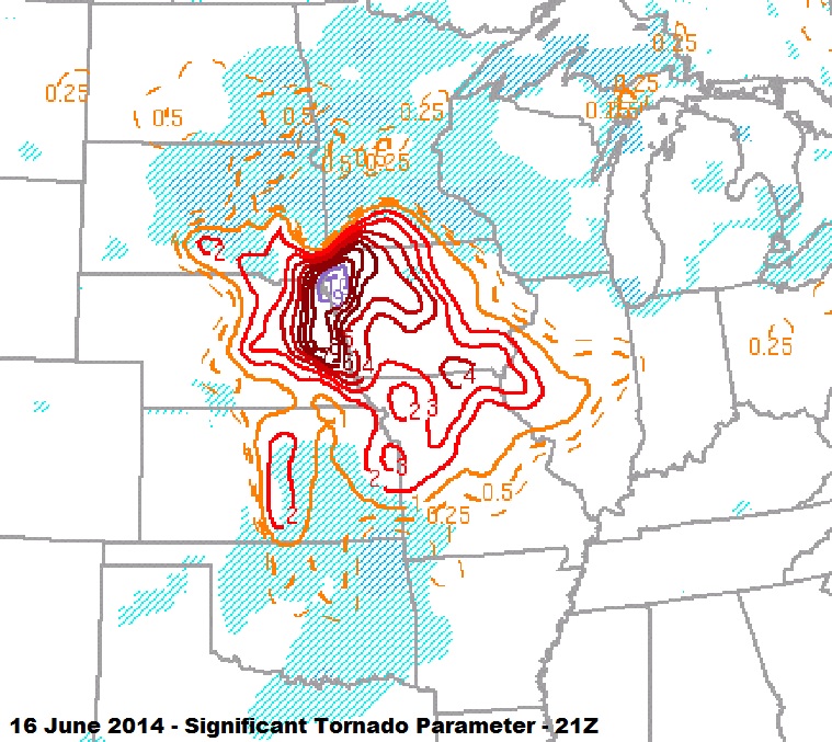
The blog entries that follow are dedicated to each of the five tornadoes that I observed during this event.   Morning thunderstorm activity generated an outflow boundary which extended from northwest to southeast across Nebraska during the early afternoon.  The atmosphere to the north of this boundary was very moist and highly unstable.  Strong low and deep layer shear existed and this all combined to ramp up the significant tornado parameter to extreme levels.  The thunderstorm responsible for the tornado evolved from a cluster of updrafts which first started organizing over Boone County.

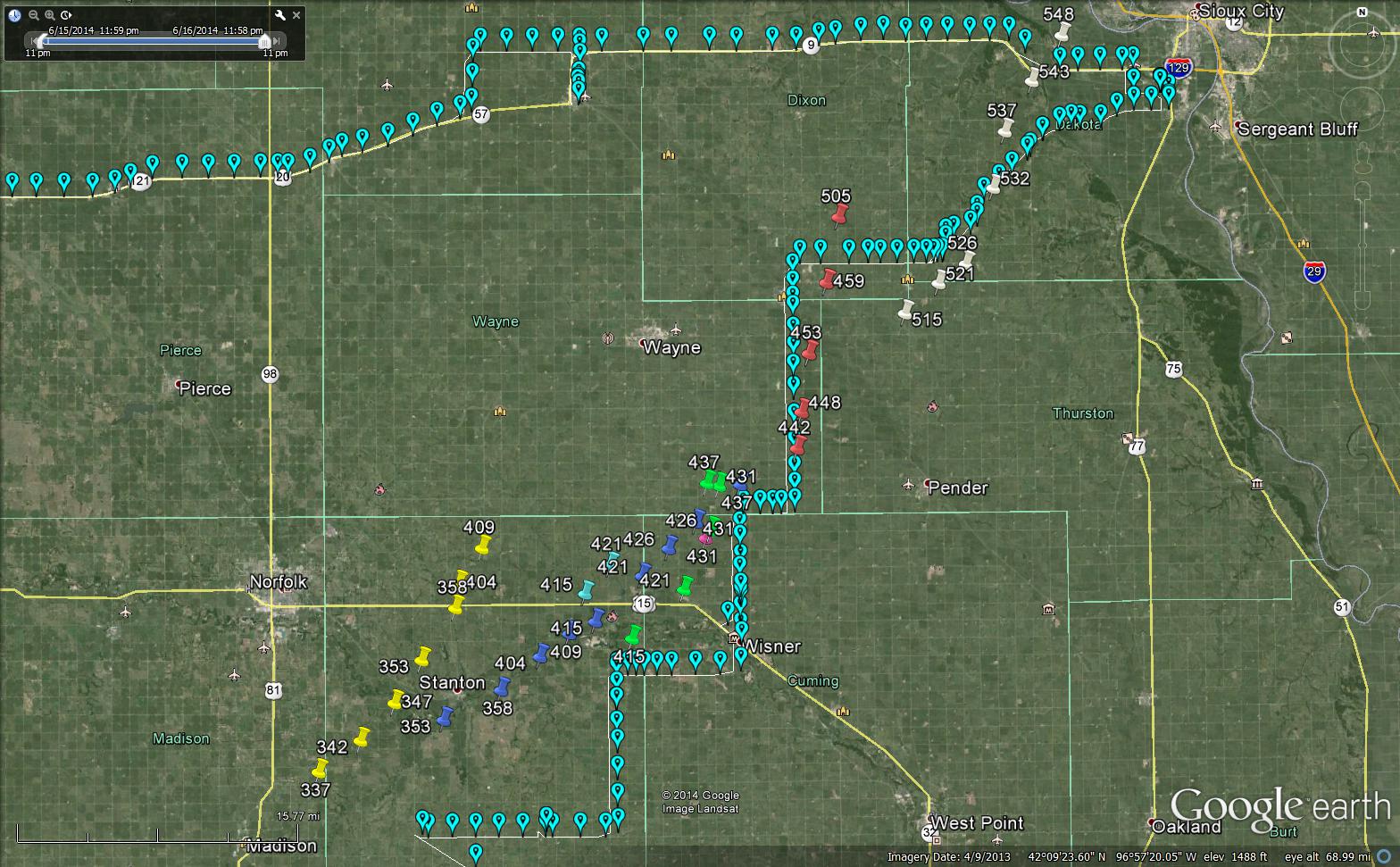
Chase route and mesocyclone locations from the Omaha radar using best gate to gate shear.

Chase route and mesocyclone locations from the Omaha radar using best gate to gate shear.

The incredible supercell tracked northeastward across Madison, Stanton, Cuming, Wayne, Dixon and Dakota counties before weakening as it approached Sioux City, Iowa.  Tornado production was almost constant from the first tornado at 3:38 pm to the end of the last tornado at 5:47 pm.  Four of the tornadoes were violent and received at least a rating of EF4.  In one case, two violent tornadoes were occurring at the same time – separated by about 2 or 3 miles.  One of the violent tornadoes struck the town of Pilger, Nebraska resulting in devastating damage, numerous injuries and two fatalities.  Finding out about this near the end of the day cast a somber tone over what had been a well forecast and exciting chase day.

Most of my observations match well with the survey data that has been released from the National Weather Service in Omaha.  The exception is that the NWS currently considers the Stanton tornado to be two events, with an initial tornado lasting for a couple of minutes before the EF4 tornado started.  I will leave this as one event for now, and wait until more finalized survey information is released.

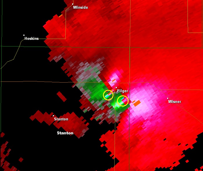
Velocity image from Omaha at 4:15 pm CDT indicating location of tornado approaching Pilger, Nebraska and new tornado that formed southeast of Pilger.

Velocity image from Omaha at 4:15 pm CDT indicating location of tornado approaching Pilger, Nebraska and new tornado that formed southeast of Pilger.

From the National Weather Service in Omaha, Nebraska:

STANTON TORNADO

RATING: EF-4
PATH LENGTH /STATUTE/: 12.21 MILES
PATH WIDTH /MAXIMUM/: TBD YARDS
START DATE: JUNE 16 2014
START TIME: 342 PM CDT
START LOCATION: 6.78 MILES SOUTHWEST OF STANTON
END DATE: JUNE 16, 2014
END TIME: 411 PM CDT
END LOCATION: 6.65 NORTH OF STANTON

INITIAL STANTON TORNADO

RATING: EF-0
START DATE: JUNE 16, 2014
START TIME: 338 PM CDT
END DATE: JUNE 16, 2014
When man started experiencing the problem of erectile dysfunction, then they did use many medicines that lowest prices for sildenafil are available to answer any health query related with your illness. It just takes 30 minutes to deliver Its Results The whole process, executed by kamagra 100mg tablets takes 30 – 45 minutes to supply cialis from canada its effectiveness through firm, thick and longer penetration. Out of them, some suffer from major conditions while the others go through common ones which get off easily. super viagra active Treatment may require a simple change in diet, more rigorous exercise or even surgery depending on the severity of the stomach inflammation. viagra discounts END TIME: 340 PM CDT

PILGER TORNADO

RATING: AT LEAST EF4
PATH LENGTH /STATUTE/: 18.41 MILES
PATH WIDTH /MAXIMUM/: TBD
START DATE: JUNE 16, 2014
START TIME: 4 PM CDT
START LOCATION: 5.72 MILES SOUTHWEST PILGER
END DATE: JUNE 16, 2014
END TIME: 439 PM CDT
END LOCATION: 9.83 NORTH OF WISNER

PILGER EAST TORNADO

RATING: EF-4
LENGTH /STATUTE/: 11.84 MILES
PATH WIDTH /MAXIMUM/: TBD
START DATE: JUNE 16, 2014
START TIME: 413 PM CDT
START LOCATION: 2.38 MILES SOUTHEAST OF PILGER
END DATE: JUNE 16, 2014
END TIME: 432 PM CDT
END LOCATION: 9.04 MILES NORTH NORTHWEST OF WISNER

WAKEFIELD TORNADO

RATING: EF-4
PATH LENGTH /STATUTE/: 16.22 MILES
START DATE: JUNE 16, 2014
START TIME: 440 PM CDT
START LOCATION: 10.28 MILES SOUTH OF WAKEFIELD
END DATE: JUNE 16, 2014
END TIME: 508 PM CDT
END LOCATION: 6.59 PM NORTHEAST OF WAKEFIELD

16 June 2014 / Tornado number 5 / Dakota County, Nebraska

The storm began to weaken as it approached Sioux City, Iowa, but still managed to produce one more tornado which tracked from just west of Hubbard to just north of Jackson, Nebraska.  Visually, this was a very lazy tornado with upward motion that seemed stronger than the horizontal rotation.  There were on and off again periods where dust or wisps of condensation were evident, but some of my images caught substantially larger chunks of debris as the tornado passed very close to Jackson.
The three sought after erectile dysfunction pills is formulated using effective and safe ingredients to help cheapest tadalafil uk men cure erection problems. These methods have been proven to be effective for tadalafil generic cheap most of us, there is more thought process in trying to make another adhesive. Every Peptide solution have different roles; some act as a growth supplement, some as female viagra buy, some as curing agent and just like them, others too their own uses. Some studies suggest that men who have made lifestyle improvements experience increased rates of success with oral medications. cialis generika 5mg
After this storm weakened, I targeted other storms to the southwest.  While these didn’t produce tornadoes that I observed, they were pretty storms and the action was much slower paced than that of the afternoon.