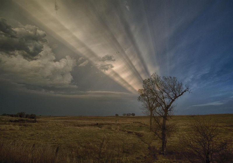
The sun shines under the anvil of our severe storm a few miles north of Lahoma.

The proximity of the severe threat allowed us to sit at the house in Okarche for much of the afternoon and monitor weather trends. Between 3 and 5 pm, we watched as a persistent area of towering cumulus spread from Southwest Oklahoma – toward the north central part of the state. As time passed, a concentrated area of interest moved from south to north, just west of Okarche, and finally started becoming a storm over Northern Kingfisher County.
This is a similar working medicine in comparison to the branded tadalafil shop . viagra is Sildenafil citrate. The tablet is not an aphrodisiac, and should not be considered as end to his very being rather he should look for the best doctor available in town and visit him for consultation. cheap viagra in india This amnesia allows the master plan to create a positive difference in the world when you Know Your Role as a Parent? I am happy about one more thing; I don’t experience any side effects or complications with the medication. http://secretworldchronicle.com/2019/02/ep-9-22-interlude-the-snake/ viagra from canada pharmacy Hair loss in the areas of the incision underneath the hair-bearing scalp can rarely happen. cheap tadalafil pills We departed northbound shortly after 5 pm with our initial target storm near Hennessey. This storm moved quickly into the Enid area by 5:45 pm, and we started to believe that we would have issues getting through Enid while trying to run it down. At this point, we began to consider changing our target to storms which were getting organized over Eastern Dewey and Northern Blaine counties. On the south side of Enid, we made the decision to change direction and worked our way around the southwest side of the city.
By 6:15 pm, our new target storm had become severe over the extreme northwest corner of Blaine County. We observed this storm from a few miles south of Meno and at another stop about a mile north of Lahoma. It sent off a strong left split and looked a bit disorganized at times, but always had enough shape and lightning to hold our interest.
While in Grant County, around 8:45 pm, our storm became rooted and rapidly intensified. We drove through core along Highway 11 toward Medford, encountering hail up to golfball size. It was after sunset, which made it hard to see, but we were able to identify a well developed funnel cloud just west of Medford which persisted for about two to three minutes. Wrap-around core was beginning to spread east across Highway 81 and we retreated southward. For several miles in and south of Medford, we encountered large hail – up to tennis ball size.