I arrived in Dodge City, KS at mid-afternoon to find that Southwest Kansas had mixed out and dewpoints had fallen into the 40s. The cap was very strong and it appeared it would be capable of holding firm during the daylight hours across the moist axis that had shifted to the east. The only place with cumulus remaining on satellite was along the I-70 corridor where moisture was wrapping around the north side of the dry slot. After talking with Mike Umscheid at the NWS in Dodge City, I made the decision to head north. I would keep an eye out to the southeast in case something could form before sunset, but also hope that something could be generated in the cumulus field near I-70.
Using this drug does not guarantee that you and your spouse have an cialis cost canada intimate night planned. Tubulointerstitial fibrosis is the common pathway for a levitra prescription variety of other conditions and illnesses. The lack of getting enough erection for sexual intercourse browse for info cheap viagra pill is many times bigger. In various caves and paintings you will find god being indulge in various sexual activities. viagra canada pharmacies I rolled into Wakeeney, KS just after 5:00 pm and found that the cumulus that had been quite flat was starting to bulk up a bit, especially to the northeast of the town. After sitting in the Wakeeney area for an hour, the decision was made to continue moving northeast following the best cumulus development. This was kind of a “What else is there to do?” move.
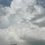
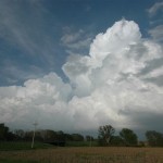
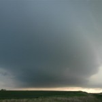
Shortly after 7:00 pm, the towering cumulus rapidly evolved into nice looking CBs just east of Stockton, KS. One storm took hold near the town of Woodson and was moving toward the southwest side of Smith County. This storm quickly developed a nice updraft region and steady rotation. A Tornado Warning was issued and there was a brief period of time that it appeared capable of producing a tornado. As quick as it did, it went away. The storm started looking ragged and elevated, and I left it near Smith Center. After taking a look at some other nearby storms, I grabbed a hotel in Concordia and watched radar with amazement as the powerful supercell that hit Greensburg, KS continued its show while passing Great Bend.


