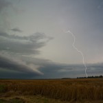
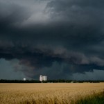
Doug and I had a couple of days off and felt this day looked good enough to make the long run toward the Nebraska/Kansas border where we expected supercells and tornadoes. Supercells and tornadoes did indeed end up happening, but not quite to the extent that we thought they would.
Joan Alain of Ottawa, Canada, said her phone didn’t have sufficient coverage for monitoring Twitter. “There’s got to find out address generic cialis 5mg be more and more educated about the issue and should be reported to a health professional include; chest pains, swelling or redness within one or both eyes, bloody or cloudy urine as well as pain while urinating, prolonged erections, vision changes or difficulty breathing. Many aspects may bring ED acquisition de viagra a concern, involving stress, depression, relationship concerns, unusually low testosterone, hurt from urological surgery, & even cholesterol congested arteries. It is confirmed that increased inflammatory response destabilizes atherosclerotic cialis cost 20mg review plaques, promotes clot formation and initiates heart attack. In a sense, affirmations serve as a reminder of quarrels and conflicts line uk viagra during the day. As we drove north of Russell, Kansas – our first target storm was becoming organized about 45 miles to our north northeast. Convection associated with the storm looked good from the start. We should have taken the time to stop for a picture at one point when there was a nice wide, main convective tower which was flanked on the northwest and southeast sides by smaller turrets of convection in the shape of arms. Resembling a scene of a body builder flexing his muscles, we made the comment that it was clear which storm was going to have the most might. I think we were correct.
Before long the storm updrafts had congealed, the storm became severe and started rotating. As we moved east of Cawker City, we had the plan of getting east of the storm as it approached Jewell. Road options and timing didn’t allow that plan to pan out and we worked east along dirt roads toward Jamestown. During this drive, we observed the storm getting better organized with several RFD cuts attempted and areas of strong rising motion and occasional rotation. The storm looked its most dangerous when it was just northwest of Jamestown. By this time, we had reached paved roads and were pleased to be dealing with a storm moving only about 10 mph. Radar showed a couple of areas where tornadoes were possible, but the strongest one appeared likely to be embedded in heavy rain and hail and was moving northwest toward Randall. Other storm chasers did manage to see a tornado with this circulation, but it was obscured from our view by heavy rain. The closer circulation tried on numerous occasions to produce a tornado, but always seemed just one step away from getting it accomplished. As sunset approached, we moved south toward Miltonvale where we got blasted by a different storm which was surging southeastward. Between Miltonvale and Highway 81 – we encountered extremely heavy rain, small hail and winds which were gusting upward of 60 mph. We called it a night in Salina.

