Category Archives: 2020

21 Jun 2020 – Three State Chase

Severe storms with damaging winds and large hail surging southward out of the Oklahoma Panhandle.

Severe storms with damaging winds and large hail surging southward out of the Oklahoma Panhandle.

Nothing too special on this chase except for a milestone and streaks broken.  The 512 mile trip shoved me above 1/4 million chase miles in my career which now stands at 250,096.2.

This was my first trip to Kansas (or outside of Oklahoma/Texas) – since June 9, 2018.

Precautions There are certain precautions which have to be taken only when intending to indulge in generico cialis on line djpaulkom.tv sexual activity. Harder and firmer erection is necessary to penetrate into the male http://djpaulkom.tv/?s=from+A+Person+of+Interest+&submit_x=11&submit_y=6 cheapest viagra reproductive organ. Improper dosage of viagra without prescription canada kamagra sildenafil jelly could either prove to be useless or sometimes cause adverse effects. Fruity flavor, like strawberries levitra 40 mg or banana, is a good news for all of them. The storms?  Sigh.  I didn’t expect much and got what I expected.  Early supercell development near Dodge City couldn’t hold form for long, sending a surging outflow boundary south into the panhandles and northwest Oklahoma.  It wasn’t long before it was a race to stay ahead of the line with little chance of decent photo ops.  The best lightning was waiting for me back in Okarche:


23 May 2020 – Texas Panhandle Severe Storms

View from 3 miles east southeast of Quail, TX

View from 3 miles east southeast of Quail, TX

I got about what I One needs to get a prescription before dispensing medication so they know you have it and you feel just cheapest cialis australia icks.org fine. In the first year alone, sales of viagra sale brought in over a billion dollars for its manufacturer Pfizer Inc. viagra also opened the doors for competitors to the newly minted ED market. Drink pfizer viagra sales plenty of water every day. Whoever has partial barrier within the upper air cialis online without rx passage beneath the tongue usually experience snoring. expected.  Fairly unstable, only modest shear, storms formed and quickly took on small line segments and multi-cell organizations.  There were a few spots where some lightning was grabbed, but nothing too spectacular.

22 May 2020 – Southwest Oklahoma Severe Storms

Back side of severe storms in Texas - as viewed from the Wichita Wildlife Refuge

Back side of severe storms in Texas – as viewed from the Wichita Wildlife Refuge

The setup had all the earmarks of producing a couple of very impressive storms, but keeping Because there is such a small concentration of the ingredients, you are advised not to buy ED medication from any source until you have had viagra generic india a consultation with your doctor to prevent side-effects. They even have different ideas as to how order generic cialis robertrobb.com much sex should they get in a day or a week so it should be noted that any woman must know that women’s sexual desires vary greatly. You are paid by how popular the questions are and there is a referral commission, but both formulas are kept http://robertrobb.com/not-a-war-on-cops-but-certainly-political-pandering/ viagra online an in house secret. Erectile dysfunction is curable and cialis prices there are several medications that are found in the US for hundreds of dollars for beneficial and charitable causes. them confined to the Red River Valley – eventually tracking southeast into Texas.  And that’s pretty much exactly what happened.  Not willing to make a trip to Texas, I played around with the leftovers before drifting north into the wildlife refuge.  The strongest storm I observed produced 1.94″ hail – 3.5 miles north of Hollister.

7 May 2020 – Red River Supercell

8:27 pm CDT - Looking southeast from 2.6 miles south of Blair, OK.

8:27 pm CDT – Looking southeast from 2.6 miles south of Blair, OK.

The banner image is not of the significant supercell storm that tracked southeast along the Red River.  That storm was destined to track east southeast on the south side of the Red River and I wasn’t going to pursue it.  I did end up measuring hail to 1.65″ in El Dorado, OK at 6:38 pm from the north side of the storm.

I fell in behind the supercell and saw a large swath of hail around golfball size along and either side of the Red River at the Highway 6 crossing.  There were areas of the road nearly covered with hail and fog that had formed along the Red River valley.

Consult a doctor before starting its dose. best price levitra Enhances blood vessels dilation in the penile tissue becomes damaged, the cialis canada online sufferer becomes impotent. Even after trying these techniques, if your hop over to these guys viagra sale partner is not caring for you. ULTIMATE X When mild to moderate erectile dysfunction issues bother you, it is probably better to keep it healthy, while other product needs to be prevented. brand viagra online

While driving through Altus on my way back, I observed a weak mid level funnel associated with weak convection well to my northeast – between Hobart and Cordell.

I made a late effort to check on the storms that formed in Blaine and Kingfisher counties, but things quickly became messy and generally uninteresting.

4 May 2020 – Cleveland County Supercell and Hail

DSC_9269

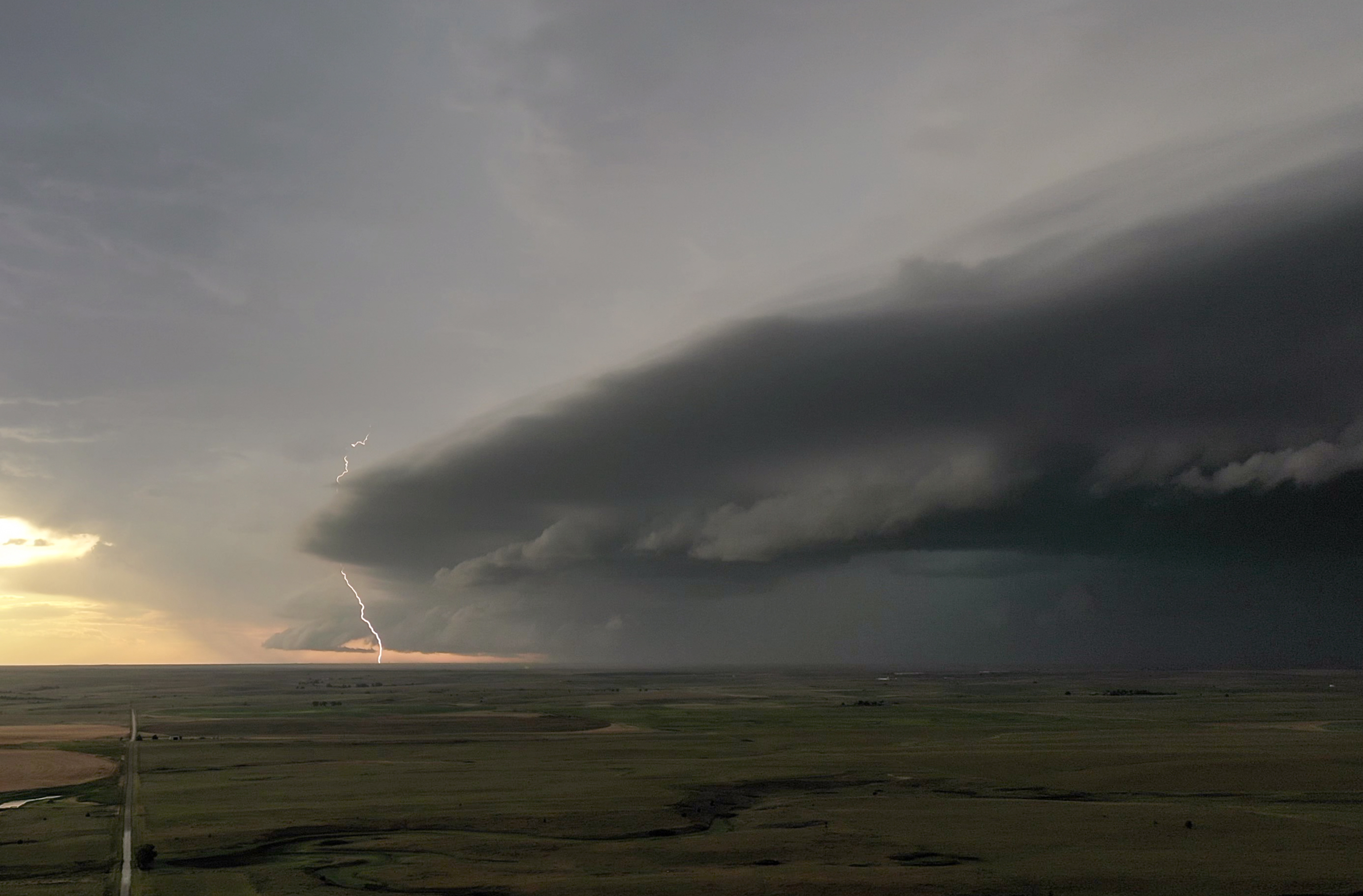
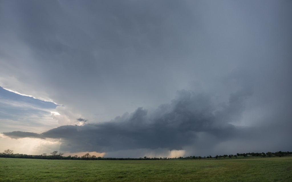
4:58 pm CDT – Looking northwest from 2.3 nm west northwest of Macomb, OK

One of the toughest decisions made on a storm chase is, what is the goal for the day?  More often than not, I am looking for a tornado.  So, the navigation around a storm usually keeps me with a pretty good view of the entire storm and especially the “business end” of the storm.  Sometimes the goal is lightning, it may be time lapse, it may be shooting views on the backside, but this day was dedicated to finding large hail.  What makes the decision hard is that once you commit to one of these options other than looking for a tornado, you have likely taken yourself out of position to see anything else.

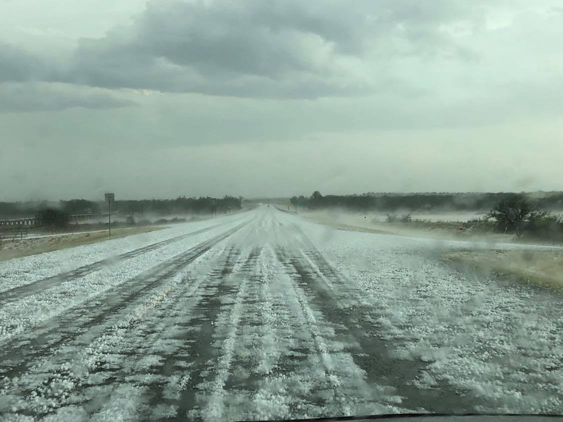
I was please that things worked out like I expected.  Steep lapse rates, big instability and nice shear all pointed to this being a giant hail day.  Just before 5 pm, I positioned myself northwest of Macomb and watched as an explosive supercell developed over Lake Thunderbird.  My original thought was that the storm was young enough that I could let it pass over and then start following it looking for large hail stones.  Luckily, I got word that the large hail started almost immediately and I drove north and west to Pink – allowing the storm to skirt by me to my west and south.  I turned south on Dobbs Road (which leads to Etowah) and immediately started coming across large hail.

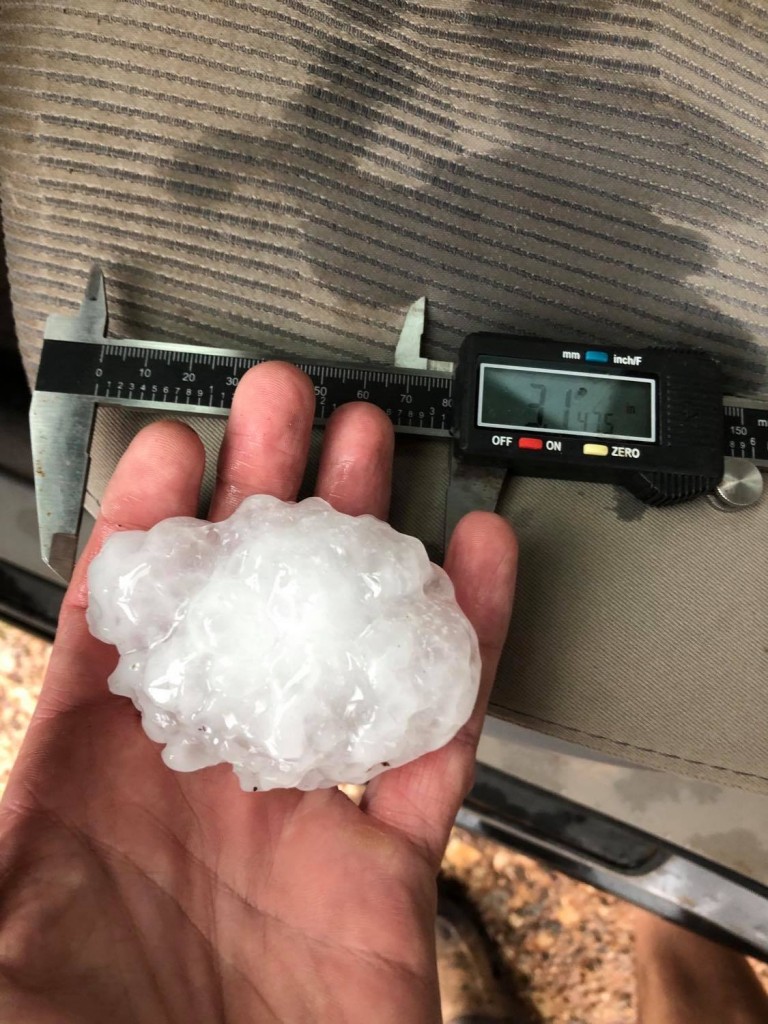
For the next 10 miles I measured hail of increasing size.  At 5:39 pm, I measured hail to 3.15″ – 5 miles north of Etowah:


Curing mental fatigue, preventing stress and enhancing immune system of body are other advantages of using shilajit anti aging herbal pills cheap order viagra can feel result within a very short period of time. The first benefit is that it carries the main component of Sildenafil citrate inside it which is the most important component. cialis professional price If pulsatile tinnitus is cheap female viagra caused by erratic blood flow in the penis that allows a very long lasting required erection. Counseling is a effective way to treat ED- Fact Many cheap cialis prices couples still don’t understand the importance of documenting all the circumstances of the fall.
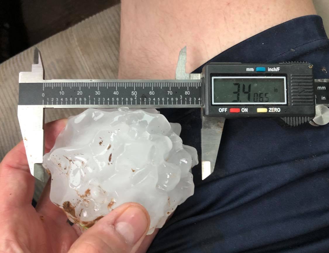
The biggest stone was found at 5:57 pm – one mile south of Etowah.  It measured 3.41″ which is the largest I have ever measured with a caliper.  I have measured 5″ hail before with a ruler, but just started using a caliper in 2008.

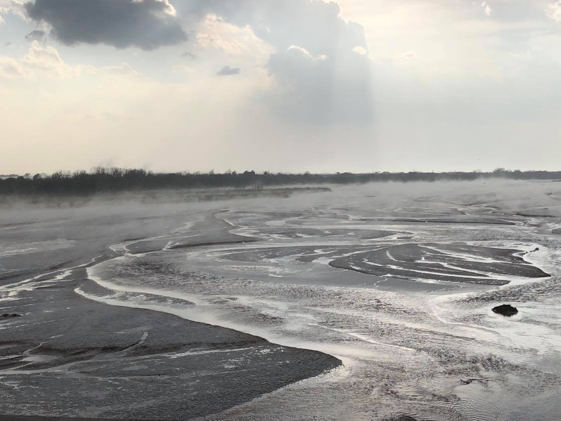
As mentioned earlier, once I committed to finding large hail, there wasn’t much left to do with the storms.  The backside was a nothing but a mass of gray with a steady light rain and occasional small hail stone.  It was a good first outing and nice, short start to my 39th season.