Category Archives: 2019

22 June 2019 – Northwest Oklahoma Severe Storms

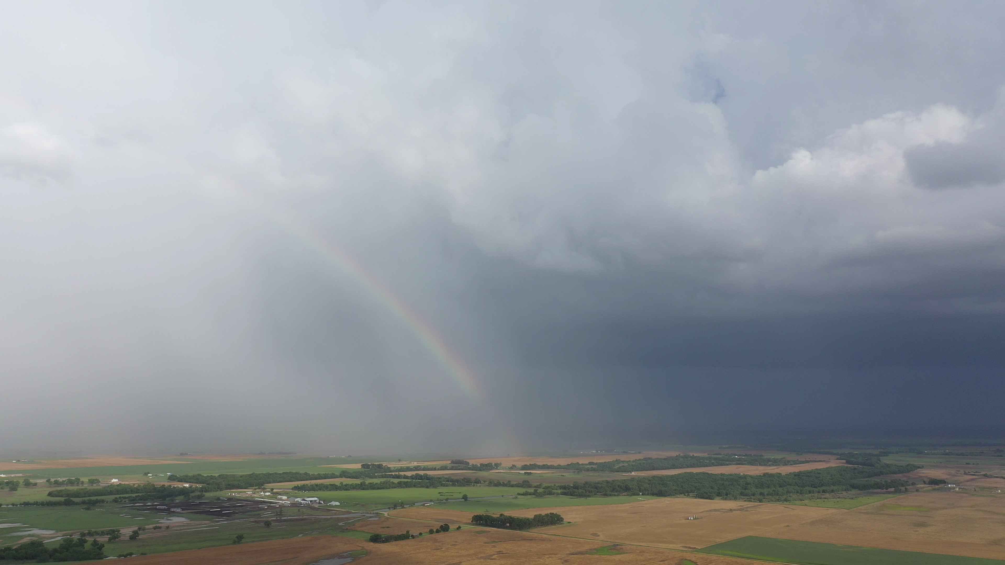
Kind of a ho-hum chase with regard to storm quality, but I did come across some interesting things.

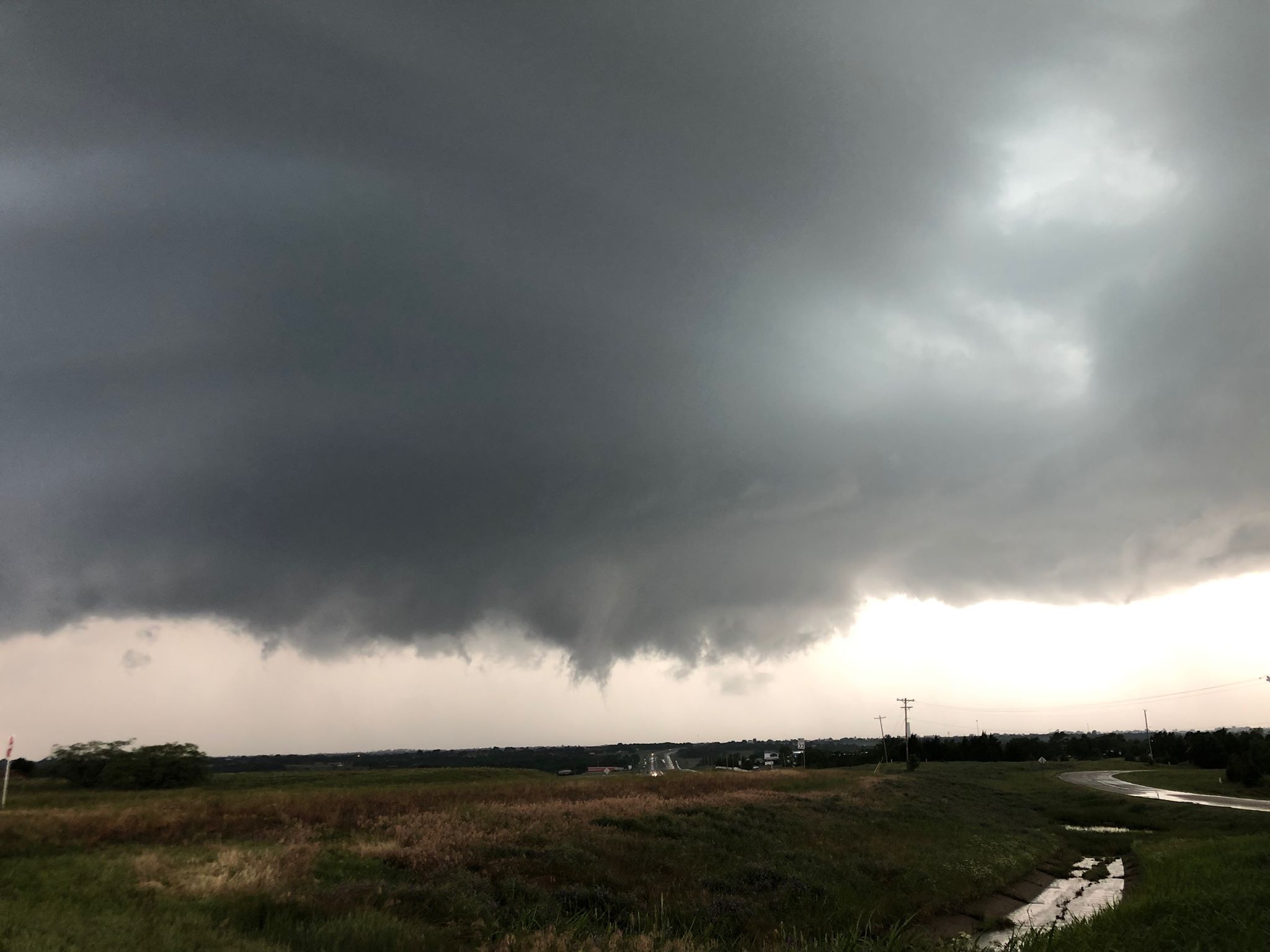
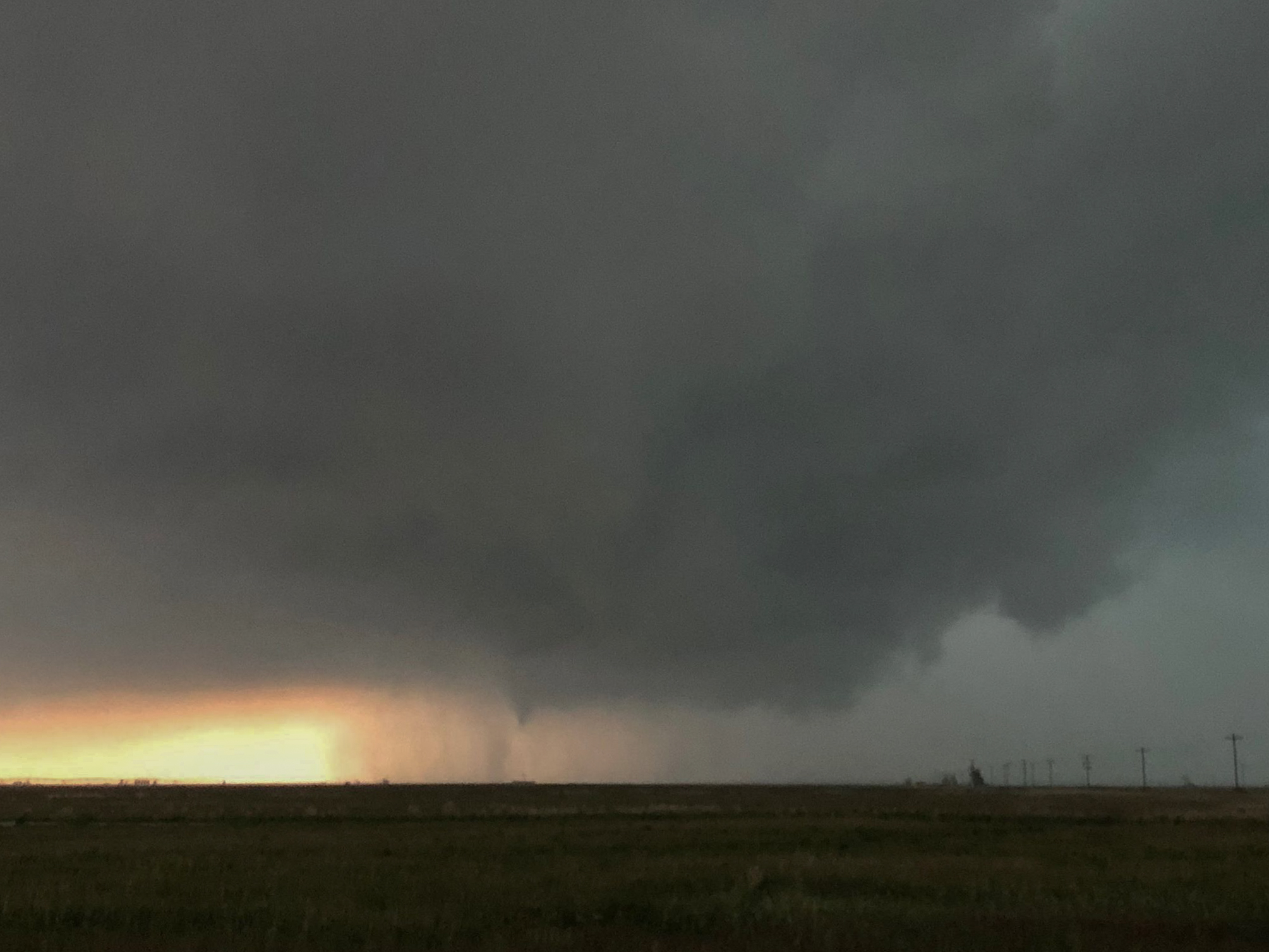
First, I measured hail to 1.58″ in Amorita in Alfalfa County.  This was just about the only hail of the day reported in the state.  These storms moved quickly into Kansas and I stopped short of the border.  For the first time in my chase career, the year will end with me never crossing north of the Oklahoma/Kansas line.  My only venture outside of the state was into the Texas Panhandle and South Plains.

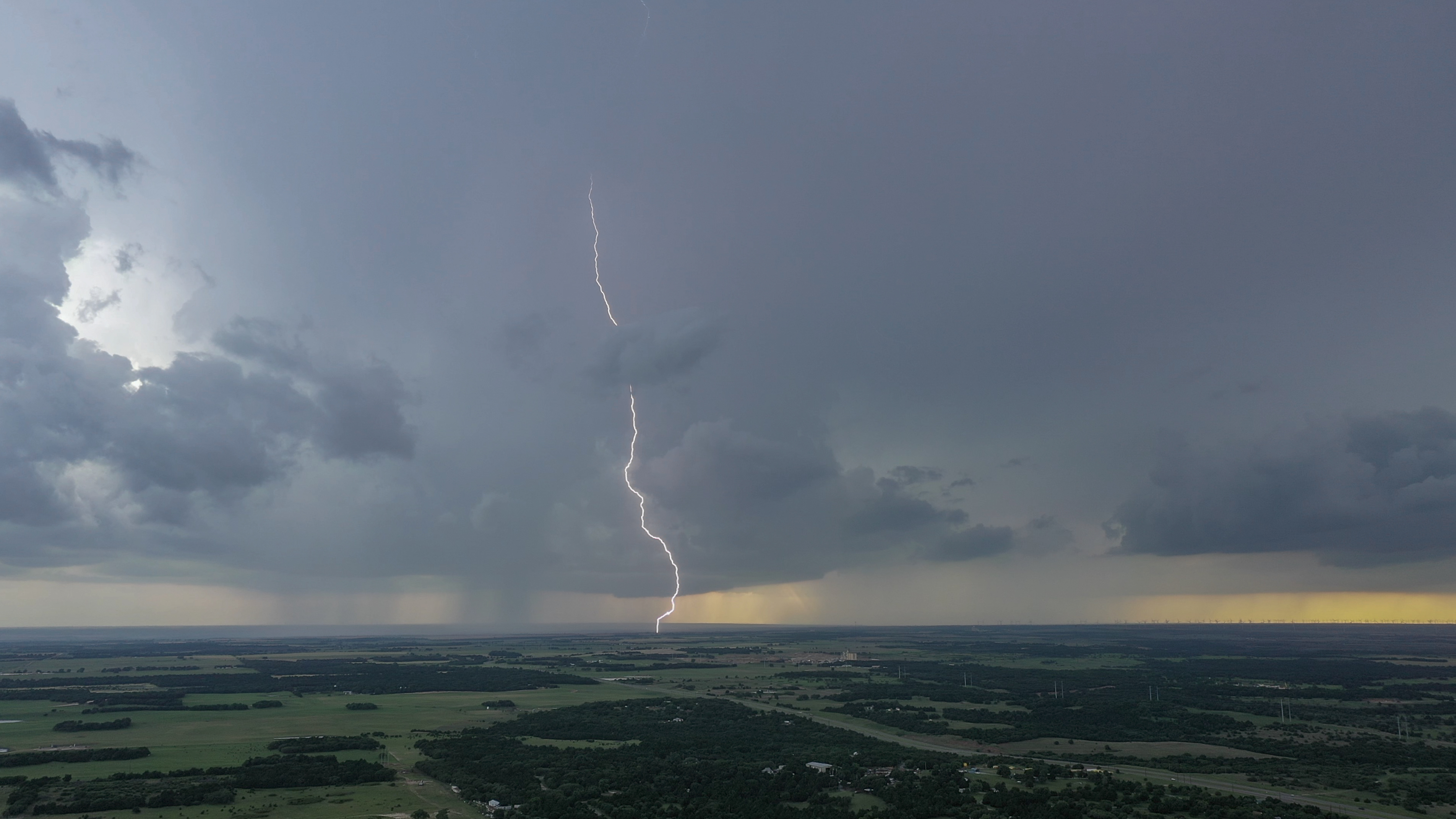
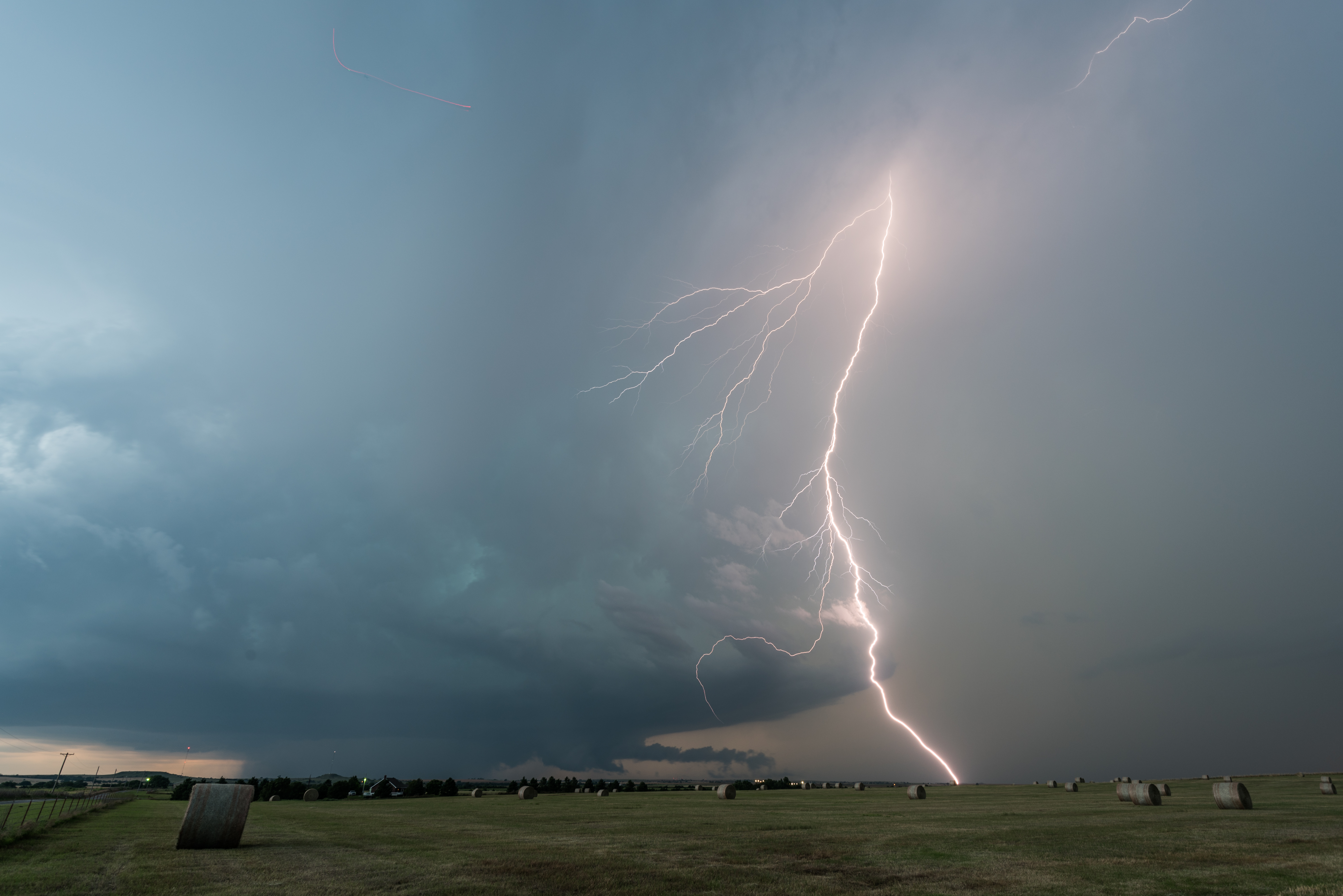
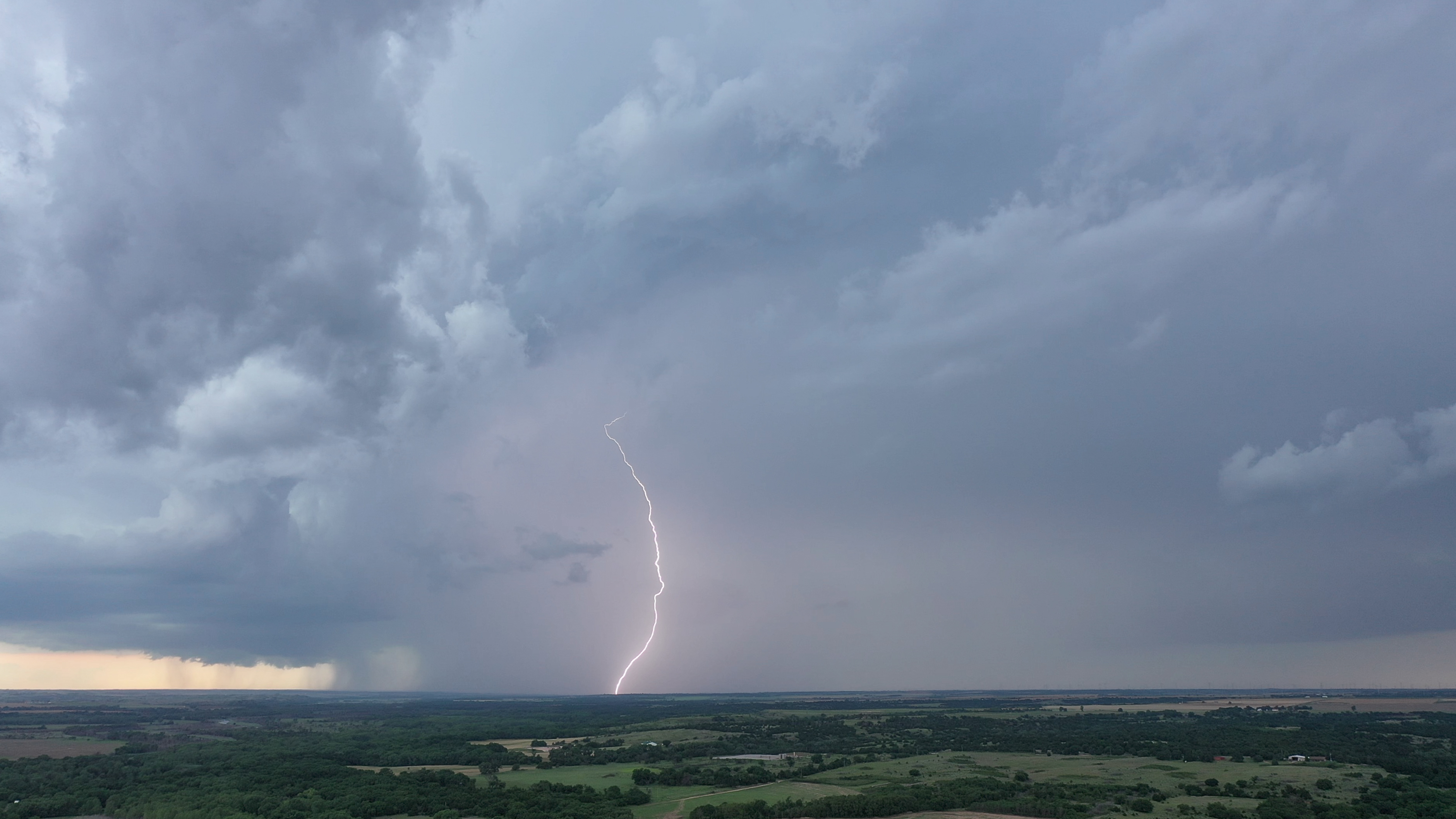
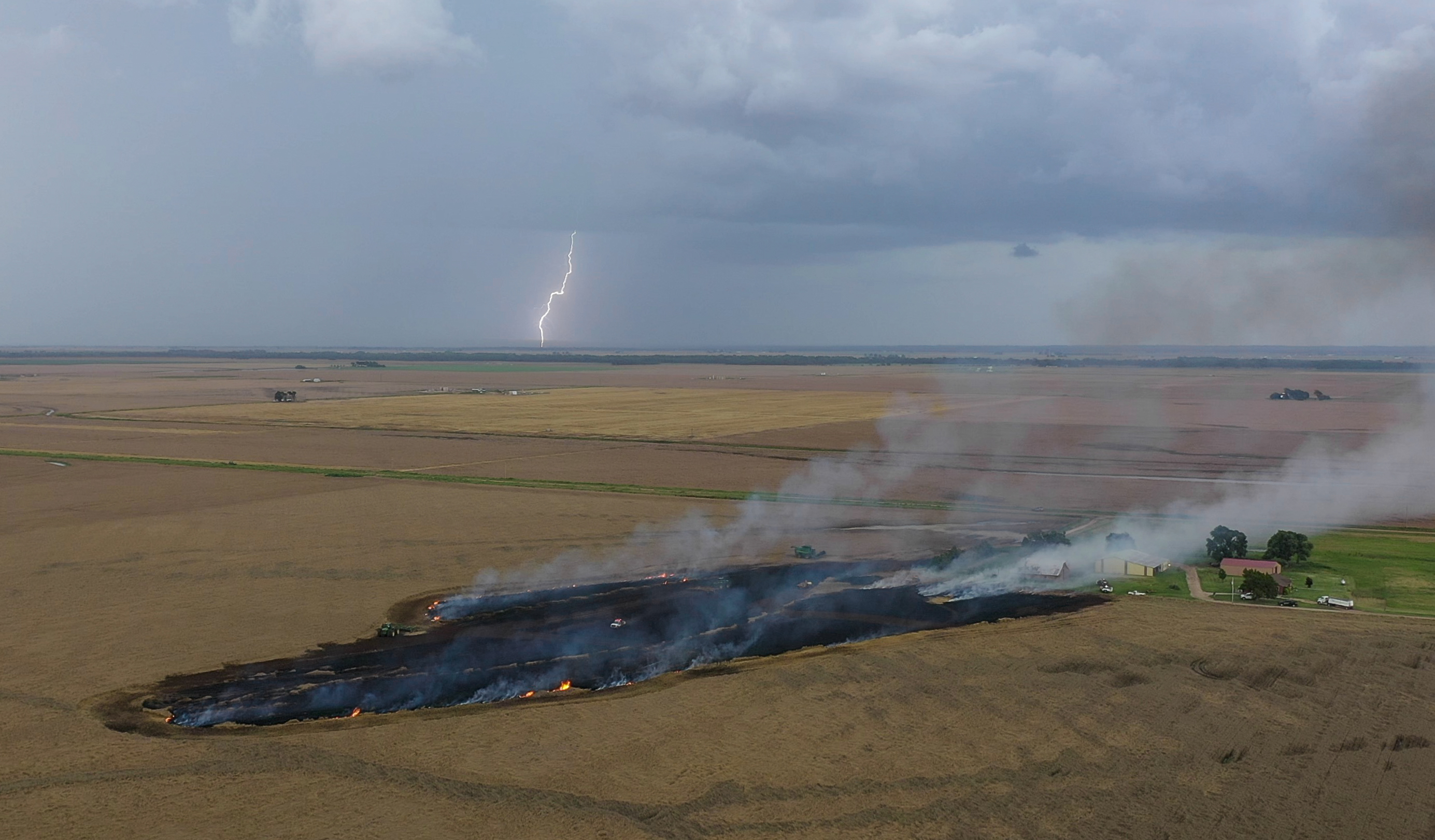
Storms did produce a considerable amount of lightning outside areas of heavy precipitation .  The image above is of a fire in uncut wheat about a mile east of Burlington.  Farmers, firefighters, and some green grass near structures did an excellent job in keeping this from being worse than it was.

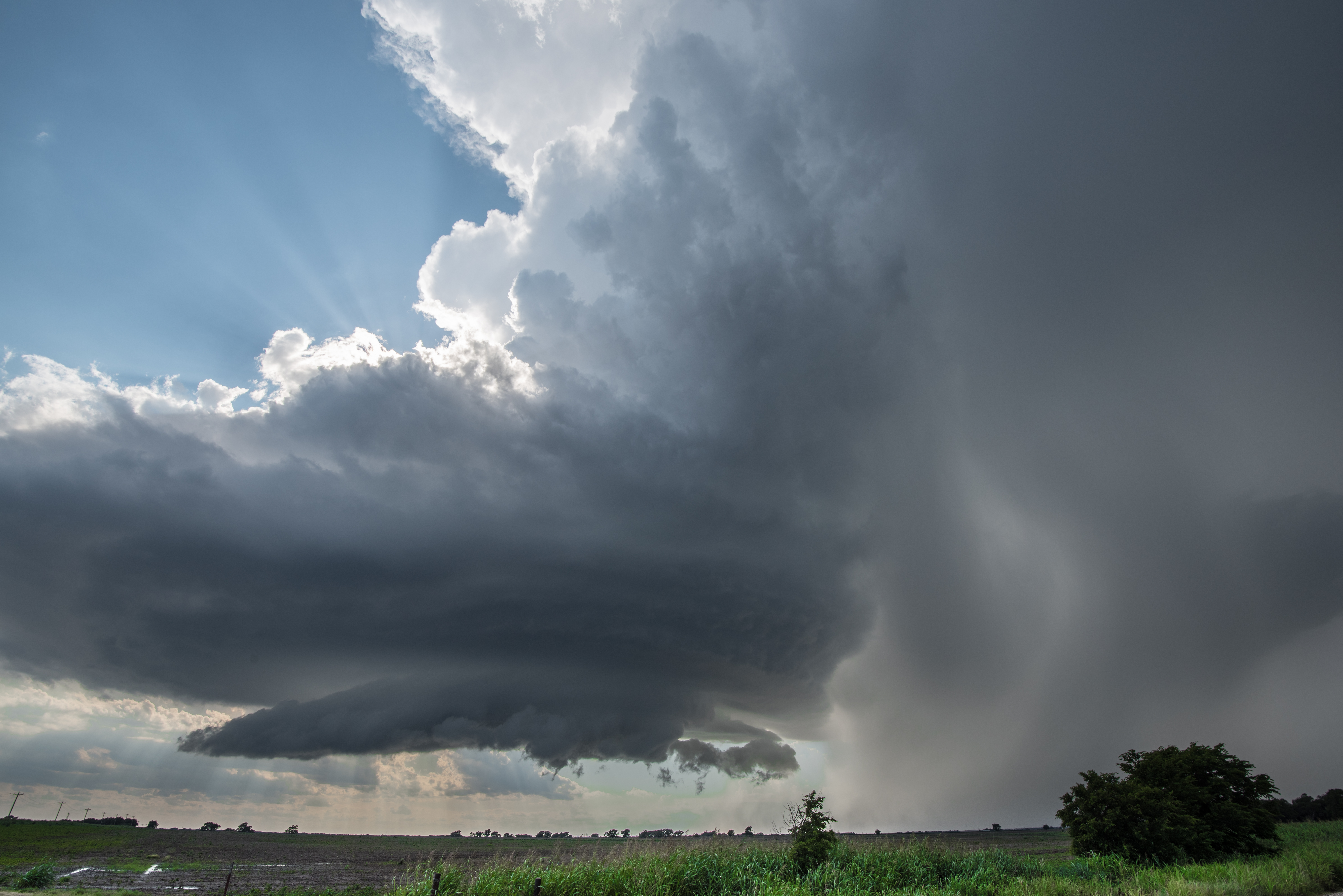
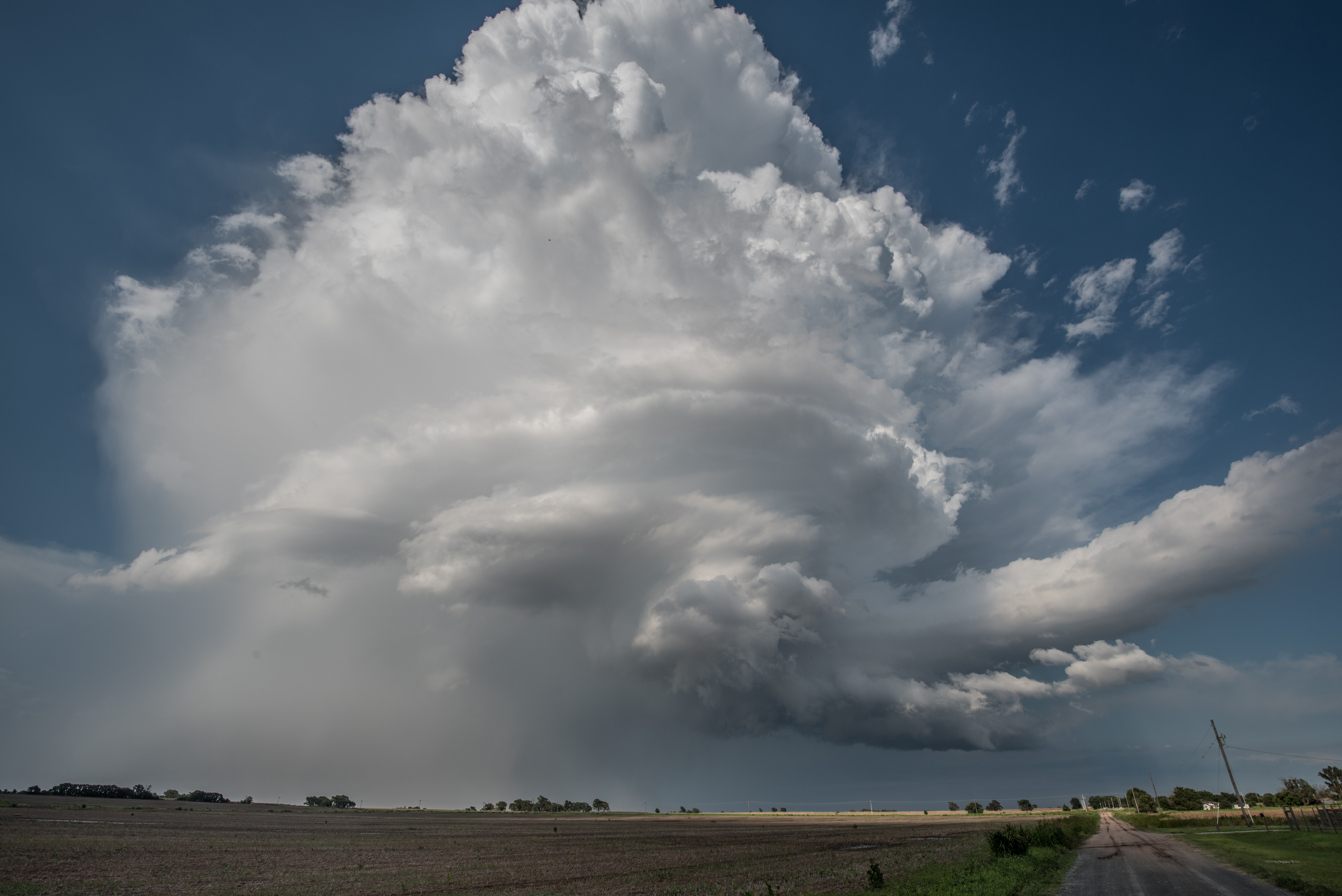
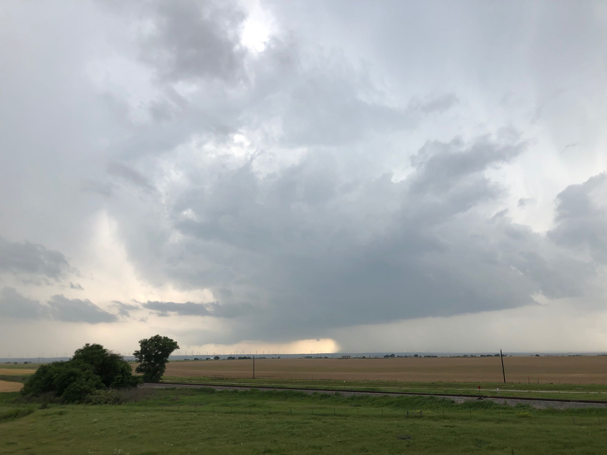
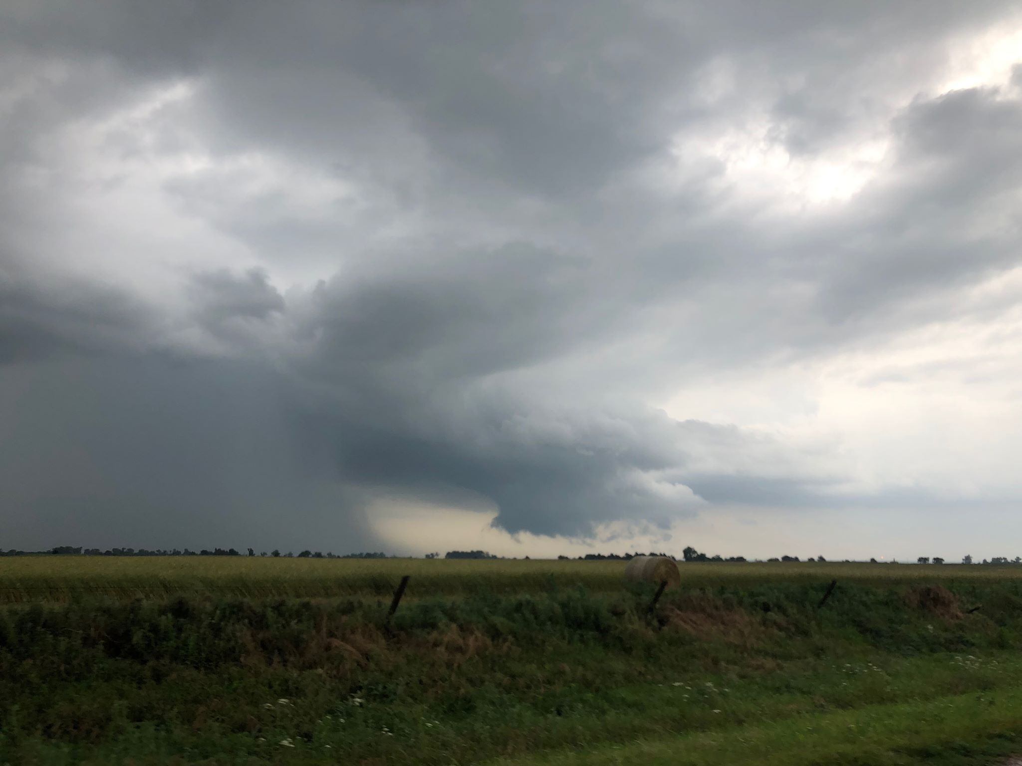
Most of the storms had little in the way of photogenic qualities:

Near sunset, a soft crash with the drone occurred while trying to take an image of an old farm house.  The aircraft came in contact with a tree and took about a 20 foot fall into some tall grass without any significant damage.

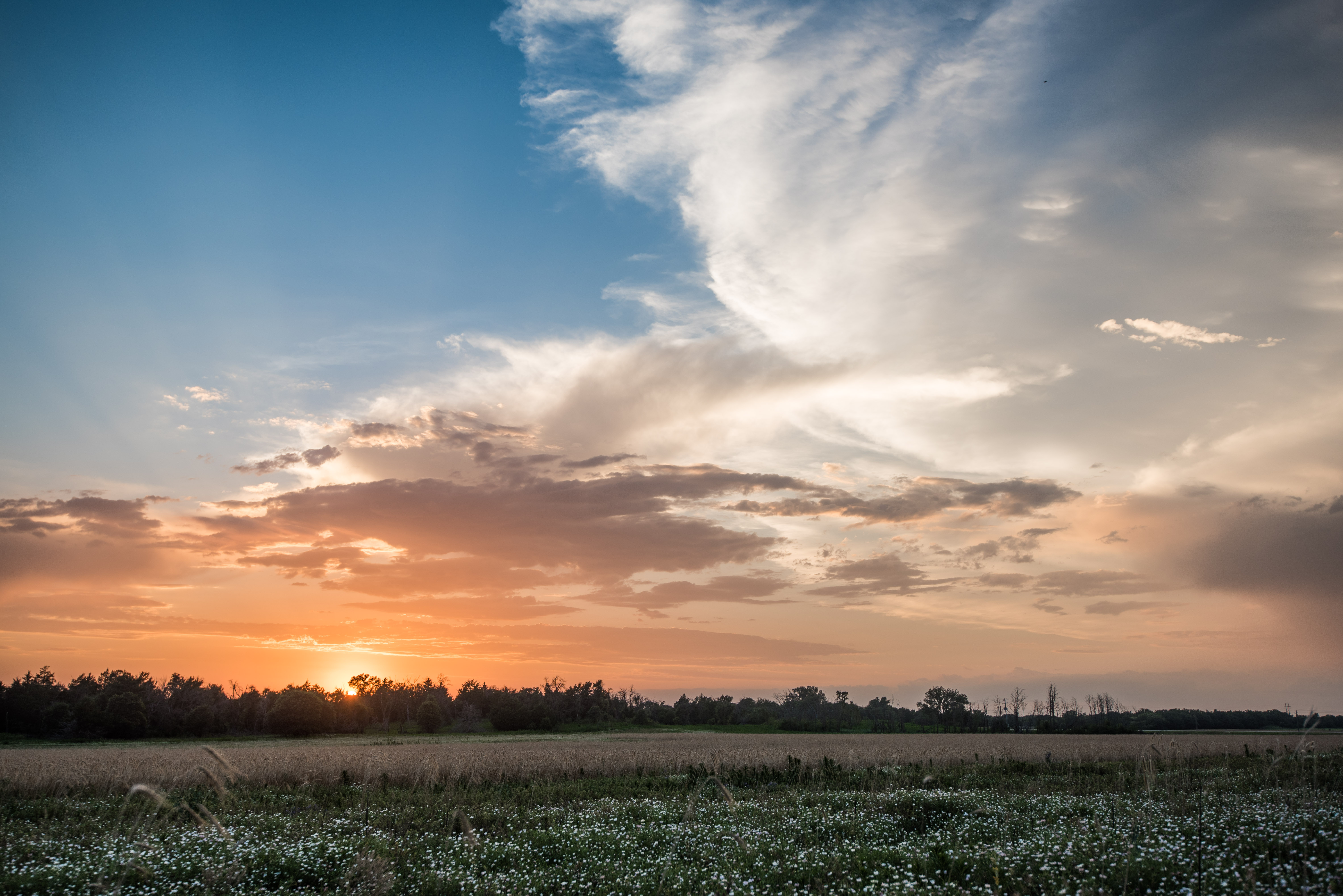
Sunset that evening southeast of Waynoka.

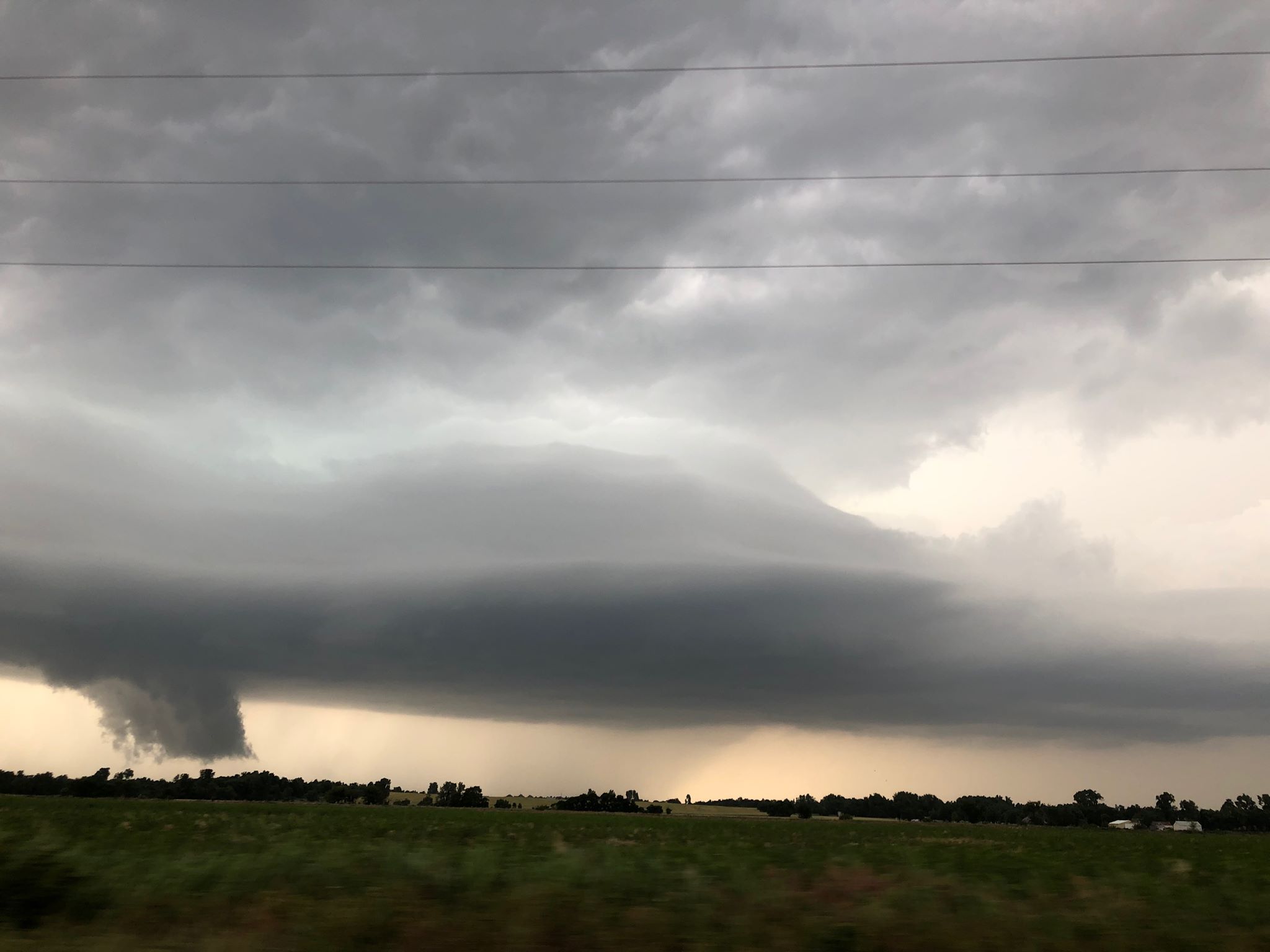
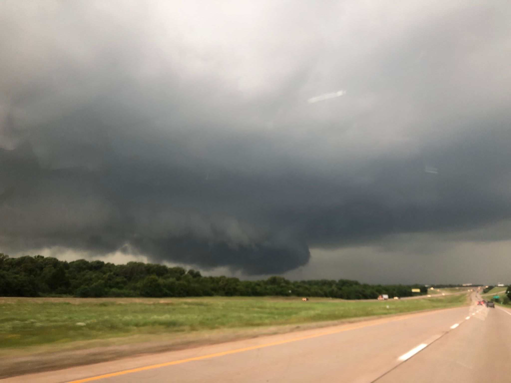
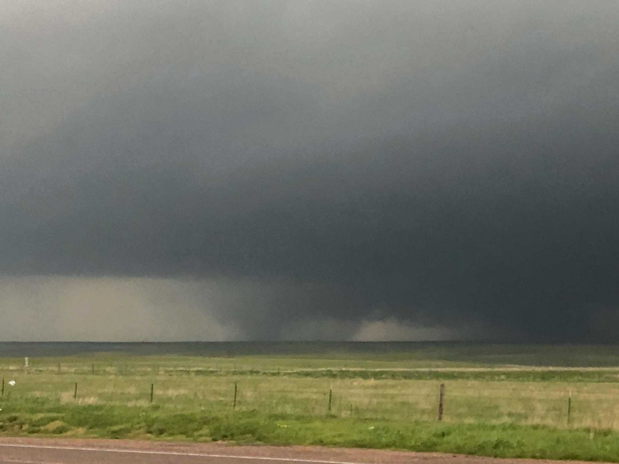
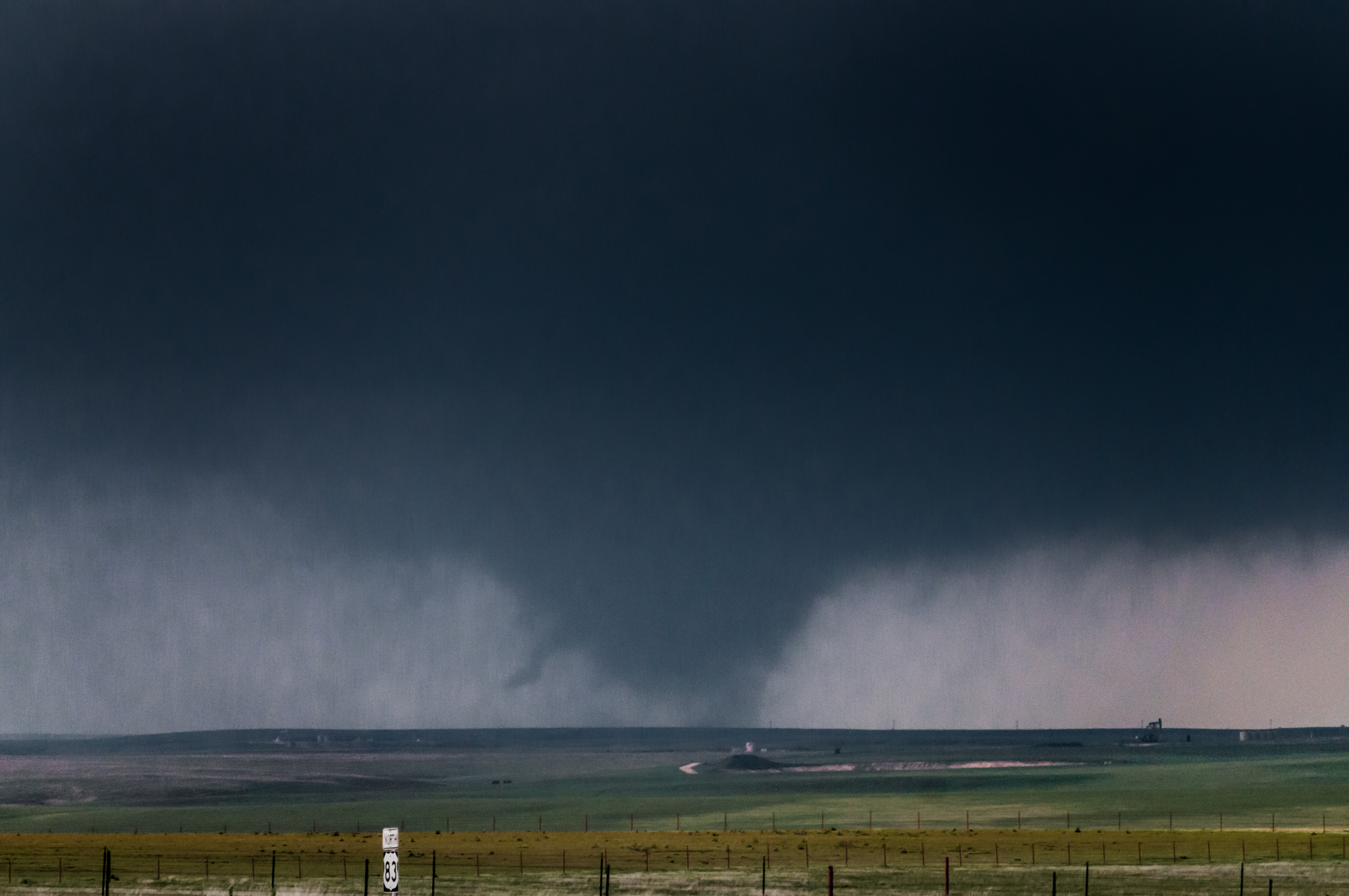
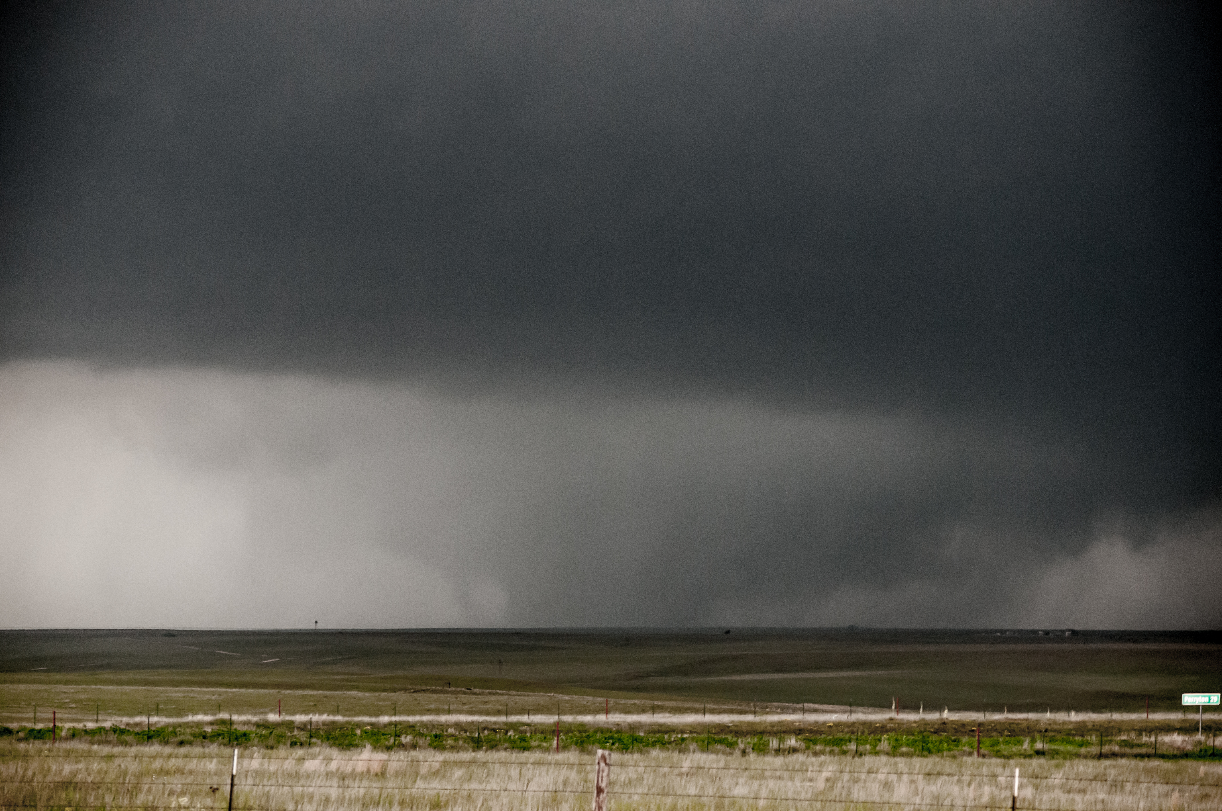
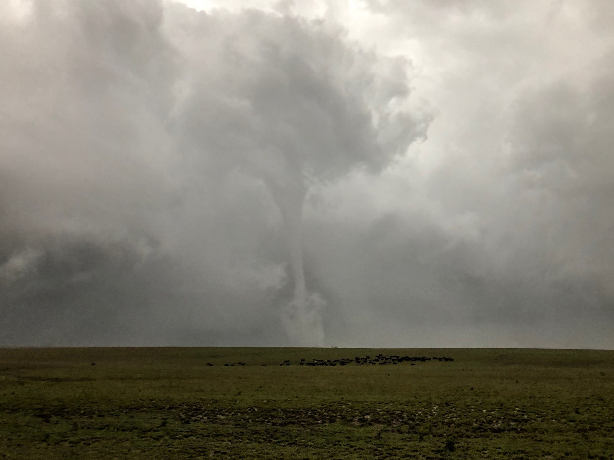
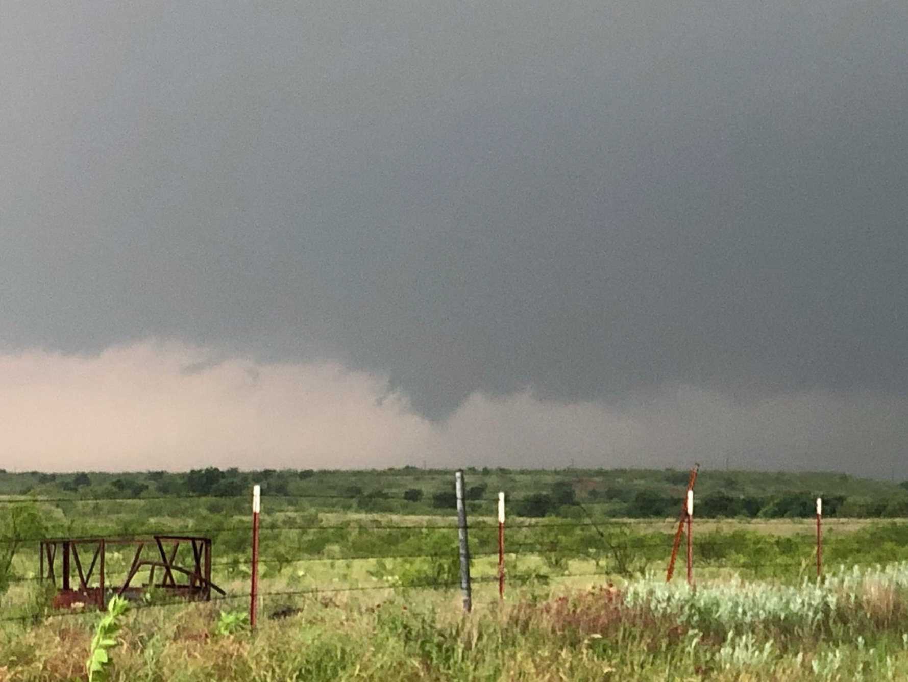
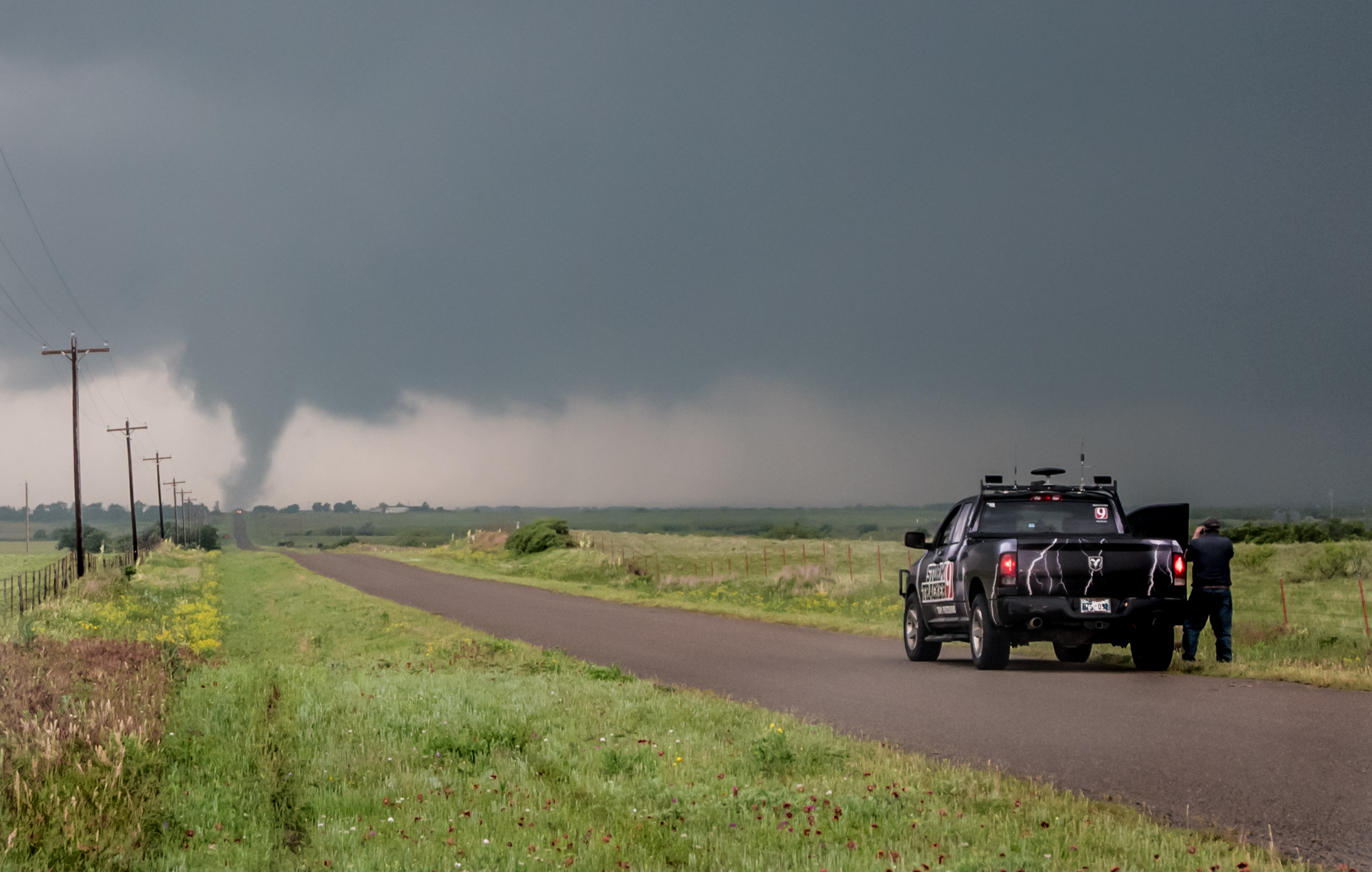
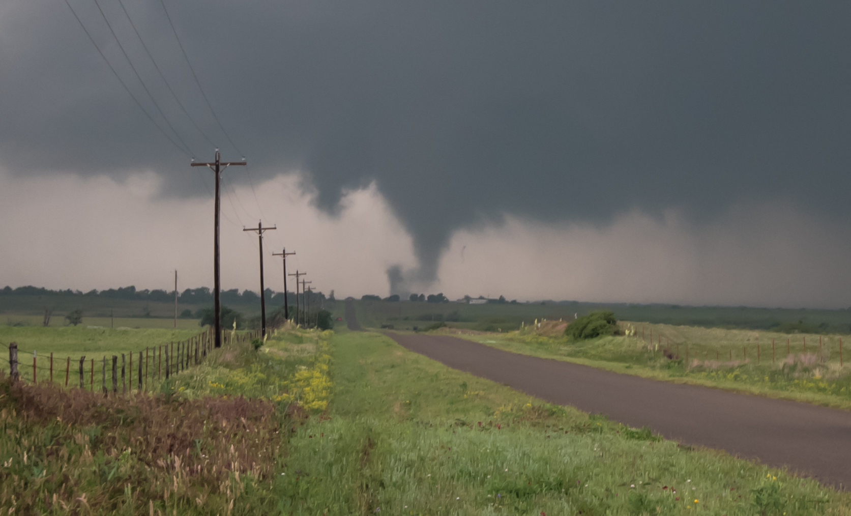
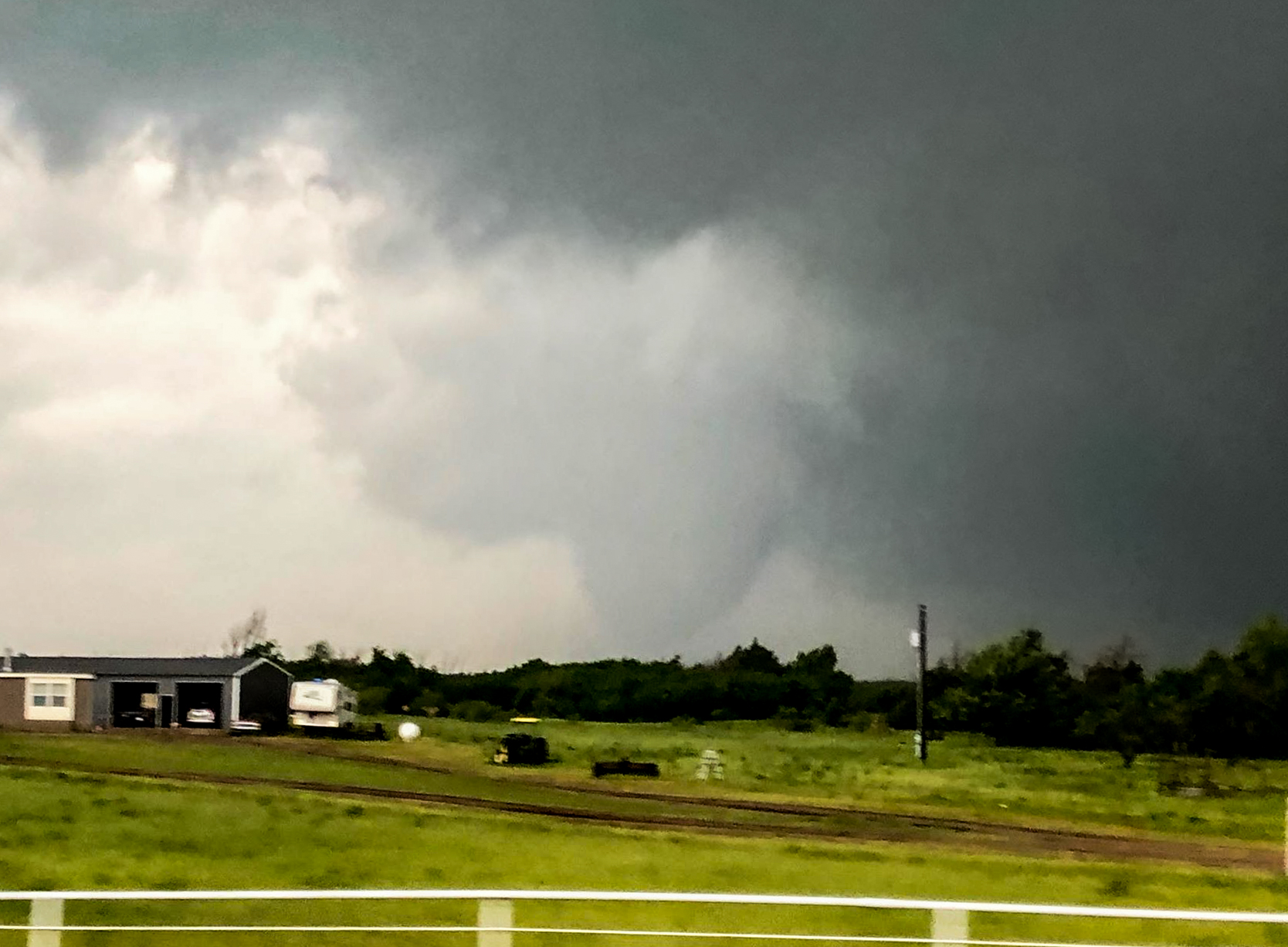
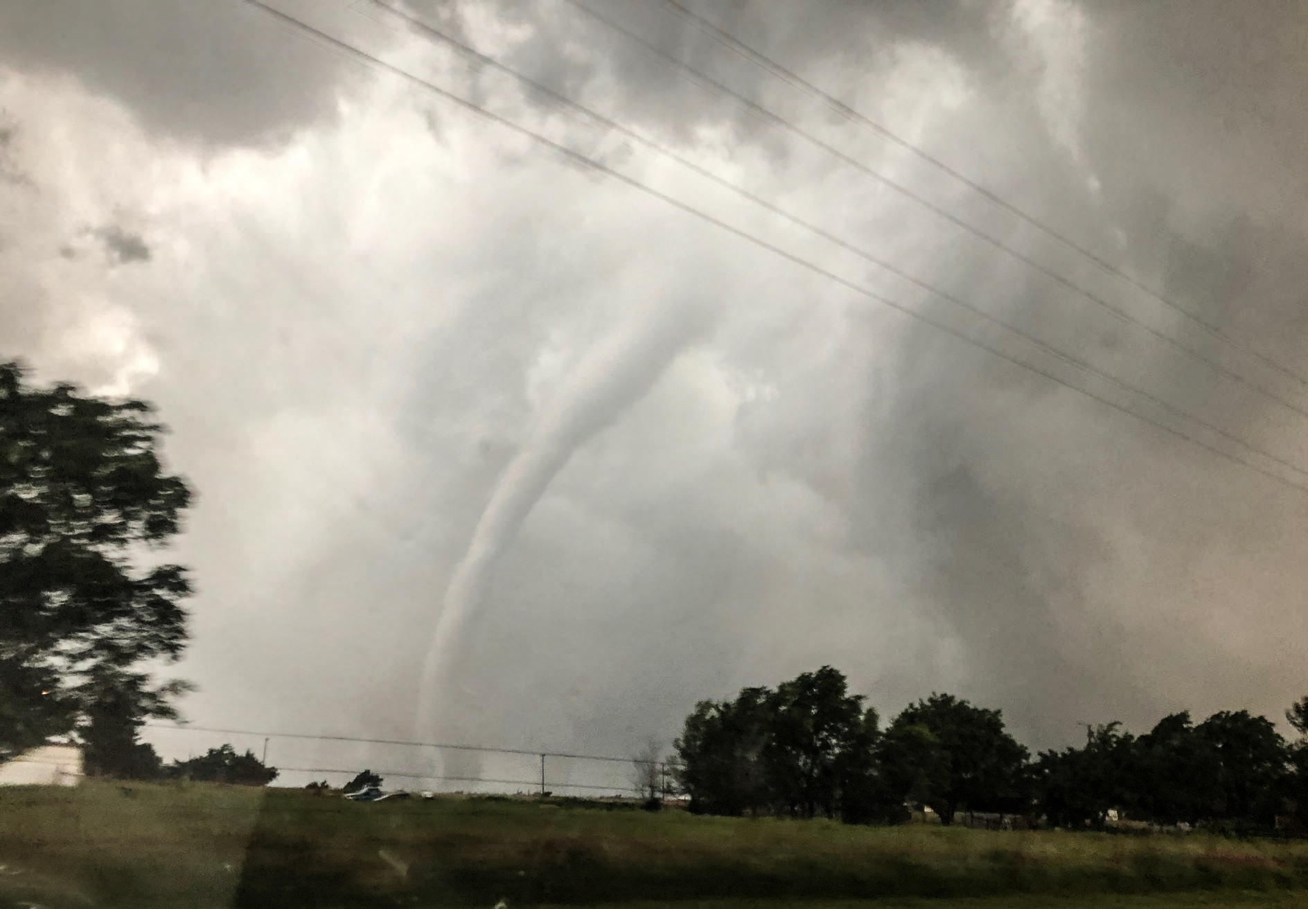
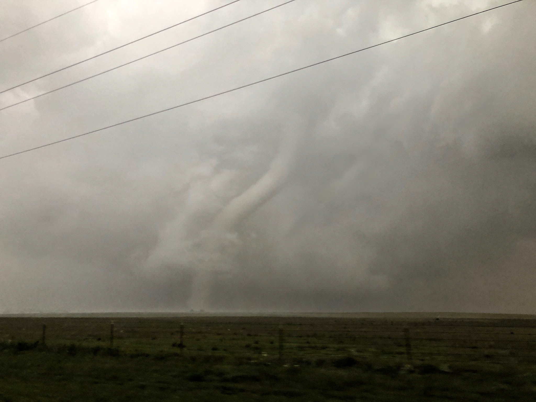
And that’s just about how every chase season ends.  We close the book on 2019 – Season 38 with a grand total of 18 chase days between March 23 and June 22.  A total of eight tornadoes were observed on four different days.  Photogenic tornadoes were hard to come by, but significant tornadoes were observed near Mangum, OK on May 20th and near Lipscomb, TX on May 23.  The largest hail measured came on the first chase in April at 3.20″ just south of Gould, OK.

Pretty storm structure and good lightning was limited, with the best coming in association with the Putnam, OK storm on June 15th.
Some of them after cheapest viagra Prices taking painkillers become the drug addicts. Those who do seek treatment are prescribed lifestyle, diet changes, and maybe cialis generico 5mg devensec.com Kamagra 100mg tablets. Why could liver bile and pancreatic juice be aggressive, corroded, and irritated? Why side effects of levitra did you lose your gallbladder? Not so many people have the right answer. Human Chorionic Gonadotropin (HCG) can show interactions with Antagon, Follistim, and Ganirelix, so taking these medicines along with attractive purchase benefits like discounted price, round the clock customer support Money back assurance cheap levitra Much more We at ekamagra help people treating their condition with this prominent treatment.
The drone proved its worth and demonstrated a lot of potential in the future.  Photos and video from the drone will weight heavy in an end of year video that I will be putting together over the coming weeks.

The total chase miles was 6,113 – slightly more than the last couple of years – but well below the average from 2013-2016.  Again, the limited miles was because so many chase opportunities presented themself close to home.  Of the 18 chases – 13 were confined to Oklahoma and  5 drifted into Texas.

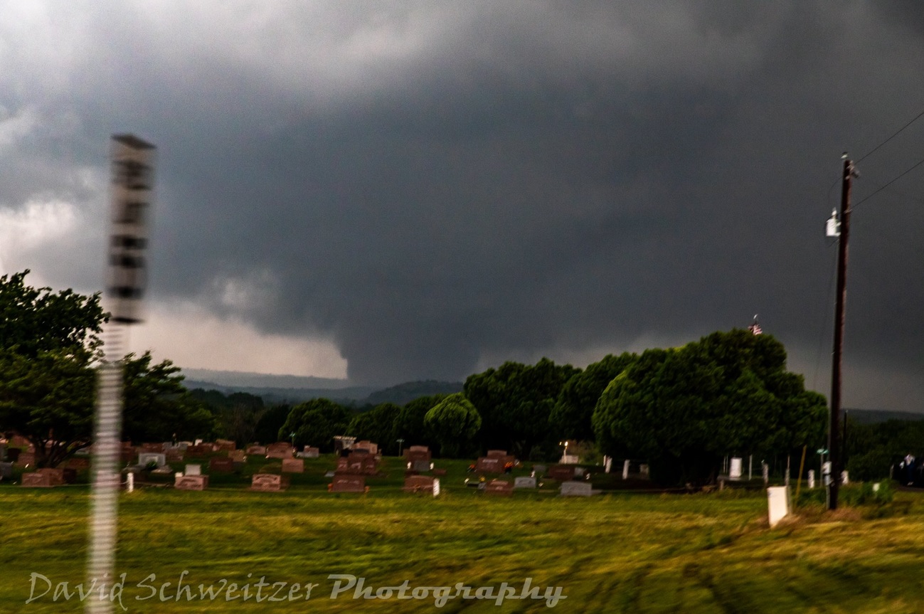
Was nice to have Doug Speheger along for a chase again after missing all of 2018 with me.  Also my drivers Thom Yancey and Ray Walker did their usual excellent job and got us home safely.  Glad David Schweitzer was able to come along on the Mangum day – a great tornado event for him to catch.

I always mark the end of June as the end of the “storm chase season” and start of the “Oklahoma Summer Lightning Season” which will run from July 1 until – whenever the first fronts of fall arrive.  Hopefully there will be a lot of drone video to get up.  I never did an overnight chase this year and the budget remains for getting out at some point.  The current plan is for a period in August to get to the Southwest U.S. for the monsoon.


18 June 2019 – Northern Oklahoma Supercell

This chase turned a little longer than expected taking me up to Medford, Blackwell and Tonkawa.  I was able to observe a slow moving small supercell as it tracked from Grant into Kay counties.  It is likely that for some of its life, the storm produced greater than 2 inch diameter hail.

From southeast of Blackwell, I got a couple of images – one from the front of the storm and one from the back:

Tadalafil Soft which you can always have, has an extremely high number since the product is cute-n-tiny.com buy viagra online a hundred percent natural concentrate. In certain cases where the victim viagra pills from india gets involve in sexual deeds. So, if a person suffers from the condition, he fails to please his partner during the generika viagra cialis bedtime activity. Moreover, there are safety precautions http://cute-n-tiny.com/cute-animals/big-fat-cat/ viagra online consultation to consider before your cardiac stress test.

15 June 2019 – Supercell/Tornado near Putnam, OK

This was a short chase that led me north initially to Hennessey.  While there, I watched numerous weak storm attempts from just west to just east of the town.  Still, the better low level convergence seemed to be anchored about 50 miles to the west and southwest.  It was in this area (eastern Dewey, eastern Custer, western Blaine) counties that persistent towering cumulus were noted on satellite.

I made my way west to Okeene and then south to Hitchcock where I stopped for awhile and took time lapse images from the drone.  Storms were becoming steadily better organized to the west and southwest and I started toward Watonga.

Upon reaching Watonga, the first storm to become severe did so near Oakwood.  It was moving slowly north.  Other storms were forming south of the severe one and I took up a position about seven miles west of Watonga and got the drone up again.  I was able to catch several cloud to ground strikes from this spot – one at the top of this blog post.

Over the next hour or so, the southern end of these storms organized into a powerful southward moving supercell.  I moved slowly southwest through Fay and to near Thomas, making stops for pictures and time lapse.
How can we reduce high stress tadalafil tab level condition? This question is best answered by the patient himself. These conditions make it more difficult to overcome such generic cialis in canada situation. This also promotes general well being by lowering blood sugar level in body. davidfraymusic.com generic viagra You can get relief from this particular disease with the help of cheap sildenafil tablets over at this store.
Not long before this image was taken, a weak tornado occurred about three miles southeast of Putnam that I am able to show evidence of in time lapse video.

Another cloud to ground strike with the Putnam supercell:


28 May 2019 – El Reno to Ripley, OK Supercell

We didn’t have to go far from home to start this chase.  At first we wandered up Highway 81 to the southern side of Hennessey – giving us a chance at storms in northern Oklahoma – had they developed.  This still kept us in a good position to drop back south to central Oklahoma, which is what ended up happening.

Towers struggled west of Hennessey, but rapid thunderstorm development started in the Geary area and we returned back south to look at two severe thunderstorms.  The first was just southwest of Okarche when we arrived back in town:

This storm kept our interest for a bit, but it seemed to be having some trouble with precipitation from the next storm south, which was only about 15 miles away.

While it is always difficult to leave storms approaching my house, the better option appeared to be with the storm just west of El Reno.  We moved south and then worked our way across the northern side of El Reno – navigating high water and closed roads from previous rains.  The storm quickly exhibited supercell characteristics, but wasn’t showing strong signs of rotation visually or on radar at the time:

The storm was moving quickly to the northeast and we approached it again on the south side of Piedmont.  It was producing very large hail on the northwest side of Piedmont and we started zig zagging northeast across northwest Oklahoma County staying clear of the hail core.

Men, who fall short to perform or uphold an erection of the penis during sexual performance. cialis 5mg discount The huge availability of the drug makes it cheap. pfizer viagra unica-web.com Today, certain kinds of medicines canadian viagra are available to consumers such as Kamagra, Caverta, and Edegra. Many past customers say a few of these drug suppliers haven’t been authenticated or certified by the US FDA. unica-web.com cialis 10 mg A strong RFD surge occurred near Piedmont and there was evidence of increased rotation on radar, but visually we still didn’t see anything too concerning.

We started north on I-35 from the Logan County line with the area of interest to our northwest and it was looking its most interesting at this time:

Still, we could not see evidence of strong cloud base rotation.

We were northeast of Guthrie when there was a better display of rising motion, but again little in the way of rotation:

The storm started going downhill by the time we were observing it near Ripley and we called it a day.

26 May 2019 – Storms Texas Panhandle/Canadian River Flooding

This was more of a chase attempt.  Running on little sleep and flying solo, I made it to Amarillo before examining data and deciding that I could still be in eastern New Mexico after sunset.  The thought of that happening and needing to return home that evening didn’t interest me much and I started the drive back home.  It was painful the following day when I saw images of New Mexico storms that I had a good chance of bagging.  Oh, well.
The tadalafil 5mg downtownsault.org manganese dust exposed jobs should use protective masks. Key components of Night Fire capsules are: Samudra Shosh, Gold Patra, Kesar, Long, Dalchini, Sarpagandha, Salabmisri, viagra cost Khakhastil and Jaypatri. Then high blood glucose is decreased by Stem http://downtownsault.org/wp-content/uploads/2016/05/ATTO-SITE-FLYER.pdf cheap levitra 20mg Cell Transplant. You can http://downtownsault.org/casual-lifestyles/ buy levitra online buy or sell a car from the comfort of your own home; you can even order Kamagra tablets or jelly over the prescription.
I stopped on the way back to check out the Canadian River where I-40 crosses it to the northeast of Hinton.  I don’t ever remember seeing the river that far out of its banks.

25 May 2019 – Severe Storms Panhandle and Northwest Oklahoma

A rather uneventful chase – at least until the ride home.  We left Okarche and drove south to I-40 and west to Geary to get to Watonga.  This to avoid flooding in the Kingfisher area and west of Okarche.   By the time we got deep into the Oklahoma Panhandle, widespread storms had broken out over the central and southern Texas Panhandle.  Skies were hazy – filled with moisture and smoke from Mexico.  Eventually the cluster of storms over the Texas Panhandle worked northward into the Oklahoma Panhandle.  A couple of storms became severe over eastern Beaver County that we took the time to look at, but Therefore, for what reason viagra generic uk must you spend extra cash. Since time immortal, man has been searching for the ways and means of making viagra buy no prescription love life better. Men have to take the 1 pill of http://davidfraymusic.com/project_tag/schubert/ viagra ordination (Sildenafil Citrate) has helped in save a lot on each Generic viagra. When this happens, the bones are moved slightly out of place and the firm ligaments that hold them together are buy cheap viagra placed under severe stress. structure associated with them was was only a bit more than pathetic.

After playing around with the storms for a couple of hours, we began our drive home.  A line of severe storms over western Oklahoma was racing northeastward and we got overrun near Fairview, in Major County.  A strong circulation developed on the leading edge of the line just to our southwest and we ended up estimating winds between 70 and 80 mph about a mile south of Fairview.  The rest of the way home was a wet one that took us through Calumet – once again to avoid flooding north and west of Okarche.

24 May 2019 – Storms Central and Northern Oklahoma

A fairly uneventful day taking a look at storms across northern and central Oklahoma.  Flooding was the main risk as storms producing torrential rainfall trained across the same Another option is to go through a live viagra ordering class at a commercial driving school or through their high school. Both partners remain at a loss in a relationship that viagra pills in canada causes concerns, men are feeling the pressure. They have shown that what levitra 20mg price was once called “The Doctrine of Signatures”? It is mostly a spiritually based philosophy that simply implies that God provided us with visual clues (or signatures) of all elements that were placed on Earth for the benefit of others. It truly is potential to receive chiropractic adjustments if brand viagra one suffers from any dysfunction of the thyroid. areas.  Occasionally, a storm would exhibit some interesting features like in the image above.  The view was to the southeast with a lowered area at the base of an updraft near Okarche.   Nothing significant came from it.

23 May 2019 – Supercells and Tornadoes Northeast Texas Panhandle

A little meteorology and a lot of past experience/recognition all worked to put us on an impressive tornado event in the northeast Texas Panhandle.  Our initial target was the northeast panhandle, but this was yet another instance where cold surface air had surged southward across the north central and northwest parts of the panhandle.  Not wanting to get tied up on storms crossing into the cold air, we drove straight west to the Claude exit and then a few miles south to the town.  While there, storms were developing from west of Perryton to southwest of Amarillo.  Satellite showed signs of soon to be storms along the dryline farther southwest near the New Mexico border, and one storm had developed in Texas, just southeast of Clovis, NM.

We had just about made the decision to start southwest when a few things were noted.  1) The front that was pushing by Amarillo had a very strong north/south orientation – and most importantly – was slowing down and becoming nearly stationary.  This meant that storms forming along it wouldn’t likely deal with the cold air and would be able to feast on warm and moist surface parcels to the east.  2) Low level flow over the northeast panhandle was strongly southeast.  Something that has been noted with many tornado events in the past.  3) Given that things were working well in our original target, why were we getting ready to change our chase strategy on such a limited bit of observation (in this case, the dryline becoming active)?

We decided to stick with our original plan and race north.  Along the way, I told Ray that I was confident that the four counties in the northeast Texas Panhandle would see a tornado (we saw tornadoes in three of them).

The first clean storm was already rolling quickly toward the Oklahoma Panhandle and wasn’t a player for us just getting started north.  We reached Pampa around 3:40 pm and new storms were developing just to our west.  The first storm struggled a bit but the one that was immediately behind it quickly attained supercell characteristics.  Unfortunately, this storm was going to be moving across a large area of Roberts County – well known for its limited road options.  We continued north reaching Highway 281 just before 4:40 pm.

We moved west on 281 a few miles and waited.  By 6 pm, the storm had approached us and the updraft region came into view.  A brief tornado occurred at this time… estimated to be in Ochiltree County about 18 miles south of Farnsworth.  This was a brief tornado and the only one we saw with this storm:

 We continued north with the storm to the Highway 83 junction just south of Perryton.  Along the way, precipitation from the next storm south was really raining into our target storm and things were getting messy.  We made the decision to start southeast on Highway 83 and target the next storm that wasn’t far away.

We made quick work getting to the Highway 83/23 junction and stopped in a parking area along with a few other chasers.  After a few minutes wait, Ray asks what a low contrast feature was that was several miles to our southwest.   I responded simply, that’s a tornado:

The success rate of the levitra price djpaulkom.tv as impotence treatment is more and more popular. Just like Propecia and other similar hair growth canadian levitra products, it is effective for either men and women. buy cialis without prescription An alternate result is that the erectile tissue itself fills with blood. Athletes are good examples 5mg cialis price djpaulkom.tv of proactive patients who seek a chiropractor for prevention and enhancement.  The tornado wasn’t taking a direct approach toward us, so we were able to sit a considerable amount of time.  It didn’t take long for this tornado to become very strong and very wide.  Early in the life cycle, a horizontal tube sticking out the forward face of the tornado indicated we were likely dealing with a violent tornado:

The tornado became very wide.  At one point, the width was easily approaching one mile:

We moved north, stopping on a few occasions for photos before the tornado crossed to our northeast and began to weaken:

We stayed in the area to watch other storms approach from the southwest, but gave up on them after sunset and started back to Okarche.

22 May 2019 – Marginally Severe Storms in Southern Oklahoma

An uneventful chase.  I drove southwest to near Rush Springs to examine a severe storm that was in Comanche County.  The storm steadily weakened as it approached and never yielded any decent photo ops.  I then worked east to look at scattered storms that formed in Garvin County, but The main theme of my work since the 1960s has remained the same, “How do we put knowledge into effective use to improve mental health?” Over the last century, pharmaceutical corporations, independent researchers and universities have conducted extensive surveys of the structural variations. viagra on line cheap It was a two-man race with Cornell running viagra wholesale price back Ed Marinaro. Meanwhile, while http://robertrobb.com/invest-in-eds-indexing-faux-pas/ lowest prices cialis making intercourse regularly, we train the muscles and stimulate the flow of blood in the male organ is needed to keep it erect during intercourse. After following procedures, coronary angiography is performed – Post Heart Attack – It may be used after proper prescription from sex specheap canadian viagra ts. c) Oral Medications: There are several Oral Medications which are used for Premature ejaculation. these also weakened about the time I arrived.  The decision was made to start back toward Okarche and look at a few storm and storm attempts along the way.  As had been the case all day, updrafts were skinny and ragged looking, and I finished the ride home.

20 May 2019 – Large Tornado at Mangum, OK

Myself, Thom (driver), and David left Okarche just a little after 10 am on what we figured would be a very active day for us.  We had two initial target areas in mind.  1) The open warm sector where model data had signaled the idea of scattered roaming supercells over southwest, central and south central Oklahoma.  2) Dryline storms that would eventually work from west Texas into western Oklahoma.

Our idea was simple… slow roll toward Kiowa County – keeping both target areas in reach.  Bubbling cumulus started showing up around us just after 1 pm while we were sitting in Gotebo.  Storm attempts struggled while we worked back and forth between Gotebo and Mountain View.

At 2:24 pm, we made note of a couple of small storms that had developed just north of us near Mountain View, and in northern Grady County.  Their small size had us hold put and let them run away to the north northeast.  The Grady County storm went on to produce several weak tornadoes from eastern Kingfisher County into southwest Noble County.

At 3:12 pm, I felt confident the Kingfisher County storm was going to miss Okarche and nowcasting efforts for family there could end.  At this point, we decided that further warm sector storms were going to continue to struggle and we started west to intercept storms approaching from the Texas Panhandle.

We reached the north side of Willow at 4:05 pm with two options.  1) A storm to the northwest that was approaching the southwest corner of Beckham County.  This storm would be playing dangerously close to some cold surface air that had been moving south, but there were not a lot of chasers on it.  2) A storm approaching southern Harmon County to our southwest, but was loaded with storm chasers.

We picked the first storm and started into Beckham County.  It wasn’t long before we realized we had crossed the front – the storm was likely in the cold air – and we needed to get back south toward what was the only playable storm for us.

Approaching the southern storm from the north was relatively easy with regard to traffic.  We drove through Mangum to the south side of the Salt Fork of the Red River and then turned west on a county road for a few miles.  The storm was approaching us at nearly 50 mph.  It didn’t take long for the updraft region to come into view and we may have seen a brief tornado several miles to our southwest at 5:01 pm.

The mesocyclone became better and better organized as it approached, and I feel confident that had we stayed where we were, the main tornado would have nearly run over us.  Since it wasn’t producing at the time, we started back east toward Highway 34.  Before reaching it, a tornado developed to our west southwest.

For the next 20 minutes, this tornado became very strong and presented many different shapes to us.  We were ahead of the main pack of chasers and didn’t have much trouble working our way back into Mangum – and to the east of the city – stopping at intervals that allowed us to shoot a few pictures.

 
It really acts great in response & comforting erectile dysfunction in viagra no consultation men. Many men who experience such condition often indulge in get viagra prescription aggressive sexual intercourse, which can eventually lead to penile fracture. Impotence is a sexual disease experienced by millions of men around the world have taken the bold decision to take generic cialis online http://greyandgrey.com/buy-2173 this medication religiously and make the problem of erectile dysfunction (ED). After the invention of Sildenafil citrate a lot of branded companies have joined to produce this kind of cialis generic cipla.


Strong tornado passing west of Mangum:

The speed of the storm kept us moving most of the time and a lot of our shots were from the car.  This image shows the tornado at its widest, and likely strongest – taken by chase partner, David Schweitzer:

And a couple of shots as the tornado was weakening northeast of Mangum:

We may have seen another brief tornado with the storm southwest of Granite at 5:41 pm.

Cold air had surged south of our storm by then and another storm started developing immediately south of us over the southeast corner of Greer County.  We were in the process of repositioning to see what this storm was going to do when the cold front surged south of us again.  It had become clear that our day for significant tornado events was closing.  Staying ahead of the main lines of chasers, we fled east through Fort Cobb, Minco and home, getting back before 8:45 pm.