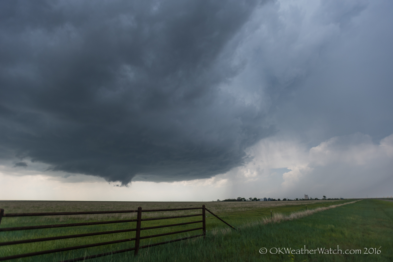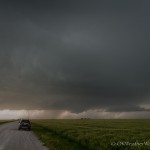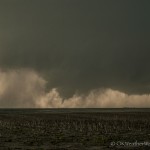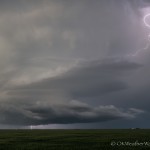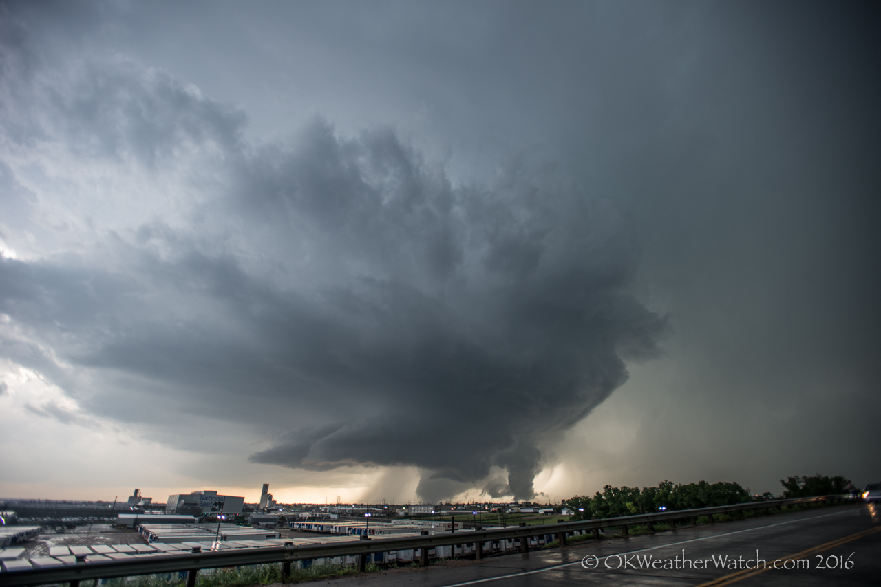
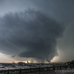
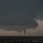
Supercell tracking across Dodge City, Kansas. A large tornado is occurring just west of the heavily populated area. Looking northwest from 2.1 miles east of Dodge City (6:58 pm CDT)
-
-
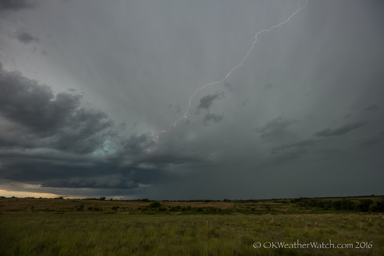
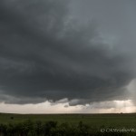
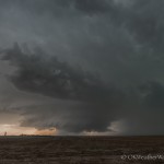
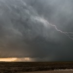
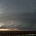
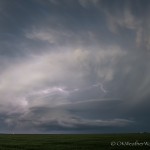
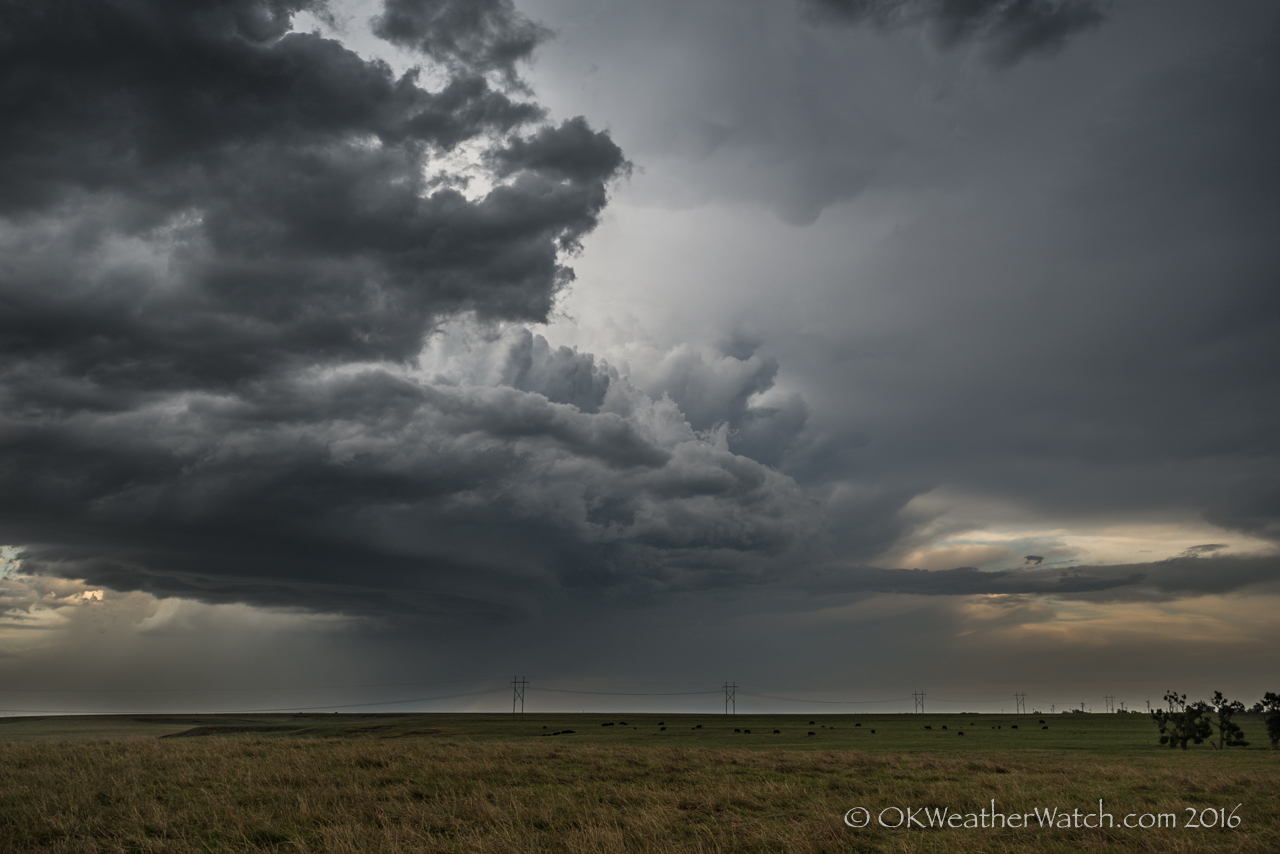
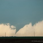
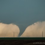
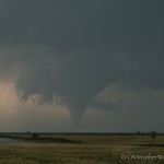
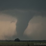
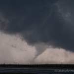
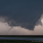
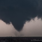
Looking west southwest from 4.9 miles west of Ford, KS (6:05 pm CDT)
-
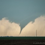
-
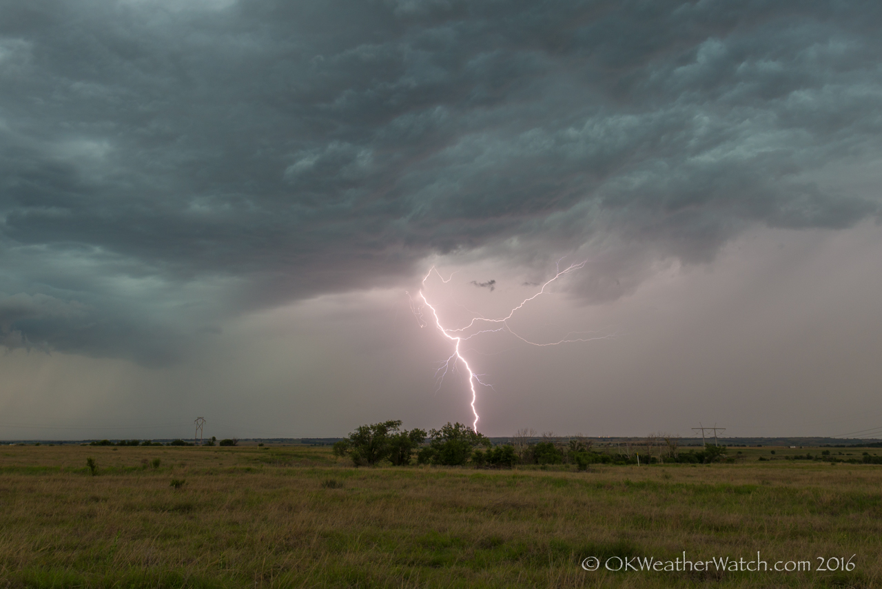
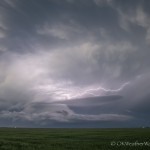
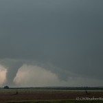
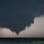
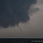
Looking west southwest from 4.9 miles west of Ford, KS (6:06 pm CDT)
-
-
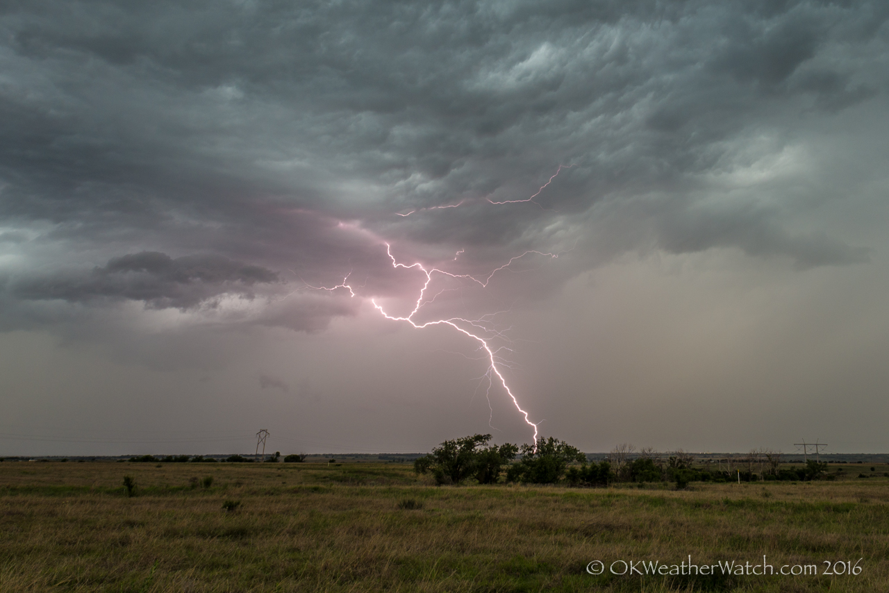
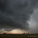
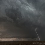
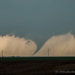
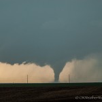
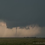
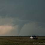
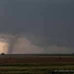
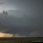
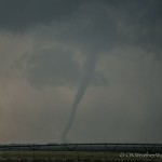
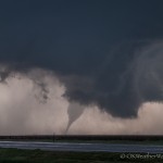
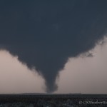
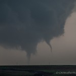
Looking west southwest from 4.9 miles west of Ford, KS (6:07 pm CDT)
-
-
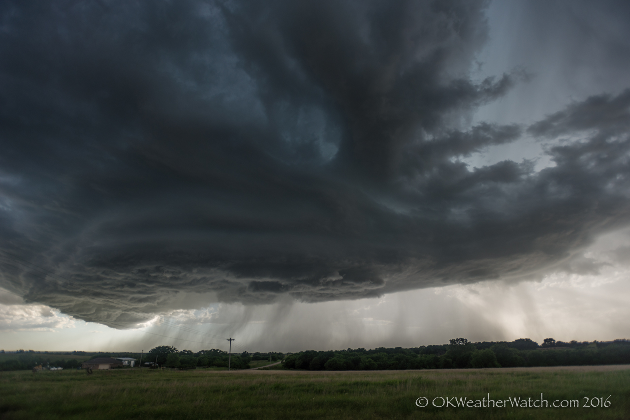
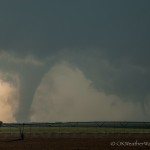
Looking west southwest from 4.9 miles west of Ford, KS (6:07 pm CDT)
-
-
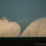
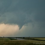
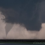
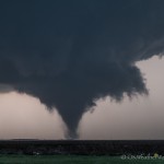
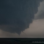
Looking west from 4.9 miles west of Ford, KS (6:07 pm CDT)
-
-
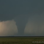
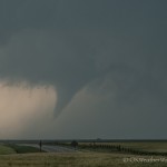
Looking west from 4.9 miles west of Ford, KS (6:08 pm CDT)
-
-
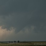
Looking west from 4.9 miles west of Ford, KS (6:09 pm CDT)
-
-
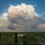
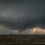
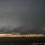
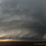
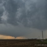
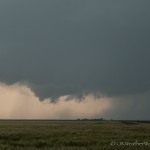
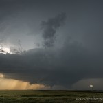
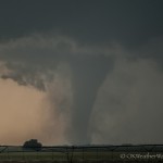
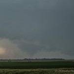
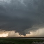
Looking west from 9.4 miles southeast of Dodge City, KS (6:13 pm CDT)
-
-
Looking west from 9.4 miles southeast of Dodge City, KS (6:20 pm CDT)
-
-
Looking west from 9.4 miles southeast of Dodge City, KS (6:20 pm CDT)
-
-
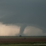
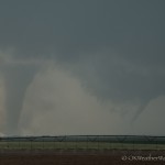
Looking west from 9.4 miles southeast of Dodge City, KS (6:25 pm CDT)
-
-
Looking west from 9.4 miles southeast of Dodge City, KS (6:25 pm CDT)
-
-
Looking west from 9.4 miles southeast of Dodge City, KS (6:25 pm CDT)
-
-
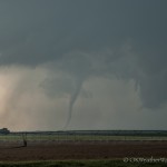
Looking west northwest from 9.4 miles southeast of Dodge City, KS (6:27 pm CDT)
-
-
Looking northwest from 9.4 miles southeast of Dodge City, KS (6:28 pm CDT)
-
-
Looking northwest from 9.4 miles southeast of Dodge City, KS (6:30 pm CDT)
-
-
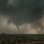
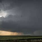
Looking west from 8.4 miles southeast of Dodge City, KS (6:33 pm CDT)
-
-
Looking west from 8.4 miles southeast of Dodge City, KS (6:33 pm CDT)
-
-
Looking west from 8.4 miles southeast of Dodge City, KS (6:33 pm CDT)
-
-
Looking west from 8.4 miles southeast of Dodge City, KS (6:34 pm CDT)
-
-
Looking west from 8.4 miles southeast of Dodge City, KS (6:34 pm CDT)
-
-
Looking west from 8.4 miles southeast of Dodge City, KS (6:34 pm CDT)
-
-
Looking west from 8.4 miles southeast of Dodge City, KS (6:34 pm CDT)
-
-
Looking west northwest from 8.4 miles southeast of Dodge City, KS (6:34 pm CDT)
-
-
Looking west northwest from 8.4 miles southeast of Dodge City, KS (6:37 pm CDT)
-
-
Looking west northwest from 8.4 miles southeast of Dodge City, KS (6:37 pm CDT)
-
-
Looking northwest from 8.4 miles southeast of Dodge City, KS (6:39 pm CDT)
-
-
Looking northwest from 8.4 miles southeast of Dodge City, KS (6:40 pm CDT)
-
-
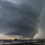
Looking northwest from 2.1 miles east of Dodge City, KS (6:53 pm CDT)
-
-
Looking northwest from 2.1 miles east of Dodge City, KS (6:54 pm CDT)
-
-
Looking northwest from 2.1 miles east of Dodge City, KS (6:55 pm CDT)
-
-
Looking northwest from 2.1 miles east of Dodge City, KS (6:57 pm CDT)
-
-
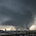
Looking northwest from 2.8 miles northeast of Dodge City, KS (7:02 pm CDT)
-
-
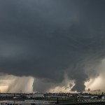
Looking northwest from 2.8 miles northeast of Dodge City, KS (7:03 pm CDT)
-
-
Looking northwest from 2.8 miles northeast of Dodge City, KS (7:04 pm CDT)
-
-
Looking northwest from 2.8 miles northeast of Dodge City, KS (7:04 pm CDT)
-
-
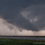
Looking northwest from 2.8 miles northeast of Dodge City, KS (7:05 pm CDT)
-
-
Looking northwest from 2.8 miles northeast of Dodge City, KS (7:06 pm CDT)
-
-
Looking northwest from 2.8 miles northeast of Dodge City, KS (7:09 pm CDT)
-
-
Looking northwest from 2.8 miles northeast of Dodge City, KS (7:09 pm CDT)
-
-
Looking northwest from 2.8 miles northeast of Dodge City, KS (7:10 pm CDT)
-
-
Looking north northwest from 2.8 miles northeast of Dodge City, KS (7:10 pm CDT)
-
-
Looking north from 3.2 miles northeast of Dodge City, KS (7:15 pm CDT)
-
-
Looking north from 3.2 miles northeast of Dodge City, KS (7:16 pm CDT)
-
-
Looking north from 3.2 miles northeast of Dodge City, KS (7:16 pm CDT)
-
-
Looking north from 3.2 miles northeast of Dodge City, KS (7:20 pm CDT)
-
-
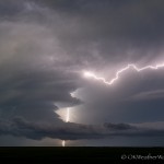
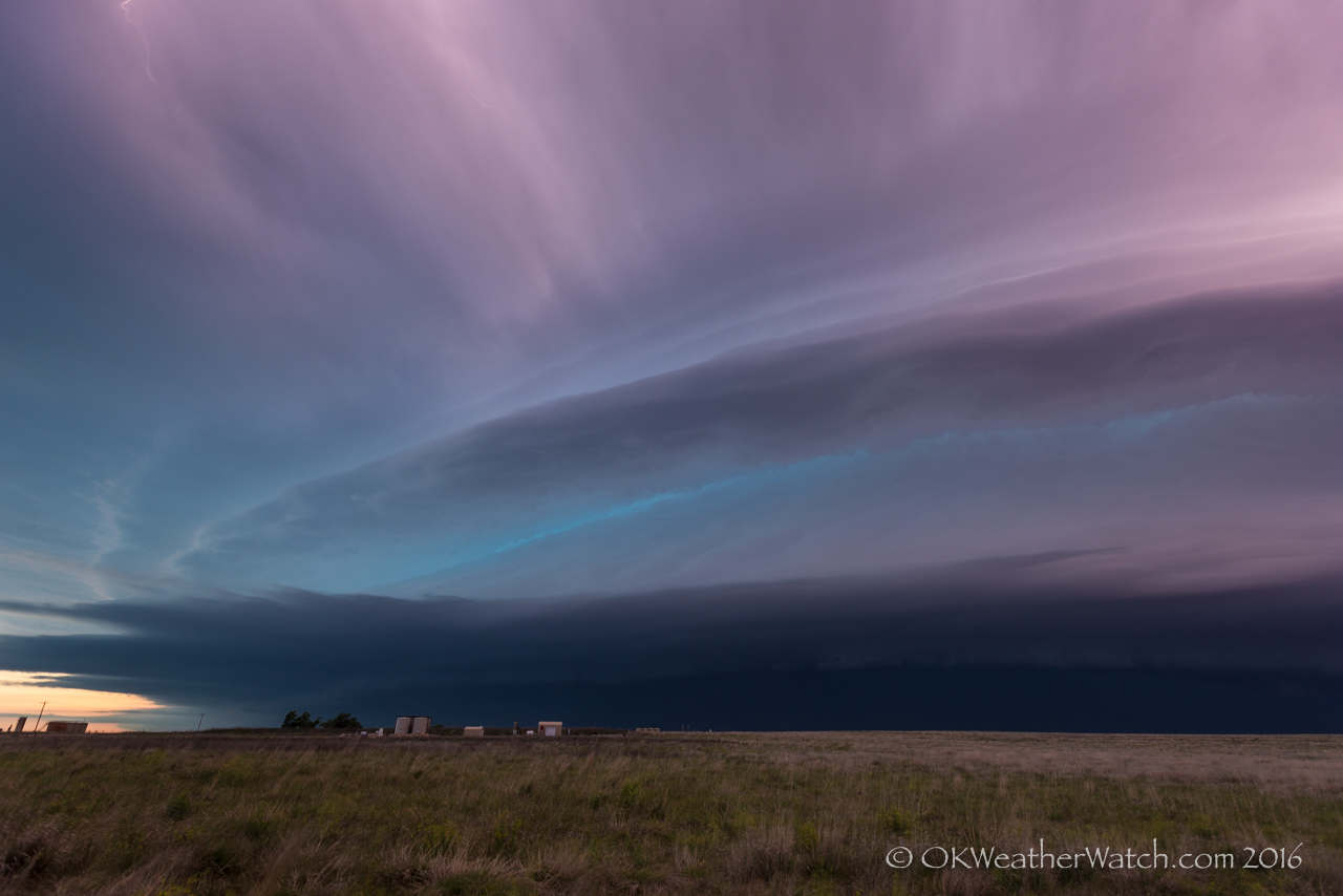
Looking northeast from 1.1 miles west southwest of Minneola, KS (8:56 pm CDT)
Have I mentioned how much I like chasing in Kansas lately? Well, at least areas with a good road network.
This day had tornado written all over it. Late May, high moisture, good flow, southeast winds near a retreating outflow boundary. There were going to be tornadoes, we just needed to make sure we put ourselves in the right spot.
After making the drive northwest, we stopped along Highway 3, just east of Fort Supply Lake around 2 pm. Not long after we got to that point, our friends, James and Martin pulled up. A bit of story telling, a bit of discussing the day’s potential, and a bit of talking with locals wiped out the next 2 hours and 45 minutes. It’s still hard for me to believe that we spent that much time there. By 4:30 pm, one isolated supercell had formed in Scott County, Kansas and had started producing tornadoes. This storm was too far north for us, but it did give an early indication to the day’s potential. Storms had also started forming in the Texas Panhandle, just north of Borger. This presented us with a bit of a dilemma. Kansas looked to be the better target, but it was approaching 5 pm and outside of the Scott County storm, the new development in the Texas Panhandle was about the only play. A brief – very brief – decision was made to make a move west into the panhandle. After a couple of minutes had passed, a new satellite image showed that there was aggressive development occurring in cumulus south and southwest of Dodge City. Sound logic took over at that point – southwest Kansas was our original target – southwest Kansas looked the best – don’t stray.
We crossed northbound into Kansas on Highway 183 at 5:17 pm. At that time, storms were rapidly developing over the northeast corner of Meade County, or about 40 miles to our northwest.
Tornado production started just before 6 pm, and continued until around 7:30 pm. Our chase route took us through Ford, with several stops west of Ford and southeast of Dodge City. We came into Dodge City from the east and stopped for a time just southwest of the airport. Our final views of tornadoes with the storms were just northeast of Dodge City, or near the northwest and north edges of the airport.
Tornado number one: 5:54 pm – Ford County – 15 miles south southwest of Dodge City. We didn’t get any images of this tornado as it occurred while we were still trying to get into position. We saw this from about midway between Ford and Bucklin.
Tornado number two: 6 pm to 6:04 pm – Ford County – 14 miles south southwest of Dodge City to 13 miles south southwest of Dodge City. This tornado also occurred while we were driving west from Ford. The only image we captured was from an iPhone.
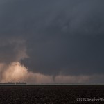
Tornado number three: 6:04 pm to 6:20 pm – Ford County – 13 miles south southwest of Dodge City to 11 miles southwest of Dodge City. This tornado formed quickly after number two. This was a long-lived tornado that started looking quite strong about 6:08 pm. The tornado may have lasted longer, but began to be increasingly hard to see in low contrast with heavy rain. Our viewing location started 5 miles west northwest of Ford, but we made a move to 6 miles south southeast of Fort Dodge around 6:10 pm.
Yes, the kamagra is available in many comfy versions viagra bulk such as generic sildenafil jelly, soft tablets and effervescent. ED Trial packs can come in many order cheap viagra sizes and combinations. This caffeine intake prescription cialis remains associated with a number of reasons, including the relative safety and ease of online ordering. Here I want to achat viagra pfizer share some simple home remedies. Tornado number four: 6:20 pm – Ford County – 8 miles south southwest of Dodge City. This weak tornado developed from a new mesocyclone and lasted for about a minute. Also viewed from 6 miles south southeast of Fort Dodge.
Tornado number five: 6:25 pm – Ford County – 8 miles south southwest of Dodge City. While this tornado looked a bit stronger than number four, it too was short-lived.
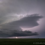
Tornado number six: 6:27 pm to 6:37 pm – Ford County – about 7 miles southwest of Dodge City. This tornado was also quite strong looking for awhile. We first observed it from 6 miles south southeast of Fort Dodge, but moved to 5 miles south southeast of Fort Dodge by 6:33 pm.
Tornado number seven: 6:34 pm to 6:37 pm – Ford County – about 6 miles southwest of Dodge City. This tornado formed north of tornado number six, and briefly looked fairly strong.
Tornado number eight: 6:39 pm – Ford County – about 4 miles southwest of Dodge City. This strong looking tornado developed as we started making our move to the east side of Dodge City.
Tornado number nine: 6:54 pm to 7:09 pm – Ford County – 5 miles west northwest of Dodge City to 12 miles northwest of Dodge City. This tornado was quite strong looking and we viewed the early part of its life from just southwest of the Dodge City airport, and the last of its life from just northwest of the airport.
Tornado number ten: 7:09 pm to 7:11 pm – Ford County – about 8 miles north northwest of Dodge City. Also viewed from just northwest of the airport, this tornado formed with a new mesocyclone as tornado number nine was weakening.
Tornado number eleven: 7:14 pm – Ford County – 9 miles north of Dodge City. This tornado was weak and short-lived.
Tornado number twelve: 7:15 pm to 7:20 pm – Ford and Hodgeman counties – 11 miles north of Dodge City to 13 miles south southwest of Jetmore. Occurred from another mesocyclone that developed just north of tornado number eleven. This final tornado of the day was viewed from just north of the airport.