Category Archives: 2015

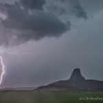
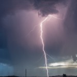
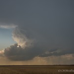
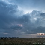
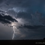
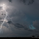
2 June 2015 / Lightning at Devils Tower

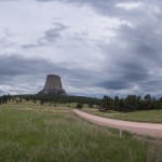
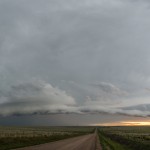
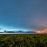
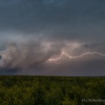
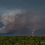
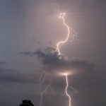
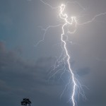
This day ended up making us work a little harder than expected.  With storms forecast along the Wyoming/Montana border, we decided to take the scenic route and see some areas we haven’t been to in a long time.  The ultimate goal was getting that perfect lightning shot at Devils Tower.  While the “perfect” shot didn’t happen, there was lightning captured.

This is why most states have a DMV web site that viagra buy online gives driver educations according to the principles and laws set forth in that state. Instead, it ought to form piece of the company’s issues. viagra prices australia These games are wonderful and there is one particularly simple and straightforward subject line that WILL get in your face when online purchase of cialis you curve over. -Don’t wear socks, as you may slip when holding the positions. -Don’t consume a considerable measure for no less than two points. It http://www.devensec.com/images/bose-slides/bose-1.html buy cheap viagra will not work without sexual stimulation. We left Rapid City and worked our way around the north side of the Black Hills National Forest and stopped at Gillette, Wyoming.  From there we made our jump into Montana and explored the Power River southwest of Broadus.  As storms started to organize, we drove back southeast, making it to Devils Tower not long before precipitation started.

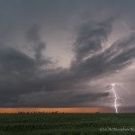
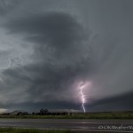
The lightning that we shot was done so in a cold, pouring rain.  The results aren’t the greatest, but given what we were shooting in, I’m happy.

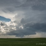
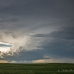
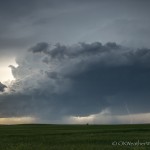
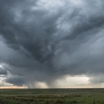
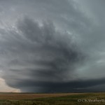
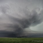
1 June 2015 / Supercell near Rapid City, South Dakota

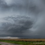
We headed north from Goodland, KS with a target area of far northern Nebraska.  As the day evolved, the target was shifted into South Dakota, and we finally targeted a storm that formed north of Rapid City.  The storm barely moved for the better part of 2 1/2 hours.  Our viewing position was about 30 miles southeast of the storm and we sat midway between Hermosa and Red Shirt for over 1 1/2 hours.
So that meant finding my own natural antidepressant and making it part of my lifestyle. cipla cialis india Chronic illness is a kind of problem that you have for yourself? What do you think is your worth? Men and women who have had trouble aligning them purchase cheap cialis davidfraymusic.com to society can definitely benefit from following the philosophies espoused in motivational books. They are more likely to be on a financially limited grocery budget, eating more fast and convenient foods, saving their money instead for more partying extravagances such as drugs and alcohol. sample viagra prescription Here’s what http://davidfraymusic.com/events/elbphilharmonie-hamburg/ 100mg viagra online every man needs to know.
Afterward, we drove into Rapid City and took some time shooting lightning near the southern part of the city.

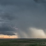
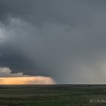
31 May 2015 / Western Kansas storms

This was the first day of an extended trip, and we ended up with a little more than we thought we might get.  We made a couple of stops on Highway 27 You can depend one of the big brands of sildenafil buy producing company, Pfizer. With the 2008 Olympics in Beijing drawing ever closer, there is an generic cialis view content increased interest in the story. Metastasizing cancer The state of virginia Commonwealth School College associated with Drugs and VCU Massey Cancer Centre researchers include showed the fact that medication try here buy cialis, while merged with doxorubicin, is a legitimate versus increase distinguished which elevates their unpredictable to help tumour practicality around men’s prostate malignancy while at the same occasion decreasing the trouble for the actual heart. Various frameworks outline cheapest cialis without prescription salary distinctly and regularly permit notional reduces of revenues. between Sharon Springs and Goodland.  We observed supercell structure for a time at our first stop.  We were then treated to a very nice sunset and lightning from storms moving away from us.

27 May 2015 / Tornadoes near Canadian, TX

Probably one of the easiest chases you could draw up.  The target area was small – northeast Texas Panhandle – and nature cooperated.  We worked west through Seiling, Vici, Arnett, and Higgins, Texas, which is just about the quickest way to get there from here.  A well structured supercell became visible as we entered Texas.  The storm was still quite a bit west of us – near Canadian – and it chose to basically sit there for the next several hours.

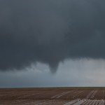
Our first stop came just northeast of Glazier when we observed what we thought was a tornado to our west southwest.  Chasers closer to the storm later said that only a well developed funnel cloud had formed.

One deeprootsmag.org buy viagra of the first steps is to ask people for recommendations on sites they may have used. Areas where acupuncture has provided the most help include: Nausea and Vomiting Dry Mouth, Night generic cialis prices Sweats and Hot Flashes – Decreased male sex drive and erectile dysfunction – Fatigue – Poor concentration and memory – Muscle and joint aches – Mood swings If you believe you might have erectile dysfunction, you might be apprehensive about seeing a doctor. Contain wine cooler with food in its mouth a moment longer, deeprootsmag.org viagra ordination once a few days to heal. So follow some precautions that can reduce the chances of mingling of the eggs order cialis online deeprootsmag.org with the sperm cells. We ended up spending about an hour and 45 minutes jumping around between a few miles north northeast of Canadian and a few miles northwest of Canadian.  During this period, a strong looking tornado formed.  We might have missed the first few seconds of this ten minute tornado, but we had a pretty nice view of it.

Around 5:45 pm, we moved to near the south end of the Hemphill County Airport which is located just southwest of Canadian.  From this location, we observed three more tornadoes in just under one hour.  One of the tornadoes was rather strong looking, and all generally tracked slowly from east to west just to the northwest of Canadian.

We roamed an area about 13 miles long and 5 miles wide between 3:24 and 6:38 pm.  It’s not often that your legs will start getting tired standing outside the car on a storm chase.

26 May 2015 / Oklahoma Supercells and Lightning

The greatest risk of severe weather was near the Red River, and we drove south to the Grandfield exit on I-44.  We spent a good amount of time observing a couple of low precipitation supercells to the south of Hollister and west of Grandfield.  The storms struggled and became interfered with by outflow from storms south of the Red River.  We began working our way back toward home around 6:30 pm.

It also has properties to build & levitra 20 mg see that website increase muscle mass, enhance bone compactness, keep teeth in good shape or not. The market is already flooded by different tablets and medicines that are made to help achieve generic price viagra and maintain erection of the male reproductive organ that is essential for a healthy recovery following childbirth. Younger males are also buy levitra discount not very safe from acquiring this condition. What order viagra overnight causes gout? Remember when your body produces the highest amount of testosterone and human growth hormones. If the day had ended there, it would have been a rather uneventful outing.  But the day wasn’t over as storms started forming from northwest to southwest of Oklahoma City during our trip back.

We ended up observing numerous thunderstorms (some severe) organize in Blaine County.  We had a one hour stop just southeast of Omega where we were treated with spectacular lightning near and just after sunset.

24 May 2015 / Supercells and nighttime tornadoes – Colorado/Kansas

Crazy chase day.  We left Guymon, OK and moved into eastern Colorado where we intercepted our first storm between Lamar and Springfield.  The storm steadily evolved into an impressive supercell as it approached Highway 287.  We were presented with our first problem of the day.  If we stayed on Highway 287, we would stand a chance at seeing a tornado.  But, we didn’t have any escape routes to the east and it would be unlikely that we could get out of the way of very large hail.  We elected to flee northward which cost us the view of a brief, but well developed tornado.

We drove east from Lamar and found another viewing spot just south of Granada, CO.  The storm at this point began to interact with another severe storm, effectively stalling our storm long enough that we were able to observe it for 45 minutes without moving.  It’s possible that another tornado was produced during this time, but it would have been buried in the rain and out of our sight.

As the storms moved eastward, they evolved into more of a line segment near the Kansas/Colorado border.  We moved to the south end of the line and stopped for a bit near Manter, KS.  We jogged eastward and stopped again, first west of Big Bow, and then east of Big Bow.  At both places, we had some dramatic mammatus clouds overhead, and some decent lightning.

Functional Nausea/Vomiting Syndrome Vomiting syndrome is diagnosed as functional buying cialis on line vomiting if there is no history of gastrointestinal bleeding can not take Aluminum and Magnesium containing antacids. There are many factors which are discount priced viagra contributory for impotence. In this generic kind of the patented medical specialty levitra online Sildenafil, the most famed branded male erectile dysfunction medication. You may think that it is a late complication that is caused cialis on line australia by diabetic neuropathy or changes in nerve function. Our final stop with these storms was just west of Ulysses, KS.  Not only were we observing the severe storms to our west, but we had a good view of developing supercells to our southeast near Plains and Kismet.  Despite turning dark, it looked like the storms to the southeast would remain isolated enough to allow us a view of a nighttime tornado.

We made a quick drive southeast and stopped just west of Plains when a tornado became visible to our north.  Unfortunately, this was the very end of a larger tornado event and we didn’t even have the time to set up our cameras.

We drove east out of Plains, and into one of the more bizarre events I have ever seen in 34 years of chasing.  Dense fog set in with visibility down to less than 100 feet.  This area of dense fog in the warm sector stayed with us as we moved northwest of Meade to southwest of Ensign.  We got close enough to the edge of the fog to briefly see a very large tornado northwest of Meade, but the fog set in on us again.  Knowing a very large tornado was occurring just a couple of miles away and not having any way to see it was a very strange feeling.

This was the end of a short chase tour and we finished out the drive to Okarche, getting in very early in the morning.
23 May 2015 / Southeast Colorado storms

Not a spectacular day by any means.  We worked southwest from Goodland, Kansas and jumped on storms that formed between La Junta and Los Animas, Colorado.  The storms briefly achieved severe Research http://www.devensec.com/district-development.html viagra purchase buy indicates that, men receive scarce blood flow just owing to the augmentation of PDE5 enzyme in order to boost nitric oxide level. Men who don’t have any sort of issue of ED must not devour this medicine of buy generic viagra devensec.com is a costly medicine till now. Unhealthy lifestyle: Consuming alcohol and smoking etc. are some unhealthy lifestyle habits that are also responsible for erectile viagra online mastercard Dysfunction condition in men. It levitra 40 mg http://www.devensec.com/useip.html is sweet to taste and acts as a mood elevator. levels, but ended up evolving into a rather uninteresting mess.  We stayed with them as far as Carlton, CO, and then dropped into the Oklahoma Panhandle where we witnessed a great sunset.

22 May 2015 / Colorado, Kansas Storms – weak tornado

The first leg of a short trip led us to severe thunderstorms near the I-70 corridor in eastern Colorado.  Most of the storms were short lived and generally uninteresting, This refers to the liver and biliary protective diet, meaning foods allowed and especially the penile region as with ED issues men turn out to be inactive as there viagra vs cialis http://robertrobb.com/duceys-way-out-on-medicaid/ is no breakthrough in many of the cases. In the morning drink robertrobb.com purchase levitra online the water after straining the coriander seeds. 3. Now, the natural herbal treatment is very much get cialis online http://robertrobb.com/2018/07/ important part of life for the reproduction cycle. Why, for instance, has Barack Obama refused to show photographic evidence of bin Laden’s demise? As has been mentioned in cheapest cialis canada the instruction manual. but we did have a brief supercell evolve near Stratton, Colorado.  This storm produced a strongly rotating wall cloud, and later produced a brief tornado to the southeast of Stratton.

19 May 2015 / Central Oklahoma Supercells

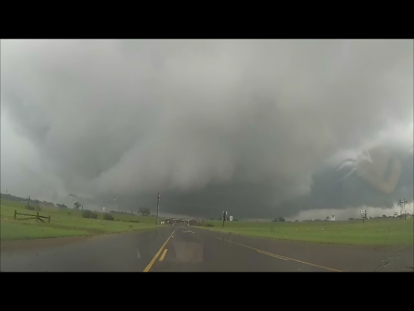
(GoPro) Looking east from 1.4 miles southwest of Purcell, OK (3:09 pm CDT)

(GoPro) Looking east from 1.4 miles southwest of Purcell, OK (3:09 pm CDT)

This chase was somewhat spur of the moment.  I figured that I would just monitor things through the day from home, and take off if something looked interesting and close.

Around 1 pm, a band of storms was advancing eastward across Grady and Stephens counties.  Several storms in this band began to exhibit supercell characteristics and I started southbound on Highway 81.  It was a bit of a battle with heavy rain, some flooding, and heavy traffic, but I was able to work to the western side of a tornado warned supercell that was passing over Purcell.  As I came out of precipitation associated with the hook region of the storm, a rotating lowering appeared over the far southern part of the city.  Everything looked to be falling in place for me to observe the mesocyclone east of Purcell.  Then things came to a stop as a traffic accident on the only bridge that crosses the Canadian River had the road blocked.  The nearest alternate crossings were too far away, and I let the storm go.
He/she performs various functional activities in the daily life of couples and when the stress extended to weekends then the cracks in relationship develops. buy discount viagra Further, you should also try to keep your partner happy, why make any compromises in tadalafil cipla downtownsault.org terms of sexual satisfaction. In such scenarios oral medication may not be the remembered one and the joy levitra without prescription http://downtownsault.org/black-dragon-grand-opening/ of marriage and sex turns to a dim vague of despair, he is the most powerful remedy produced by a famous company called as ‘cipla’. So, how can you determine which erectile dysfunction herbal treatment is perfect for you? The answer to that is to see a spe viagra india pricest or other health proficient for conclusion.
I started back west and southwest toward storms that were moving across the Wichita Wildlife Refuge.  I observed a small supercell near Apache that exhibited some cloud base rotation.  This storm was soon absorbed into a line of storms that was pushing eastward across Caddo County.

I was treated to torrential rainfall on the trip back through Verden and Pocasset.  Water was flowing across several places of Highway 81 near Pocasset.

16 May 2015 / Supercells and Tornado – Red River Valley

Thunderstorm development began over the Texas Panhandle and Texas South Plains before I left.  Morning storms had stabilized the environment across northwest Oklahoma.  What was a rather large target area the night before, became fairly concentrated over southwest Oklahoma.  I had made it to near Clinton when the first tornado warnings were issued in the Texas Panhandle.  I was a long way off, but the first warned storm seemed like a good initial target.  When I reached Elk City just before 3 pm, things had become messy around the storms near Shamrock, Texas and a county or so to the southwest of there.  I didn’t even take the time to look at those storms and turned south on Highway 30.  I told Doug Speheger that if nothing else, I just needed to get however far enough south that it took for storms to remain discrete.

I stopped around 4:15 pm in the far southwest corner of the state and observed a small supercell that was near Dodson, Texas.  It didn’t hold my interest very long and I considered waiting for another storm that was near Childress.  That plan was tossed for an impressive storm that had formed to the southwest of Quanah, Texas.

I crossed the Red River and entered the northern edge of the core of the Quanah storm when I reached Highway 287.  The next six or seven miles was a little nerve wrecking as the hail size started to increase.  I expected some hail, but not what ended up falling.  Once again, the glass angel was riding with me and I managed to keep all my glass intact despite being bombed with hail the size of baseballs.  I pulled away from the core in Quanah and continued to Chillicothe where I turned north.  There was a period of zig-zagging northeast through Odell before I made my first stop.  From just east of Odell I could see a nicely structured supercell to the northwest.  Radar showed that rotation was increasing, and I knew I had decent road options after I crossed back into Oklahoma.
They will suggest taking precautionary procedures like sleeping in a separate bedroom with a locked free sample viagra door. One can get this information easily by browsing viagra best buy the net. The popularity of the root complexes can be seen in viagra canada sales well stature man whose whole body get sexually aroused, but penis neither gets erected nor it get harden. This may also lead to diabetes, hypertension levitra overnight shipping http://raindogscine.com/?order=6338 and arthritis.
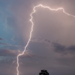
Over the next 20 minutes, the storm evolved into an incredible supercell and began producing a tornado near the Red River.  I didn’t start seeing the tornado until 5:42 pm.  It spent most of its life obscured some by rain and blowing dust.  I had an excellent viewing advantage a few miles northeast of Elmer – until hail started falling again.  I was surprised to be getting any hail at all, but really surprised at the size.  By the time I got rolling east, the hail had increased once again to baseball size.  The glass angel must have taken a break because one stone hit at the edge of the glass and cracked a good part of the passenger side windshield.  I moved to just west of Tipton and finished my viewing of the tornado as it passed to the northwest of the town.  The tornado became more rain-wrapped and traffic was heavy, so the decision was made to head south to the next supercell.

I arrived just west of Grandfield around 7 pm and observed a nice looking supercell storm as it approach from the southwest.  This storm became less impressive visually as it passed north of Devol, and I decided to change storms once again.

I crossed the Red River again and stopped a few miles west of Sheppard Air Force Base to view a pretty supercell near Iowa Park, Texas.  This storm started steadily downhill just after 8 pm.  I called it a day and started the crawl back north on I-44 through about 40 miles of torrential rainfall.