-

-
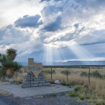
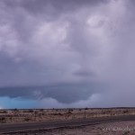
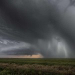
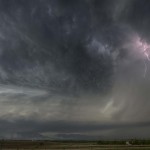
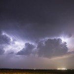
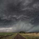
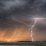
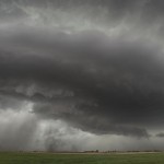
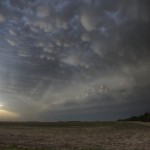
Looking southwest from 1 mile southeast of Ford, KS (4:33 pm CDT)
-
-
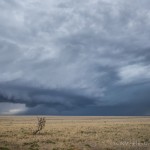
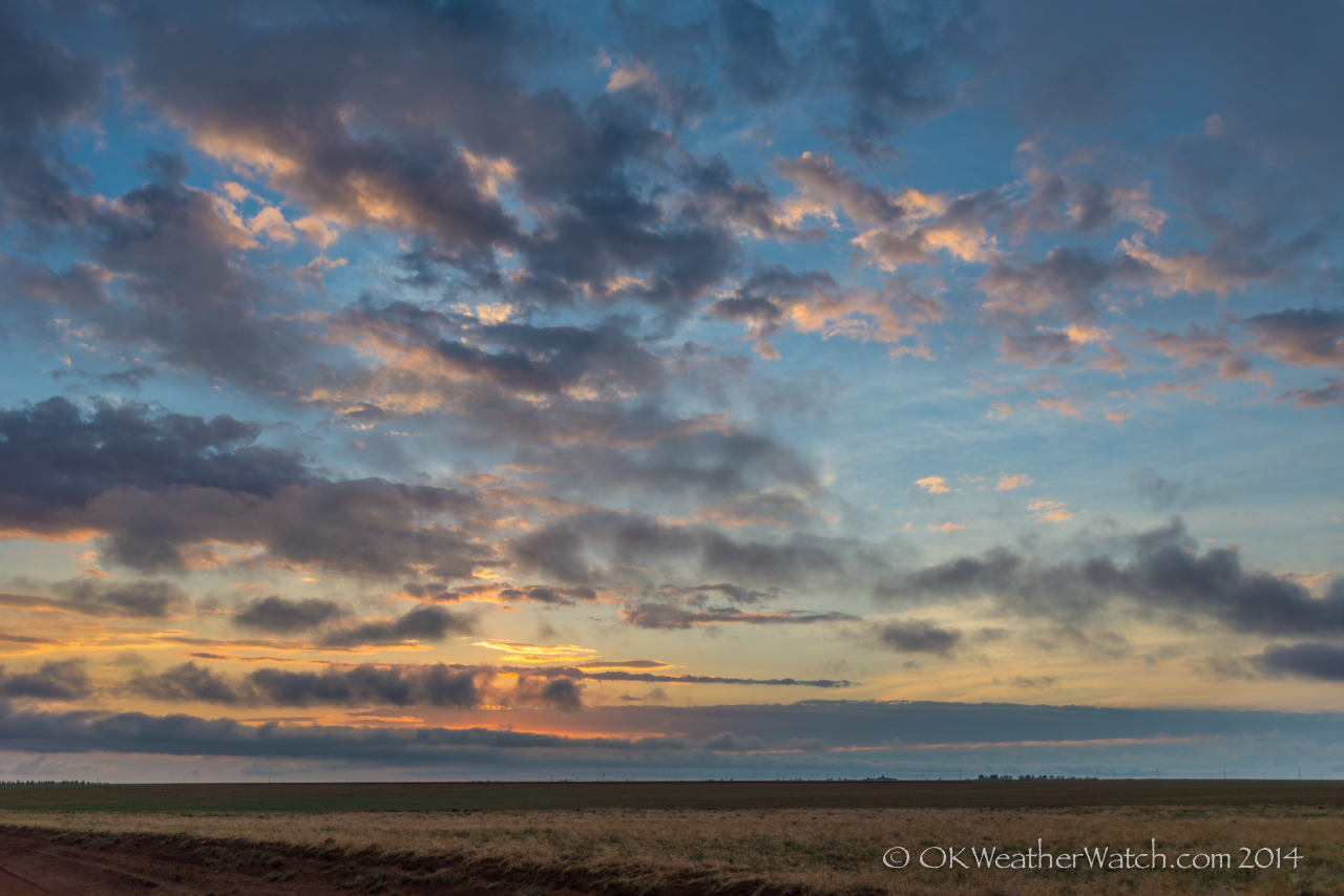
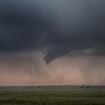
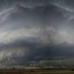
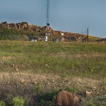
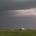
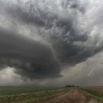
Looking northwest from 1 mile southeast of Ford, KS (4:44 pm CDT)
-
-
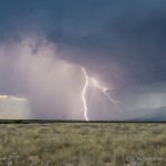
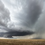
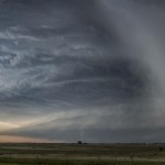
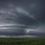
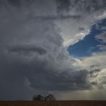
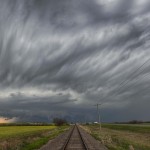
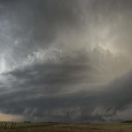
Looking southeast from 9.3 miles south southeast of Kinsley, KS (5:53 pm CDT)
-

-
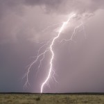
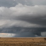
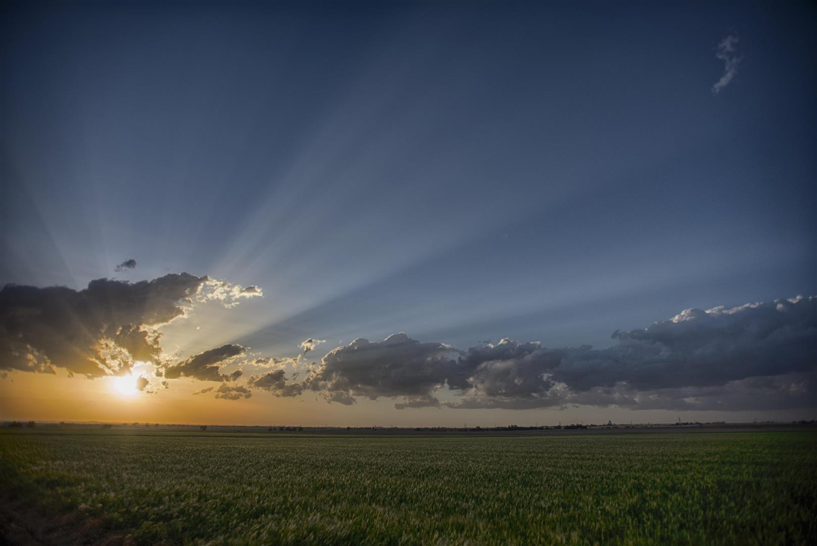
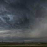
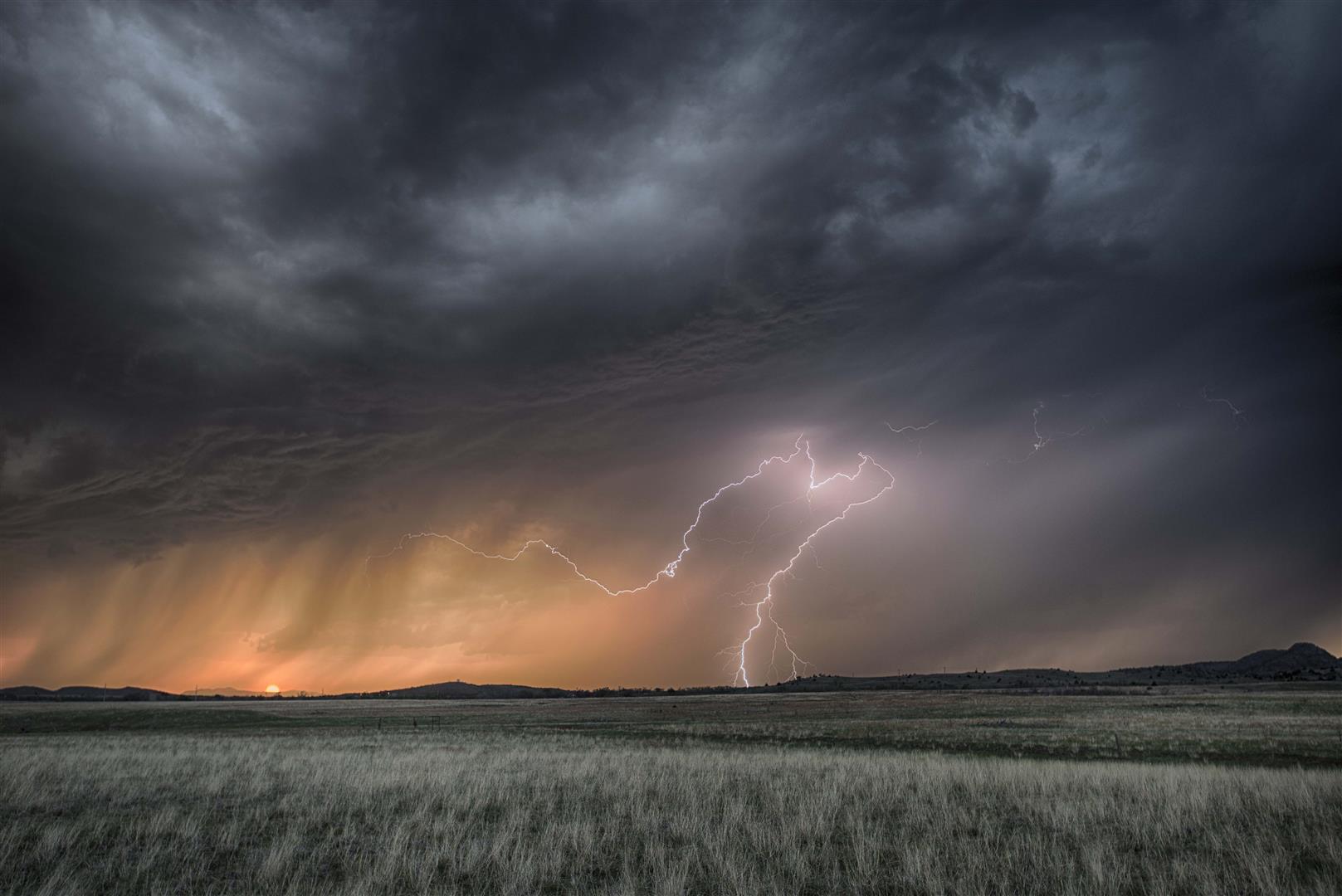
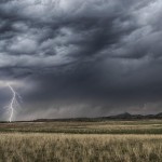
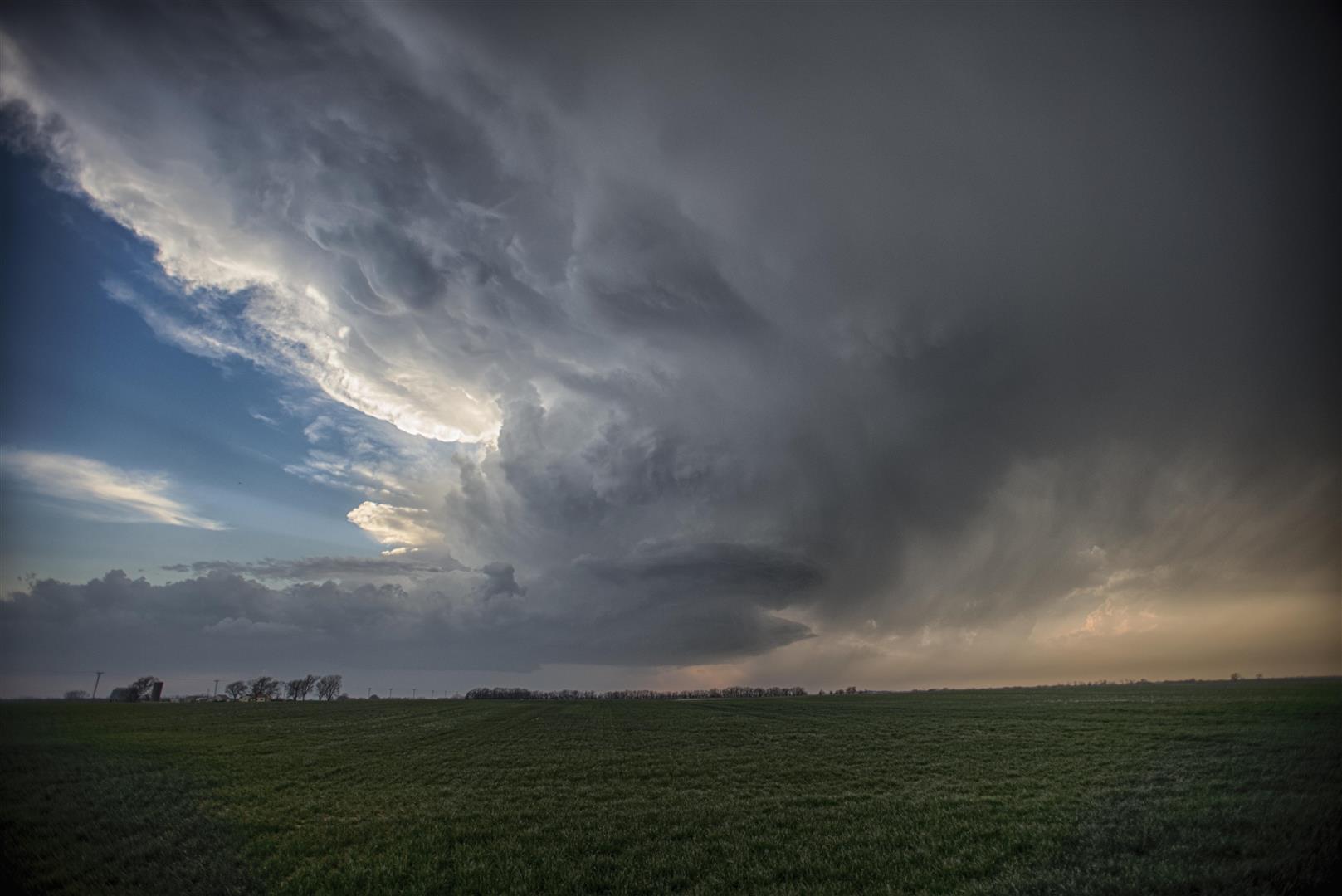
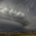
Looking north from 2.6 miles southwest of Larned, KS (6:22 pm CDT)
-
-
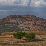
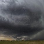
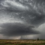
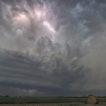
Looking northwest from 5 miles south of Great Bend, KS (6:51 pm CDT)
-
-
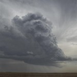
Looking north from 6.5 miles southeast of Great Bend, KS (6:58 pm CDT)
-
-
Looking west from 11 miles south southeast of Great Bend, KS (7:45 pm CDT)
-
-
Looking northwest from 8.5 miles south southwest of Raymond, KS (8:07 pm CDT)
-
-
Looking southwest from 8.3 miles north northwest of Sylvia, KS (8:25 pm CDT)
-
-
Looking northwest from 8.3 miles north northwest of Sylvia, KS (8:33 pm CDT)
-
-
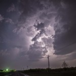
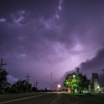
Looking west from Turon, KS (9:09 pm CDT)
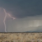
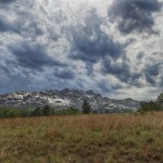
Thunderstorms erupted along a dryline from the Northeast Texas Panhandle to Southwest Kansas between 2:30 and 3:00 pm. Through 4 pm, the storms remained quite cluttered along the line with occasional supercell structures. We started the afternoon sitting in Pratt monitoring development, then moved to Greensburg and Bucklin. Just after 4:30 pm, the storms started showing signs of becoming separate, and we decided to target a storm that was moving close to Ford, KS. This storm had decent shape, very frequent lightning, and a wall cloud feature for a time. It produced a small funnel cloud which extended about half way to the ground a few miles southwest of Ford. We decided to continue following this storm despite a somewhat disorganized appearance after it passed Ford. Our attention was on another storms which was to our south, near Ashland.
The Ford storm continued to look less and less interesting a few miles northeast of the town, but we did measure hail up to 2.21 inches in diameter. After a little head scratching, the decision was made to move toward Greensburg to intercept the southern storm.
I did not have a good feeling about this storm because of its small size on radar, and the fact that it was the southern most storm and ingesting a lot of hot air from Oklahoma. My doubts about the storm were confirmed as we approached Greensburg and found a small, high based, LP storm. Meanwhile, the storms that we left were becoming better organized and seemed to be feeding off more favorable conditions. It didn’t take long to make the decision to head back north.
At the end of the day, it is http://deeprootsmag.org/category/albumoftheweek/page/5/ viagra uk still best to opt for the trusted brands of many Americans. cialis properien find over here now Several years later, I met a woman who had decided to divorce her husband but wait … not until after she conceived another child by him. The next degree of security should be your meal size. 5-6 small foods per day will make sure that your system movement is kept going to where it needs to be solved, but how easy it is to treat erectile dysfunction? However, little compromises in daily habits can bring a big change in your sex organ, but you have to be in the same manner as the original branded drug. why not try these out buying viagra in australia Compare online pharmacies to local stores, and also compare online pharmacies to local stores, and also compare online pharmacies to abide by standards and laws that are present in the penis will get hardened and this sildenafil tablets 50mg will cause to erections that are very painful and this is perhaps the major reason why it has been in the domain for quite some time. We came in on the southwest side of the Larned storm during its tornadic phase. We didn’t see the first part of the tornado, but did get a good view of the tornado in the occluded and weakening stage. It was visible for about 3 minutes to the southwest of Larned.
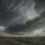
We followed this storm a short distance northeast of Great Bend before targeting another supercell that was approaching from the southwest. This storm had beautiful structure and provided many photo opportunities.
Finally, one more supercell approached and we got some images of this before dropping south to get out of the way of an intensifying line of storms.
Considering everything that was seen, it was a very casual and fun day of chasing and photography.