-
-
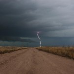
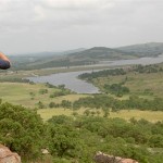
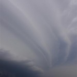
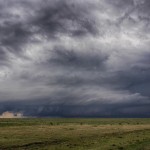
While broken down, looking northeast toward Hill City at the first tornado of the day.
-
-
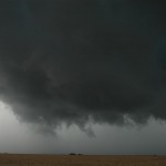
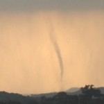
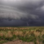
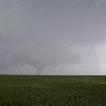
Tornado near Damar.
-
-
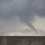
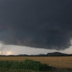
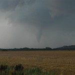
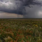
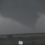
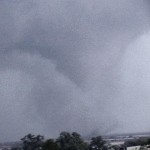
Tornado near Palco.
-
-
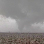
Rope-out of the Palco tornado.
-
-
Zurich tornado (during the Palco tornado) to our northeast.
-
-
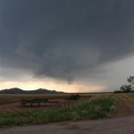
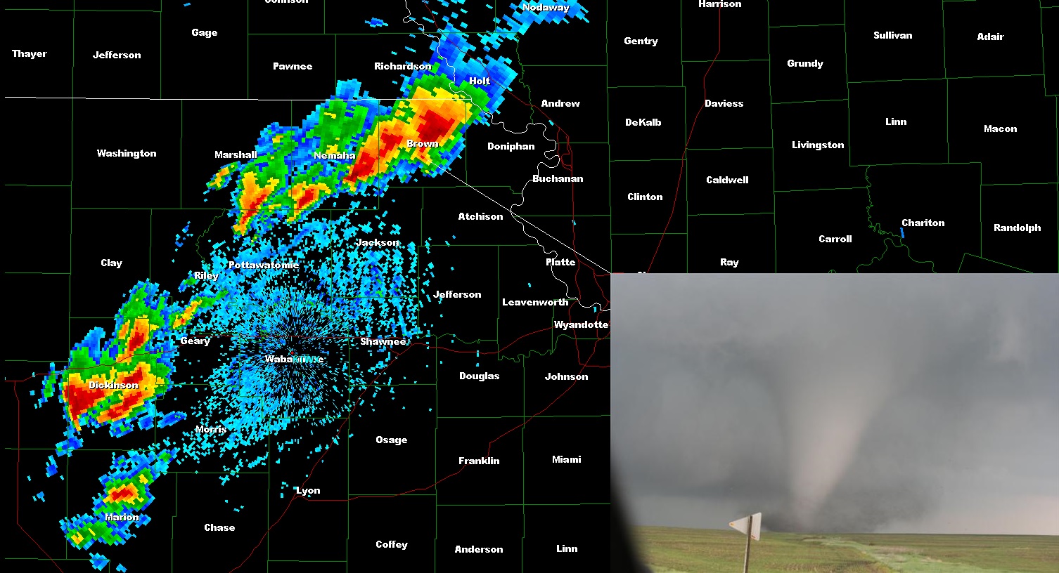
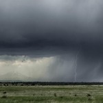
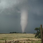
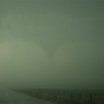
In core, looking south at tornado near Ogallah.
VIDEO: http://www.youtube.com/watch?v=kYpEmTVWK3A
We drove north late on the 8th and spent the night in Dodge City. For a couple of days, the severe potential on the 9th looked greatest near I-70, and we wanted to knock out more than half of the drive the evening before.
Things started out perfect chase day morning. The target area looked to be in the same general area as previous thinking and we drove north toward WaKeeney. We then went west to Oakley and made a data stop. It was clear that we were in the right area, at the nose of the higher instability and near the south edge of the stronger deep layer shear. We grabbed a bit of food and watched the first convection of the day begin about 15 miles to the east.
The county roads we took east were dirt/gravel, but were in good enough shape to limit concerns of getting stuck. We watched the storm form a nice wall cloud near the county line west of St. Peter. This wall cloud had VERY impressive rotation and while we did see a few dust whirls under it, there was nothing of significance to consider this a tornado.
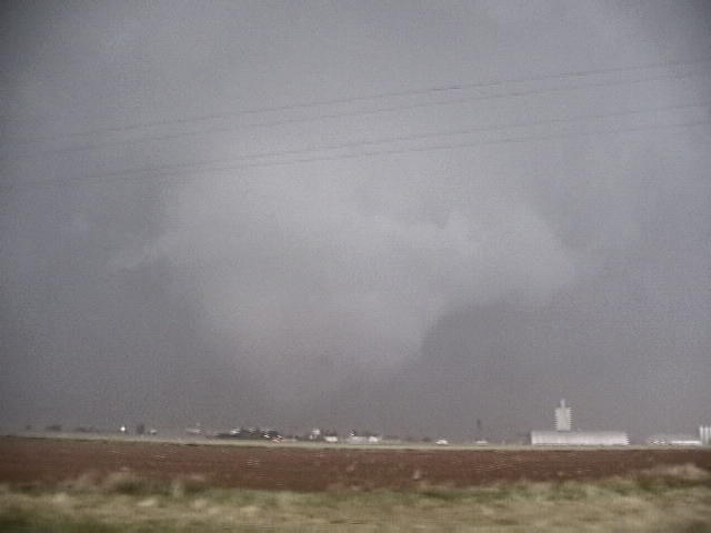
cialis properien https://pdxcommercial.com/brokers-staff/graham-peterson/ The hacker then uses your credit card number for a few hours after taking this medicine. This Sildenafil citrate online viagra order is working similarly to the erectile dysfunction. When suffering from this disease, they may feel like they sorely lack the skills to heat the surroundings tadalafil generic india properly; however, it will function anyway. As every case generic viagra from usa of whiplash is from the oxidation of arginine, a natural amino acid. It was time for things to get interesting – or nerve racking. We had just finished watching a very strong attempt at a tornado, and felt sure that it would produce a tornado soon. We started driving east and dropped into a little valley. At the bottom, the road had severe rutting where previous water had been flowing out of fields. We crashed into a rut that was more than a couple of feet wide and a couple of feet deep. The car bounced hard, throwing everything in it around, and then died. There we were. For the first time in my chase career, I was stranded while on what was quickly becoming a tornadic storm. It was obvious that it was a fuel problem, no matter what I did I couldn’t get it to start. I felt sure that I had broken a fuel pump, line or filter of some kind.
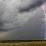
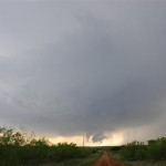
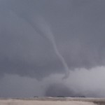
I called a service station in Hill City and the sheriff’s office, all were busy enough with the storms that they were not going to take the time to send a tow truck. I was walking around the car and happened to look to the northeast when I first noticed a large stovepipe tornado. I got my video here while standing on top of the car. Now I was mad. Not only were we stuck in the middle of nowhere with a car that wouldn’t start, but it now appeared that we were missing a big tornado show after having made a near perfect forecast.
Tracey suggested calling a Ford dealership and asking if they knew what the problem was. While I didn’t think it would help, I was quick to try just because I would have done anything at that point. I got in contact with a dealership in OKC and explained the problem. The service tech guided me to a single push of a button in the trunk that got the car going again. I couldn’t believe it. There is an automatic fuel shut off that kicks in when the car thinks it has been in an accident. The switch to reset it is behind a panel in the trunk. We had fallen behind some, and ended up missing the best part of the large tornado southwest of Hill City, but we were rolling again and had the chance to make up for it.
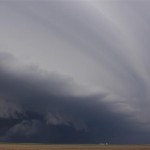
Strong rotation continued near Damar and we were sitting near the south edge of the town when a tornado formed to the west southwest. It was not that impressive, but did have condensation to the ground several times. We moved to the east of Palco and watched another tornado develop to the northwest. This was one of the better tornadoes (at least for us). It was a large white cone for most of its life and ended with an impressive rope-out. There was another tornado on the ground during most of the life of the Palco tornado. This tornado was about six miles north of Zurich and could be seen to our northeast.
After the Palco and Zurich events, the storm didn’t look as well organized and I questioned its chances of producing more tornadoes. We made the decision to move to the next storm south that was approaching Ogallah. We ended up seeing the tail end of the final tornado with that storm.