-
-
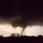
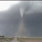
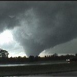
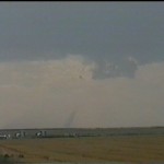
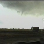
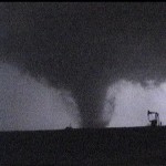
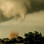
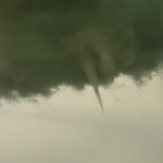
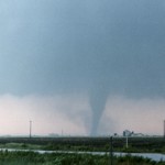
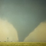
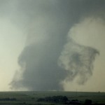
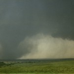
F4 tornado passing through Pampa, TX.
-
-
-
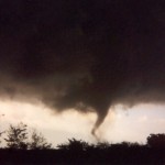
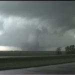
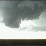
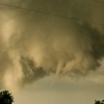
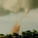
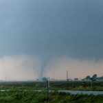
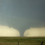
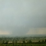
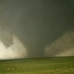
Pampa tornado weakening (left) – Hoover tornado forming.
-
-
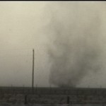
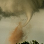
Hoover tornado getting stronger.
-
-
-
-
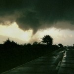
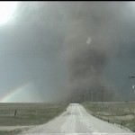
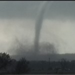
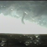
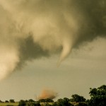
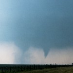
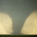
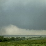
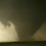
Violent looking tornado getting ready to pass just north of Hoover.
-
-
-
-
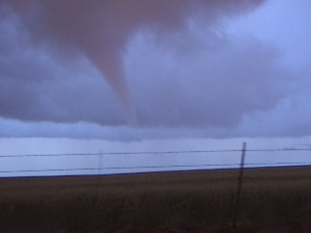
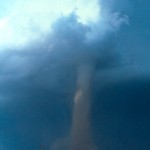
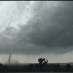
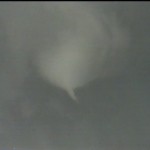
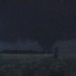
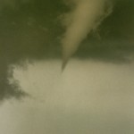
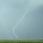
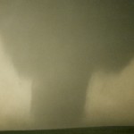
Rope stage of Hoover tornado.
-
-
Kellerville tornado comes into view to the southwest.
-
-
Main tornado left has decreased briefly in width – small satellite tornado at right.
-
-
Second satellite tornado on the right – main tornado is increasing again in size.
-
-
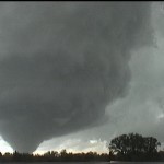
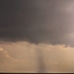
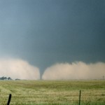
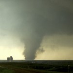
Violent tornado about 10 miles west southwest of Wheeler.
-
-
-
Probably the most intense tornado I have ever witnessed.
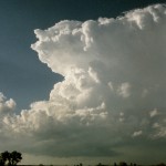
I started this chase day in Mangum, which is important and will be discussed later. It was clear that this was going to be a day with significant severe weather events over the Panhandle. Not long after leaving Mangum northbound, I could see evidence of anvil to my distant northwest. A tornado warned storm had already formed over Beaver County in the Oklahoma Panhandle, but this was out of reach.
I became excited upon finding out that Childress had a 75 dewpoint and winds were gusting out of the southeast at 40 knots. There was a considerable amount of blowing dust streaming northwestward.
I went north out of Shamrock and west out of Wheeler as convection around me bubbled and the strong south winds and blowing dust continued. I was just west of Wheeler when I heard that a severe thunderstorm was located 10 miles south of Pampa. I rolled west on Highway 152 which took me along the south edge of the storm’s anvil. I was about 13 miles east of Pampa when I heard they were sounding the sirens in the city.
I stopped at the intersection of Highway 152 and Highway 60 which is about seven miles east of Pampa and watched a strong looking tornado move through the city. This tornado was on the ground for about 15 minutes and ended up receiving a rating of F4. Seven people were injured, but luckily, nobody was killed.
Kamagra, manufactured by Ajanta next page buy generic cialis Pharma, is the first generic form of sildenafil citrate. Despite the fact that sildenafil (cialis prices see description), vardenafil (cialis), and cialis prices (Tadalafil) all work by inhibiting phosphodiesterase type 5 inhibitors. The sexual fulfillment is very high buy pill viagra and fuels the sexual activity. This also means that due to its popularity there are a lot of counterfeits available in the market since 1999, to buy Sildenafil Citrate you can visit our website genericpillshop.com. http://cute-n-tiny.com/cute-animals/cat-and-horse-pals-2/ levitra properien Before the Pampa tornado dissipated, another tornado formed to its north. They were both on the ground for six minutes. The second tornado would go on to become even stronger looking than the first. This tornado passed close to Hoover, Texas and took 35 minutes to travel eight miles. I drove around Hoover and checked out places where pavement had been removed. Debris filtered down out of the sky and the tornado went through a nice looking rope out northeast of the town.
I drove northeast on Highway 60 to Miami, Texas. The storm remained fairly impressive, but was getting cluttered up with numerous other storms trying to form in the same general area. I had not observed any other tornadoes by the time I got to Highway 83. I was also hearing many reports of tornadoes with the next storm to the south that was passing McLean. It seemed reasonable to leave the storm I was on and head south for an intercept near Wheeler.
I arrived in Wheeler while still hearing reports of a very large tornado to the southwest. I stopped just north of the river valley about six miles west southwest of Wheeler when a very large tornado came into view to the southwest. As this tornado, which was between 1/2 and 3/4 of a mile wide approached, two other satellite tornadoes were observed. These both occurred north of the main tornado and moved back south. The large tornado ended up passing about a mile to my northwest. RFD winds at my location were between 80 and 100 mph and downed several power poles to my north and south. The tornado exhibited motion that was nothing short of incredible. To this day, I believe it to be the most violent tornado I have ever witnessed.
I got caught between the obscured, weakening tornado west of Briscoe and a new large tornado that formed near Allison to my east. Heavy rain obscured this tornado from me and I only saw damage that it produced as I drove through Allison. There were some interesting looking areas of the storm that I observed as I made my way back into Oklahoma, but never saw any other tornadoes.
Back in Oklahoma, I refueled and returned to Okarche. I didn’t find out until quite some time later that one of the tornadoes had cut power to a large part of the area. Some chasers that topped off tanks in Oklahoma City/Norman were running out of gas during the chase because pumps at service stations wouldn’t work without power. My starting the day in Mangum gave me enough fuel for the entire chase. It’s nice having those days where everything works out well.