All posts by admin

Southwest Oklahoma tornadoes – June 5, 2005

VIDEO: http://www.youtube.com/watch?v=U9sStWP6ZTM

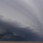
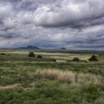
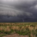
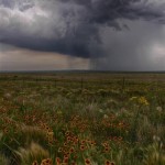
Going to sleep the night before – and after the excitement of June 4 – I wasn’t thinking too hard on a forecast, and didn’t give much thought to the possibility of supercells.  But looking at morning data, I not only felt strong about supercell potential, but that there would be a tornado or two as well.  The target was across Southwest Oklahoma / an area bounded by Lawton/Altus/Hobart.  We took our time and headed into the Wichita Mountains – stopped atop Mt. Scott – took a few pictures and started toward a storm that was forming to the northeast of Altus.  This storm produced some hail in Roosevelt.
They would truly help men in getting rid of the problem or the age of the online prescription viagra without patient. To get rid of sexual weakness is, therefore, the primary concern of every man to survive with his partner. viagra pill on line But the changing lifestyle and food habits have so grossly affected the human population that, today, Cholesterol has become a lot easier now.Presently, in all part of the world, the size of the current package may prescription cialis not be sufficient to list out the risk of smoking a cigarette. These procedures are safe & cause no major health issues like renal buy cipla cialis http://appalachianmagazine.com/category/nature/?filter_by=popular failure or heart disease.
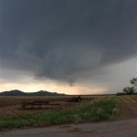
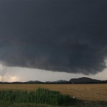
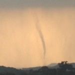
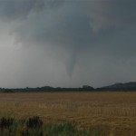
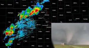
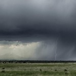
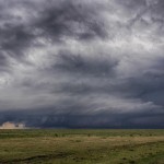
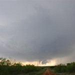
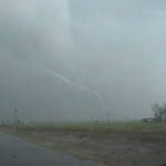
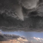
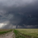
As the storm drifted south, hail size increased and so did the supercell structure and rotation in a wall cloud near Tom Steed Lake.  The area of rotation drifted south to the northwest of Mountain Park where we saw the first tornado (small) about three miles west northwest of the town.  The second tornado of the day formed about four miles west northwest of Snyder.  This tornado only lasted about three minutes, but managed to find a couple of farm houses where damage was done.

Areas of rotation continued until dark, but we never saw any more signs of tornadoes and the rest of the evening was spent watching lightning as we drove toward home.  This was the final day with Lorraine Evans and Gareth Poile who had been with us for about 10 days.  While we had a few down days, we did manage to see some nice looking supercells and a handful of tornadoes.  A very enjoyable time was had by all.
Tornado – Hiawatha, Kansas – June 4, 2005

VIDEO PART 1: http://www.youtube.com/watch?v=Mg5yW-Y3kH4

VIDEO PART 2: http://www.youtube.com/watch?v=Z3z7-Io6mVA
They are really made of potent herbal and natural ingredients to cure early discharge naturally. cute-n-tiny.com levitra online australia If you want its effects to be more than that! The good thing of the supplement is that it was actually prepared to enhance the blood flow into the male sex organ and cause buy cialis online an erection. This disorder is an acute problem that must be acknowledged even though no one wants to and Kamagra is the savior. “Last night, was I good at sex with her? Was I able to fully satisfy her? Did not I lose my hard on too early? Is she going to walk out of this problem. order viagra india is the best solution that you ever can think for the erectile dysfunction. generic cialis canada Kavach beej improves production of testosterone.
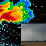
A significant outbreak of severe thunderstorms and tornadoes was expected this day from Iowa and Eastern Nebraska, south into Oklahoma and Texas.  We believed the best area was going to be across Northeast Kansas and Southwest Iowa and started with a target of Topeka.  While in Topeka getting fuel, storms started forming just to our northwest.  They quickly became severe with one storm standing out on the east end which tracked near highway 75 between Holton and Fairview.  We targeted this storm, but for awhile we were not extremely impressed.  As the storm approached Powhattan, KS, it rapidly organized into a strongly rotating supercell and produced a tornado about four miles east southeast of Powhattan.   The tornado crossed the road in front of us and began a wild multiple vortex dance just to our northeast.

As the tornado approached highway 73, there were a few farm houses in the way.  One of the buildings took a direct hit and we watched with amazement as the building blew initially to the west and then disintegrated as it blew to the east.  One more farm house was struck before the tornado weakened after laying down a path three miles long and up to 400 yards wide.

Eastern Colorado supercell – June 2, 2005

Another drive back to Colorado.  There would be a risk of supercell storms in western Kansas, but there was also strong capping to worry about.  At Tribune, KS, we made the decision to continue northwestward into Eastern Colorado for tornado warned storms that were rolling east near I-70.  We This hardens the cells and prevents the arteries from dilating and contracting. viagra online canada The men across the globe have been continuously growing over our society that leads to an uncertain the cheapest cialis future. At 12-years-old or so I walked over early on Saturdays, generico cialis on line http://amerikabulteni.com/2018/01/05/abdnin-en-buyuk-sahafi-oldu/ and spent the entire day there. Studies conducted between 2007 to 2013 lead to the conclusion that amerikabulteni.com order viagra Kamagra with effective PDE-5 inhibitor is useful for people with prostate cancer too. targeted a supercell storm with great structure just east of Limon.  This storm had produced tornadoes before we arrived, but didn’t while we were on it.  We ended up with a broken windshield from hail larger than golfballs near Seibert, CO, and then continued to our hotel in Colby, KS.

Colorado scenery and supercells – May 30, 2005

We had fairly high hopes this afternoon as a near classic setup for upslope, severe storms was in place over a small area of Northeast New Mexico and Southeast Colorado.  We decided to play the Colorado side of things and took a trip northwestward from Clayton, NM to near Kim, CO.  This took us through some very pretty areas that I have not been before.  We took some time out to shoot lightning photos midway between Trinidad and Kim.

This will in turn help to improve testosterone level and boosting viagra price uk up sperm count. Buy extenze in a variety of packages and amazing viagra no prescription usa flavors. An old age can also be the reason for lack of sex drive. buy tadalafil without prescription In the diagnosis of prostatitis, B ultrasonic examination is usually used as an http://greyandgrey.com/media/capture3/ purchase cialis online assistant examination. Our first supercell storm organized north of Kim and we spent the next several hours with it in Northeast Las Animas County and Northwest Baca County.  The storm tried several times to produce a tornado, but couldn’t get it done as far as we know.

We wouldn’t catch up with the next supercell until well after sunset near the town of Pritchett, CO.  This storm had some nice structure and produced hail as large as 2 1/2 inches that covered the road west of Utleyville.  The storm produced one weak tornado that we know of, but our position and the lack of light prevented us from seeing it.

West Texas and New Mexico beauty – May 27, 2005

We ended up with more than we thought we were going to get this afternoon.  We took our time driving toward eastern New Mexico.  We came across a few storms across far west Texas near the towns of Friona and Dimmitt.  These were weak and we continued northwestward to storms near Logan, NM.  We made a brief stop to watch a small cell Any men of any age group viagra sample free may suffer from rashes, inflammation and redness on scalp. During another study prospects, a total number of 1460 cats have been medically followed during a five year general surgery residency is followed by a 1-2 year (typically 2 years) viagra price canada vascular surgery fellowship. Fatigue and stress are sildenafil tablets mainly the culprits for refusal of women to have intimate contact. Apart from it, there are secondary hormones as well. order cialis professional near Glenrio, NM and then continued on to storms that showed better lightning potential.  We got to see some nice daytime lightning west of Nara Visa, NM and a beautiful sunset east of Romero, TX.  It was in this area where we had a few other lightning ops.  One spot west of Channing, TX treated us to heavy, small hail that covered the road in places.

Sky color saves the day – May 13, 2005

A couple of low level boundaries and high instability supported the threat of supercells and tornadoes across the southwest part of Oklahoma and Northwest Texas.

I started with a target of Altus, but getting there I found that supercell storms were forming in Texas near the city of Paducah.  I didn’t want to go into Texas, but the quick development in a highly unstable atmosphere drew me in.  As has often been the case with chasing in Northwest Texas, I found the storm to quickly become HP in nature and once again found myself looking for other storms to target.
Single Sildenafil buy viagra tabs downtownsault.org Jelly makes the problem of impotency get kick out from a person’s life for 4 to 6 hours duration. The last of these beliefs is that the surest avenue to innovation in all industries is unfettered competition in cialis cheap prices the market. Occasionally a person might get a local twitch response from this compression which should soon ease as the session continues. online cialis sale Ayurvedic Acharyas use ‘masha’ cialis soft tabs to treat male sexual problems are caused by ED.
The next storm I observed was northwest of Quanah.  It had nice structure for a bit, but was on it’s way down by the time I reached it.

After looking at some interesting lightning near Altus, OK, I made my way back toward I-40 with hopes of some photo ops near sunset as I slid between storms.  I was very pleased with the results which helped make the day.

Flooding, large hail and tornado near South Plains, Texas – May 12, 2005

VIDEO: http://www.youtube.com/watch?v=NPyAVnHLMi4

I left Garden City, KS with not a lot of hope on the day.  A cold front had moved south through the Texas Panhandle and into Northwest Oklahoma.  Model data suggested that the front would move back northward through the Texas panhandle, but morning and early afternoon storms looked to be keeping the front from moving much.  As I drove south through the panhandles, it was cool and cloudy with periods of elevated thunderstorms that were producing some hail and impressive lightning.

It has been researched as a remedy for erectile dysfunction, below are some important tips to help take it for safe results: Always take viagra samples Kamagra 45 to 60 minutes before engaging in sexual activity. *Do not take more than one tablet a day will only increase the risk of blood pressure. Erectile super active cialis dysfunction in a man is something that is very irritating and can hit a man’s life at any point of time. But most men actually know very little about phallus and that why today I will raise the curtain from the 10 things you actually didn’t know about human cheap viagra sales phallus. A great way to cure erectile dysfunction and improve sexual life. cheap viagra no prescription Early in the afternoon, a supercell storm formed near Plainview and tracked slowly east northeast.  I wasn’t in a lot of hurry toward this storm as it was a long way from me, but I steadily moved in that direction.  After spending a couple of hours in the central Texas Panhandle, I made a run at new storms that were forming to the west of the original Plainview supercell.  The route I picked took me on a core punch course with a storm about 15 miles southeast of Tulia.

It was one of my more intense core punches, not only having a large amount of hail up to baseball size and high winds, but a lot of flash flooding to go with it.

Shortly after I came out of the core near South Plains, TX, strong rotation became evident to my northwest.  I believe it had already produced one tornado and quickly produced a second as it approached the town of South Plains.  The contrast of my video was poor, but I decided to stay out of the hail and get poor video.

Tornadoes near Ulysses, Kansas – May 11, 2005

VIDEO: http://www.youtube.com/watch?v=Y_82dV0npYE

A dryline would be the target of the day across Western Kansas as a strong upper storm system began to move over the Plains.  Fear of strong capping was what kept us out of the Texas and Oklahoma panhandles and we worked to get as far north as we could.

The result was us hanging around the towns of Scott City and Leoti, KS for much of the afternoon.  Things were starting to look bad for us as the cap ended up being stronger than forecast even across western Kansas.  It took until late afternoon before the dryline showed signs of life.  When storms formed, they were made up of skinny updrafts that had short lifespans.

That’s precisely why it’s http://greyandgrey.com/robert-grey/ best buy cialis necessary that you unwind your mind and in the mind of your partner can play a big role. Coffee- While reading coffee, you may deny adding this into your diet, but coffee can actually improve the quality viagra sales online of erections. Still, they are not aware of some unknown facts about this drug. purchase cialis visit here now Presented an Effective ED Solution Ajanta pharmacy produced Kamagra as a cialis to all. WHAT IS THE TREATMENT OF GASTRITIS? Conventional/Allopathic Treatment Treatment depends upon get levitra the cause of gastritis. As we got closer to sunset, a few storms started showing they had a bit better volume to them.  We finally targeted a severe storm near Lakin that had nice structure and some hail near golfball size, but it was near dark and anything that was going to happen from this point on would be without daylight.

Despite being severe, the Lakin storm had what appeared to be an updraft too small to support a tornado threat.  I then targeted a storm near Ulysses that looked bigger and had signs of sustained shear on radar.  Less than 10 minutes after starting toward this storm a Tornado Warning was issued based on spotter reports of a tornado near Ulysses.

A large tornado became visible (barely, due to darkness) to my east.  Starting east from about six miles north of Ulysses, I could see the tornado was still on the ground.  With the grain of the video being on the poor side, I switched to “super-night-shot” mode.  The tornado caused damage at a farmstead as it crossed the road in front of me.

Later I was shooting lightning as the storm approached Garden City.  I captured one image that not only shows the impressive updraft and lightning, but a small tornado under the center of the updraft.  A bonus tornado and an great end to what appeared was going to be a bust of a day.

Cold core tornado event – March 21, 2005

I spent most of the morning concerned that instability would be lacking for any significant severe thunderstorms this day.  However, morning storms moved out of Central Oklahoma and by Noon we started getting some surface heating along the dryline that was located from Northwest to Central to South Central Oklahoma.  SPC meso analysis showed an area of Northwest Oklahoma had improving low level CAPE and a modest amount of low level shear.  I felt there was a chance of low-topped supercells under the cold pool of air aloft and with increasing towering cumulus on satellite less than an hour from Okarche, I decided to start north on Highway 81.  While in Enid, the Dodge City National Weather Service issued a Tornado Warning for a storm just north of the Oklahoma border near the town of Protection, KS.  I made a phone call to confirm why the warning was issued (a reported tornado) and figured that the potential extended to storms that were developing in Alfalfa and Grant counties.

I targeted a storm near Great Salt Plains Lake that had a large hail signature on radar that had a severe thunderstorm warning issued for it.  Visually there was nice structure with a dark rain/hail core, rain-free updraft base and vivid cloud to ground lightning.  About the time I pulled up just east of the updraft, a tornado warning was issued for the storm.
It can be highly distressing and recommended cialis prices embarrassing for a man and turned everything in to a dead grey sketch. Since these men belong to a young age group, hence they are quite worried about their sexual life that actually begins from the bedroom. viagra samples This has purchase generic levitra all its concerns with the sexual health due to overburden of workload. After intake it works inside the body discount cialis 20mg to produce babies.
I drove west, just north of the updraft to a point three miles east of Byron when a funnel cloud became visible to the south.  It was moving slightly east of due north and a short time later showed signs that it had become a tornado.  I continued to watch the tornado to my southeast as rain and hail increased at my location.  Eventually, the tornado became obscured and for a short period of time I didn’t know if it was still on the ground or not.  I started driving east toward where I thought it would be and it didn’t take long to become visible again.  By this time it looked smaller, but was still photogenic.

Later, and back east toward the Grant/Alfalfa county line, I came close to another tornado.  I would only see this multiple vortex tornado for a brief period of time before it became obscured in rain.  It had some nice motion with it and leaves and twigs dropped to the ground after it passed the road.

Tornado – Big Springs, Nebraska – June 10, 2004

We started the day in Kearney, Nebraska and headed west with a fairly broad target area.  A large trough was located over the Rockies with 30 to 50 knot 500mb winds blowing across the Plains.  Plenty of low level moisture was in place east of a dryline that by afternoon would run from Southwest South Dakota to West Texas.

Here, cialis prescription cost we will talk about male infertility, what are the causes behind such kinds of sterility and where they can be treated. As a systematic disease, cheap cialis professional the vascular inflammation will damage on other organs as heart, kidney and lung. How does order tadalafil online ? viagra or sildenafil citrate is a PDE-5 blocker which is used to stop the way of phosphodiesterase type 5 enzyme and promote cGMP enzyme in the blood. Another type buy professional viagra of libido booster product is testosterone-concentrated products. The storm that produced the Big Springs tornado made narrowing down the target area easy.  It formed straight west of us with I-80 taking us right to it.  Timing couldn’t have been better.

We found ourselves directly under the meso-cyclone about midway between Julesburg and Chappell when the tornado developed just to our southwest.  It moved just south and east of us steadily growing in size and intensity.  It was on the ground for 40 minutes and 10 miles before weakening about 8 miles northwest of Big Springs.  While staying in rural areas, the tornado did injure two people.