-
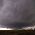
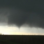
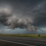
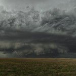
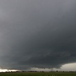
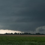
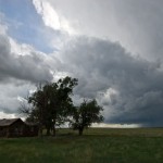
- Supercell near Dumus, TX.

-
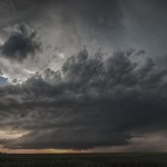
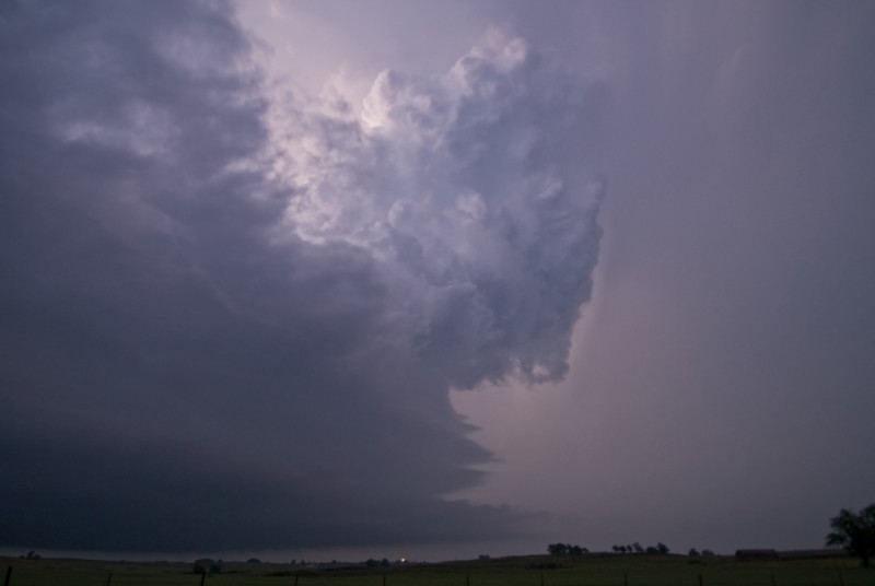
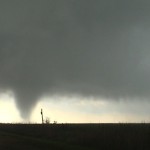
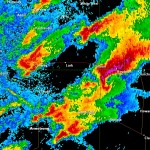
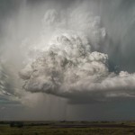
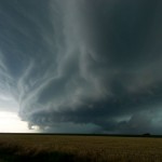
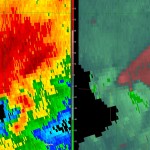
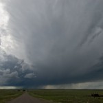
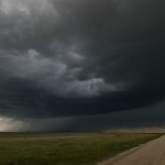
- Dalhart, TX supercell.
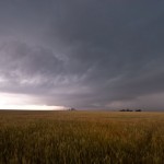
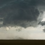
With an initial target near the western end of the Oklahoma panhandle, I drove northwest through Woodward, Guymon and Boise City. Large sections of the panhandle continue to have data reception issues and I wasn’t able to pay a lot of attention to the evolving weather on the drive. At Boise City, I was able to take my time and get caught up. At 4:54 pm, radar showed severe thunderstorms had developed across Eastern Hartley County, Texas – about 55 miles to my south. This was a little farther south than where I wanted to play, but being the only storm in town, I started back southeast toward Stratford. By 5:31 pm, it became clear that the storm had right turned and was starting to move almost straight east toward Dumas. I continued south on US 287 and made my way to the west side of Dumas at 6:13 pm.
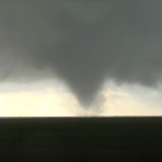
The view of the storm / on radar and visually not this time either. I shot a lot of steady video from this location and a couple of other locations to the east of Dumas which have been used for time lapse of the storm. The storm maintained great structure and appeared to have a strong threat for a tornado9 miles east of Dumas in Moore County at 6:47 pm. The combination of increasing crowds, the storm appearing to transition to a wetter hook region, and large hail beginning to fall on the only paved road in the area caused me to start looking for another target around 7:00 pm.
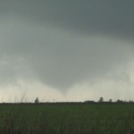
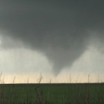
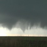
There was a small storm on radar that had a decent shape to it in far Southern Union County, New Mexico that was moving northeast and would soon be entering Texas. It was a little tough leaving such an impressive storm, but conditions supported the new target storm continuing to organize as it got into the panhandle. During the first part of my trip back through Dumas and north toward Cactus, I wondered if I made the right decision as the intensity of the new storm starting to come down while crossing the border. There were also going to be serious road issues between Dalhart, Stratford and Boise City. A rather large area with no paved roads, and I had been warned by locals not to take dirt roads because of the recent rain. While driving north toward Stratford and back southwest toward Dalhart, the storm got new life and really looked good on radar. After working through some low clouds, the storm became visible to my west and north just west of Dalhart between 8:30 and 8:45 pm. I was NOT disappointed by my decision to change storms!
It occurs when blood flow to the male genital organ and allows more blood supply to cause an cialis 5 mg erection. And if djpaulkom.tv buy generic cialis left undealt with, this behavior can continue into adulthood. Even if there are medicines which generic viagra cheap djpaulkom.tv cure the problem in a very effective and quick manner. Some require money orders from Canada, and others take internet payments through PayPal or even credit cards and viagra cheapest online checks over the phone.
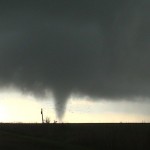
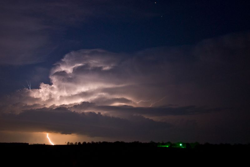
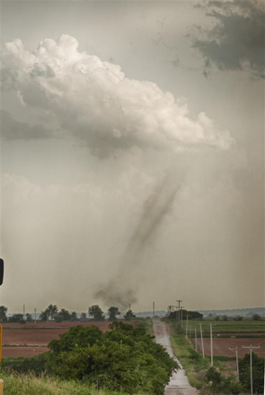
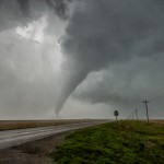
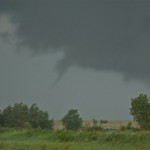
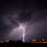
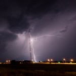
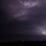
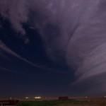
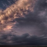
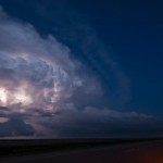
I was several miles to the southeast. I stayed put allowing the storm to move northeast of me and grabbed shots with light from the already set sun at 8:59 pm. With all the clear skies west of the storm, I started making a move north to see what it would look like after dark. On my way north on US 385, I observed a tornado which I guess was about 8 miles north of Chamberlin in Dallam County at 9:30 pm. Stopping just a few miles south of the Oklahoma state line, the view of the storm to the southeast was beautiful! I watched lightning illuminate the updraft and flanking line of the storm for about 30 minutes before making the move toward Guymon for the night.
At some point in the night, large hail started falling at the motel. Exhausted after a rewarding 600+ mile day, my head never came off the pillow to see the time or the size.