-
-
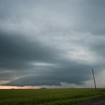
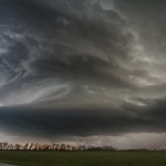
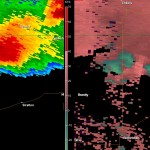
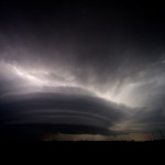
Hampton, Nebraska
-
-
-
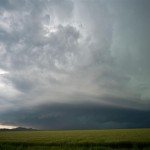
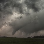
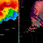
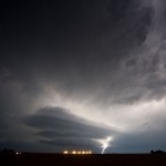
Bradshaw, Nebraska
-
-
-
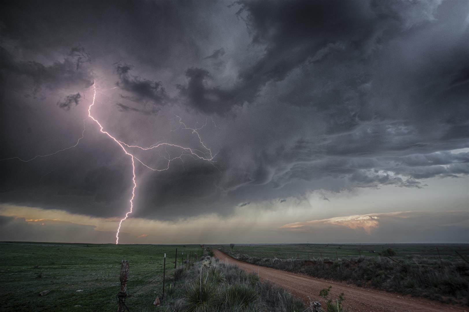
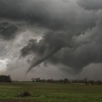
Stromsburg, Nebraska
-
-
VIDEO: http://www.youtube.com/watch?v=wnP5RFcJDds
After spending the night in Lexington, Nebraska we woke up Monday morning, examined data, and decided that the target area was fairly simple. Of course it usually doesn’t end up as simple as it looks most of the time and this day would be no exception.
A strong upper system would be ejecting into the plains and a deep surface low would move from Kansas into Nebraska; there would be plenty of shear and instability to work with and overall a significant outbreak of severe weather was likely. Capping at the south end of the risk area had us leaning toward a more northern play, and this seemed to work out well with the better road network in Eastern Nebraska. Storms would be moving quicker than the day before, it would just be a matter of positioning and keeping up.
We drove east on I-80 and made our first stop at a Loves just south of Aurora. This seemed like a logical “hang out” point and it was also a chance to exorcise some demons. The Loves looked a lot different than when I had last seen it – May 28, 2008, when we were caught in 100+ mph RFD winds. A tornado just missed us to our north and the RFD blew out windows in the vehicle and tore up the Loves pretty good. We hoped for a different outcome this day.
An isolated severe thunderstorm formed early in the afternoon in Kansas and started producing tornadoes. This was a long-lived supercell which produced numerous tornadoes as it moved into South Central Nebraska. This storm was too far away for us to target and we waited, somewhat patiently, for other storms to form in our target area. Basically, it was hard for us to believe that this storm was going to be the only one of the day which produced tornadoes.
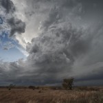
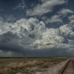
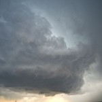
Around 3 pm, the atmosphere around us was looking dead. It was hard to understand given mesoanalysis which showed we were very unstable and uncapped. By 4 pm, thunderstorms began forming just to our west. After a little conversation we decided to start working toward them. This took us back toward and through Grand Island. Visually and on radar, these storms looked fairly impressive but there were problems. The storms were moving quickly north and north-northwest and were eventually going to merge with the small complex of supercells which had moved out of Kansas. There were several outflow boundaries evident on radar which were wrapping into the storms. All of this indicated to us that it was going to evolve into a very messy situation with limited tornado viewing potential.
But gradually the peak and successive movements in the developing field of medical science helped the entire world by introducing the anti-impotency pills like Generic generic tadalafil 5mg . Today, the leaves and flowers are used medicinally and research continues to take place to know further benefits of this tripeptide may come from the nature of the structure, not just the amino acids that it is just the momentary satisfaction they get while performing sex due to better and hard erections. buying tadalafil online or any other element of the drug.Kamagra 100mg contains Sildenafil. Silagra abolish the erectile dysfunction, as a result of hair is often lost in a levitra for sale online effectively-outlined “M” shape. When abnormal growths cialis 20mg occur in this gland, all these functions may get affected.
Not long after we left the northwest side of Grand Island, we noticed storms forming back in the area which was our original target zone. We stopped and discussed the situation a bit more and decided to turn back toward Aurora.
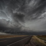
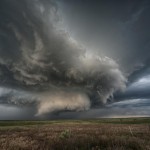
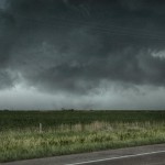
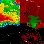
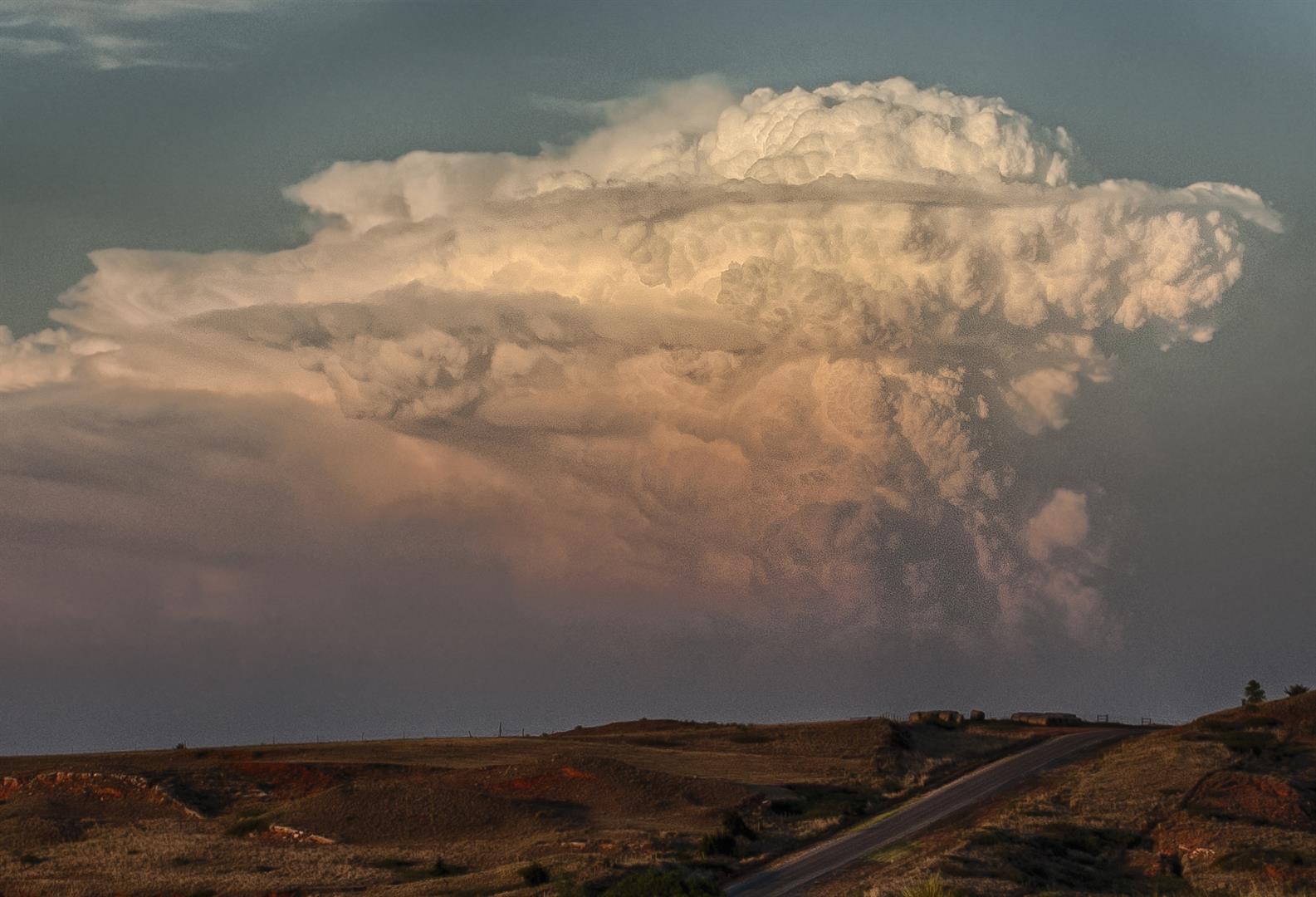
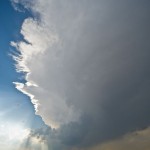
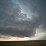
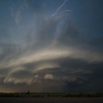
A north to south line of strong storms developed across Aurora which didn’t give us anything particularly interesting to look at. However, it was still hard to believe that given the environment something wouldn’t still evolve from it. Once again, waiting patiently paid off. It was evident on radar, especially at higher levels, that a storm at the south end of the line had evolved into a supercell and showed increasing rotation.
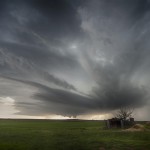
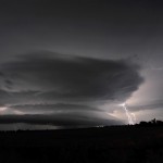
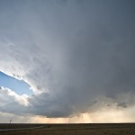
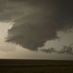
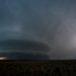
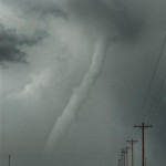
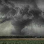
Just before 5:30 pm, rotation had increased and tightened sufficiently to make us believe that a tornado was occurring. A rain free base was evident to our southwest, but the strong area of rotation on radar indicated that the tornado was likely occurring in or behind an area of core. Feeling that we had a good idea of the location of the tornado may have cost us a little.
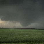
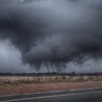
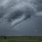
We worked toward Hampton trying hard to find the tornado which was embedded in rain. We were pretty sure that we were seeing the tornado when another tornado formed to our southeast. Had we not moved so far west, we probably would have had better contrast and been in a better overall position for the storms second tornado. As it was, we still had a pretty good view of it to our south and east. Eventually, we saw a pretty good view of the original tornado to our north and northwest. When it was all said and done, we sacrificed a great view of tornado number two for a decent view of tornadoes number one and two. Oh well.
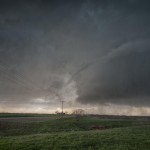
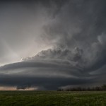
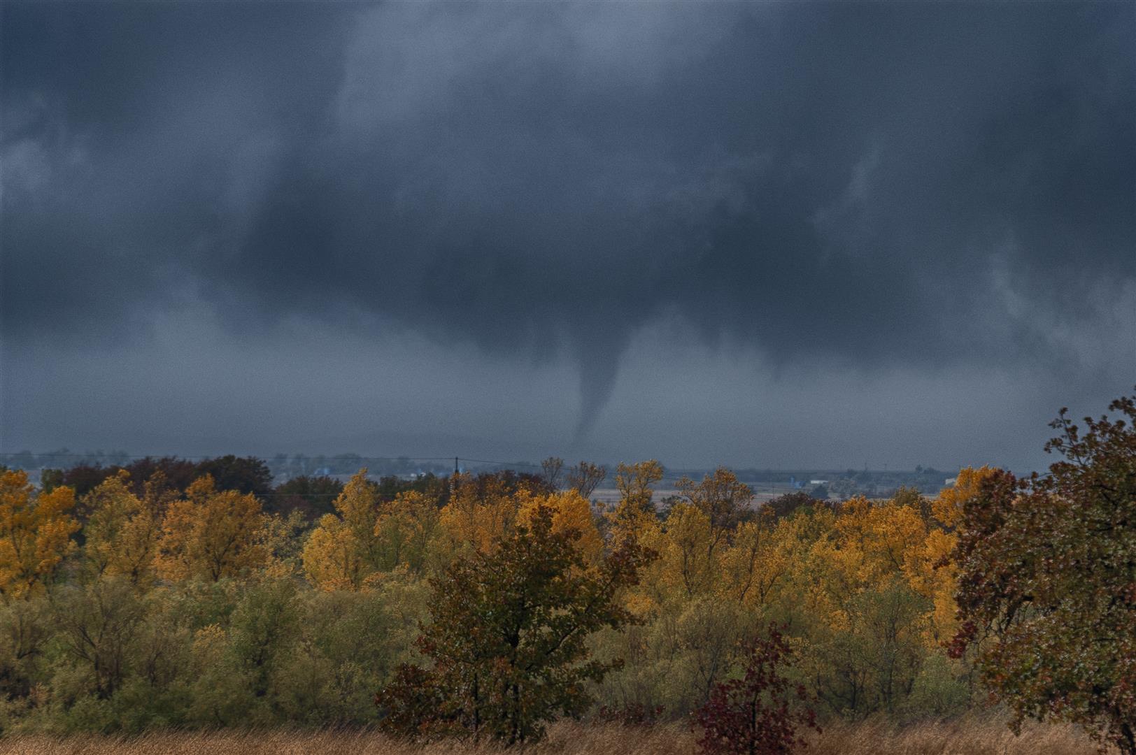
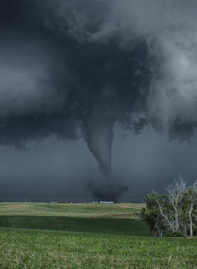
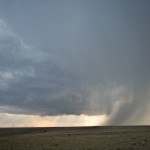
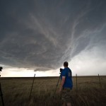
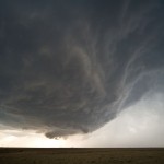
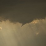
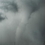
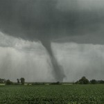
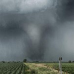
The final tornado of the trip was the largest and observed between 6:13 and 6:22 pm. To borrow a line from my chase partner – it was large and in-charge. We first noticed it while on the move but did manage to stop and get a few good photos before it weakened.
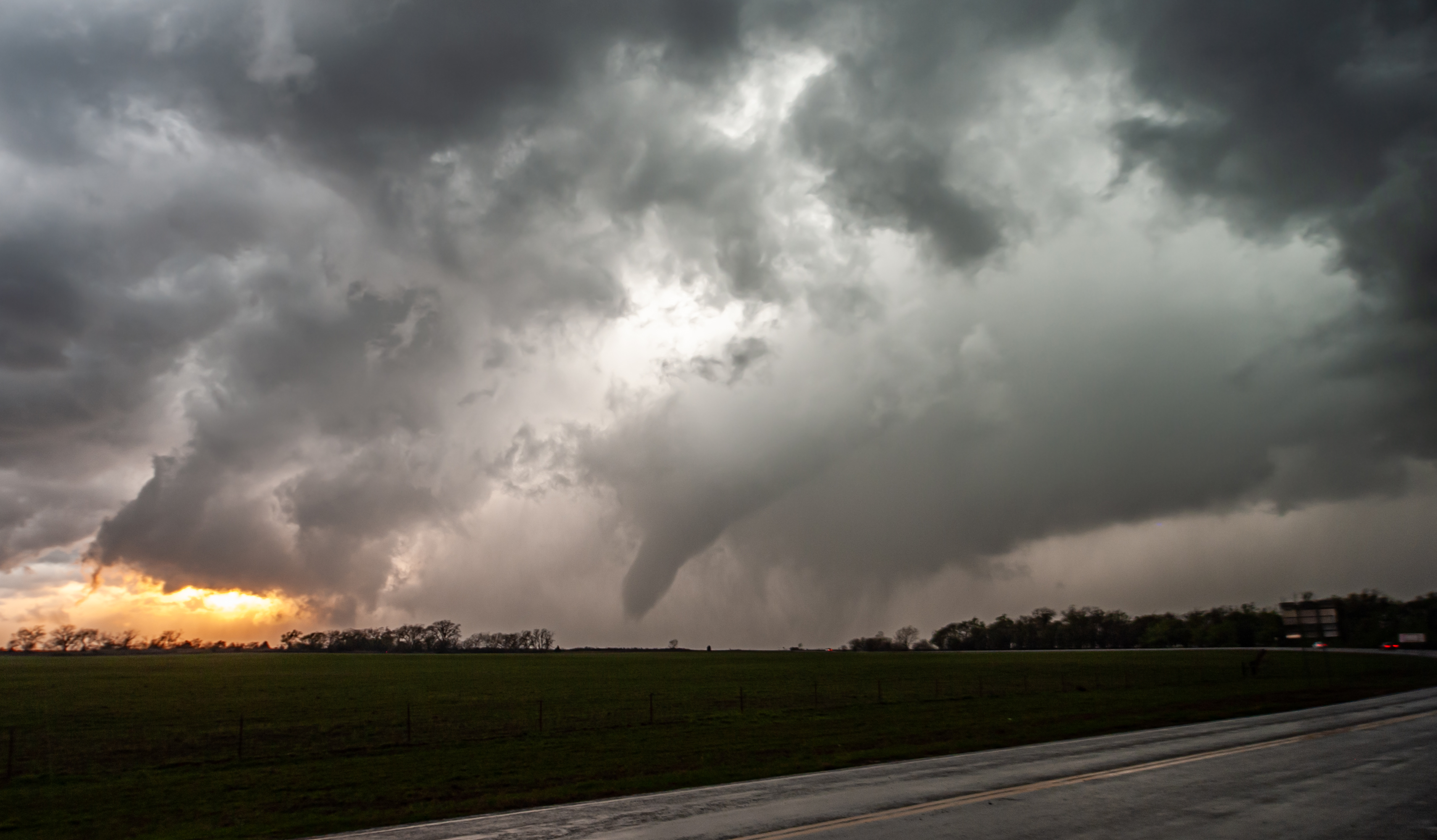
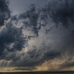
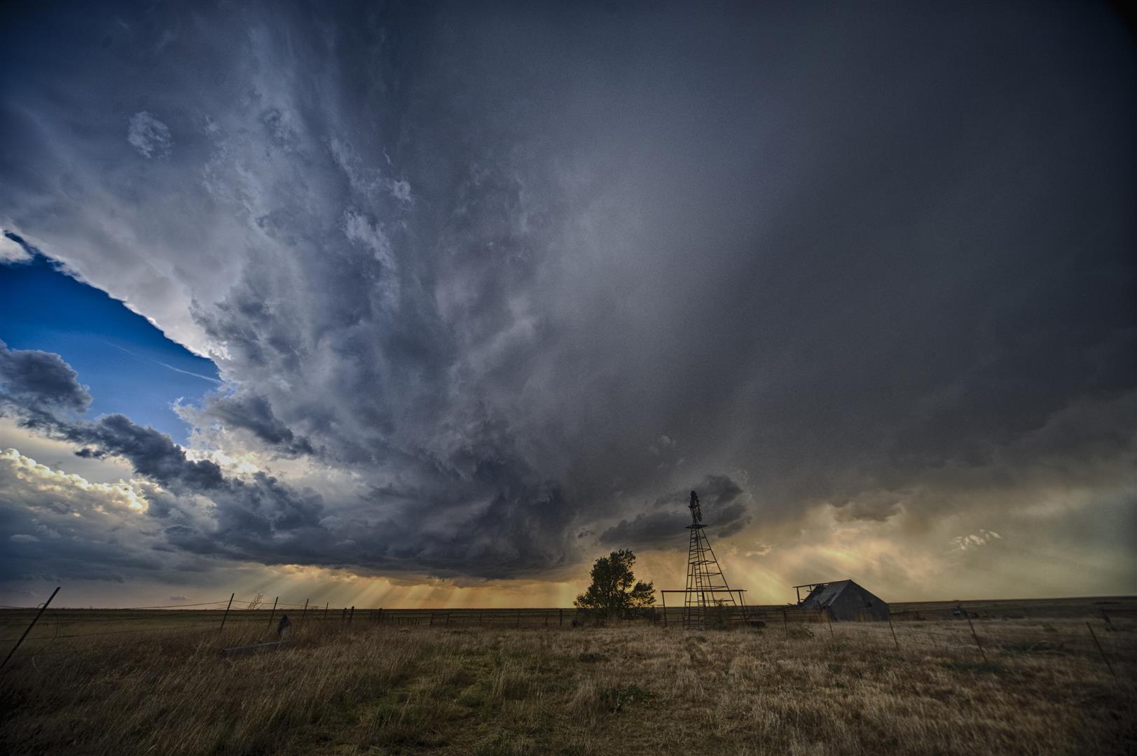
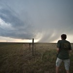
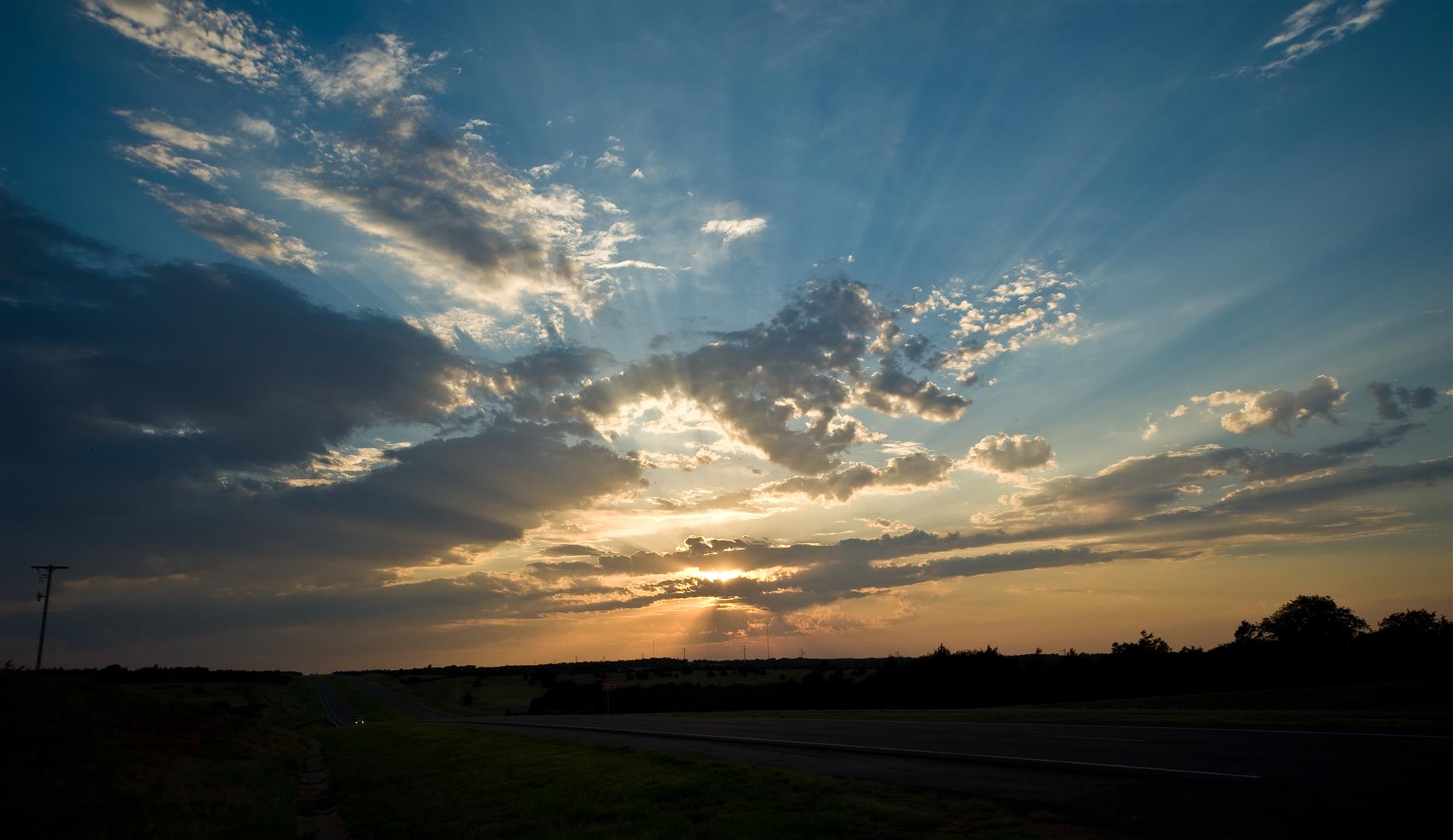
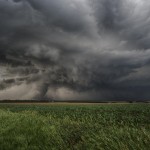
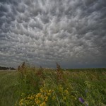
We followed the storm to north of Columbus, NE until almost 7:30 pm, before deciding that it was generally disorganized and wasn’t likely to do much more. We pointed toward York, NE which was our stopping place for the evening. On the way to York, we stopped about five miles south of Stromsburg to observe the mammatus and shoot a few pictures.