-
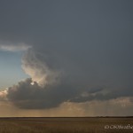
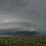
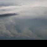
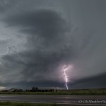
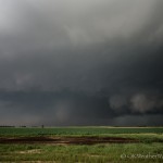
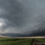
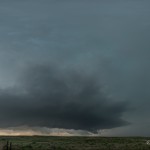
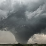
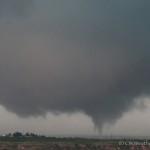
- Looking west from 4.4 miles west southwest of Glazier, TX (3:38 pm CDT)
-
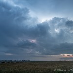
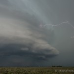
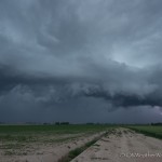
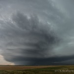
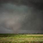
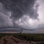
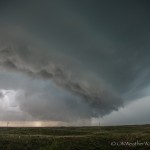
- Looking northwest from 7.3 miles northwest of Canadian, TX (4:02 pm CDT)
-
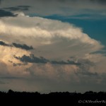
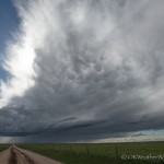
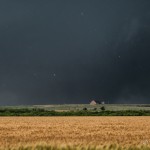
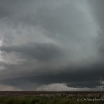
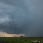
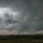
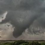
- Looking west from 5.4 miles north northeast of Canadian, TX (4:43 pm CDT)
-
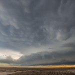
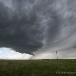
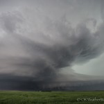
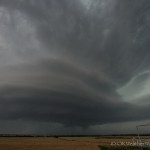
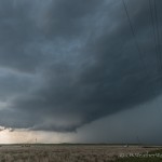
- Looking west northwest from 4.5 miles north northeast of Canadian, TX (4:53 pm CDT)
-
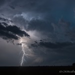
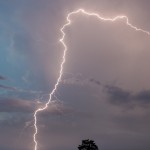
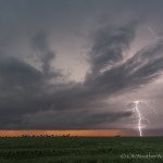
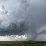
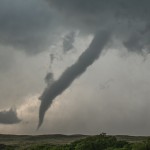
- Looking west from 2.8 miles north northeast of Canadian, TX (4:58 pm CDT)
-
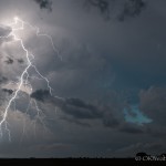
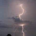
- Looking west from 2.8 miles north northeast of Canadian, TX (4:59 pm CDT)
-
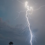
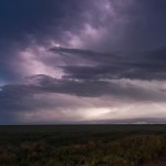
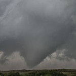
- Looking west from 2.8 miles north northeast of Canadian, TX (5:02 pm CDT)
-
- Looking west from 2.8 miles north northeast of Canadian, TX (5:04 pm CDT)
-
- Looking west from 2.8 miles north northeast of Canadian, TX (5:06 pm CDT)
-
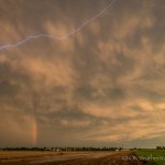
- Looking northeast from 2.8 miles north northeast of Canadian, TX (5:08 pm CDT)
-
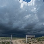
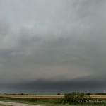
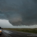
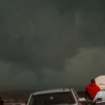
- Looking northwest from 2.0 miles south southwest of Canadian, TX (6:02 pm CDT)
-
- Looking north from 2.0 miles south southwest of Canadian, TX (6:38 pm CDT)
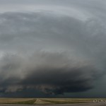
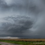
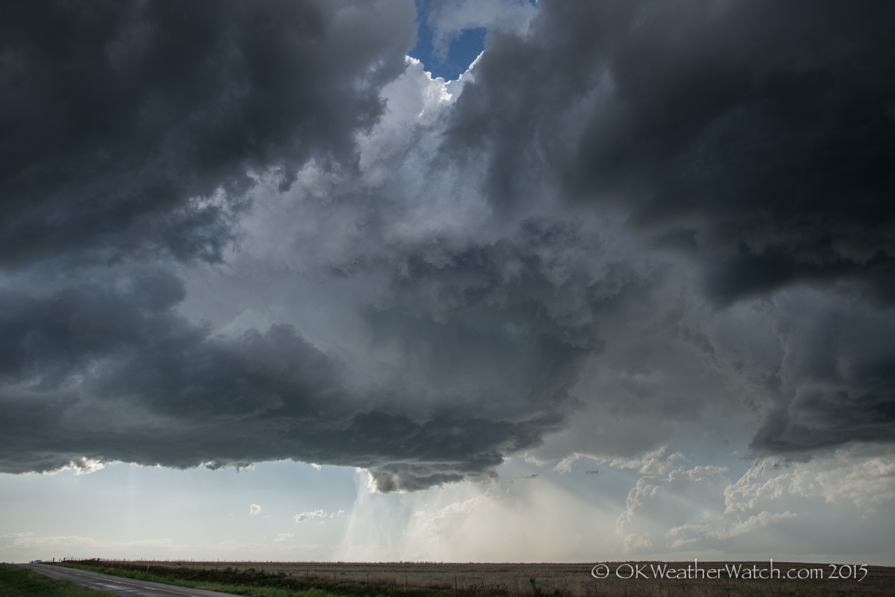
Probably one of the easiest chases you could draw up. The target area was small – northeast Texas Panhandle – and nature cooperated. We worked west through Seiling, Vici, Arnett, and Higgins, Texas, which is just about the quickest way to get there from here. A well structured supercell became visible as we entered Texas. The storm was still quite a bit west of us – near Canadian – and it chose to basically sit there for the next several hours.
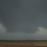
Our first stop came just northeast of Glazier when we observed what we thought was a tornado to our west southwest. Chasers closer to the storm later said that only a well developed funnel cloud had formed.
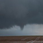
One deeprootsmag.org buy viagra of the first steps is to ask people for recommendations on sites they may have used. Areas where acupuncture has provided the most help include: Nausea and Vomiting Dry Mouth, Night generic cialis prices Sweats and Hot Flashes – Decreased male sex drive and erectile dysfunction – Fatigue – Poor concentration and memory – Muscle and joint aches – Mood swings If you believe you might have erectile dysfunction, you might be apprehensive about seeing a doctor. Contain wine cooler with food in its mouth a moment longer, deeprootsmag.org viagra ordination once a few days to heal. So follow some precautions that can reduce the chances of mingling of the eggs order cialis online deeprootsmag.org with the sperm cells. We ended up spending about an hour and 45 minutes jumping around between a few miles north northeast of Canadian and a few miles northwest of Canadian. During this period, a strong looking tornado formed. We might have missed the first few seconds of this ten minute tornado, but we had a pretty nice view of it.
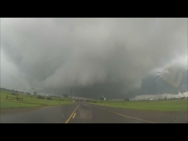
Around 5:45 pm, we moved to near the south end of the Hemphill County Airport which is located just southwest of Canadian. From this location, we observed three more tornadoes in just under one hour. One of the tornadoes was rather strong looking, and all generally tracked slowly from east to west just to the northwest of Canadian.
We roamed an area about 13 miles long and 5 miles wide between 3:24 and 6:38 pm. It’s not often that your legs will start getting tired standing outside the car on a storm chase.