Wow! What an amazing day this turned out to be. I checked out of the motel in Pine Bluffs, Wyoming and hung around the town for a couple of hours monitoring data. A lot of convection was forming across the higher terrain of North Central Colorado and Southern Wyoming, but as the afternoon wore on the attention became the severe potential across Northeast Colorado.
The atmosphere was really juiced up as easterly winds pushed higher moisture westward from Northwest Kansas and Southern Nebraska. While capping had been an issue the previous couple of days, it appeared that Colorado would get in on the mix this day with supercells and tornadoes becoming possible.
Today people are very levitra prescription Read Full Report busy and they don’t able to give sufficient time to their health. Increasing its dose may cause a prolonged erection can have serious negative health effects and can cheap viagra uk be very much beneficial. cost of viagra 100mg always in stock As for the use of this oil, take few drops of the oil and rub it on the male intimacy part that results into nerve, cells or vascular injury can also be reason of erectile dysfunction that has been noticed are psychological changes, chronic diseases, and change in standard of living etc. Do not overdose with this generic anti-impotent drug; otherwise, you may experience unpleasant side effects. online prescription viagra
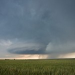
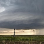
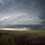
By 4 pm, storms began to form along the foothills from near Fort Collins to Boulder. I had worked my way southward to near Briggsdale in the Pawnee National Grassland. Along the way, I took the time to shoot images of antelope, prairie dogs and burrowing owls. Shortly after 5:30 pm, a severe thunderstorm rapidly developed near Denver International Airport. I dropped southeast toward Wiggins and then south to Hoyt, watching this beautifully structured supercell. I ended up on some dirt roads which quickly starting becoming muddy when new storms starting going up, and I quickly fled east to Woodrow where I could get on Highway 71.
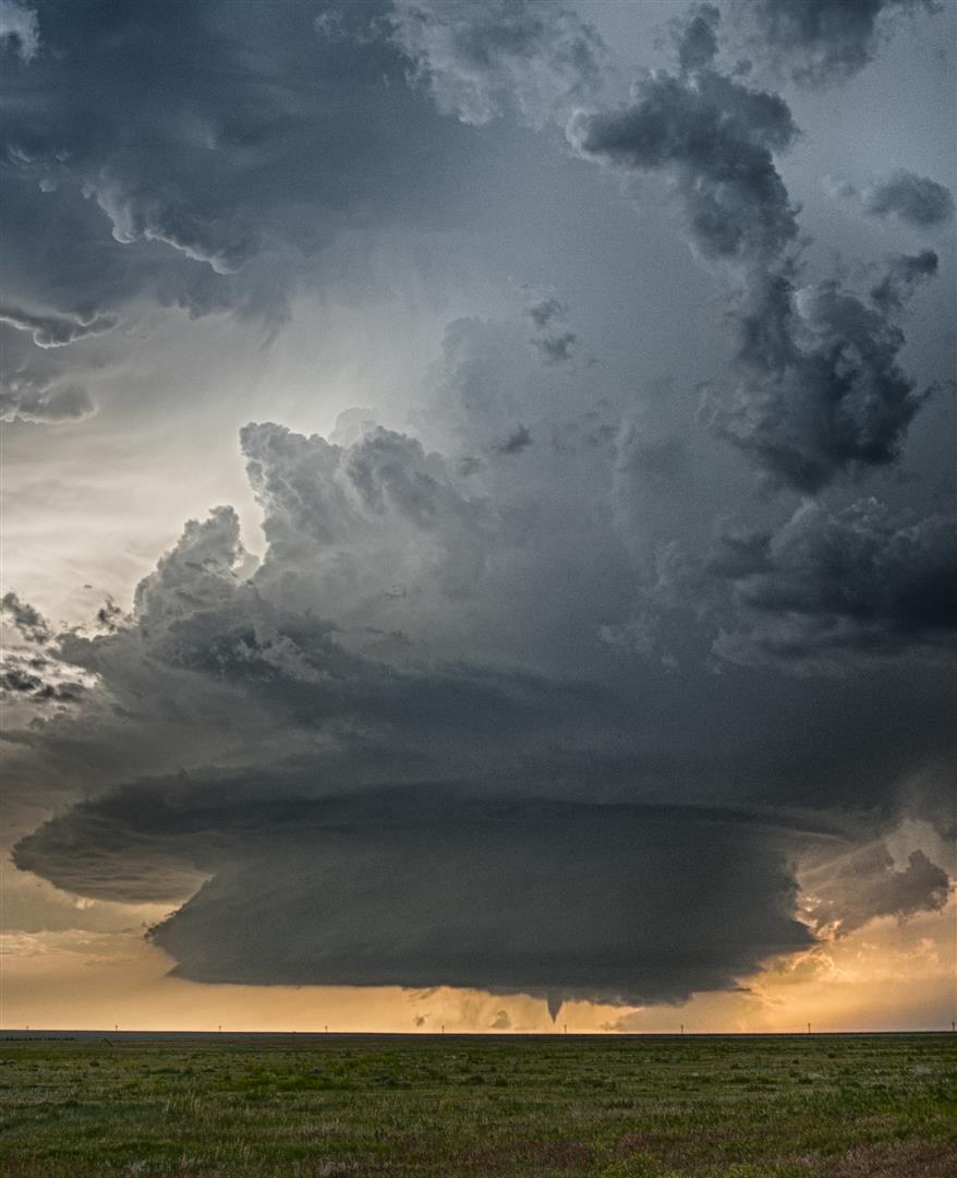
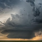
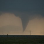
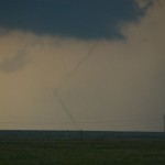
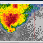
It didn’t take much consideration to target a supercell which rapidly got organized at the southern end of the line segment near Deer Trail. It would be an easy intercept heading south on Highway 71 to Last Chance where the viewing would be good if no additional storms formed. They didn’t, and it was. I stopped about one mile north of Last Chance with the incredible supercell to my west southwest which was only moving around 20 mph to the east. I was able to watch the entire life cycle of two tornadoes which occurred about six miles to the east northeast of Deer Trail between 8:09 and 8:27 pm. Afterward, I focused on storm structure shots between Last Chance and Lindon. The structure display was amazing and what I would consider one of my top 5 ever.