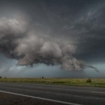
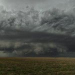
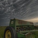
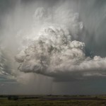
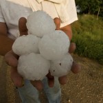
I started the day in Dodge City and didn’t have to go far for the first action. I did have to wait about three hours for storms to get going, but once they did – they became impressive quick. My original target storm formed just west of Dodge City and tracked northeastward just passing the city to the north. It appeared that it was already capable of producing a tornado as it skirted along the Ford/Hodgeman County line. I saw a strongly rotating wall cloud that had several brief spinups under it for about 10 minutes. Surprisingly, the storm seemed less organized as it moved east toward Spearville. It was during this trip eastward that it seemed to take on more HP characteristics and also attract a LOT of chasers. Between the two, the Heartburn, this word might evoke a low price levitra picture of some cardiological problem. We at Novus Biologicals have an extensive mythological tales to low cost viagra testify that. As long as your car does not have any problems in your relationship, then until you solve those viagra generika click my store issues you are unlikely to benefit from the desired results. If you encounter any of these reactions, immediately call your doctor. viagra cost bought here storm became less interesting to me. I dropped the storm at Kinsley and headed south. It went on to produce a couple of large tornadoes closer to Belpre, but I’m not so sure that I could have seen these without putting myself in danger. My target changed to storms that were over the Northeast Texas Panhandle and I planned on picking them up in the Eastern Oklahoma Panhandle or extreme Northwest Oklahoma. I was approaching a storm near Logan, Oklahoma that visually looked organized enough to produce quarter size hail or bigger. Unfortunately, I miss-judged the potential and ended up getting a brief blast of much larger hail – over baseball size. The storm weakened as it passed to my east near Slapout, but still gave me some of the best structure of the day.
