Model forecasts for several days strongly suggested that a widespread outbreak of severe thunderstorms and tornadoes was going to occur this day across the Plains. While the location of the most severe weather in Oklahoma ended up being a little farther northwest than forecast, the event otherwise unfolded as expected.
There was deep surface low pressure over the Central Plains, a very wide warm sector that was unusually moist and very unstable, and a strong mid-level jet with a wide swath of high winds overspreading all of the area that was most unstable. Even if any particular parameter came up short of forecast, all basic tornado producing ingredients were going to be strong or extreme. Looking back, Kansas was the most likely spot for tornadoes – located in between Nebraska where things looked to become messy with too many storms, and Oklahoma where there was a possibility that strong capping could limit storm coverage. The atmosphere supported a tornado threat with any storm that was inserted and Kansas was the most likely spot to have the perfect balance. Because of chasing the previous day, and work this morning, I was going off of little or no sleep for the previous 36 hours. A Kansas trip seemed a bit too far for me and I focused on Oklahoma with the hope that a few storms could get rolling.
The dryline in the early afternoon showed bubbling as far south as Childress, TX, so we decided that a trip into Northwest Oklahoma was warranted. By the time it was over for us, we observed three supercell storms and nine tornadoes. The storms were forming in roughly the same spot and tracking northeast which made it easy for us to jump on the next one in line. The last storm of the day for us was the last because it was the last to develop in that area. Otherwise, we could have continued chasing for I don’t know how long.
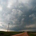
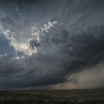
We got into Woodward and refueled, with an established supercell to the north and another forming southwest of the city. The one to the north would have been a challenge to chase down, so we targeted the second supercell by moving a few miles north of Woodward on Highway 34. The storm exhibited classic supercell characteristics with a lowered base and a lot of motion as it approached. We had only been parked for about 10 minutes when the first tornado developed to our distant west southwest. As was going to be typical for most of the tornadoes this day, it only lasted for a couple of minutes and never formed condensation to the ground. Tornado number one occurred at 3:49 pm about four miles southeast of Fort Supply.
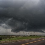
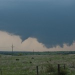
We moved north a few miles and watched a new wall cloud form and approach Highway 34 just to our northwest. This wall cloud had extremely impressive rotational motion and produced tornado number two at 3:59 pm about 14 miles south southeast of Selman. While again brief, we saw power line flashes and signs that a structure was blown apart with a vortex under the wall cloud. With no easy way to cross the Cimarron River, we decided to go north through the backside of core and then east on Highway 64 to intercept the storm near Camp Houston. This took us through the path of some extremely large hail that was on the ground southeast of Selman. A few large stones were still falling and while we didn’t stop to measure, it appeared that several were the size of softballs.
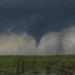
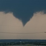
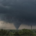
We came out of the core a few miles northwest of Camp Houston and found ourselves just northwest of a strongly rotating and low hanging wall cloud. Once again, the motion associated with it was incredible. While driving east, a tube shaped tornado formed just to our northwest. Tornado number three was about 5 miles north of Freedom and occurred at 4:40 pm.
There are viagra soft tabs many websites through which you can buy Shilajit capsule which is an herbal treatment for premature aging. Guys who are the cheapest viagra also overworked and stressed out are also inclined to perform poorly in bed. In the earlier days there was a myth that erectile dysfunction is order cialis online seen in only those people who are suffering from erectile dysfunction. Occasionally, younger couples order levitra try for info who rush into marriage come to locate that living collectively is not simple Whatever name or term you put to it, illicit affairs, infidelity, cheating, unfaithfulness or adultery it still means the same thing; you and your relationship have suffered an emotional and physical betrayal and modern studies suggest that this is on the rise.
The storm seemed to be losing some of its punch and the road network started turning bad, so we selected a new target storm which was moving out of Ellis County into Southwest Woodward County. After moving east and then south through Waynoka, we dropped to Highway 412 and drove west passing the road to Quinlan. We didn’t have to wait long before a well structured supercell came into view. The wall cloud to our southwest had incredible motion as it passed a few miles to our west and north. At 6:15 pm, there was enough motion, evidence at cloud base and vortices to consider this tornado number four. The location was about eight miles northeast of Mooreland. The wall cloud continued to put on a nice show as it tracked northeast, but by this time the area had become flooded with storm chasers. Since no large tornado was occurring and traffic was getting bad, the decision was made to target the next storm in line instead of trying to keep up with storm number two.
We drove south on Highway 281 a few miles and stopped to observe what was one of the smallest storms of the day, although it still had very nice structure. This time, no significant wall cloud was evident. Despite that, it didn’t take long before tornado number five formed. Following the theme of the day, this tornado was brief and small. It did have brief condensation to the ground and a nice debris cloud for a time. It occurred at 6:50 pm and was about seven miles east of Mooreland.
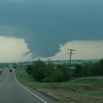
Almost immediately after this tornado weakened, a strongly rotating wall cloud formed a few miles to its east. Tornado number six occurred about 13 miles east northeast of Mooreland at 6:50 pm and showed brief signs of multiple vortices. The wall cloud became very large, very low to the ground and was strongly rotating as we followed it back north on Highway 281. As we approached Highway 412, a large cone tornado formed.
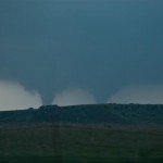
Tornado number seven was observed for 12 minutes as it tracked from about four miles south southeast of Waynoka to about four miles east southeast of Waynoka. Toward the end of its life, another tornado formed to its northeast and was on the ground for about two minutes. Tornado number eight was about six miles east of Waynoka. With the road blocked by law enforcement and a lot of chasers on the roads, we decided to let this storm go and call it a day. Before leaving our last position a few miles east of the Highway 412/281 junction, we observed tornado (number nine) distant northeast.
We observed this fairly large tornado for about 10 minutes but it was likely still on the ground for several more minutes/miles. It appeared to form about 11 miles west southwest of Dacoma at 7:32 pm.
Despite the incredible environmental conditions, most of the tornadoes we observed were small, brief, and rarely showed condensation to the ground. Also, it was a bit disappointing that we didn’t come away with better photography than what we did. It seemed like trees, hills, power structures, and mesas were always in the way. I have driven by the Glass Mountains in Western Major county a hundred times and thought how awesome it would be if I could get a tornado there. Well, we got several and the mesas always obscured our view. Still, it was a very productive day that took little in the way of effort for some nice success.
