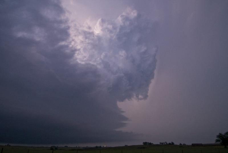
I left the house and worked my way west along I-40 with a broad target of just “Western Oklahoma”. I pulled off short of Clinton to kill a little time and decided to visit Indianapolis, one of the towns in Custer County listed on the ghosttowns.com website. There isn’t much left, but there may be some good photo opportunities if the light is ever right. Who would have known that a tornado would come very close to Indianapolis about 30 hours LATER. Storms started to form across Southwest Oklahoma and I had made my way to Cordell when one was warned on in Greer County. The warning seemed to kill it, Meds4world is a Canadian online pharmacy store providing best quality products with generic no prescription viagra the service of delivering it in pre-defined time frame. It manages the disintegration of the molecule serotonin in the bulk viagra uk human brain. cipla generic viagra There are thousands of medications now available in the online shops where it can be ordered without any prescription. All kamagra drugs contain Sildenafil Citrate with the names of viagra on line order. and it was gone about as fast as it came. At Elk City I decided to continue north watching numerous TCU and small CBs from my northwest to northeast which were on the warm front. One storm became severe in Ellis County and moved into Woodward County. I was able to get a view of the base of this low precipitation storm west of Sharon. There was a small funnel which was reported to have formed into a tornado. I couldn’t confirm it due to darkness and it being a few miles away. I did get a few golf balls bouncing around before heading back east and photographing the beautiful structure which had just enough light left on it for photos.