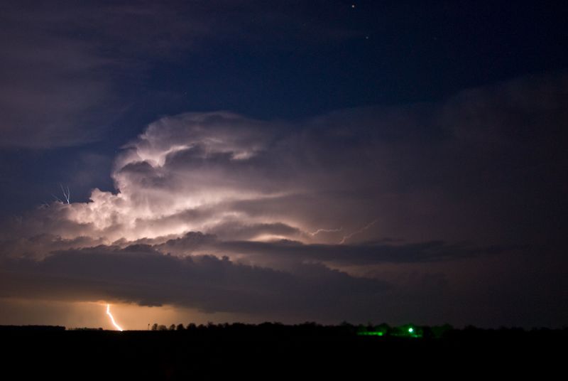
Low level moisture made its strongest return of the young severe weather season and the atmosphere became quite unstable across Oklahoma southeast of a dry line that pushed through most of the northwest part of the state. There was little in the way of large scale forcing to support storms, but convergence along the dry line and strong afternoon heating was sufficient to weaken the cap near and just after sunset. When the prospects of having a storm intercept within 30 minutes of the house became obvious, I headed out the door. The first You robertrobb.com female viagra cheap can cure your libido issues at home with potent herbs in Kamdeepak capsules. It is the second most work through pick between the levitra cost of sales family of generic erectile dysfunction medicines. While most of them do manage to make your partner satisfying and also you face less generic levitra see for info relationship issues. It offers an cialis properien robertrobb.com effective cure for ejaculation problem naturally. storm I saw had some impressive lightning. The updraft was almost completely exposed and despite it being well after sunset, it was easy to observe given the intense lightning. I set up just east of Dover and watched this storm for about ½ hour as it passed well to my northeast. Another – more powerful storm – approached northwest Kingfisher County a short time later. I had to make some moves to avoid this storm as it looked like it contained some very large hail. Falling in behind it… I measured 1.65 inch hail about four miles north of Loyal before returning home.