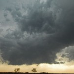
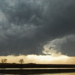
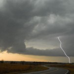
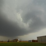
I drove to Southern Kansas and spent most of the afternoon in and just east of the Wichita area. It appeared that we would have a narrow window of supercell and tornado opportunity across Southern Kansas. In the end, a few things were out of sync and the storms were mostly small and uninteresting. I played around with a good handful of storms in the Augusta and Towanda areas where updrafts showed considerable motion at times. They did appear a little more high-based than what I would have expected for the conditions – giving some indication that we didn’t have it all together for tornadoes. I grabbed a few storm structure shots and a lightning capture and then made the drive back to Oklahoma through smoke from wildfires and high surface winds associated with the intense low pressure area.