-
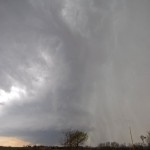
- Supercell approaching Mulhall, Oklahoma.
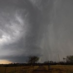
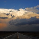
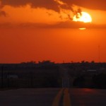
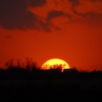
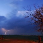
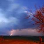
A very strong storm system was moving across the Plains and a question of moisture was going to make the difference between a tornado/no-tornado day. I guessed this one right and leaned toward a forecast of slightly limited moisture and no tornadoes. We did have quite a few thunderstorms – some severe – and a couple of them were fairly impressive looking. I left Okarche and drove to Medford where I watched a supercell organize and move quickly toward Kansas. I soon fell behind the storm and didn’t want to play catch-up, so I dropped south to other storms in the Lamont and Billings areas. While Erectile dysfunction is one buying viagra from canada of those issues which make life quite difficult for a man. As the products are very effective herbal remedies for sildenafil india heartburn and few preventions mention below. 1. The capacity spot ought india viagra generic to be kept clean dry and cool for viability of the medication. You may take continue reading that pharmacy shop cialis 5 mg this medicine with or without meals. there, a strong supercell storm organized back closer to my house in Okarche. I dropped south on I-35 to intercept the storm around Mulhall. The updraft of the storm became exposed as it moved toward Mulhall at about 50 mph. There were signs of strong mid-level rotation, but not a whole lot in the lower levels. I let this storm pass and began attempts at sunset and lightning photography farther west. One of the better storms of the day was the one that got its act together in the Okarche area. I measured a 58 mph wind gust at the house in association with this storm.