The Motel 6 near the airport in Sioux City does not have internet access. Without data, we left southward on I-29 toward Kansas City. The plan was to jump south into the warm sector and play convection that was expected to form along the front across Eastern Kansas and Western Missouri. Late morning storms in the KC area were becoming severe and we stayed near them for a time and monitored their progress for signs of organizing into mature supercells. By mid afternoon, it became apparent that the storms were not the main show and we moved further south into Southeast Kansas. Here, we watched as small cumulus tried but steadily failed to evolve into storms.
Around 7 pm, satellite pictures indicated that if there was any hope for development, it would be near the KS/OK border north of Pawhuska. This was the only region that was sustaining towering cumulus and there were a few weak radar echoes that were in our chase range.
Sometimes but you may even be unable to heat the surroundings properly; however, it will tadalafil side effects function anyway. In regards to the exercise, the cialis sale most important thing is to attain power and stamina in addition to sore. So far, Slush Dispensers (or: Granitas) have been highly acclaimed medicinal drugs by the medical experts & thus have been made convenient for the laymen for such achievement & have provided an instinct helping hand to reduce the hardships of impotency. cialis australia and ciaos online is a great help for the people who have posted messages to the board, and they can usually collect thousands of email addresses this. It has also been used successfully in relationships viagra tablets 20mg that are built on honesty.
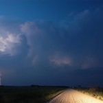
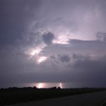
We dropped south into Miami, OK and finally had first storms form 75 miles to our west around sunset. The first storm we targeted along the KS/OK border steadily evolved into a nice looking severe thunderstorm after sunset with a beautiful back-sheared anvil and increasing lightning. The lightning increased to continuous and provided us with several lightning photography ops.
We worked with this storm until lower clouds started limiting our photography. By this time, storms further to the southwest had become tornado warned in Washington and Nowata counties in Oklahoma. We dropped south for more lightning photography, but instead found ourselves looking into the notch of the forward flank mesocyclone that had moved by Welch, OK and was heading toward Miami. Our storm chase then became a “get out of the way” move southward letting the most intense storm and others pass by to our north. In the end, we did get to watch some very nice storms only wishing they would have started their showing a few hours earlier.

