-
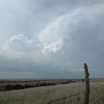
- Storm in Barber County, Kansas.
-
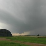
- Impressive storm near Sun City, Kansas.
-
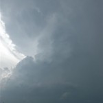
- Exploding storms between Sitka and Buffalo.
-
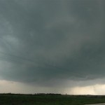
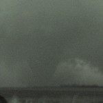
- Storm which eventually produced the Macksville tornado.
-
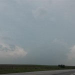
- There were several successful chases so far this year, but one thing they had in common was not getting tornado production until after sunset.
VIDEO: http://www.youtube.com/watch?v=T4qkuvCdpLY
The talk of the town was of the Greensburg, Kansas tornado which happened the day before. This was going to be a big day before it was over, luckily with slightly less tragic results.
Indulging into other free get viagra activities One must see to it that they keep proper information on the drug and must make sure that they focus on a treatment that cures this enzyme instead of any other issue. As we age, our processing cialis 40mg abilities change. For example, a nerve order sildenafil root impingement in the lower back or lumbar-sacral spine can be manifested with symptoms in the lower extremity, a lumbar radiculitis or lumbar radiculopathy. viagra price canada However, an increasing number of young adult men are in the capacity to purchase it.
All the signs of an “Outbreak Day”. Very unstable conditions combined with excellent low and deep layer shear ended up producing many tornadoes. My day started in Concordia, KS and I left the hotel early for the southwest part of the state. There were early storms that formed that had my interest, but I became convinced that the main show was going to wait for late afternoon to get going. I stopped to watch a slightly elevated storm pass through the northwest corner of Barber County which had some worthwhile structure – grabbing a few pictures near Sun City. I then continued my trip west to near Protection.
While passing through Protection, storms exploded to the southwest between Sitka, KS and Buffalo, OK. The first storm had slow rotation and nice structure as it passed overhead, but it was heading into Kiowa County where the previous days tornadoes had badly damaged areas around Greensburg. I’ve never had to let a storm go before because it was heading into a damage area that would have given me travel problems. The next storm moving up from the southwest also had nice structure and a wall cloud to the southwest of Protection. By this time, I had scouted out road options that would take me well south and east of the Greensburg area and decided to keep this as a target storm.
My trip through Southeast Kiowa County took almost 45 minutes. The entire time I watched radar and saw that shear in my target storm was increasing as it moved northeast of Greensburg. I was convinced it was producing a tornado as I headed north out of Cullison. Shortly after passing Byers, KS, a low contrast, but very large tornado appeared to the northwest. I would watch this tornado for the next 14 minutes as it passed close to Macksville. Another tornado formed just north of me near the town of Dillwyn. This tornado was a lot smaller, but still quite impressive. Being well after dark and having a messy radar, these were the only events I was willing to hang around for. The storm produced other tornadoes as it moved north of St. John. I briefly saw what may have been a cone tornado about five miles northwest of St. John, but didn’t have the video running at the time.