The atmosphere across Southern and Eastern Oklahoma was extremely unstable at midday, and while it didn’t look like that tornadoes were likely, severe storms were expected and we felt there were some supercell chances. I picked up Doug Speheger and Erin Maxwell at Doug’s house in Norman. Not long after I got there, a severe thunderstorm developed almost right overhead and moved off into the trees of Northeast Cleveland County. We decided to let this storm go and target storms that were forming about 50 miles to the southwest.
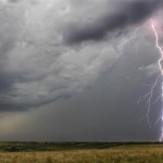
We found marginally severe hail in Southwest McClain County, but not a lot of structure as the storms were quickly evolving into a long line segment. There was a supercell storm at the southwest end of the line that was anchored in Cotton county for a time. We saw a brief, small funnel cloud with this storm as we moved around the south end of Waurika Lake. The storm quickly became outflow unbalanced as it moved toward the Red River. Before it blasted us with wind and hail, I was able to come away with a couple of lightning shots.
We made a turn-around in Wichita Falls, TX and spent a bit of time on photography on the way back.


