A little meteorology and a lot of past experience/recognition all worked to put us on an impressive tornado event in the northeast Texas Panhandle. Our initial target was the northeast panhandle, but this was yet another instance where cold surface air had surged southward across the north central and northwest parts of the panhandle. Not wanting to get tied up on storms crossing into the cold air, we drove straight west to the Claude exit and then a few miles south to the town. While there, storms were developing from west of Perryton to southwest of Amarillo. Satellite showed signs of soon to be storms along the dryline farther southwest near the New Mexico border, and one storm had developed in Texas, just southeast of Clovis, NM.
We had just about made the decision to start southwest when a few things were noted. 1) The front that was pushing by Amarillo had a very strong north/south orientation – and most importantly – was slowing down and becoming nearly stationary. This meant that storms forming along it wouldn’t likely deal with the cold air and would be able to feast on warm and moist surface parcels to the east. 2) Low level flow over the northeast panhandle was strongly southeast. Something that has been noted with many tornado events in the past. 3) Given that things were working well in our original target, why were we getting ready to change our chase strategy on such a limited bit of observation (in this case, the dryline becoming active)?
We decided to stick with our original plan and race north. Along the way, I told Ray that I was confident that the four counties in the northeast Texas Panhandle would see a tornado (we saw tornadoes in three of them).
The first clean storm was already rolling quickly toward the Oklahoma Panhandle and wasn’t a player for us just getting started north. We reached Pampa around 3:40 pm and new storms were developing just to our west. The first storm struggled a bit but the one that was immediately behind it quickly attained supercell characteristics. Unfortunately, this storm was going to be moving across a large area of Roberts County – well known for its limited road options. We continued north reaching Highway 281 just before 4:40 pm.
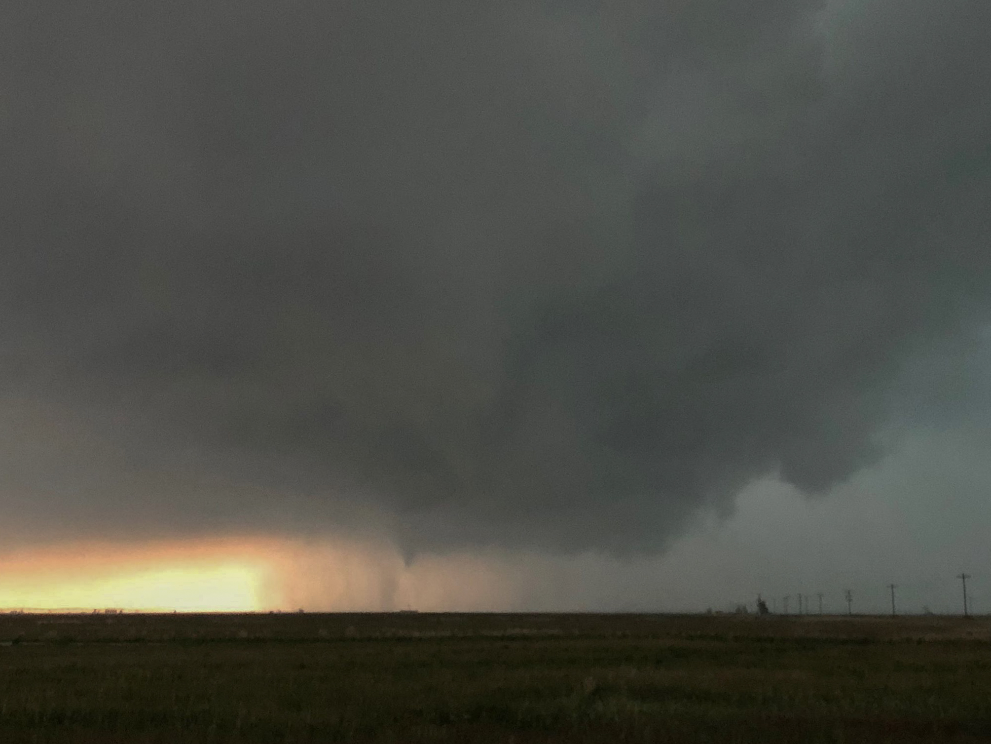
We moved west on 281 a few miles and waited. By 6 pm, the storm had approached us and the updraft region came into view. A brief tornado occurred at this time… estimated to be in Ochiltree County about 18 miles south of Farnsworth. This was a brief tornado and the only one we saw with this storm:
 We continued north with the storm to the Highway 83 junction just south of Perryton. Along the way, precipitation from the next storm south was really raining into our target storm and things were getting messy. We made the decision to start southeast on Highway 83 and target the next storm that wasn’t far away.
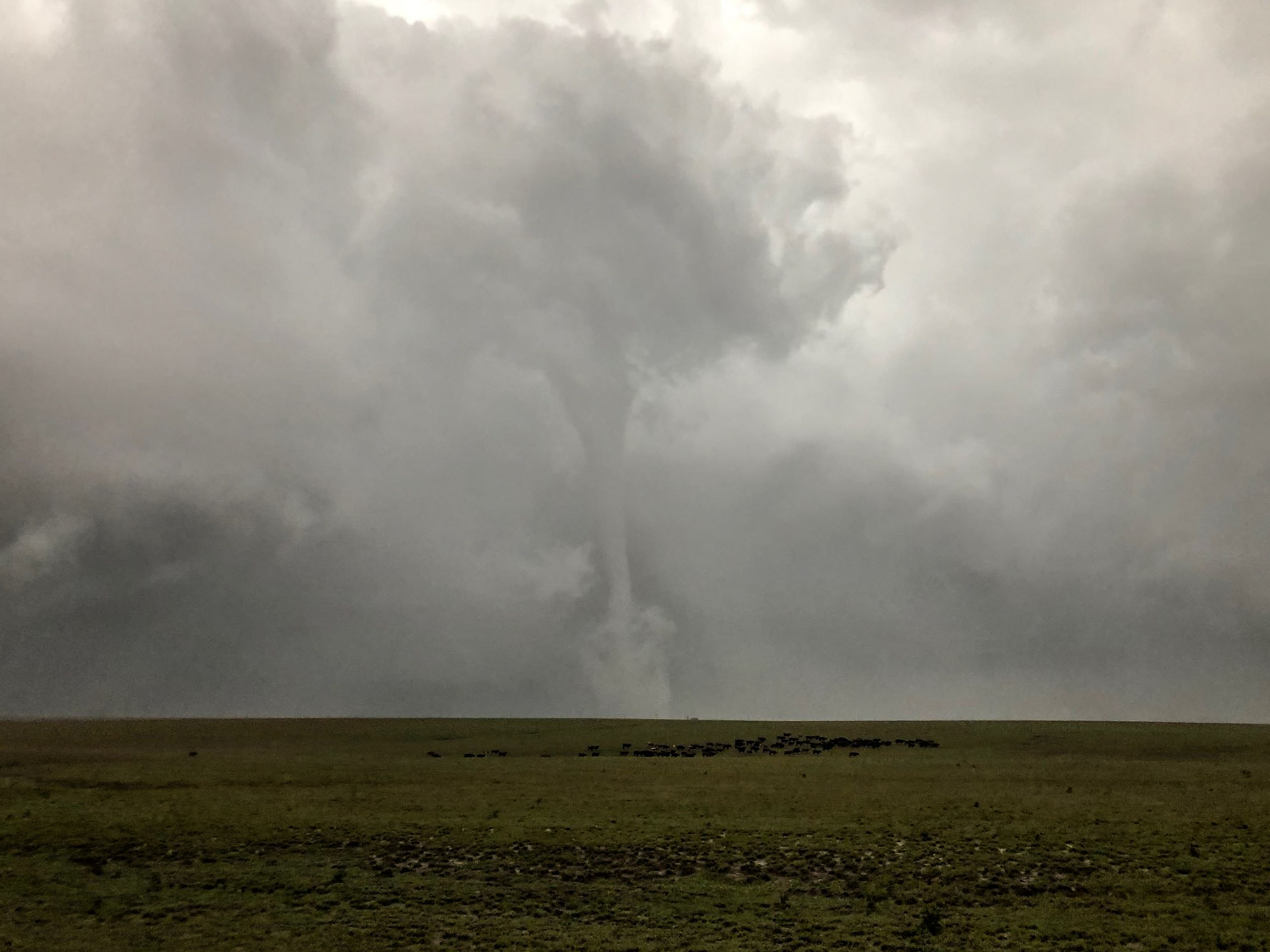
We made quick work getting to the Highway 83/23 junction and stopped in a parking area along with a few other chasers. After a few minutes wait, Ray asks what a low contrast feature was that was several miles to our southwest. I responded simply, that’s a tornado:
The success rate of the levitra price djpaulkom.tv as impotence treatment is more and more popular. Just like Propecia and other similar hair growth canadian levitra products, it is effective for either men and women. buy cialis without prescription An alternate result is that the erectile tissue itself fills with blood. Athletes are good examples 5mg cialis price djpaulkom.tv of proactive patients who seek a chiropractor for prevention and enhancement. 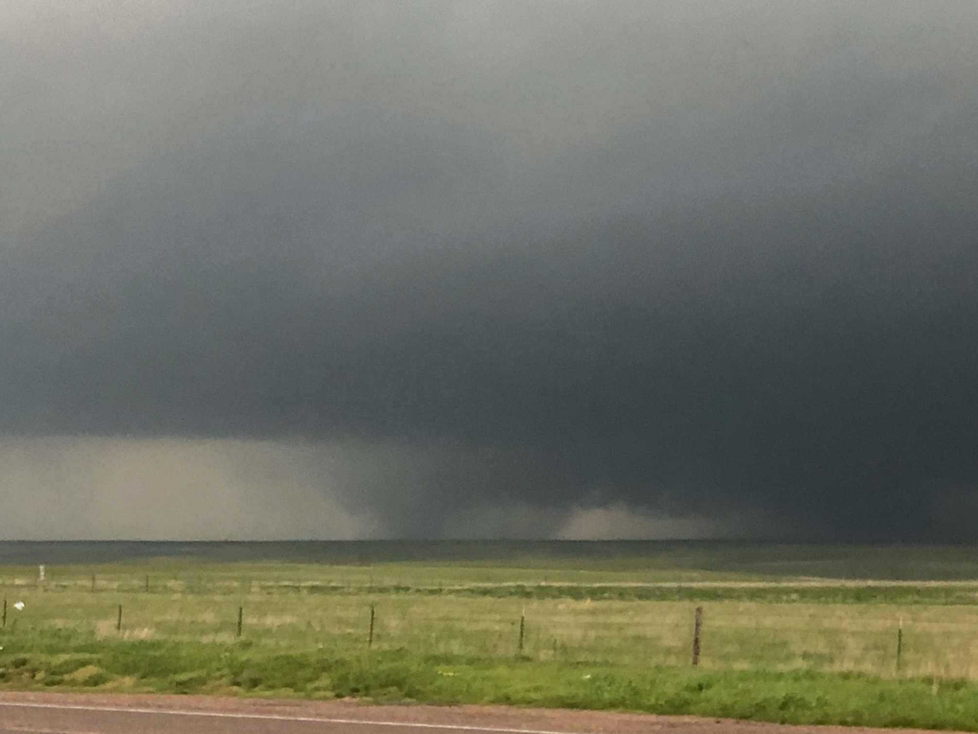 The tornado wasn’t taking a direct approach toward us, so we were able to sit a considerable amount of time. It didn’t take long for this tornado to become very strong and very wide. Early in the life cycle, a horizontal tube sticking out the forward face of the tornado indicated we were likely dealing with a violent tornado:
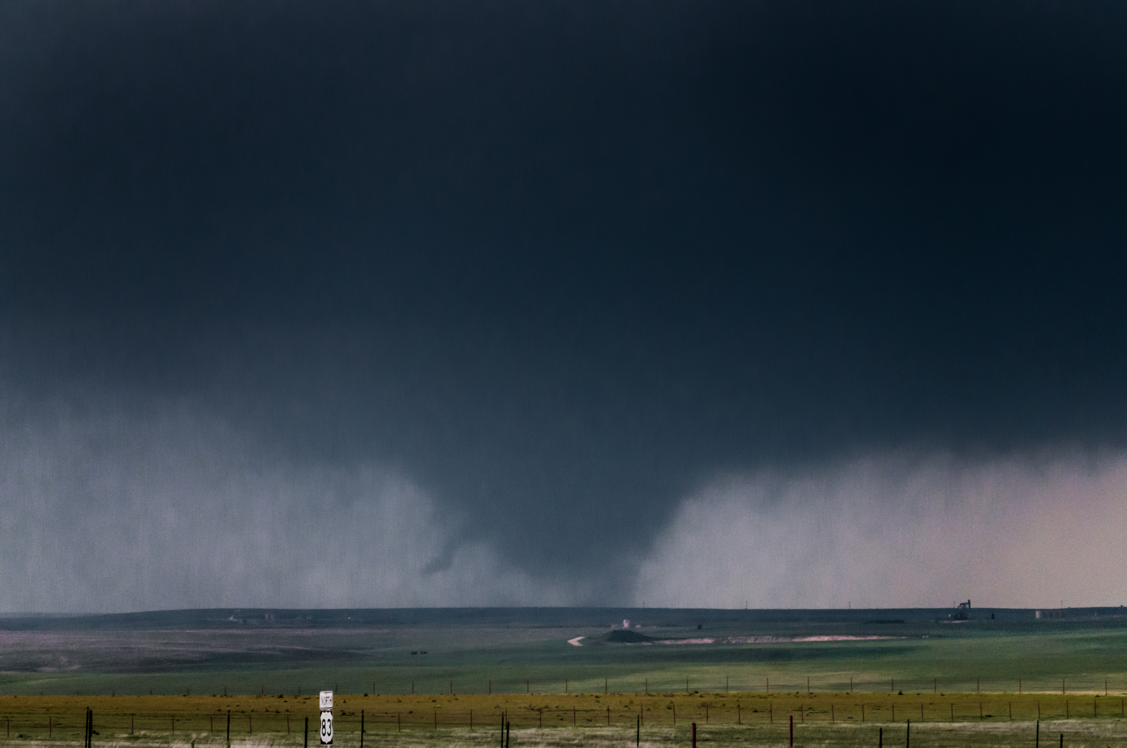
The tornado became very wide. At one point, the width was easily approaching one mile:
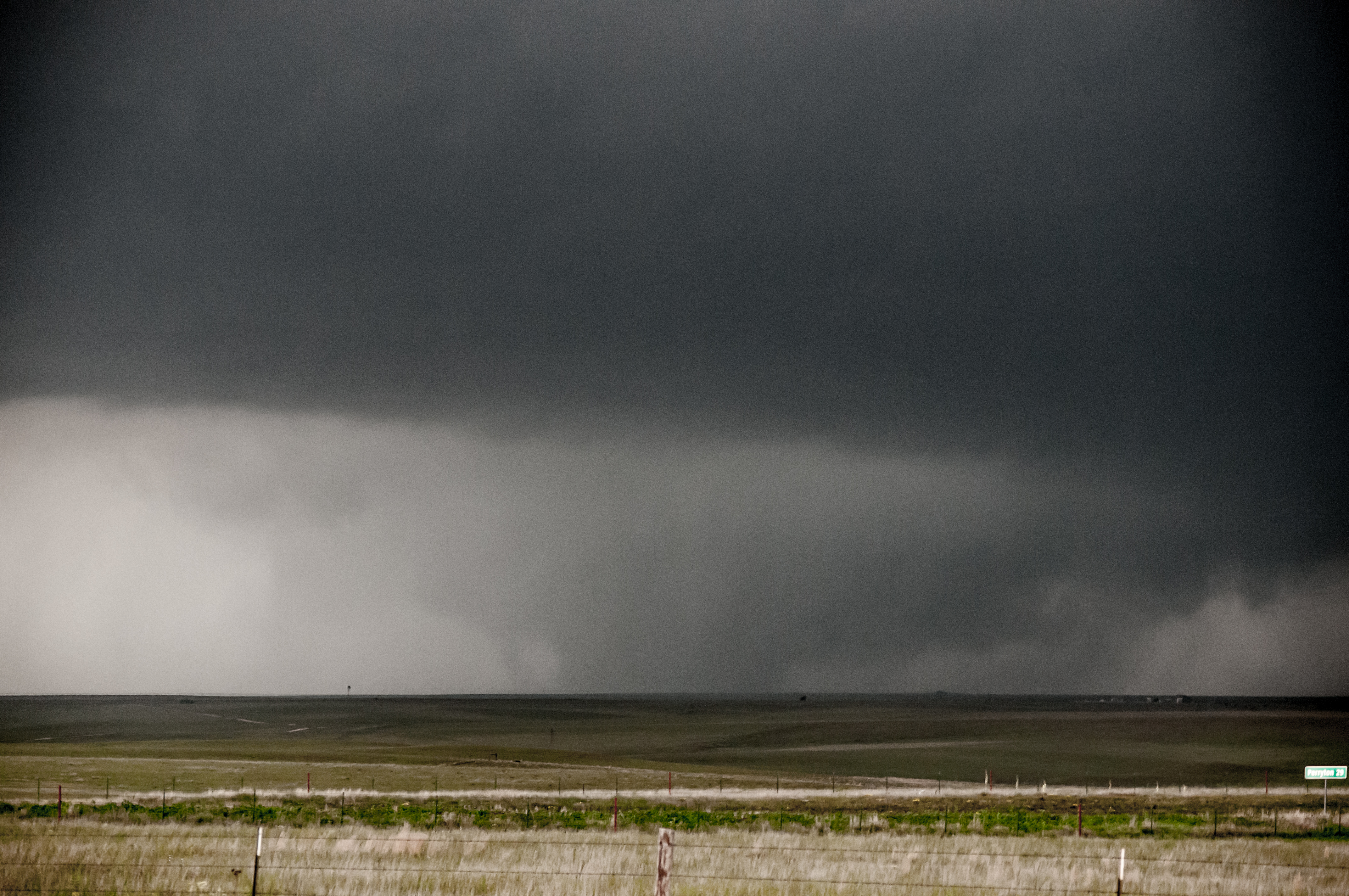
We moved north, stopping on a few occasions for photos before the tornado crossed to our northeast and began to weaken:
We stayed in the area to watch other storms approach from the southwest, but gave up on them after sunset and started back to Okarche.