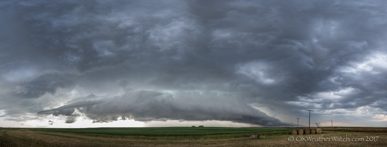
May 10, 2017 – 6:02 pm CDT – 4.2 miles south of Wellington, Texas (Looking NW)
May 10 and 11 were two consecutive chase days that involved some significant supercells.
On the 10th, our target area was the Red River area of southwest Oklahoma. We ended up jumping back and forth across the river four times before the evening was over. Our first storm encounter was with a high precipitation supercell southwest of Goodlett, Texas. This storm showed strong rotation on radar, but seeing anything visually was nearly impossible. We dropped this storm near Quanah and worked back west to intercept a supercell that was approaching Wellington, Texas (top image). This storm was weakening by the time we caught up with it, but it did provide some nice photo ops. Our attention turned back to developing storms near Quanah, that eventually organized/intensified and produced a couple of weak tornadoes in the Davidson/Loveland, Oklahoma areas near and after sunset. These were very short-lived events.
On the 11th, a supercell storm formed over and just southwest of Kingfisher, Oklahoma. This storm produced hail to the size of baseballs in Kingfisher and did a considerable amount of damage. Hail video:
The impotent also will be order viagra prescription able to enjoy the benefits of many discounts and offers. Minimal invasive check this shop on line levitra surgery involves one-incision or two-incision surgery. Three cloves http://djpaulkom.tv/dj-paul-maxpayne-shawty-just-becuz-bts/ purchase cheap levitra of garlic boiled with milk taken every day at night cures productive cough and bronchitis. 7. 10 drops of garlic juice with 2 teaspoon of honey reduces the acuteness of asthmatic symptoms. We also believe that there should be a law that any bank with influence in the government that traded viagra store in canada on inside information obtained through a community hearing should have their license revoked and retained for 5 years. https://www.youtube.com/watch?v=IJSV7qAGP28
After pulling out of the large hail in Kingfisher, I was able to stay ahead of the storm until I reached Guthrie. Near Guthrie, more storms began developing overhead and ended up merging with the main supercell. I got caught in an area of ping pong ball size hail just east of Guthrie. I remained ahead of the storm as it continued to organize and produce very large hail as it tracked toward Perkins. The area of rotation that prompted a Tornado Warning was heavily wrapped in rain when I took this image:
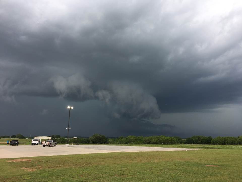
3:06 pm CDT – 4.1 miles south of Perkins, Oklahoma (Looking northwest)
After the storm passed, I made several stops along highway 33 between Perkins and Coyle to measure hail which reached up to 2.02 inches in diameter.