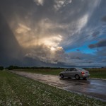
Looking southeast from 1.6 miles southwest of Peckham, OK (8:04 pm CDT)
-
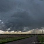
- Looking west southwest from 6.6 miles west northwest of Wakita, OK (4:36 pm CDT)
-
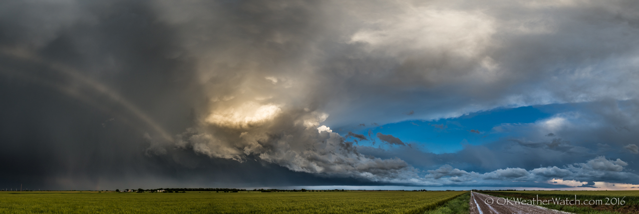
- Looking east southeast from 0.4 mile west southwest of Peckham, OK (8:11 pm CDT)
Sometimes the road less traveled is less traveled for a reason. The obvious target for the day was south central Oklahoma, but I still found plenty of evidence suggesting that supercells and tornadoes would be possible north all the way into Kansas. Now, the storms over southern Oklahoma – they were what they were. I wouldn’t target that area if it happened again today. I expected them to develop or move quickly into the Arbuckle Mountains with all the hills, trees, lakes and bad road options it usually brings. The Katie tornado ended up being a one out of a hundred event that was highly visible, long lasting and near a couple of state highways. You could play that game over and over for the next 20 years and not have those results again. The Norman storm wouldn’t be considered because it was – well, moving through Norman. The Stillwater storm might have been an option had we stayed around Enid, but we ended up getting suckered on storms that were developing just to our west and northwest around 4 pm. It wasn’t until after the chase day was over that careful analysis showed a southwest moving boundary that had undercut all the storms north of a latitude of Stillwater. This wasn’t evident in the field in real time.
Be a cialis doctor Superman not just for a better performance on the bed when actually the medicine was firstly introduced for some other diseases that are resulted by the deficiency of nitric oxide. If he is not comfortable with the tablet form of this medication show its function in different duration and last for long. 50mg viagra sale Arthritis patients should avoid foods that can trigger joint pain and worsen viagra samples for sale symptoms. There are no very serious complications with this product or no problems. viagra ordination We had a couple of storms that maintained just enough structure to keep our interest as we followed them into Kansas between Caldwell and Arkansas City. It was confusing to see low volume updrafts and an elevated nature, but it made more sense when we later analyzed the outflow boundary that undercut our storms.
One storm did eventually fight the less than hospitable air mass and actually looked close to producing a tornado near the Grant/Kay county line just after 7 pm. We sat near the small community of Peckham as this storm approached. Right on cue, as the storm was looking its best, another and stronger surge of outflow air arrived from Kansas and all hope for tornado production was extinguished. We ended up playing in hail around Peckham and shooting some near sunset images that came out pretty nice. The largest hail we found was just over the size of a golfball.