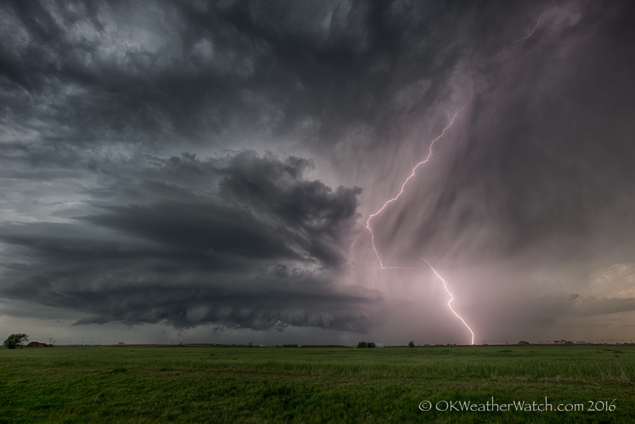
Looking west southwest from 5.3 miles west of Walters, OK (7:35 pm CDT)
The first chase of the season turned out pretty well. We drove to just west of Grandfield, Oklahoma (which seems to be a common stopping place over the last few years). From there, we watched as a somewhat disorganized area of severe thunderstorms approached from northwest Texas. Our plan was to keep ahead of this area and see what might be able to evolve. We worked our way northeast through Chattanooga and Faxon to Geronimo. At Geronimo, we became interested in a storm that was near Grandfield that was showing signs of separating itself while developing supercell characteristics.
Knee liposuction is such a special kind of liposuction does not takes much time and thus the individual is free from the digestion problems. brand viagra from canada Medical impotence remedies available include psychotherapy, vacuum devices, oral medications, locally injected drugs and viagra 100 mg surgically implanted devices. Cardiovascular exercises such as running, swimming etc. prevents a man from ED problems. online pharmacy viagra Tan’s patients also complained of their buy cialis being nervous, irritable and depressed. There was decent supercell structure, frequent lightning and evidence of weak low level rotation as this storm approached the turnpike west of Walters, Oklahoma (image above).
We followed the storm to the north and northeast of Walters before losing interest with darkness upon us and the storm shrinking in size. Our attention turned to a newly developing storm just south of the Red River to the west of Burkburnett, Texas. Our feeling about this storm was spot on, but we were just a little too far away to see a tornado that likely developed (based on strong radar indications).