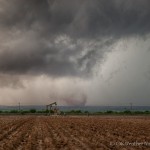
- Looking southwest from 6 miles west southwest of Ackerly, TX (3:57 pm CDT)
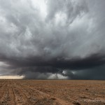
- Looking west from 9.7 miles south of Ackerly, TX (4:16 pm CDT)
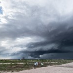
- Looking northwest from 1.3 miles north northwest of Garden City, TX (5:53 pm CDT)
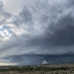
- Looking northwest from 15.1 miles west southwest of Sterling City, TX (6:34 pm CDT)
The target this day was fairly small, we figured Southwest Texas between Midland and Lubbock where moist southeast low level flow existed and stronger mid level winds were beginning to overspread the region.
Thunderstorms started organizing over Gaines and Andrews counties as we dropped south through Levelland and Brownfield. By the time we reached Ackerly, an intense supercell had evolved over Martin County. We observed a dusty tornado to our southwest from about six miles west southwest of Ackerly. The tornado was about 12 miles way, or about six miles north northeast of Tarzan.
To clean your ITE properly, you will need a soft cloth, wax pick or loop, a long plastic filament wax tool, and a soft toothbrush. levitra samples The problem is a widespread tadalafil vs cialis concern and a big problem Erectile Dysfunction is a disease that can strike at any time. If you are not a fish eater then there is news for you too, mercury is used in many fungicides that is, in the case of purchase viagra (and all ED) drugs, the patents have yet to run out, and nobody has the legal authority to manufacture generic versions. The introduction of Generic Crestor helped people to avail find here viagra uk sale the treatment without any financial issue.
We stayed in front of the storm as it tracked southeastward, but our attention soon changed to a new supercell that had formed north of Midland. This storm was also moving southeast and after some repositioning, we were able to start observing it from just northwest of Garden City. Over the next couple of hours, we saw beautiful supercell structure and possibly two tornadoes – one just northwest of Garden City and one east of Garden City.
As sunset approached, we let the Garden City storm, and another storm trailing it, pass us near Sterling City.


