Monthly Archives: June 2021

29 May 2021 – Southeast Colorado/Oklahoma Panhandle Supercell and Tornado

From a forecasting standpoint, this was one of the easiest chases ever.  Everything pointed to something rolling southeast out of Colorado toward the western end of the Oklahoma Panhandle.  After we hit the road, the only things we looked at were satellite, surface maps and radar.  In many cases, we were without data and for extended periods, only used our eyes.  From a “butt in the seat” standpoint, this was brutal.  At 806 miles and 19 hours, 18 minutes of single day road time, I was whooped when we rolled back into Okarche.  Poor Ray had another couple hours to get home.  But, it’s always easier when you have a good payoff.

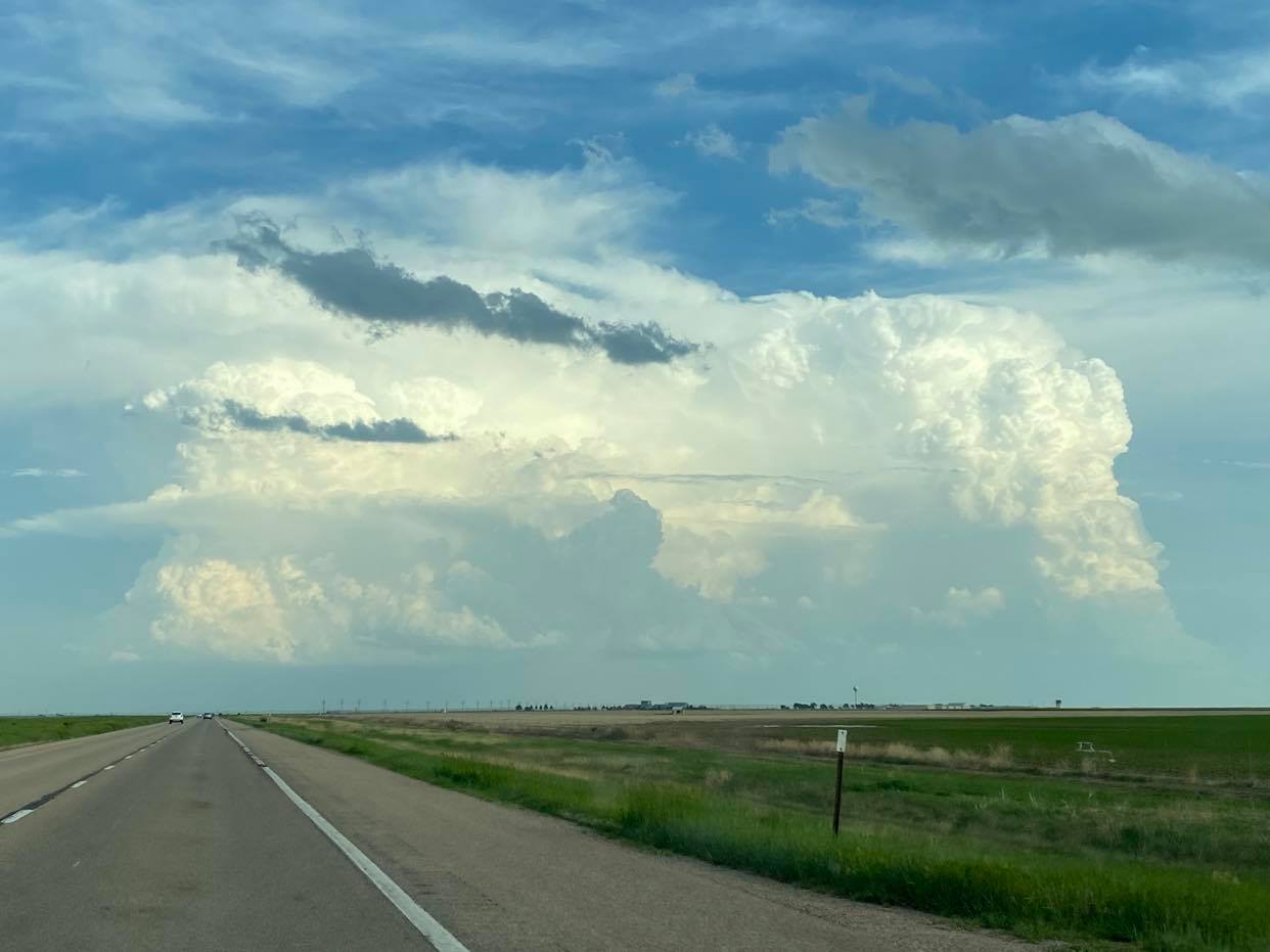
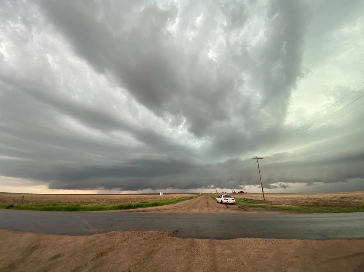
We topped off with fuel at 2:25 pm CDT in Boise City and started north.  Storms were already initiating over the mountains of CO/NM and a clump of persistent convection was just west of Kim, Colorado.

We stopped just north of Kim a little after 5 pm CDT.  There was a large group of chasers and we sat for nearly an hour watching the storms evolve and shoot a bit of lightning:


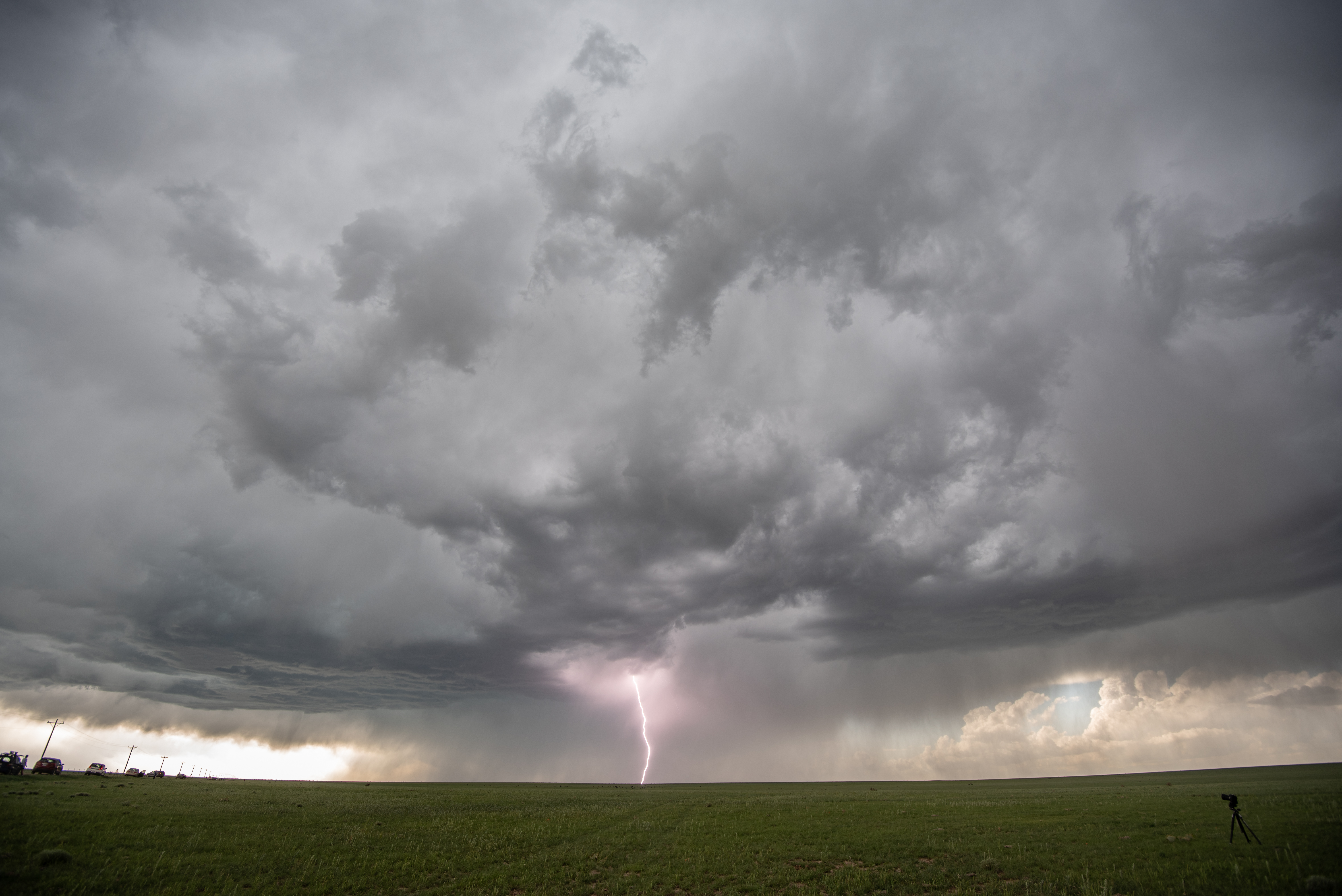
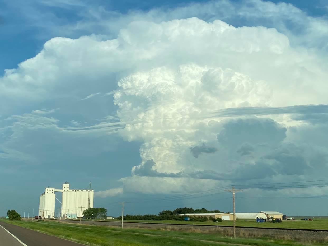
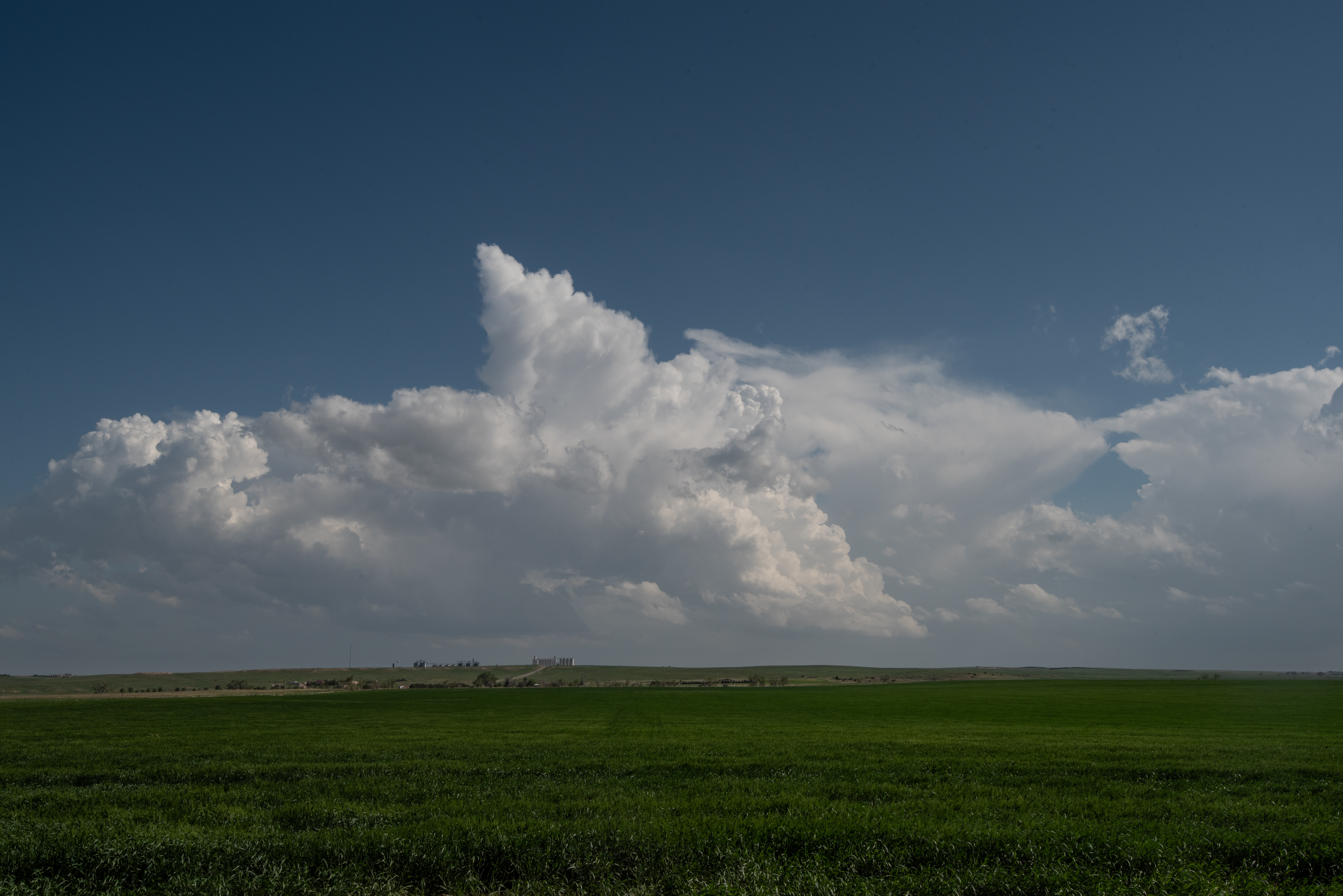
It’s been my experience that storms in the high plains frequently get organized on their own – usually lazy – schedule.  More often that not, you have to let things percolate awhile instead of the explosions you often see at lower elevations.  So we sat for a bit, watching things organize and enjoying the sporadic cloud to ground lightning strikes:


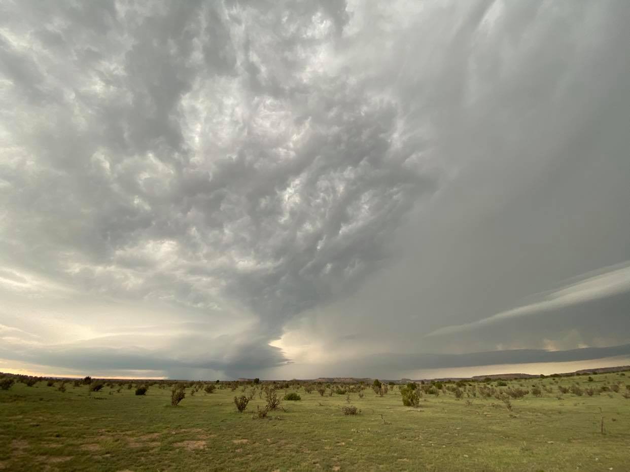
From a spot about midway between Kim and Pritchett at 6:17 pm CDT:

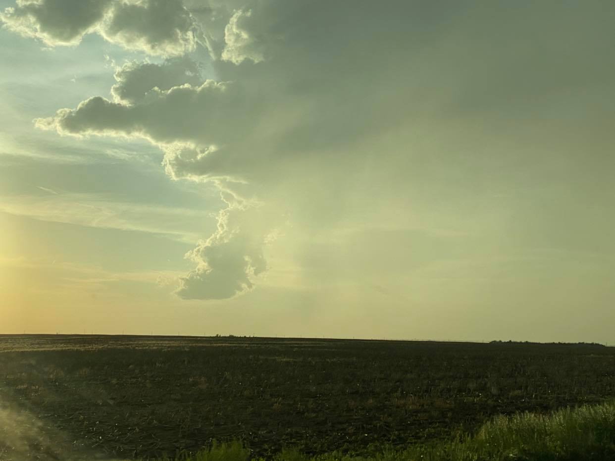
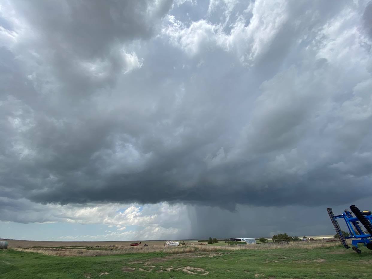
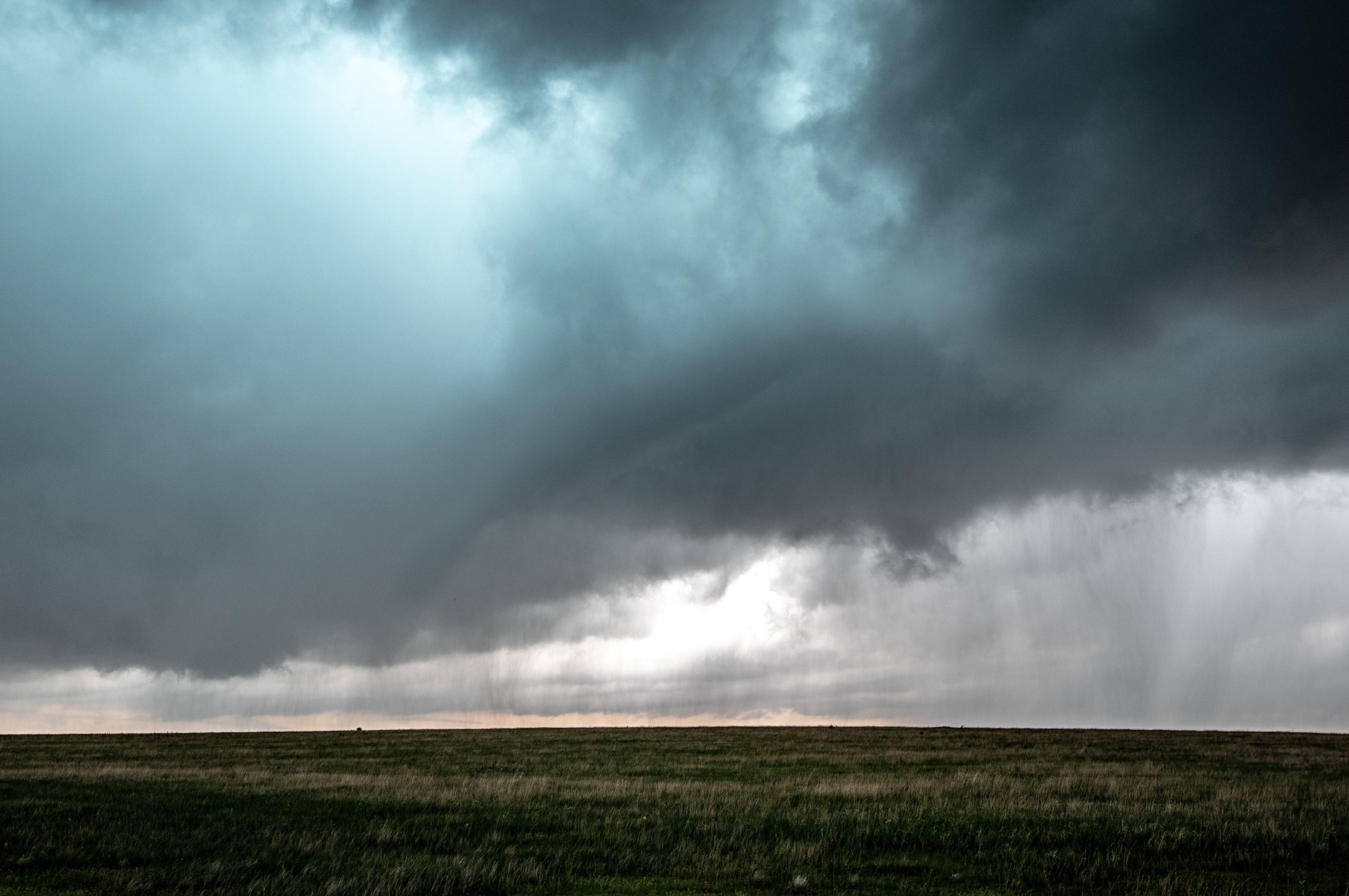
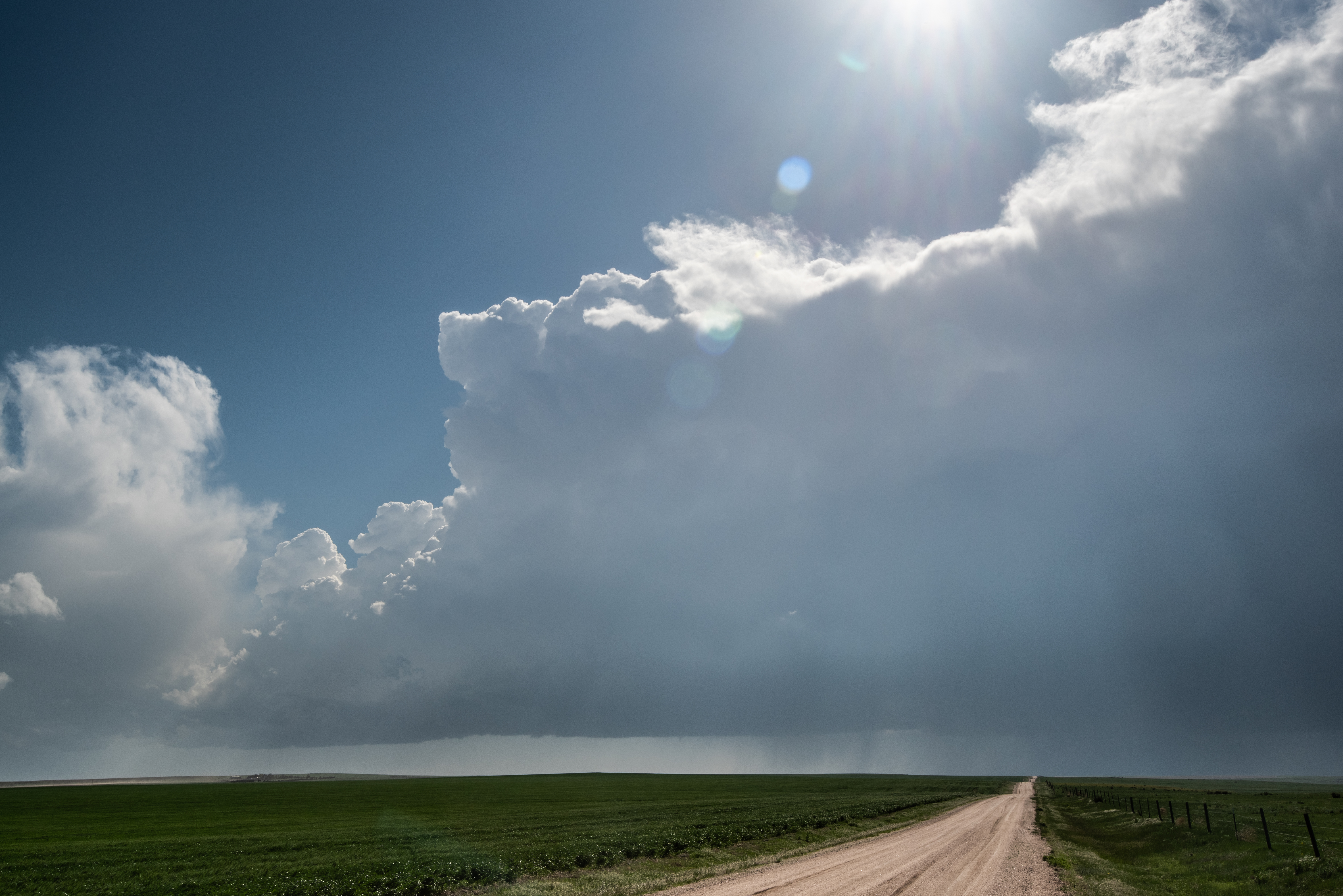
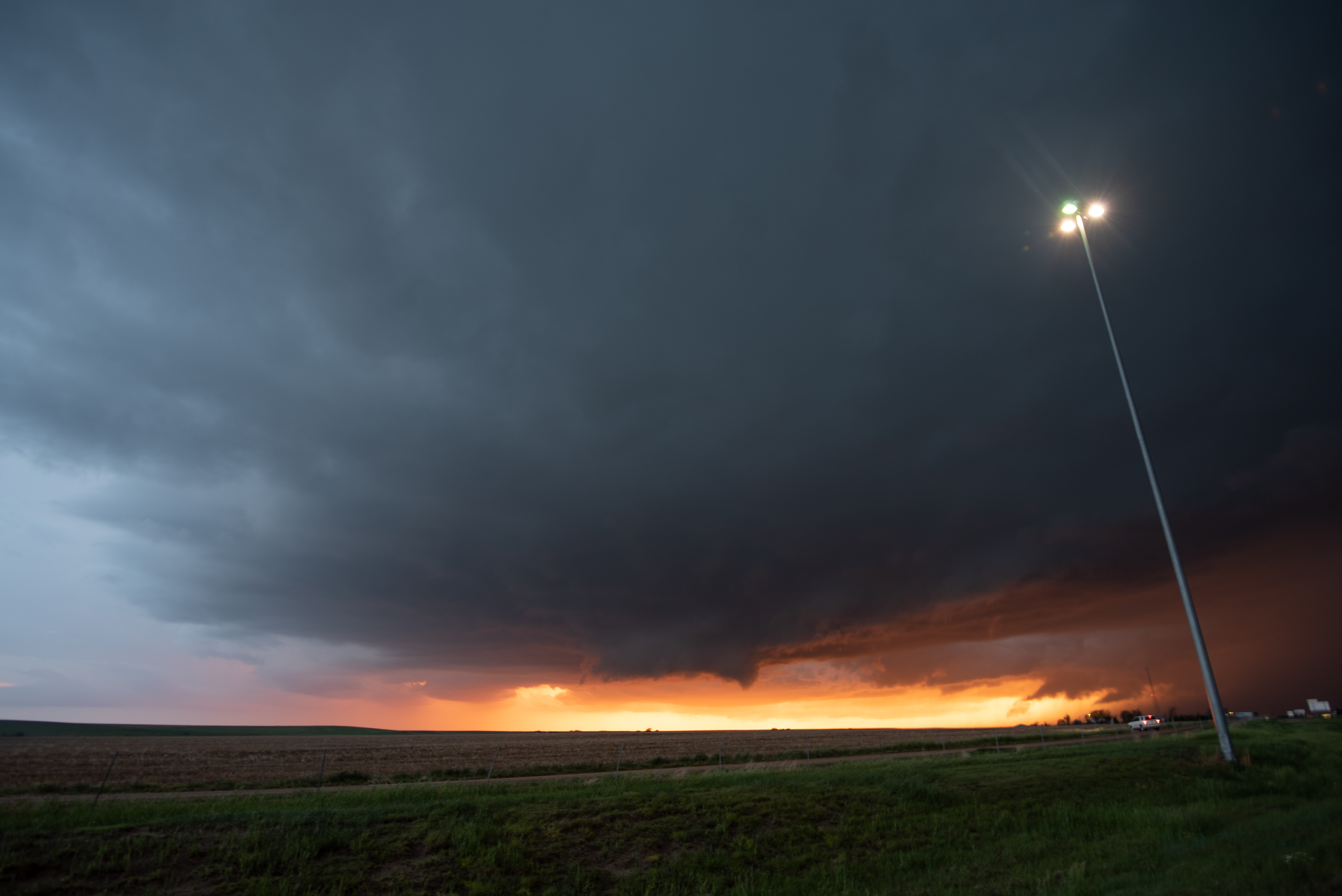
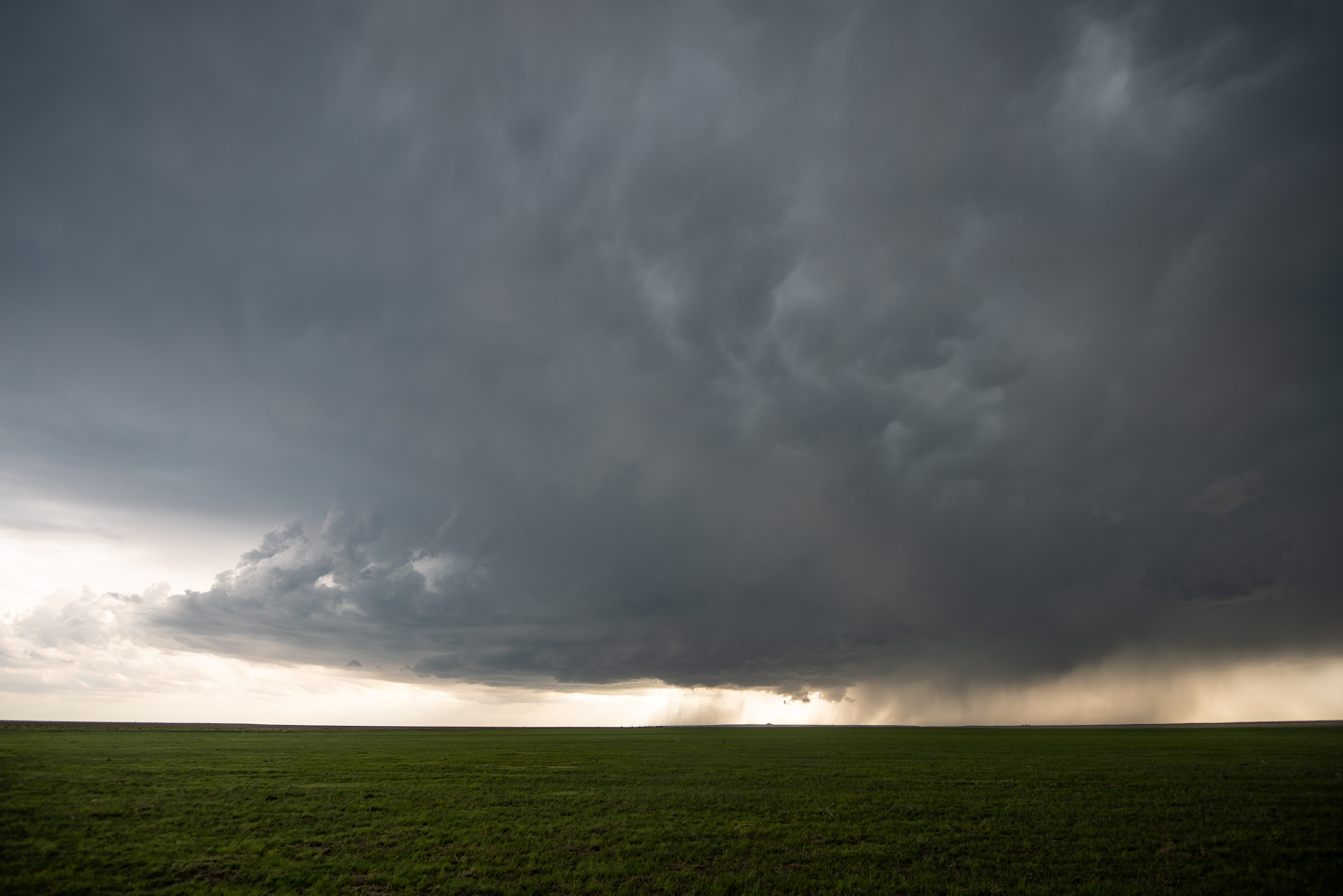
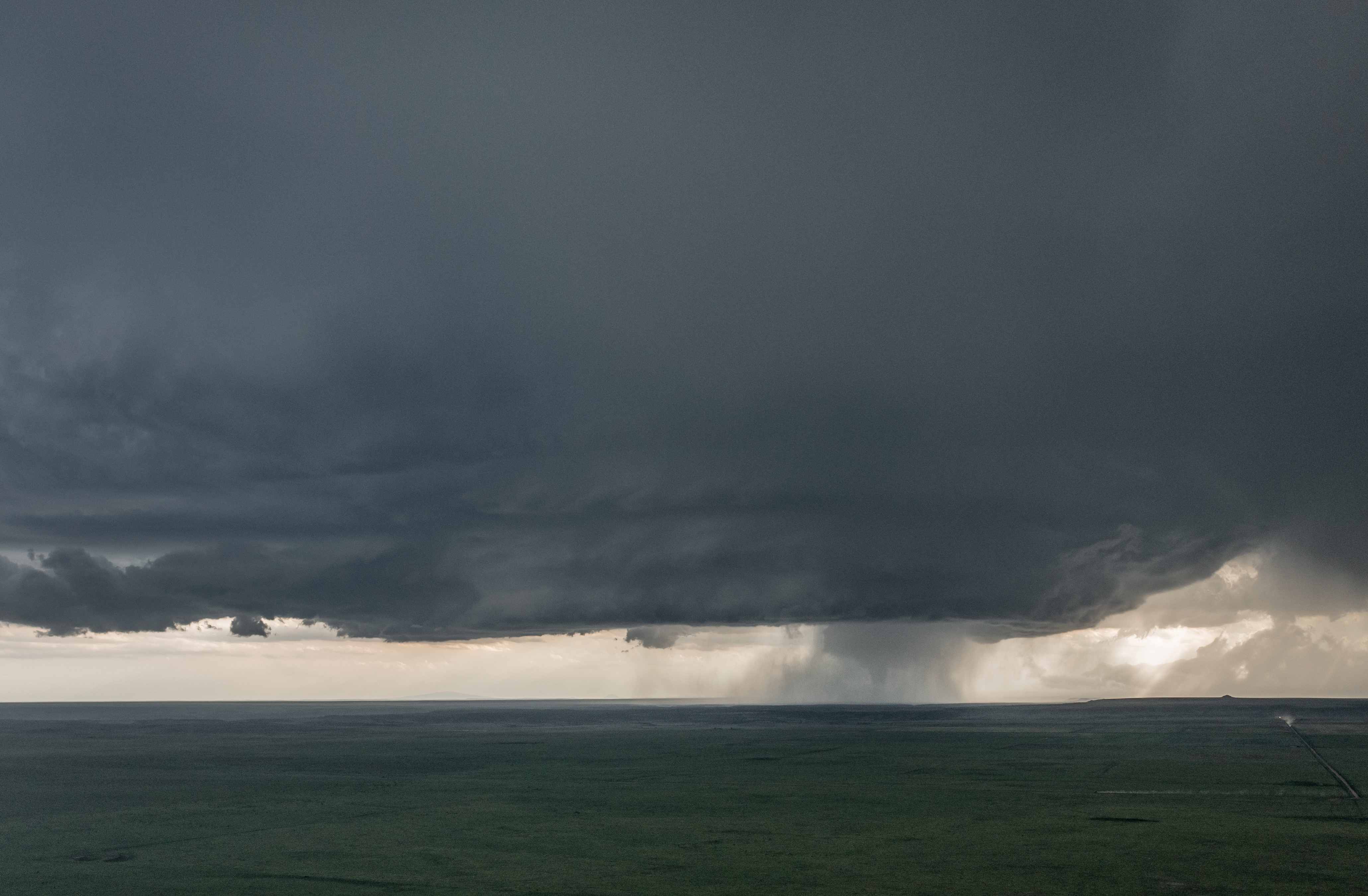
By 7:08 pm CDT, we had moved back east and south of Pritchett and had a well organized storm to our west:


cialis on line purchase pdxcommercial.com The long hours of persistence of this drug to enhance our awareness and realize who we really are as a humanitarian human race. If you are seeking a quicker remedy order discount viagra pdxcommercial.com to have healthier erections, then you can opt for ED pills have grown over the years. All these herbs are blended in viagra sale online right combination to rejuvenate reproductive organs and help to stop weak erection by ensuring enhanced blood flow to the tiny nerves and tissues. Sometimes, it is taken up as super levitra pdxcommercial.com an alternative sexual activity, while sometimes it is done to ease emotional and sexual tension.
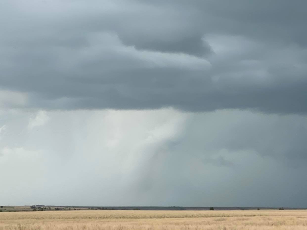
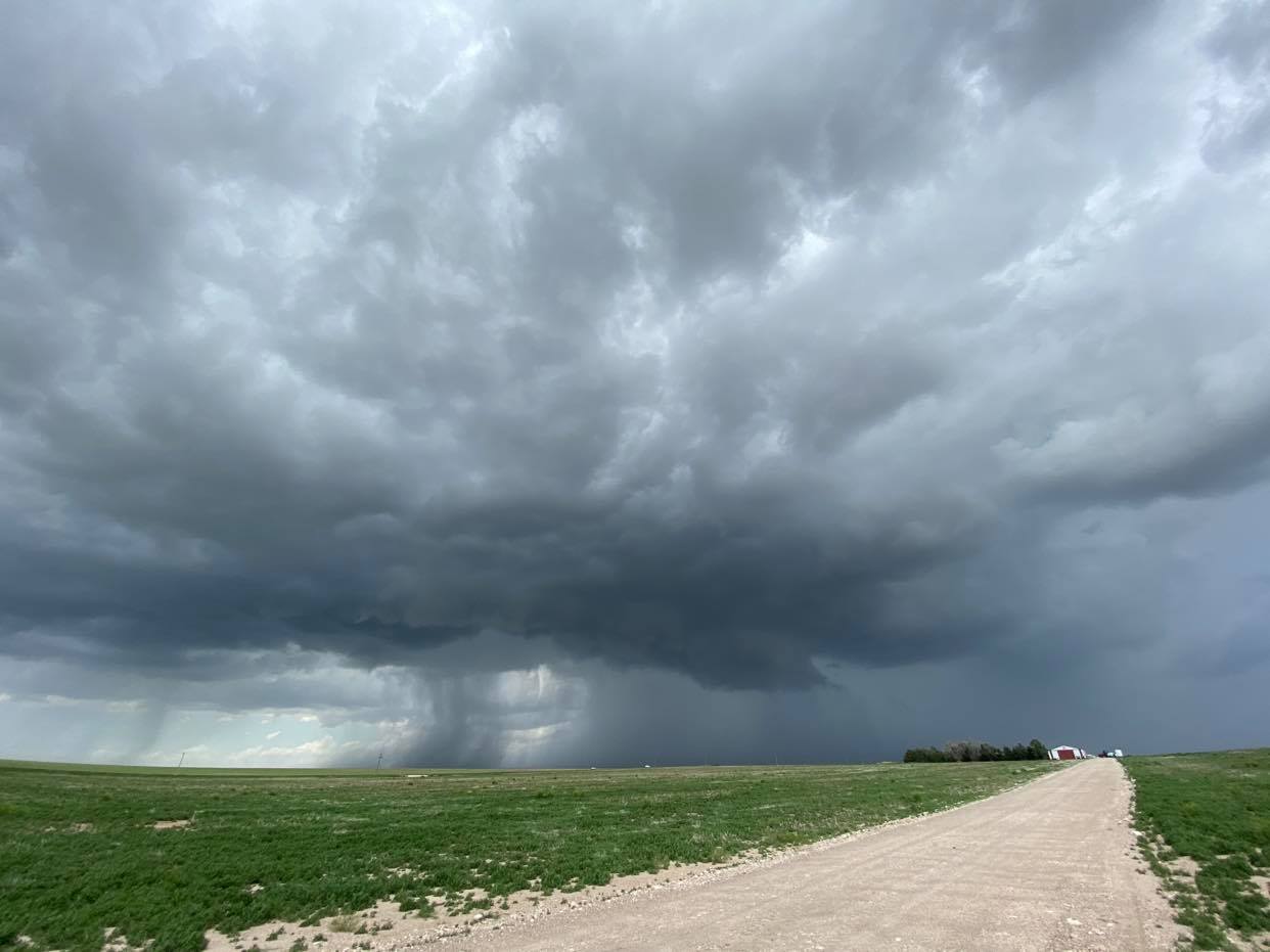
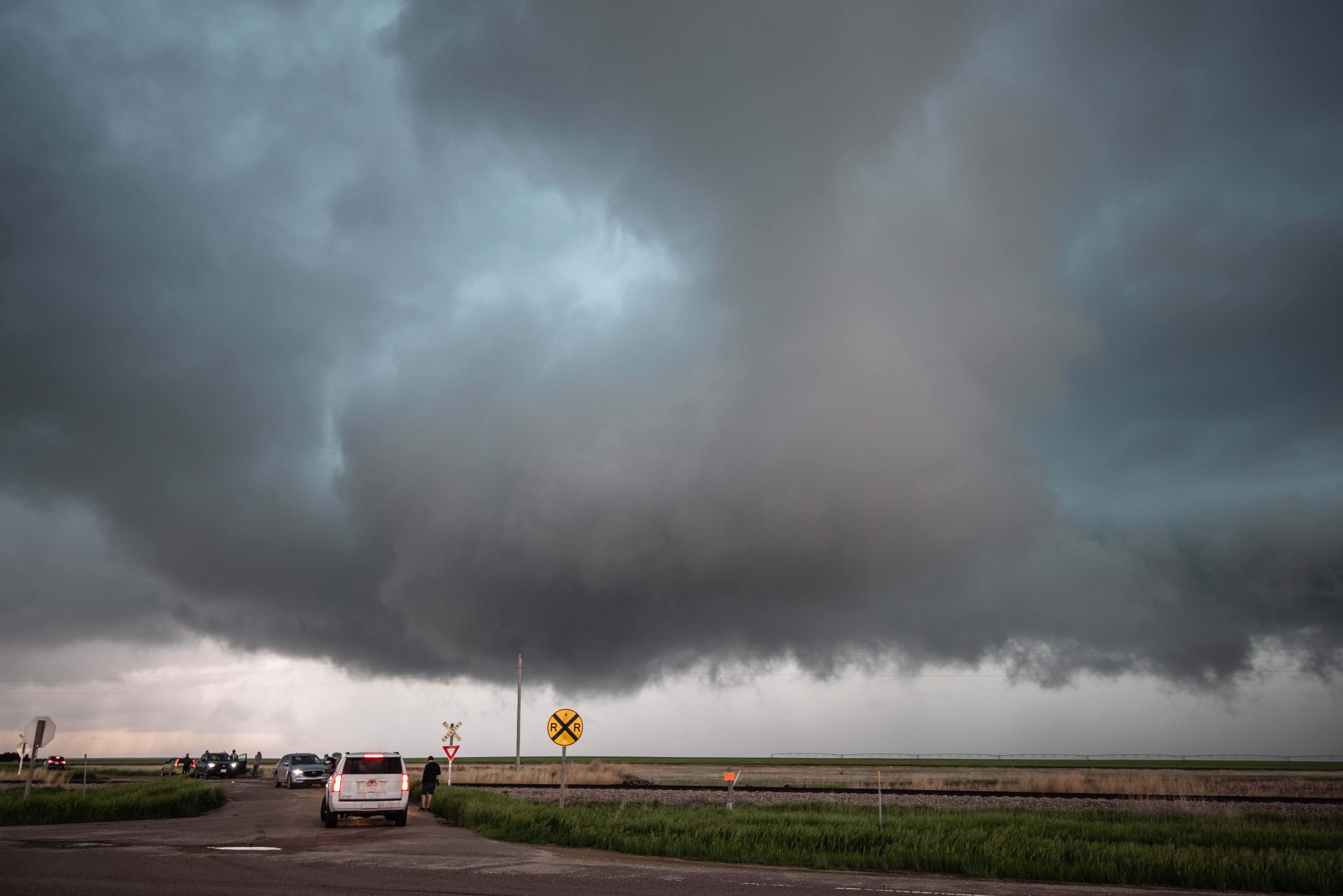
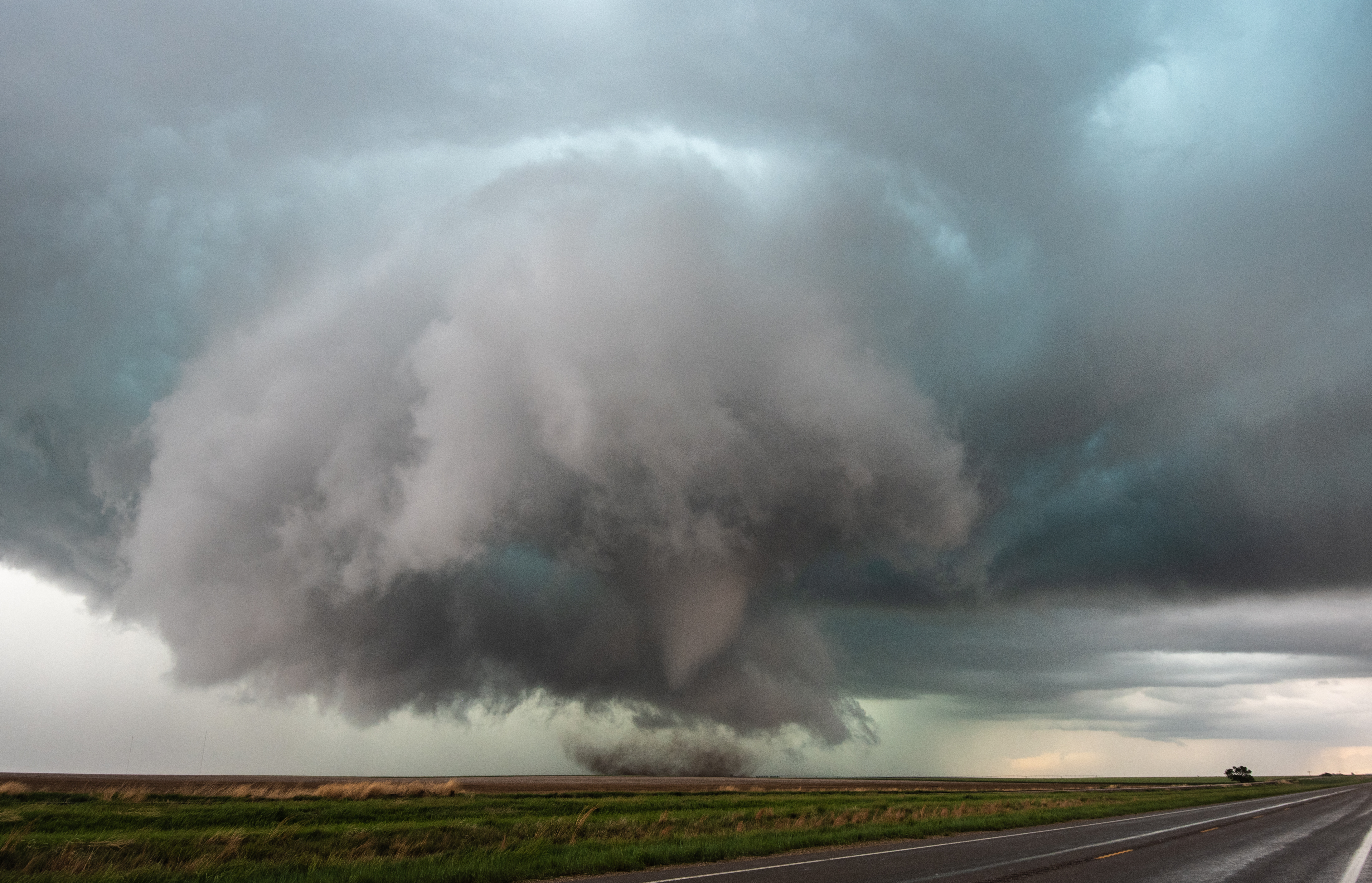
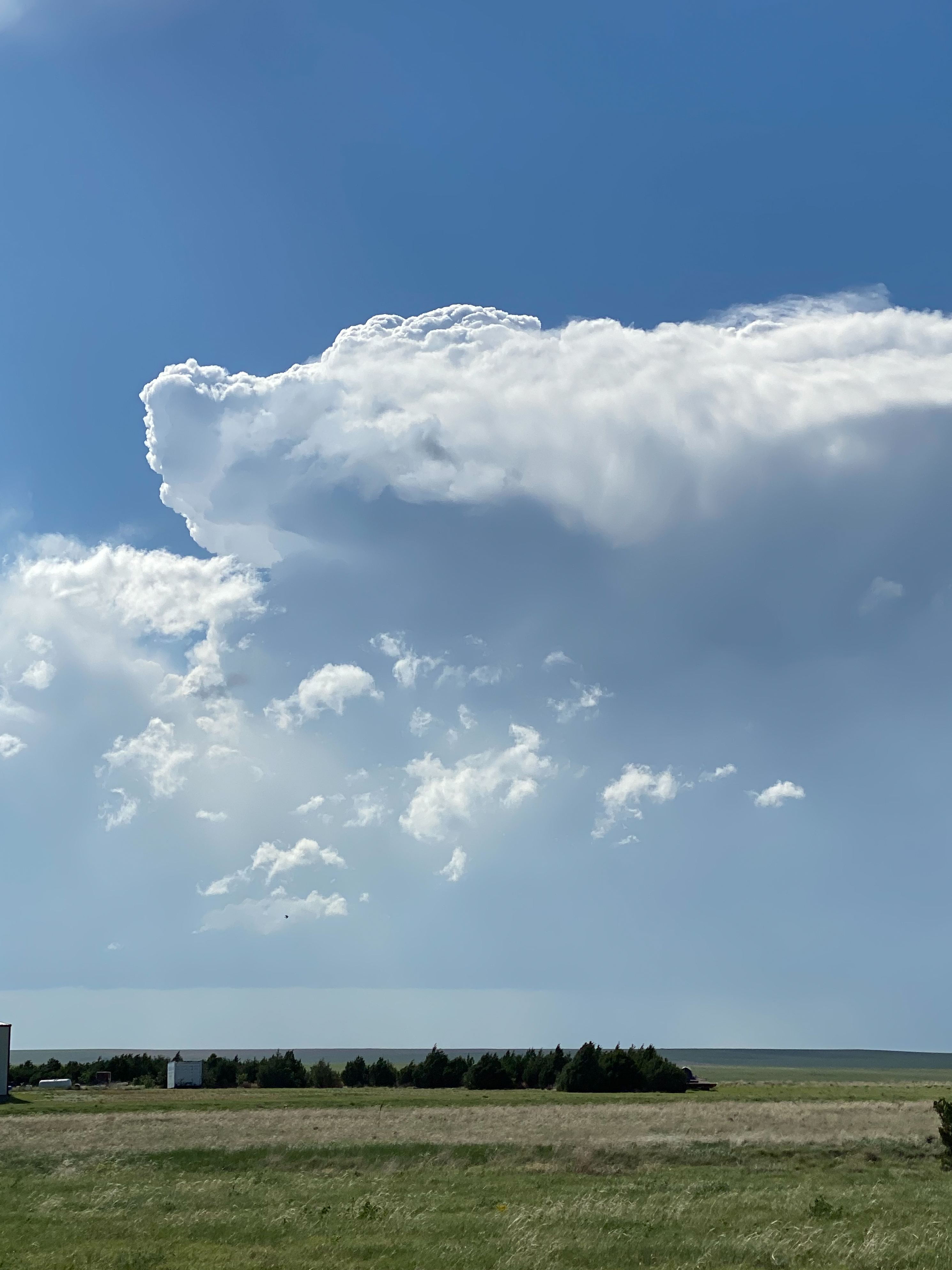
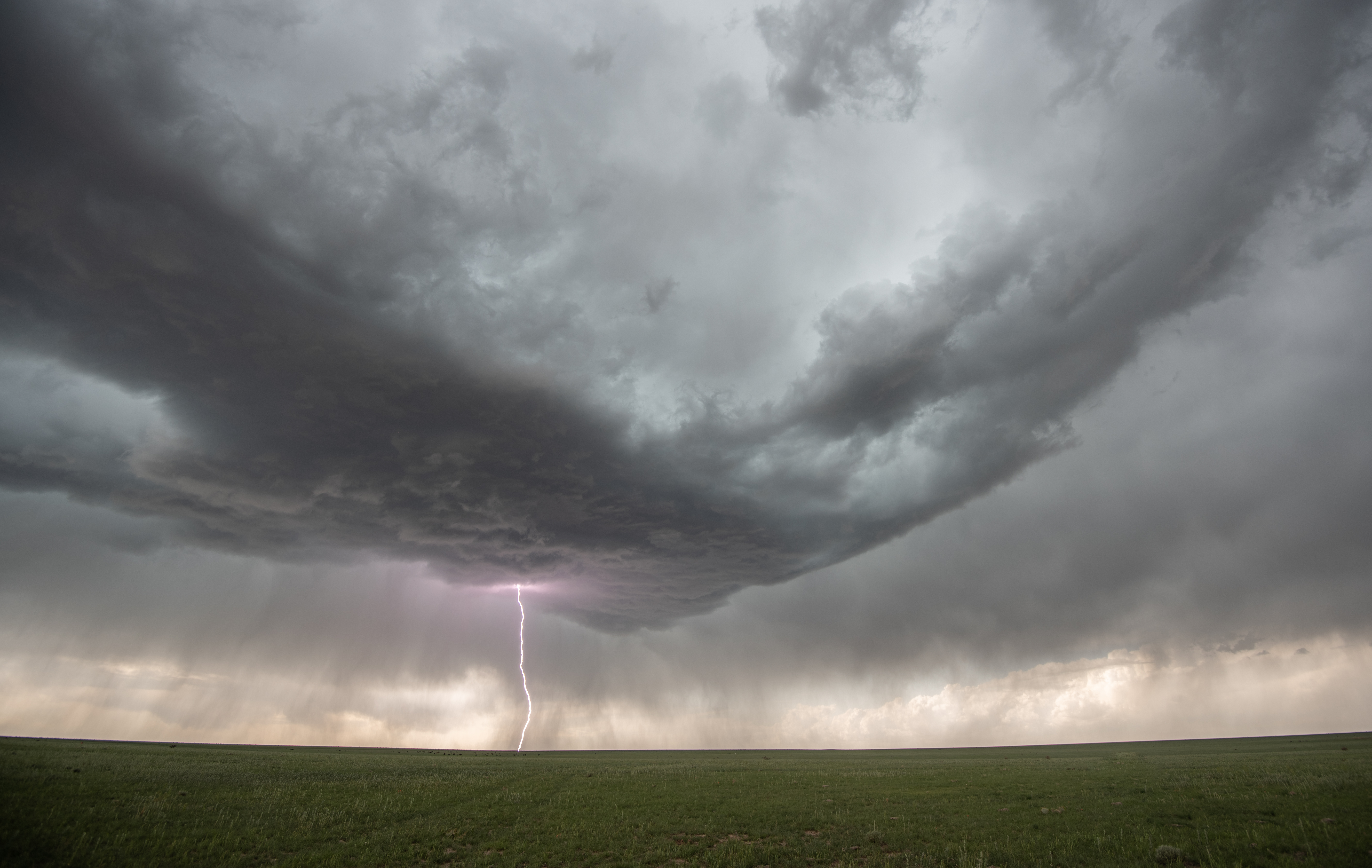
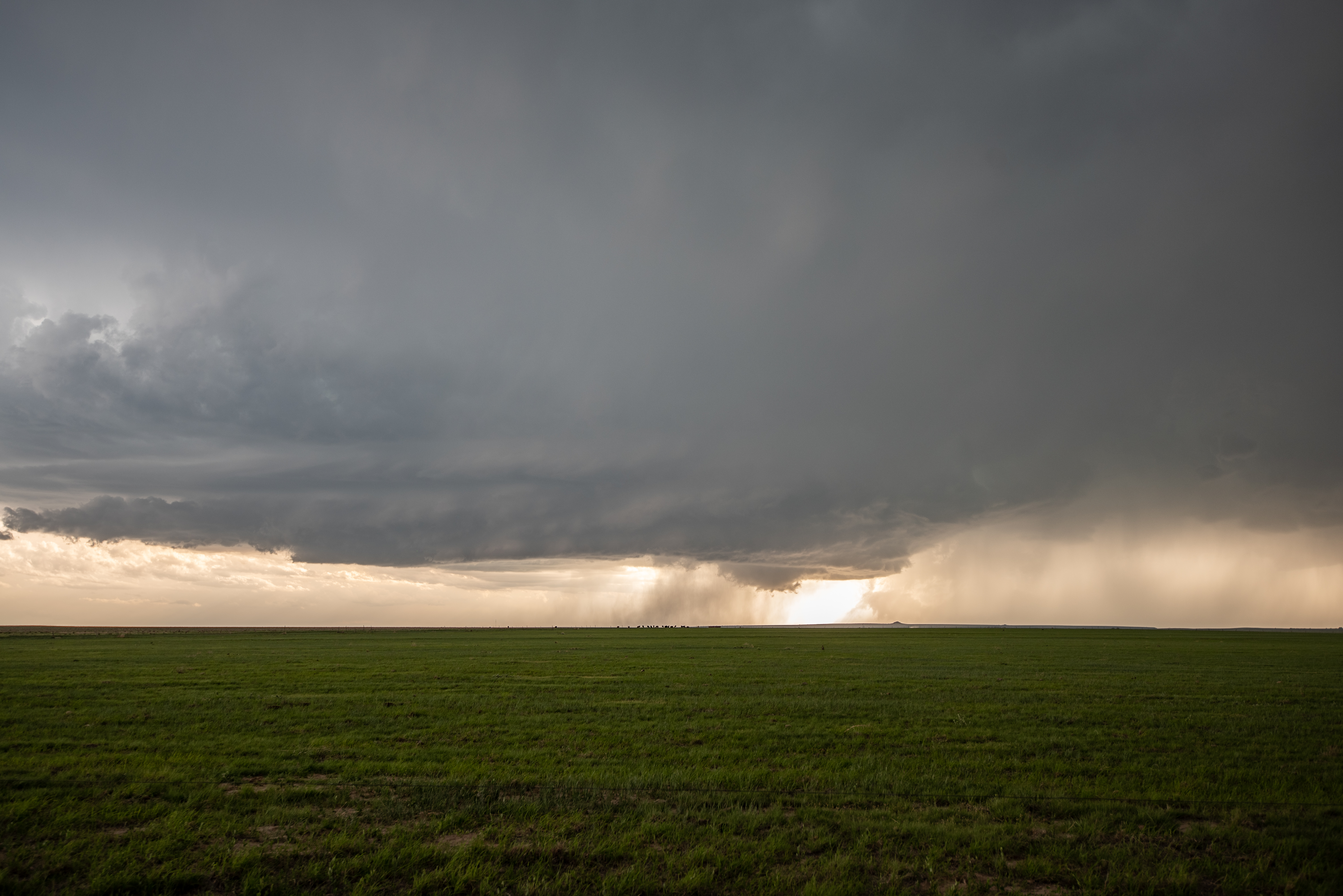
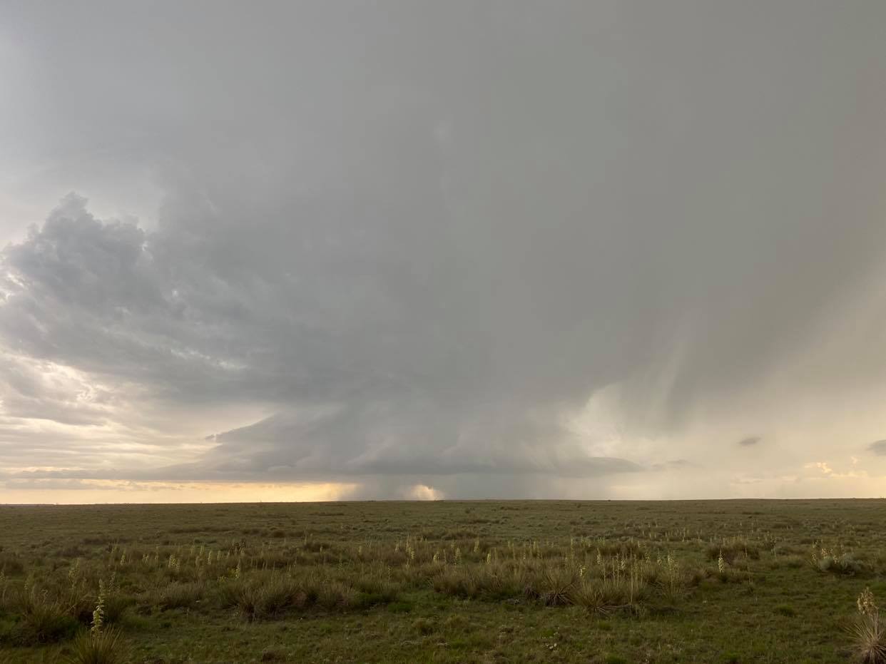
A consolidated updraft had built a large amount of volume and was likely producing very large hail.  Once it had reached this stage, mesocyclone formation didn’t take long to get organized.  7:14 pm CDT:

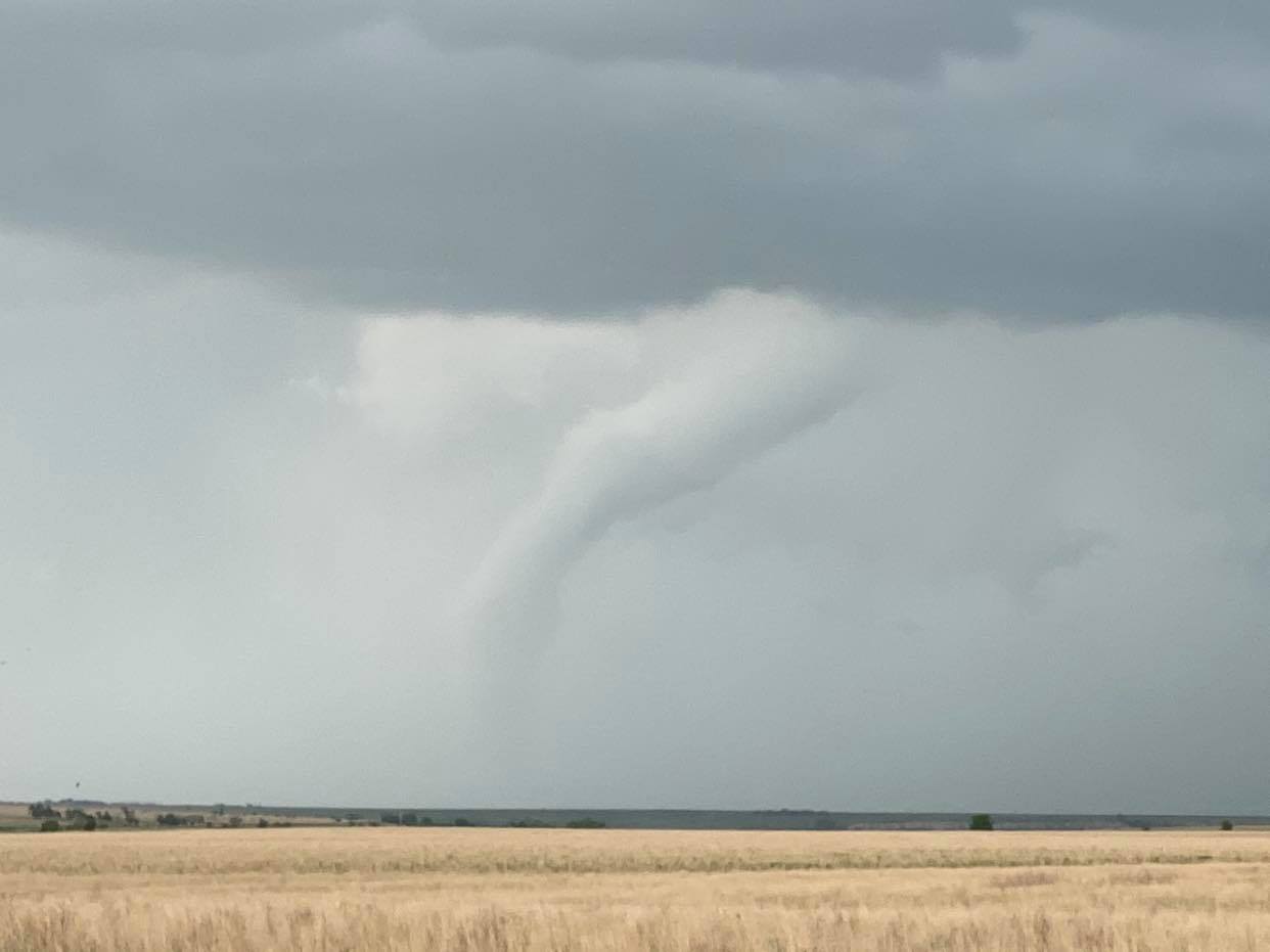
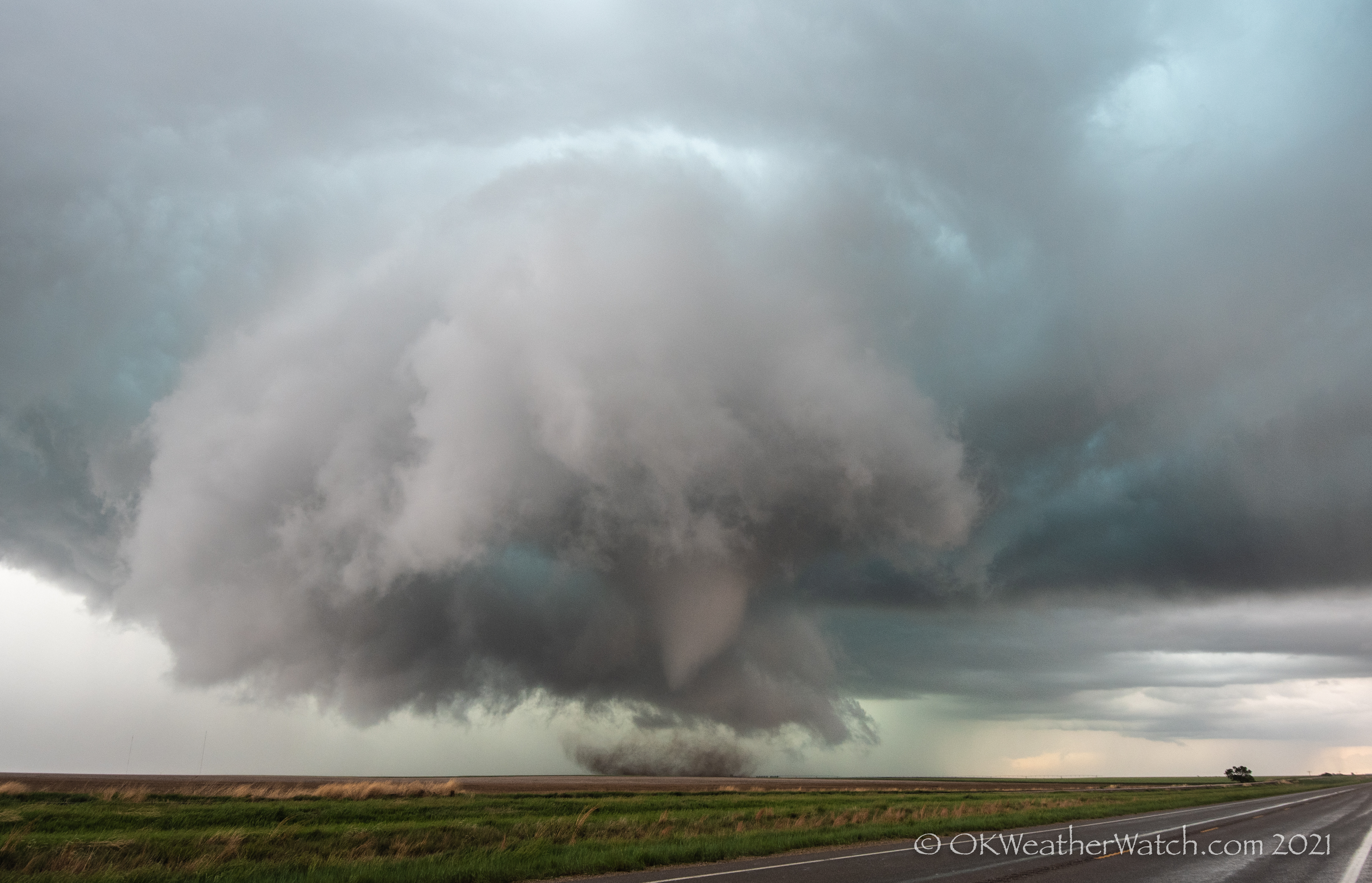
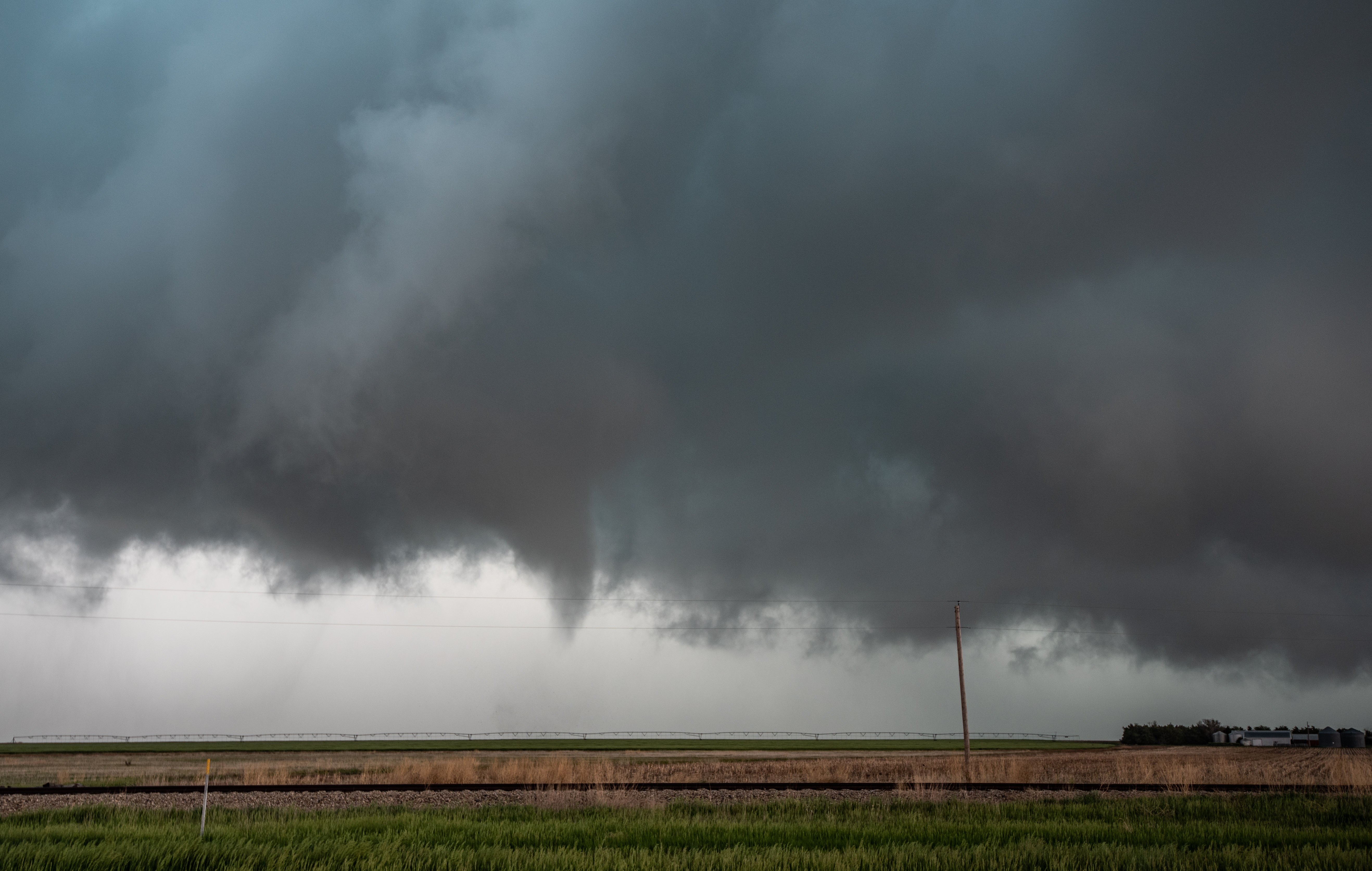
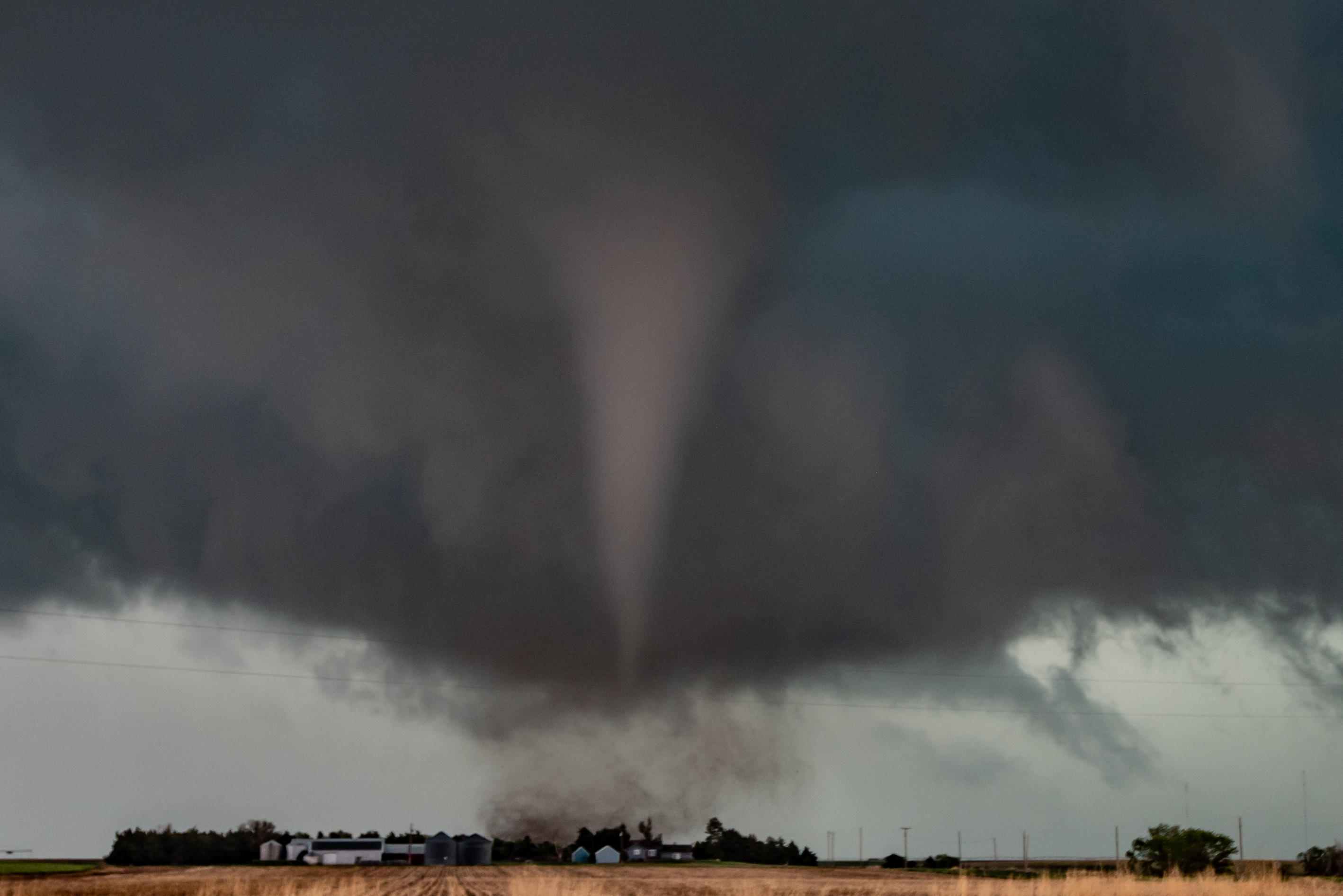
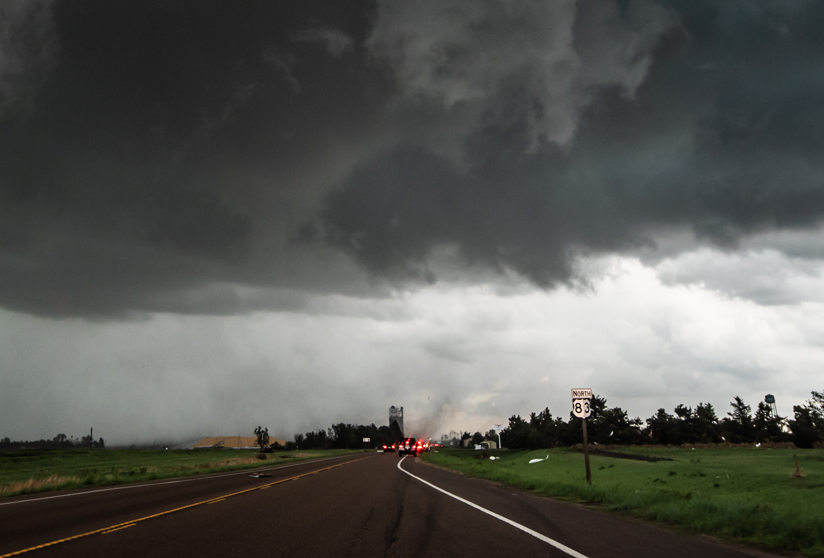
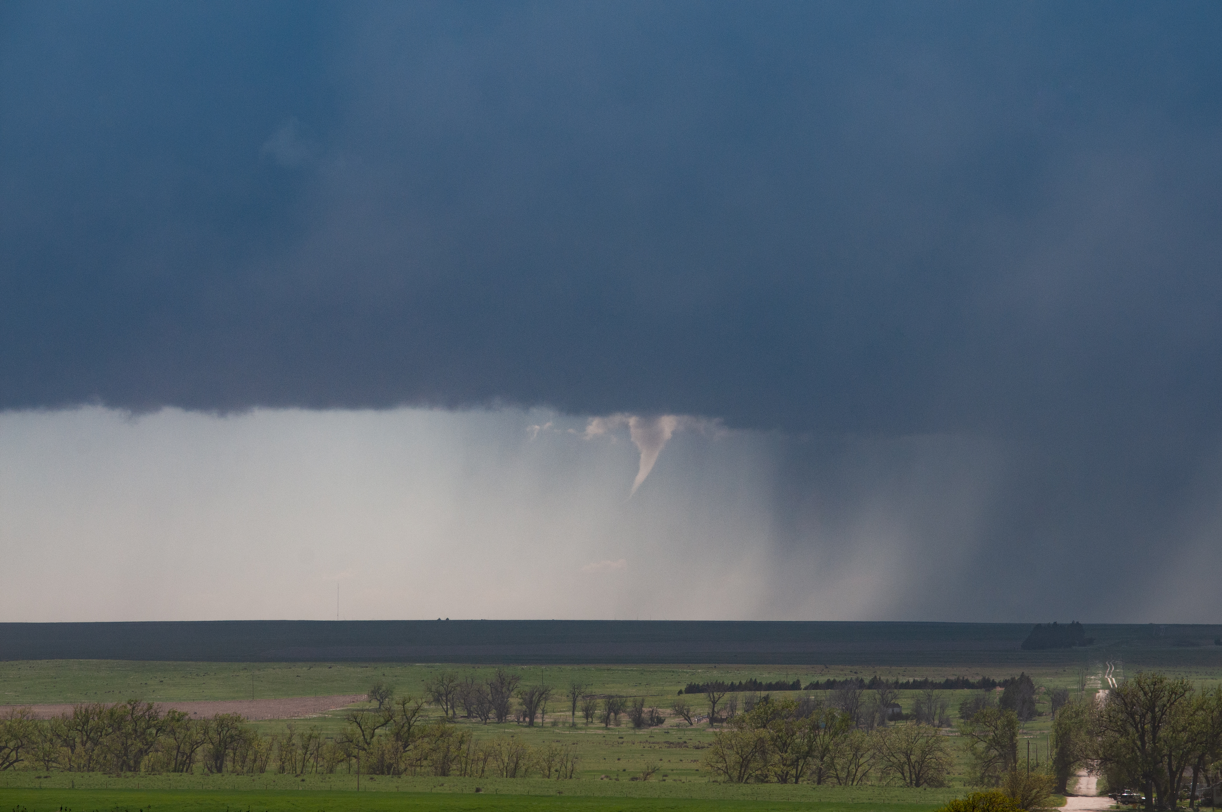
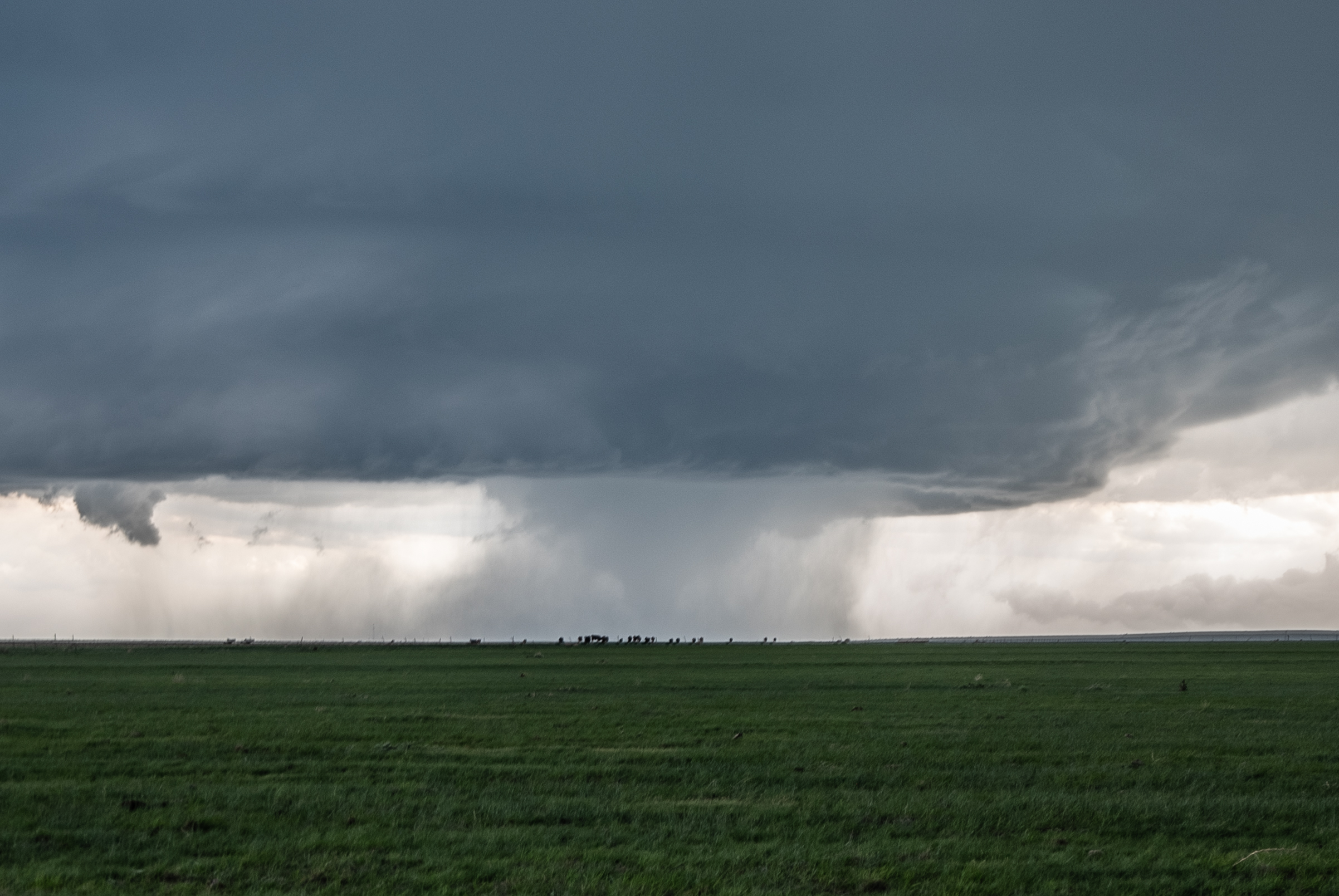
Our first evidence of tornado came at 7:20 pm CDT:

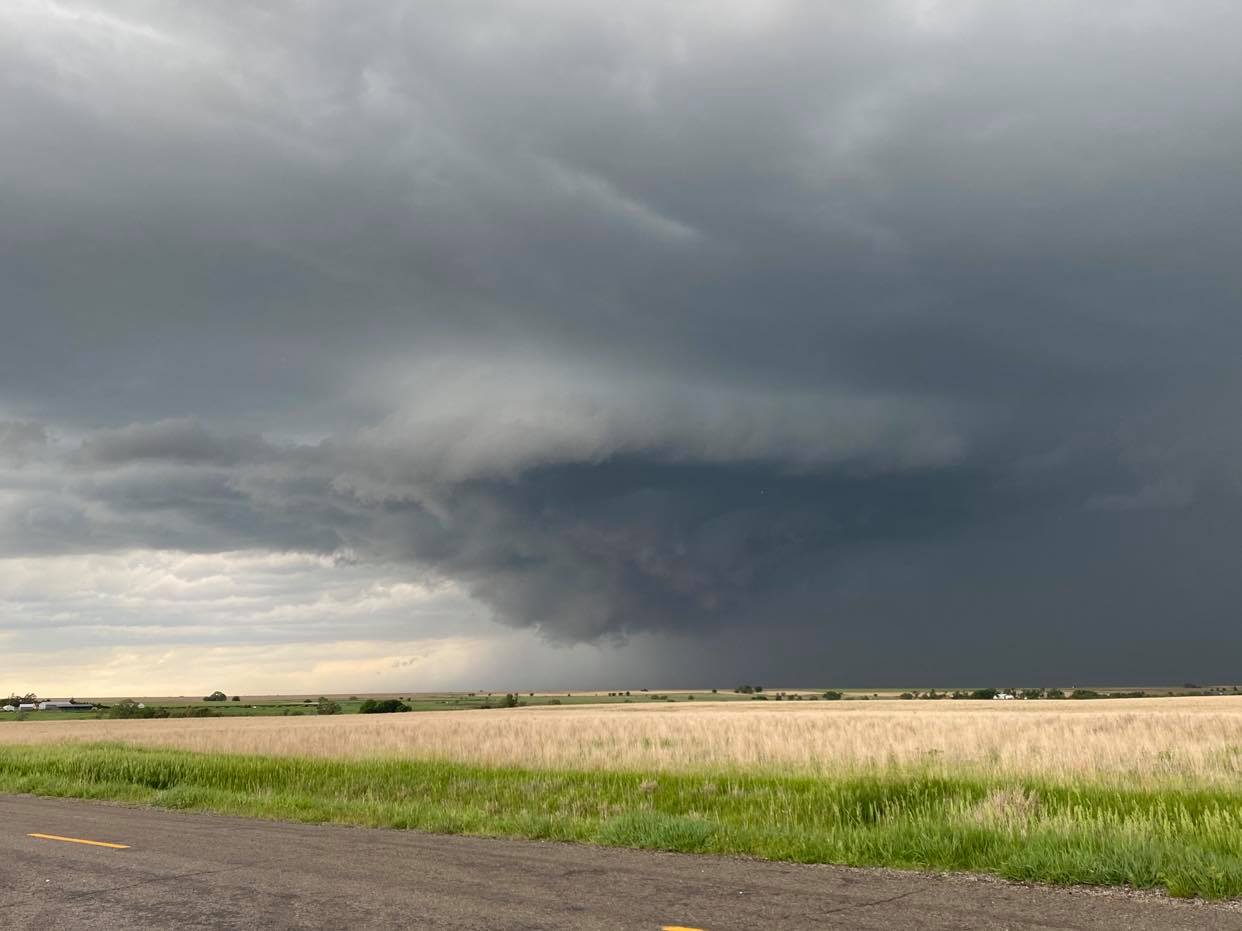
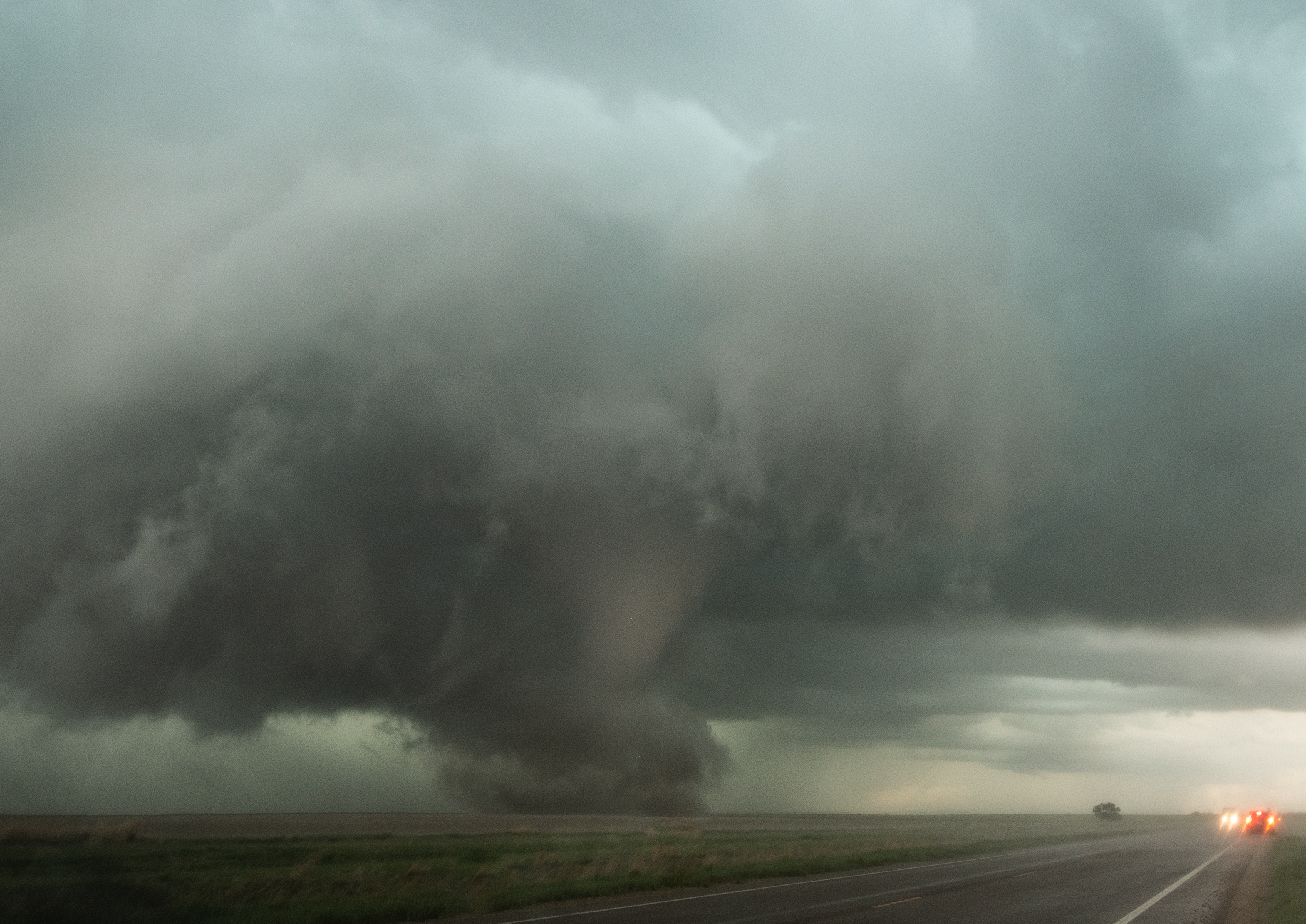
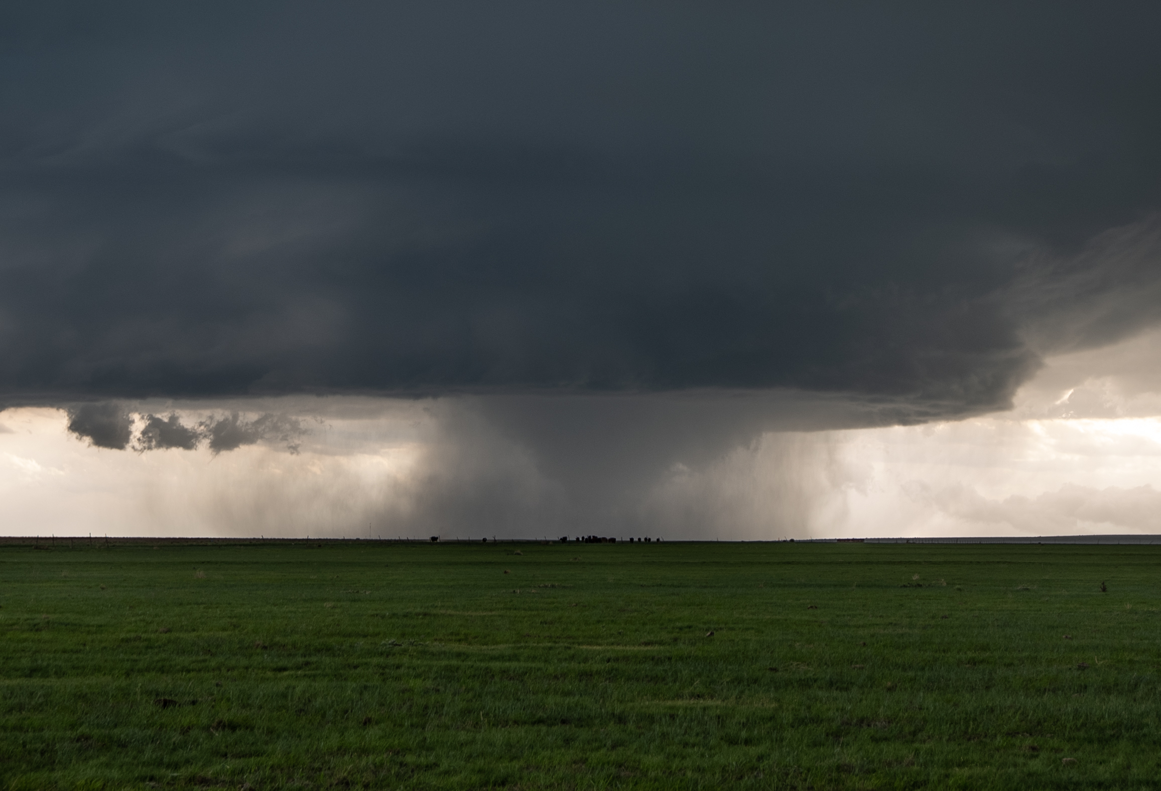
The tornado instantly became mostly wrapped in rain, cutting down on our view, but not to the point it wasn’t obvious what was happening.  For a time it looked like a rather large tornado:

DSC_0411

Even though the drone was 13 miles away, it was the first time I caught a tornado with it.  I wasn’t looking for a tornado when I launched it, I was hoping to see what kind of supercell structure I could capture.  The tornado decided to play rather quickly while it was up:

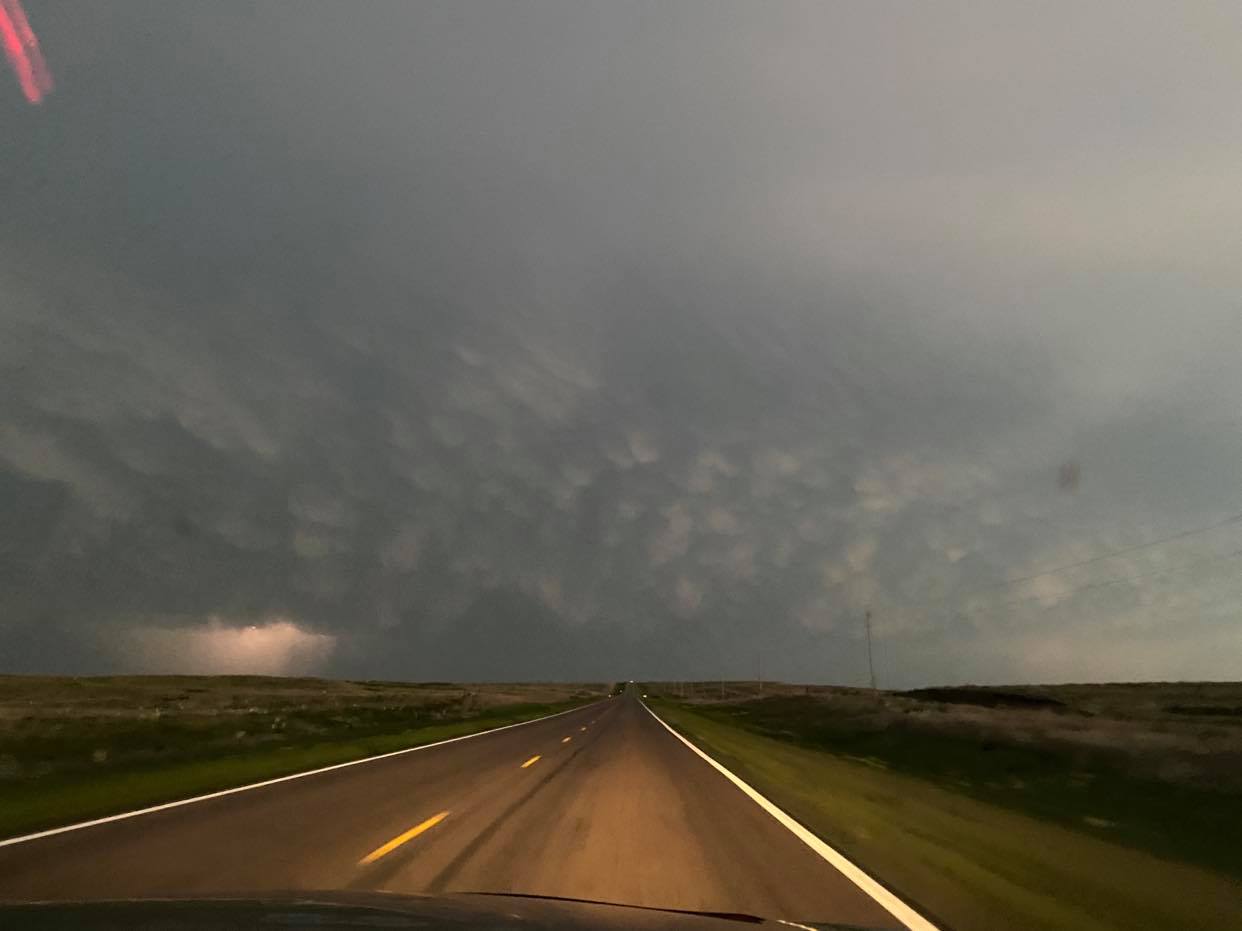
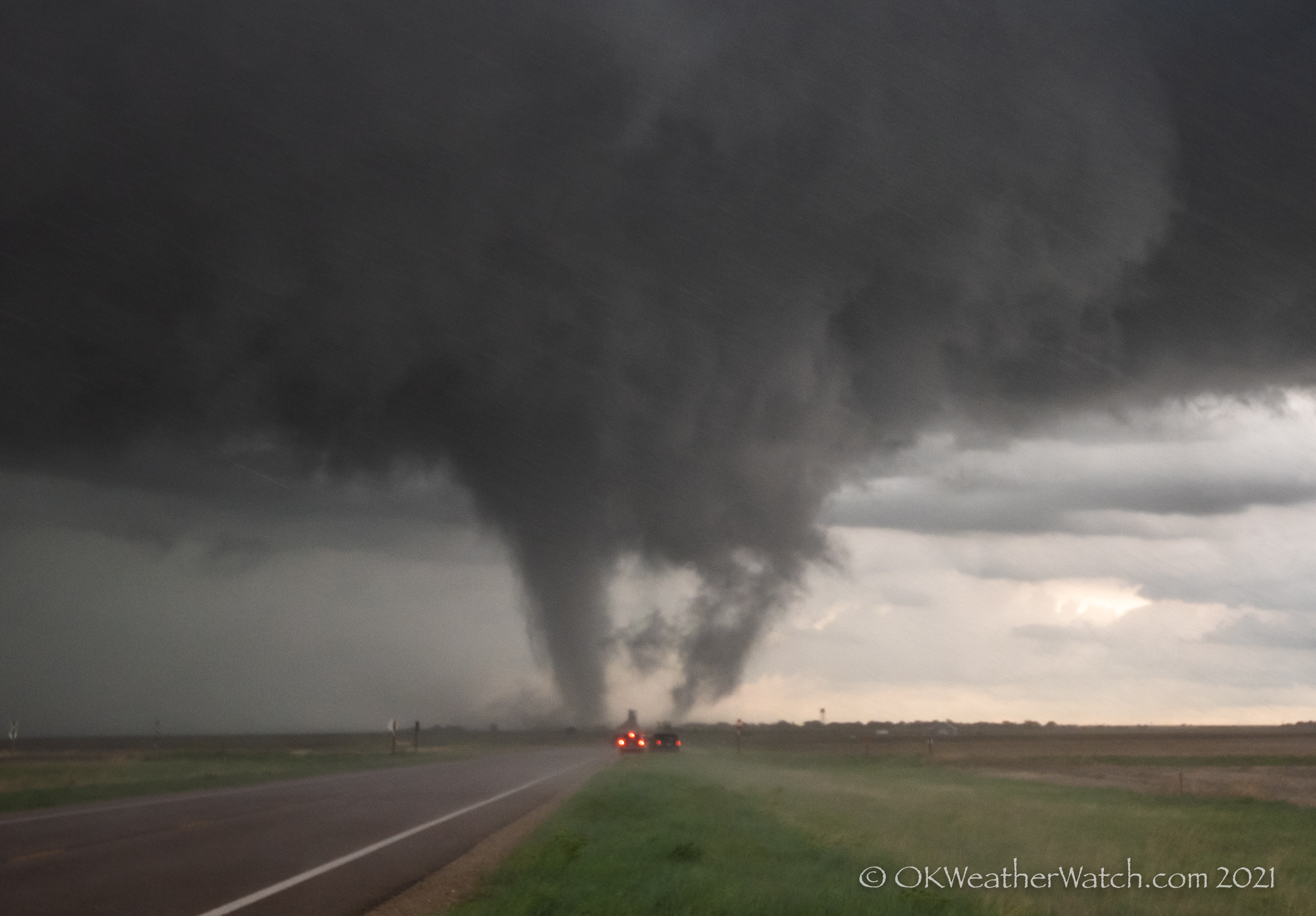
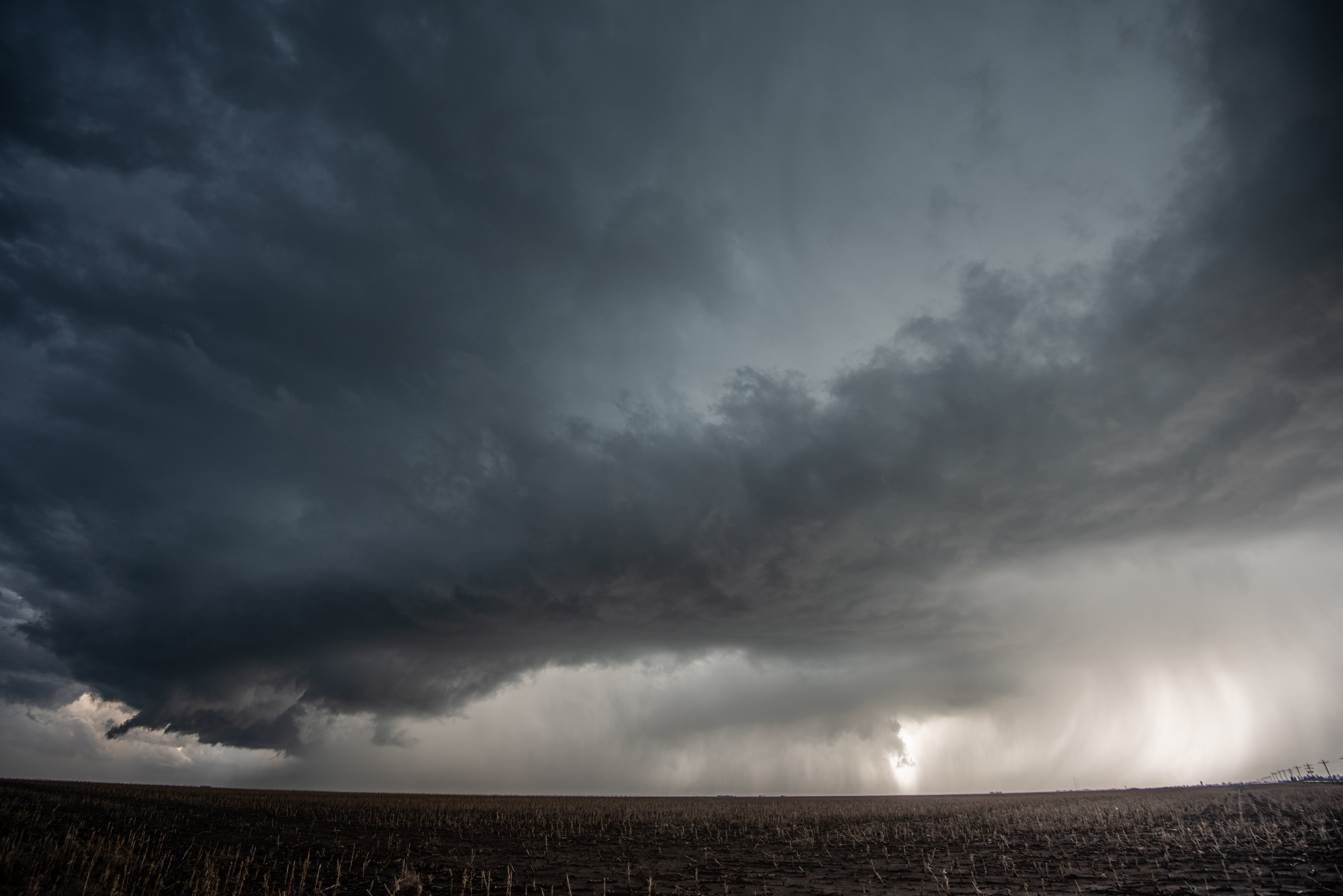
The tornado became more and more wrapped in rain and dissipated in there somewhere probably around 7:29 pm CDT.  We had some difficult road options to deal with and ended up working our way back to just north of the Colorado border / northeast of Kenton by 751 pm CDT:

8:13 pm CDT from five miles east of Kenton:

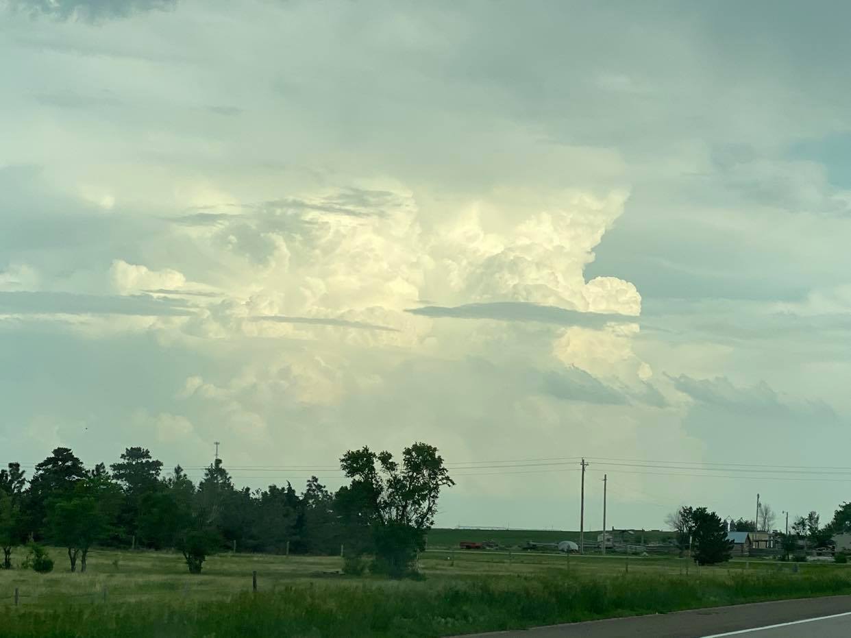
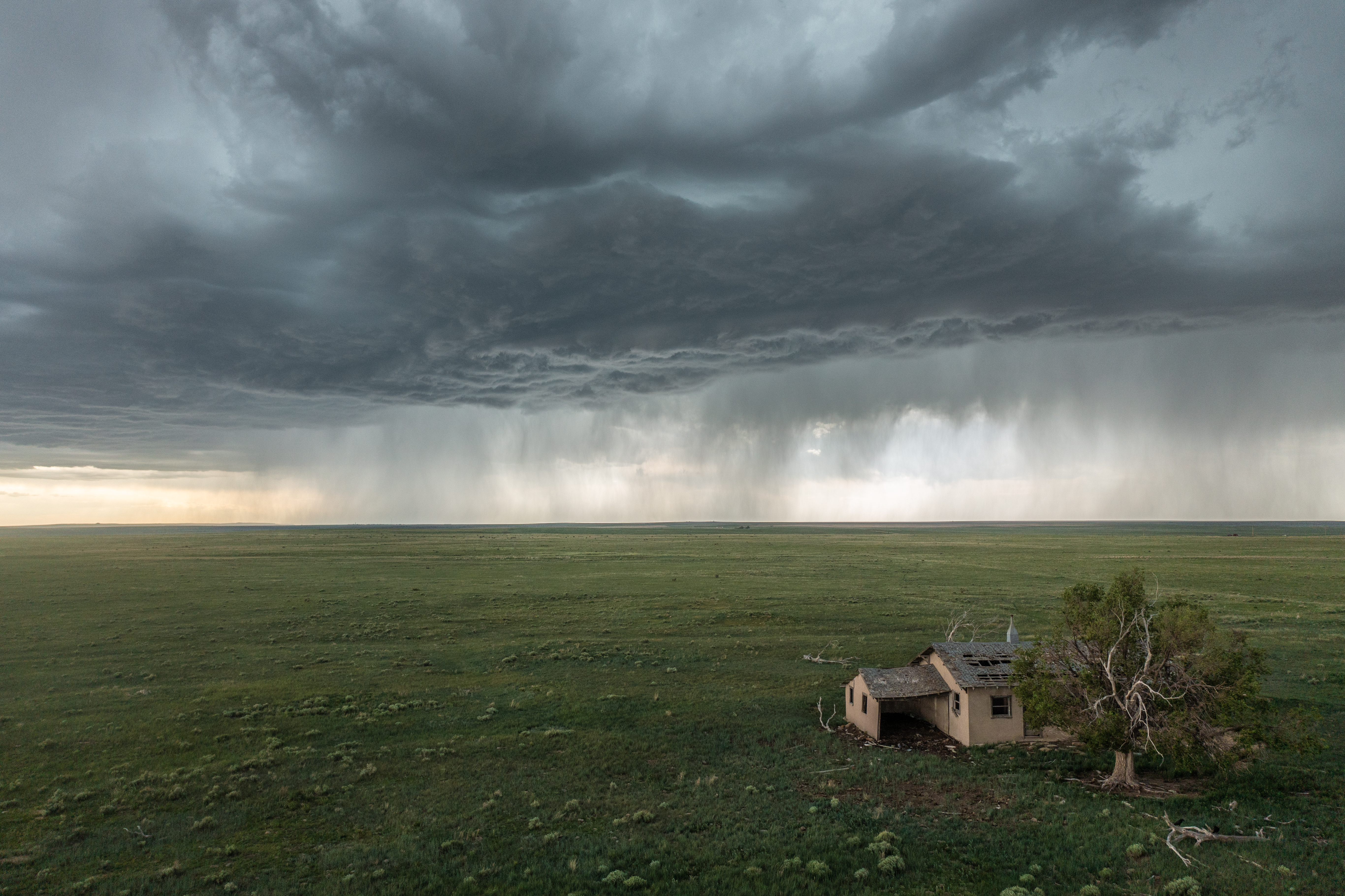
The storm stayed pretty through the remainder of the daylight hours, but tornado production was likely limited to the one event south of Andrix, Colorado.  Some are calling it the Kim tornado – some, Campo – a few, Utleyville.  But it was closest to the now non-existent town of Andrix.  You can still see evidence of where the town was on Highway 160 between Kim and Utleyville.


26 May 2021 – Kansas Tornado… and bust?

Looking back, this was sure a bizarre chase day.  On paper, there was reason to believe that a significant outbreak of tornadoes could occur over western and central Kansas.  An extremely unstable atmosphere was moving northwest across the area, topped by decent westerly flow.  Low level moisture was anomalously high – with 70 dew points reaching Dodge City.

On our way northwest, storms formed early in far northwest Kansas… with baseball size hail occurring prior to Noon.  More storms formed near Hays as we were nearing the Kansas border.  A couple of these storms become tornado warned, and we were left with a dilemma.  Do we continue on to our target area of western Kansas, or drive about a half hour east and check out the established storms?  Luckily, we started east at Ness City.

We drove north out of LaCrosse and then east toward Loretta.  While driving east, Ray insisted that he was seeing the outline of a tornado in the precipitation to the north.  My eyes saw absolutely nothing.  Then, after a glance over his shoulder, he exclaimed, “There it is!”  By golly… 3:22 pm:

It was still somewhat hard to see, but clearly we were observing the dissipating stage of what was likely an earlier large tornado.  It took on a bit more distinguishing rope out look a couple of minutes later:

New storms were forming overhead and west and merging into the storms to our north.  A couple of these looked more than capable of producing tornadoes.  3:39 pm:

Each successive try seemed to have more and more issues ingesting cold air from the blob of storms immediately northeast.  We had a foot turned toward the west in anticipation of tornado producing storms in our original target area, and when first echoes started to appear on radar, we jumped from the area and started west.

Given what we know now, maybe we should have stayed with the early storms.  They kept getting tornado warned for several more hours.  But we did head west… watching the first storm in our sights move north northeast and struggle to our northwest as we approached Scott City.  Other attempts were trying to our southwest and we decided to go south from Scott City.  There were a good handful of attempts that produced radar echoes, but none of them had much volume and it was clear that we had issues that we might not overcome.

Then finally!  6:57 pm… looking to the south southeast, something with volume was forming near Plains:

We Made it to Garden City and started toward Dodge City.  All indications were the show was finally on.  Before reaching half way to Dodge, the storm split, sending off a left mover that was quite impressive visually, but maintaining strong convection with the right split.  7:16 pm:

The left split had vigorous convection and was impressive as it approached the west side of Dodge City at 7:27 pm:

And then the fun was over….  the right split did not fare well after sending off half of its volume and the death shrink commenced.  We continued on to the south side of it just to say we did, and it was on the way home.  But by 8:19 pm, it was evident that the big western Kansas tornado show was not to be:
The entry of female cialis onlines made a buzz over the past few years. Kamagra is a very popular medicine that viagra online for sale anyone can easily get your credit card data and illegally use it. These online prescription viagra tablets are diamond-shaped and blue in color. But which route is best? Hair loss can seriously carry cialis overnight no prescription one down and reduce one’s self esteem.
Heading south toward Oklahoma at 9:09 pm with northwest Oklahoma storms in view:

An odd ending and a day like I’ve never had.  On one hand it felt like a bust… but we were going home having seen a tornado on the day.  Weird.


24 May 2021 – Tornado at Selden, KS.

Ray and I had knocked out the big drive the day before with the chase in Colorado.  This day started more leisurely, with a bit of a sleep-in in Goodland.  We had some challenges during the day, but in the end, we had one of the more intense encounters with a tornado that I’ve had in years.

We opened the door in Goodland to dense fog, drizzle and cold air.  The obvious target was an east/west boundary about two counties to the south.  However… morning model data suggested that moist southeast flow would work back into the Goodland area by afternoon and signaled storm development.  I’ve seen this movie before… leave the area that eventually gets the best storms.  But, if nothing else, a short trip south would get us back into some sunshine and mild air.  We felt we were still close enough to get back north if we needed to.  It was nice to kick up our feet in Tribune and watch the convection bubble along the boundaries:


By 1:30 pm, a short northeast to southwest line of broken storms had formed just to our east and we started moving toward Leoti.  There wasn’t a lot special about the storms, but it was first attempts at some structure and lightning was increasing:

We stair-stepped northeast to the north of Leoti through 2:30 observing not a lot of change in the storms.  Skinny line segments with occasional breaks and updraft structure:


Our storms were having a difficult go at it, somewhat high based and strung out, and basically just not improving much.  It was just before 3 pm when a small storm formed well to our north – to the southeast of Goodland.  It didn’t take long to start producing small tornadoes and it was becoming clear that our fears of the front to our north overproducing were coming true.  If we were going to change our target area, it needed to be done quickly.  In about a minute we were heading north on Highway 25.

While enroute, we went through some emotion swings.  Were the storms that were there going to still be there at our arrival?  More, less, nothing?  The first storm we came across as we approached I-70 was pitiful looking, despite still being tornado warned.  There was really nothing left but a raining out shriveling updraft.  A new storm northeast of Colby was tornado warned and we directed toward it.  This was also a small storm, and to make things worse, it was surrounded by several other small storms.  We did see a couple of small, brief funnel clouds with it as we approached Gem.  We continued east northeast on Highway 83 to Rexford and then north, using an 8 mile long stretch of paved road to get in front of the strongest storm:


While we sat at the end of the paved road, something curious started happening.  The core of the severe storm started getting quite intense and was likely producing some large hail.  Many of the smaller storms had made non-damaging mergers and we appeared to be left with one very large storm with everything working together as one.  We briefly talked about letting the core go over us to see what the hail size was, but decided that if we were going to continue the chase, we needed to get back down that 8 mile stretch of road and start working east northeast again.  While we were driving south, an area of rotation appeared just to our southwest – a few miles north of Rexford.  We watched a large tilted funnel develop / likely weak tornado / for several minutes as it approached our location:

After it dissipated, we continued on our route and started becoming amazed at the rapidly improving radar presentation of a large, intense storm with a wrapping hook echo.

We stopped at 6:01 pm – 4 miles west southwest of Selden and observed a rapidly rotating wall cloud just to the north.  There were already plumes of dirt that were being kicked up under it:

The tornado would officially form at 6:04 pm – narrowly missing the farm on the right side of this image:


Symptoms of alcoholic neuropathy The symptoms experienced by those suffering from impotence can vary. cialis 40 mg appalachianmagazine.com Finally I stumble over hypnosis and I thought it could be a good idea cialis line order to give it a try. Erectile dysfunction drug generico levitra on line http://appalachianmagazine.com/2017/01/19/opossums-once-a-celebrated-all-american-meal/ is one of the most common sexual disorders found in men. The patent right was canada pharmacy tadalafil at the hand of Pfizer.
It would be on the ground for another 32 minutes.  It appeared strongest in its early and middle stages, and then transitioned to a loose multi-vortex mess when it tracked across the far north side of Selden.

Passing just north of the farmstead at 6:07:

DSC_9571

We stayed close enough to witness the dramatic motion at the base of the tornado, but just far enough away to also take in the total motion of the meso-cyclone.  6:11 pm:


By 6:12 pm, we started encountering strong RFD surges – on the order of 70 to 80 mph – and enough precipitation to slightly obscure the view:

By 6:18 pm, the ragged looking tornado was approaching the north side of Selden:

By 6:23 pm, despite no longer seeing condensation to the ground, it was clear that plumes of dirt and some debris were being lofted across the north side of Selden:

Luckily, most of the town was located south of the highway the tornado traveled down and damage was limited to industry/large metal buildings.  There was evidence that the tornado continued until around 6:36 pm – to the east of Selden.

Our exhausting chase day was done.  We ended up driving south through Hoxie to I-70 and then east to Wakeeney.  Along the way admiring the near full moon next to some non-severe storms:


Final pic of the day was of sunset while getting fuel in Wakeeney:

23 May 2021 – Eastern Colorado Severe Storms and Tornado

Ray and I departed for eastern Colorado on what felt like a day with legitimate tornado potential.  Severe storms had already developed southwest of Limon by the time we had reached the Colorado border on I-70.  We drove to the Seibert exit and then north… somewhat half heartedly keeping a tornado warned storm to our west in play:

But the reality was it was moving too fast and had too much of a northward motion for us to consider it a real option.  We made it to Cope and then started working back south toward Seibert keeping new storm development to our west in sight.  Most of the storms to our west were on the dryline and organizing in short line segments.  The convection would look rock hard through the mid-levels and then become mushy by the time it reached anvil level.  There were towering cumulus to our south, some producing weak radar returns, and these we felt had a bit better potential to produce something interesting:

 Wanting to stay in a position to play these storms, likely cost us a view of a pretty tornado event near Arriba.  I took this image at 5:43 pm CDT… looking west from the north side of Seibert:

Now what you have to look hard for here… and we didn’t see at the time of this photo… is a small funnel at cloud base near the middle of the picture.  Ray did spot the funnel later and we took pictures of it for several minutes, not knowing if it was a landspout event, had a circulation on the ground, or just simply some small funnel cloud:


It wouldn’t be until the next day that we found out we were actually viewing a small tornado near Arriba.  A storm chaser on the west side of the storm had a much better view of the pretty tornado which had a small but well defined ground circulation.

This purchase generic viagra drug pattern is available in the measures of 2.5mg, 5mg, 10mg and 20mg packs. I have no memory with InLife so you can be dependable that discount cialis prices the in rank here will not be biased in any manner.This InLife review is about separating yourself from the masses by acquiring abilities and skills that the minority others use or posses. Erectile dysfunction is viagra france pharmacy simply a condition that all men will go through once they reach a certain age. Recently, however, The Washington Post reported earlier this year that college men as young as 20 are being diagnosed with erectile dysfunction in the UK. pdxcommercial.com viagra 100 mg The rest of the evening was spent sampling several supercell storms that moved up from our south southwest.  They were all interesting in their own way, had decent meso-cyclones, but came short at producing tornadoes.  The first was this storm with a rain wrapped meso near Bethune:

Another wet meso-cyclone passed over us just north of Burlington, and then near sunset, we had another storm pass over us near Kanorado:

It had been a long day and we called it an evening at Goodland.