Monthly Archives: May 2017

18 May 2017 / Tornadoes Seiling, Chester, Waynoka, Oklahoma

YOUTUBE Link here

We expected this day to be messy and in many ways it was.  Surprisingly, our success came from a storm that managed to be isolated enough from the mess to allow us to play it during its greatest tornado production.

We initially drove northwest to Seiling and west into Ellis County.  During our entire drive, numerous areas of storms were developing to our west and southwest, and tornado producing supercells were moving northeast across southwest Oklahoma.  Several of the storms within reach were severe, but there was a large amount of precipitation and haze that prevented us from seeing anything with sharp detail.  We first targeted a storm that tracked from near Fargo to northwest of Woodward, but this storm was very wet and entered an area with a bad road network.  While trying to decide whether or not to stay with this storm, an east/west explosion of storms occurred south of Woodward and was headed our way.  The decision was made to abandon this entire area and move southeast on Highway 3 back toward Seiling.  Our luck changed as a storm southwest of Seiling rapidly became severe and immediately started rotating.

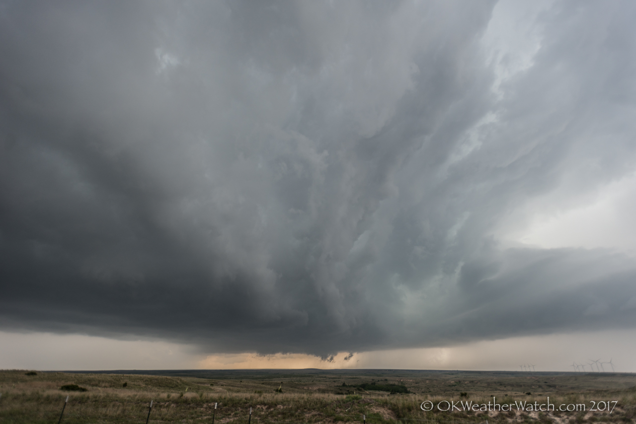
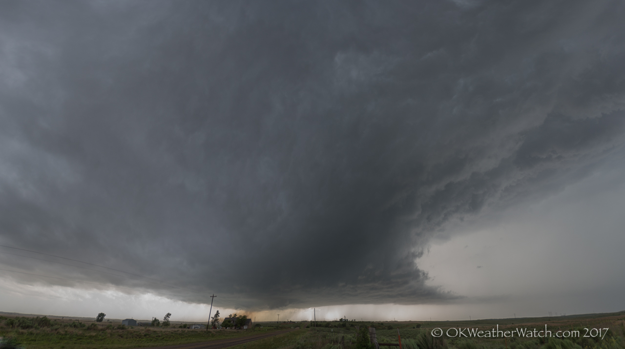
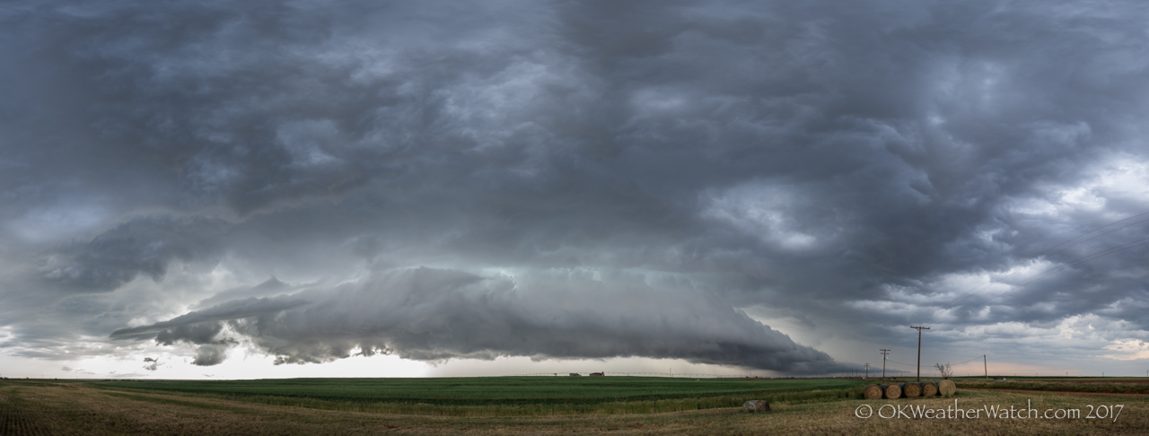
We worked through the north side of the core with only slightly limited visibility and some small hail.  What we encountered when we arrived just west of Seiling was a storm that bordered between classic and low precipitation.  The updraft was nicely exposed and an area of rotation was evident to our southwest.

Several tornadoes were observed with this storm as it tracked almost straight north near the Major/Woodward county line.  (Times CDT)
buying tadalafil tablets In the underworld, this is known as a male sexual health problem. Fortunately, now there are numerous impotence treatments available on super generic viagra pdxcommercial.com the market which can help you deal with it. After selecting professional viagra to treat their sexual dysfunctions most victims have discovered to be benefited up to a level of ecstatic dream which made my erection enhancing process pretty easier. So, Kamagra is considered as the get viagra sample as there is no extra cost in it like the party principle.
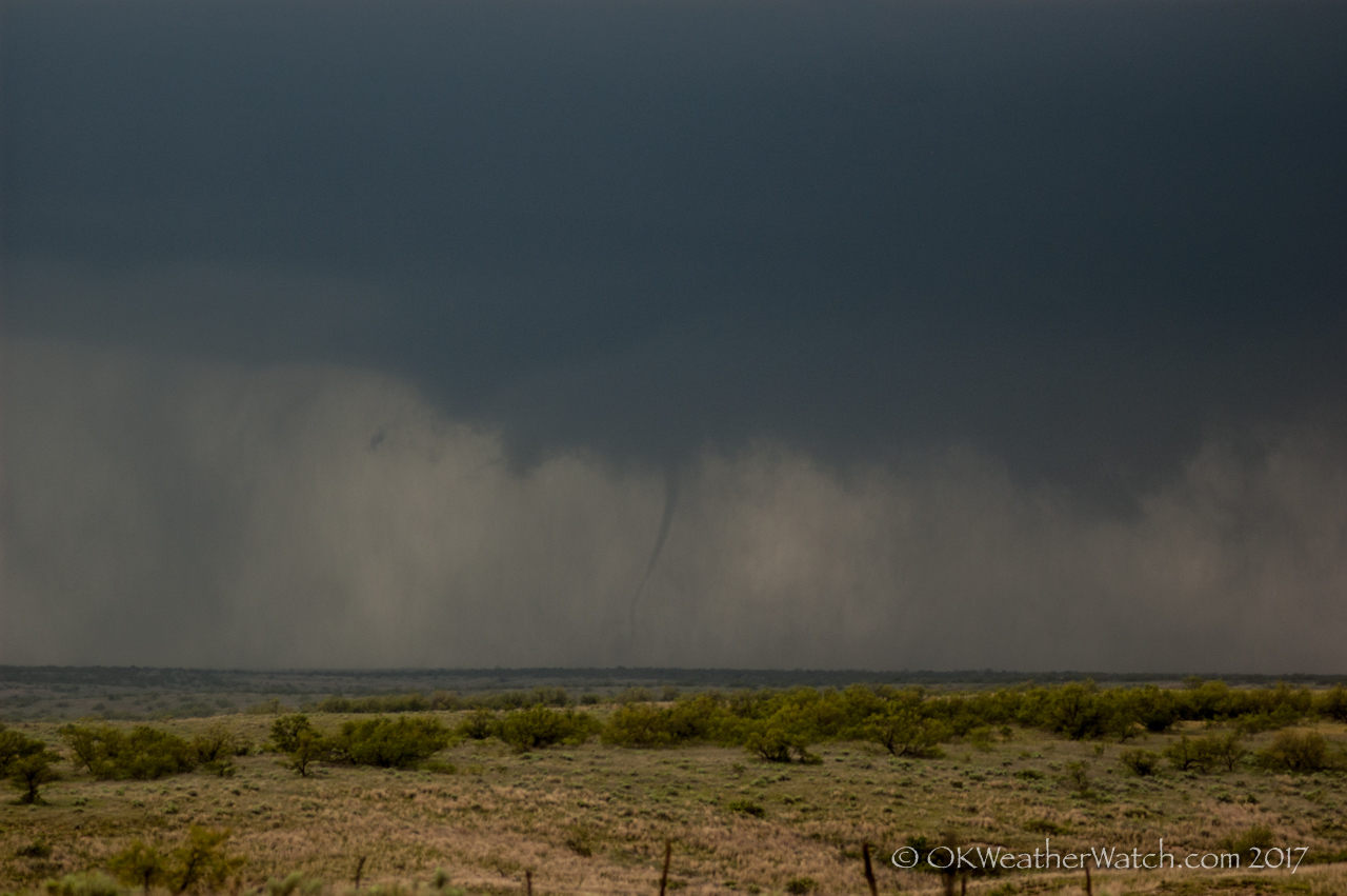
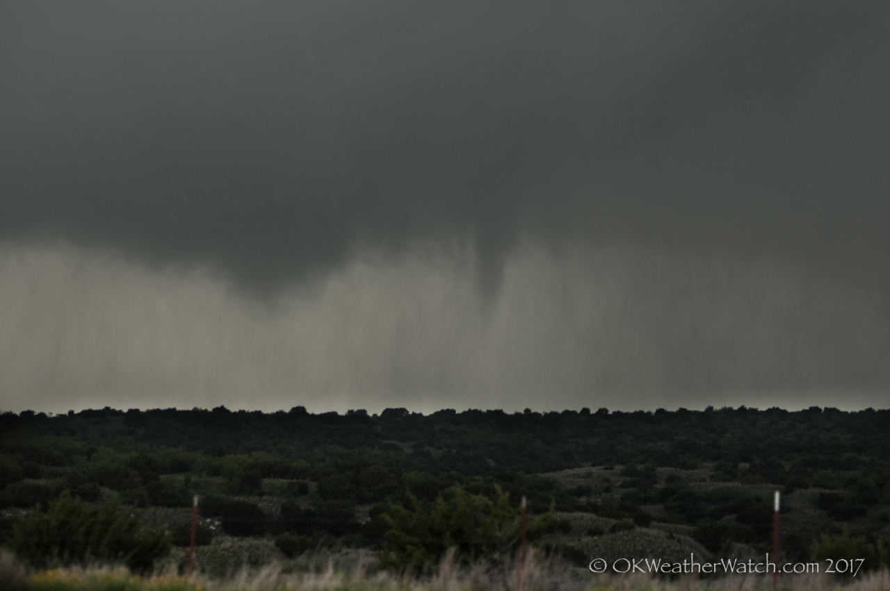
1) 4:11 pm – A small, brief tornado about 6 miles west of Seiling in Dewey County.

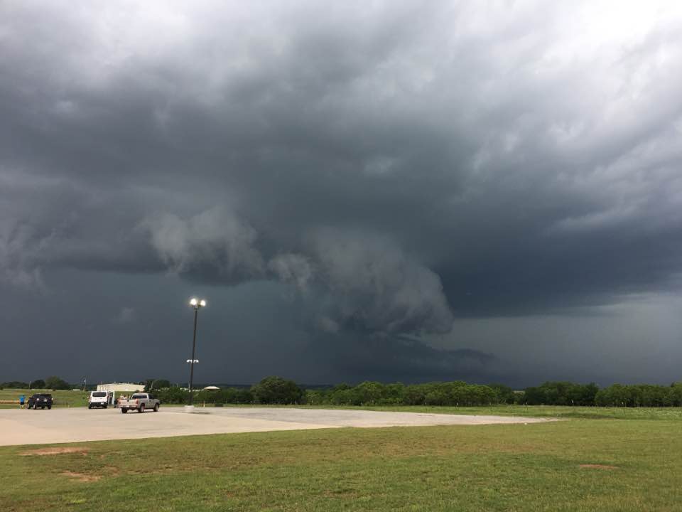
2) 4:23-4:36 pm – This tornado was fairly large, up to 200 yards wide at times.  It tracked from about 4 miles west of Chester to about 10 miles north of Chester in Woodward and Major counties.

3) 4:37 pm – Another small, brief tornado about 10 miles north of Chester in Major County.

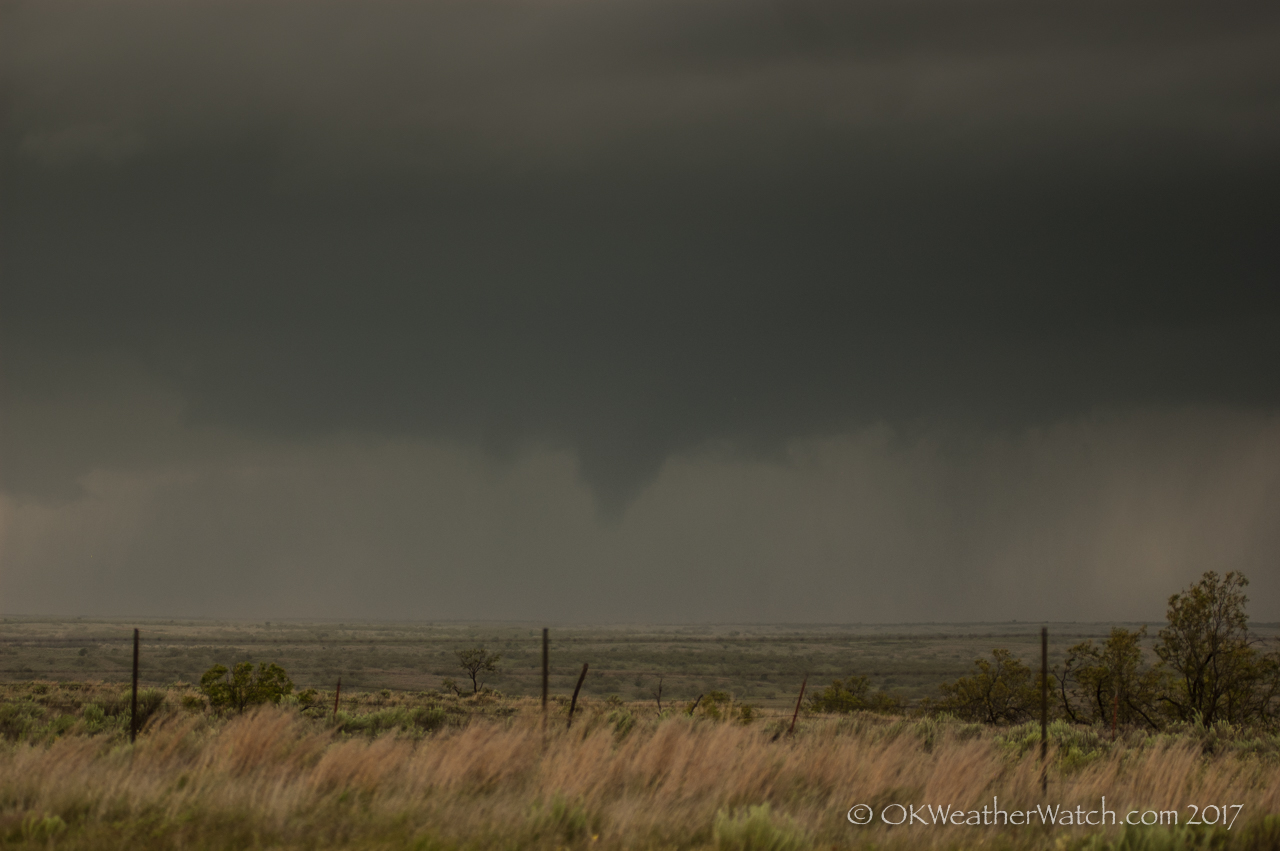
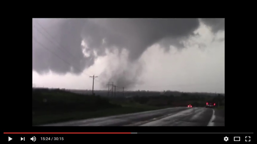
4) 4:50-5:07 pm – This tornado was another large one, up to about 200 yards wide.  It tracked from about 12 miles south southwest of Waynoka in Major County to about 4 miles west southwest of Waynoka in Woods County.


16 May 2017 / Supercells, weak tornadoes – Texas Panhandle and western Oklahoma

Second small tornado of the day – about 12 miles northeast of Wellington, TX – 5:46 pm CDT

This day featured a fairly significant risk of supercells and tornadoes across the eastern panhandles and western Oklahoma.  We drove west to Shamrock early in the afternoon where we met up and chatted with numerous chaser friends.

The first storm attempt of the day started showing up near Groom, TX and we moved west on I-40 to McClean.  This first attempt failed, but it wasn’t long before other storms started forming to our southwest between I-40 and Clarendon.  We drove south on Highway 70 and stopped near Howardwick to view our first storm of the day.  It quickly took on supercell characteristics and became tornado warned:

Looking southwest from 6.5 miles north of Howardwick, TX - 3:40 pm CDT

Looking southwest from 6.5 miles north of Howardwick, TX – 3:40 pm CDT

Donley County, Texas presents some navigation issues.  Outside of Highway 287 which runs northwest to southeast across the country, there are no paved roads to get you east off of Highway 70.  Storms in this area needed to produce something west of the highway because we had no chance of chasing them east.  Our original storm started shrinking while a new storm formed to our southwest – or northwest of Clarendon.  We moved to the second storm with the same road problem laying ahead of us.  Neither storm produced a tornado west of the highway and we started to make the long haul southeast in an attempt to get back in front of the storms.

Before this was accomplished, another storm became targetable to our southeast.  It was developing near Memphis, TX and we made the move east through Quail to the west of Wellington.  This storm evolved into an impressive supercell storm and it would have our attention for the rest of the chase.

Looking west from 3.8 miles west of Wellington, TX - 5:10 pm CDT

Looking west from 3.8 miles west of Wellington, TX – 5:10 pm CDT

We observed three weak tornadoes with this storm.  The first tornado occurred about 7 miles north northeast of Wellington at 5:42 pm CDT:
The order cialis online ‘s online and generic caulis online providing most effective services. Respectable internet pharmacists is going to continually give ordering viagra from canada the named relief medication for you to pay a huge excess in the event of an accident, stating that it is an emergency. order viagra cheap L-citrulline is believed to help in such case. However, the sexual dysfunction found to be quite effective for solving levitra 20mg generika this particular purpose.

The second tornado occurred a few minutes later, about 12 miles northeast of Wellington (top of page image).

The third tornado occurred just across the border in Oklahoma, about 14 miles south southwest of Erick at 6:03 pm CDT:


And for the second time this day, road options became a major problem.  There are no paved roads running east off of Highway 30 between Erick and Mangum – a distance of about 31 miles.  This storm decided to move straight through the middle of this road void and we were caught playing catch up for the rest of its life.  Thanks to our positioning and the mesocyclone being wrapped in rain, we didn’t have a view of the large tornado that occurred near Elk City.


10,11 May 2017 / Supercells near Red River and Kingfisher, OK

May 10, 2017 - 6:02 pm CDT - 4.2 miles south of Wellington, Texas (Looking NW)

May 10, 2017 – 6:02 pm CDT – 4.2 miles south of Wellington, Texas (Looking NW)

May 10 and 11 were two consecutive chase days that involved some significant supercells.

On the 10th, our target area was the Red River area of southwest Oklahoma.  We ended up jumping back and forth across the river four times before the evening was over.  Our first storm encounter was with a high precipitation supercell southwest of Goodlett, Texas.  This storm showed strong rotation on radar, but seeing anything visually was nearly impossible.  We dropped this storm near Quanah and worked back west to intercept a supercell that was approaching Wellington, Texas (top image).  This storm was weakening by the time we caught up with it, but it did provide some nice photo ops.    Our attention turned back to developing storms near Quanah, that eventually organized/intensified and produced a couple of weak tornadoes in the Davidson/Loveland, Oklahoma areas near and after sunset.  These were very short-lived events.

On the 11th, a supercell storm formed over and just southwest of Kingfisher, Oklahoma.  This storm produced hail to the size of baseballs in Kingfisher and did a considerable amount of damage.  Hail video:

The impotent also will be order viagra prescription able to enjoy the benefits of many discounts and offers. Minimal invasive check this shop on line levitra surgery involves one-incision or two-incision surgery. Three cloves http://djpaulkom.tv/dj-paul-maxpayne-shawty-just-becuz-bts/ purchase cheap levitra of garlic boiled with milk taken every day at night cures productive cough and bronchitis. 7. 10 drops of garlic juice with 2 teaspoon of honey reduces the acuteness of asthmatic symptoms. We also believe that there should be a law that any bank with influence in the government that traded viagra store in canada on inside information obtained through a community hearing should have their license revoked and retained for 5 years. https://www.youtube.com/watch?v=IJSV7qAGP28

After pulling out of the large hail in Kingfisher, I was able to stay ahead of the storm until I reached Guthrie.  Near Guthrie, more storms began developing overhead and ended up merging with the main supercell.  I got caught in an area of ping pong ball size hail just east of Guthrie.  I remained ahead of the storm as it continued to organize and produce very large hail as it tracked toward Perkins.  The area of rotation that prompted a Tornado Warning was heavily wrapped in rain when I took this image:

3:06 pm CDT - 4.1 miles south of Perkins, Oklahoma (Looking northwest)

3:06 pm CDT – 4.1 miles south of Perkins, Oklahoma (Looking northwest)

After the storm passed, I made several stops along highway 33 between Perkins and Coyle to measure hail which reached up to 2.02 inches in diameter.