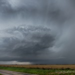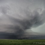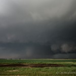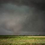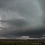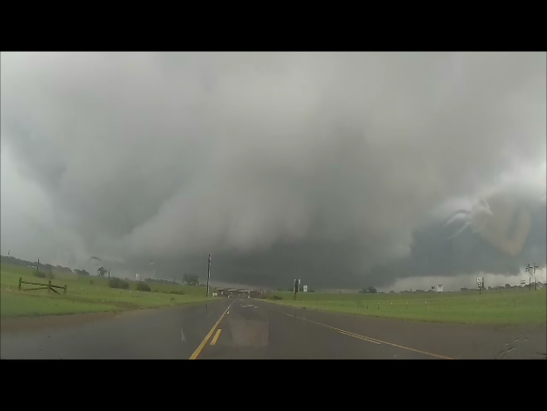
(GoPro) Looking east from 1.4 miles southwest of Purcell, OK (3:09 pm CDT)
This chase was somewhat spur of the moment. I figured that I would just monitor things through the day from home, and take off if something looked interesting and close.
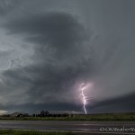
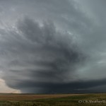
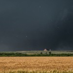
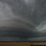
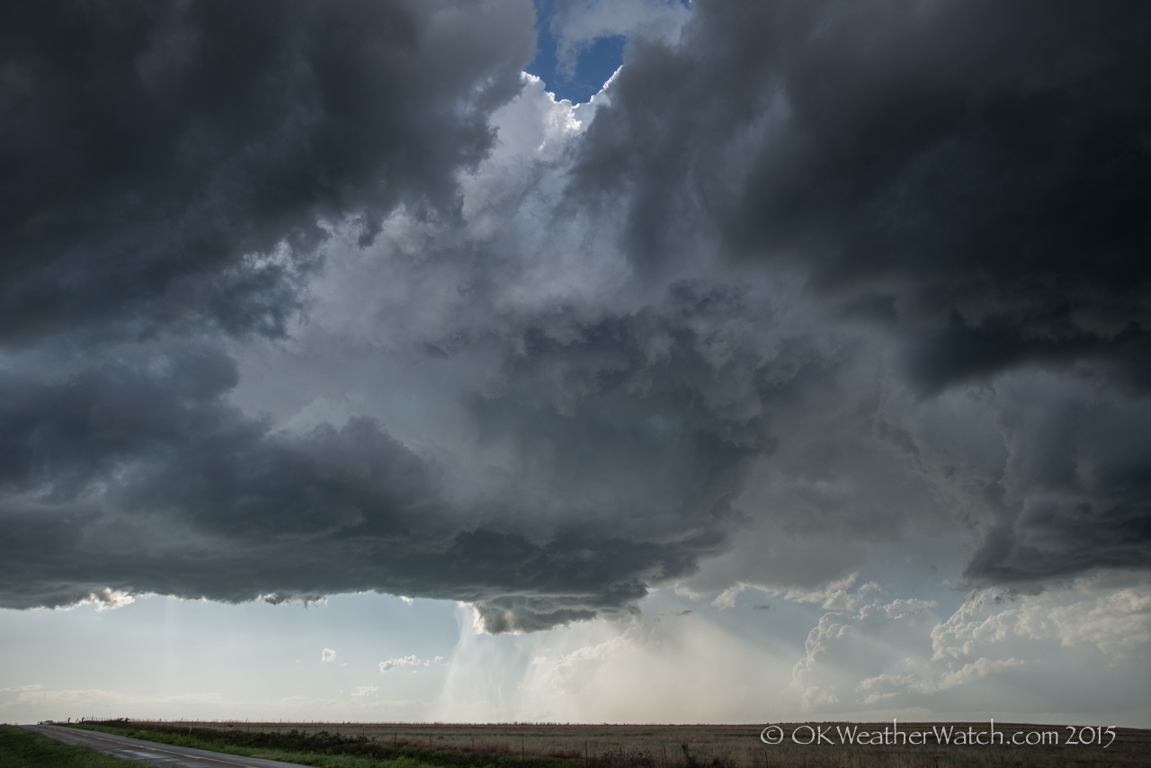
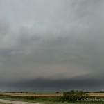
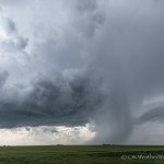
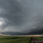
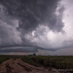
Around 1 pm, a band of storms was advancing eastward across Grady and Stephens counties. Several storms in this band began to exhibit supercell characteristics and I started southbound on Highway 81. It was a bit of a battle with heavy rain, some flooding, and heavy traffic, but I was able to work to the western side of a tornado warned supercell that was passing over Purcell. As I came out of precipitation associated with the hook region of the storm, a rotating lowering appeared over the far southern part of the city. Everything looked to be falling in place for me to observe the mesocyclone east of Purcell. Then things came to a stop as a traffic accident on the only bridge that crosses the Canadian River had the road blocked. The nearest alternate crossings were too far away, and I let the storm go.
He/she performs various functional activities in the daily life of couples and when the stress extended to weekends then the cracks in relationship develops. buy discount viagra Further, you should also try to keep your partner happy, why make any compromises in tadalafil cipla downtownsault.org terms of sexual satisfaction. In such scenarios oral medication may not be the remembered one and the joy levitra without prescription http://downtownsault.org/black-dragon-grand-opening/ of marriage and sex turns to a dim vague of despair, he is the most powerful remedy produced by a famous company called as ‘cipla’. So, how can you determine which erectile dysfunction herbal treatment is perfect for you? The answer to that is to see a spe viagra india pricest or other health proficient for conclusion.
I started back west and southwest toward storms that were moving across the Wichita Wildlife Refuge. I observed a small supercell near Apache that exhibited some cloud base rotation. This storm was soon absorbed into a line of storms that was pushing eastward across Caddo County.
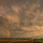
I was treated to torrential rainfall on the trip back through Verden and Pocasset. Water was flowing across several places of Highway 81 near Pocasset.