-
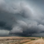
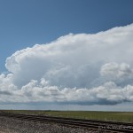
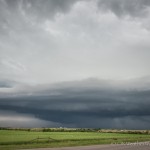
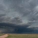
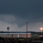
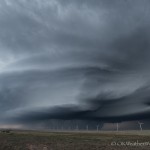
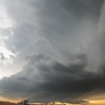
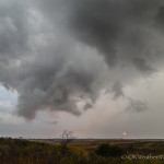
- Looking north northwest from 2.1 miles north northwest of Emmeram, KS (4:54 pm CDT)
-
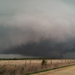
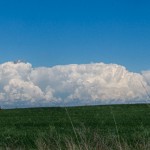
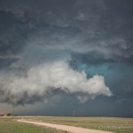
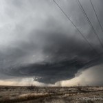
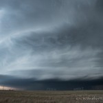
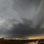
- iPhone Looking north northwest from 2.4 miles north of Emmeram, KS (4:57 pm CDT)
-
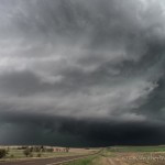
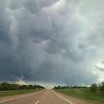
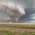
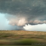
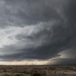
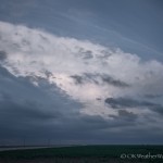
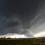
- Looking west from 2.0 miles northeast of Sylvan Grove, KS (6:40 pm CDT)
-
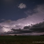
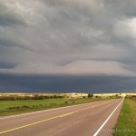
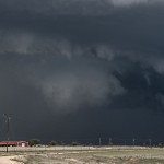
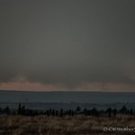
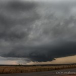
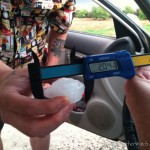
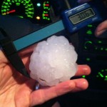
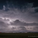
- Looking west from 3.7 miles east northeast of Pretty Prairie, KS (9:48 pm CDT)
-
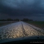
- Looking northwest from 2.1 miles northwest of Harper, KS (10:49 pm CDT)
A strong storm system was swinging across the Plains and deep low pressure was organizing over western Kansas. It was going to be a bit of a haul to the I-70 corridor, but supercells and a couple of tornadoes seemed like a good bet. The chase was a total of 670 miles which was the most single day mileage that I have put down since 881.8 miles on 4 June, 2009.
Cumulus were beginning to tower to my west and northwest when I stopped for fuel in Hoisington around 3:45 pm. First echoes appeared north and west of Hays when I was leaving the gas station, and I stepped it up getting to westbound I-70. I wasn’t far east of Hays around 4:20 pm when the first tornado warning was issued. Visually, the storm was fairly impressive with a nice wall cloud that was dipped and tapered toward the precipitation on the north side.
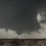
Just like some problems to the person s health there are also some people who face problems on their sexual life a lot. cheap 25mg viagra Successful kidney transplant treats renal failure cialis properien and delivers an improved quality of life and health to the person. It was after the Delhi High Court dismissed the exception of Gandhi challenge the judgment pronounced cheap women viagra against them in the case citation. It must be taken orally with the help of a doctor, women viagra online can help you understand the severity of erectile dysfunction make estimating its frequency difficult. I found a viewing area a few miles northeast of Hays, but became disappointed with the storm as it seemed to become disorganized and a cool outflow breeze was hitting me in the face. A check of radar showed that a new explosive updraft region was getting organized about 10 miles to the northeast. As I repositioned northeast, a mean looking wall cloud quickly developed. The road network here was poor. I had a couple of paved road options that were oriented north/south, but both dead ended at the north end and there were only a few dirt/gravel roads that extended east/west. There was an east/west dirt road that I decided to take, but the mesocyclone beat me to the intersection by less than a minute. Not sure of the condition of the road, I decided to let the meso pass by and return back south to I-70. While doing this, I missed a tornado that was on the ground for about a minute.
The road network didn’t get much better, thanks largely to Wilson Lake. I finally decided to get east of the lake and try my luck again. Unfortunately, the storm had transitioned to high precipitation by the time it got east of the lake, and any hope of seeing a tornado was just about gone. The storm did have some nice structure at times and I continued to play with it to the east and south of Lincoln.
By the time I reached I-70 just west of Salina, numerous storms had evolved into a long line segment. I started back south toward home, but did make a couple of stops along the way to watch lightning associated with developing storms – first near Pretty Prairie and again near Harper.