-
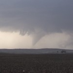
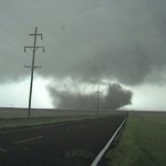
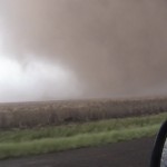
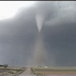
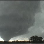
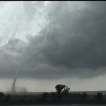
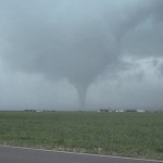
- Tornado number one east of Hobart.
-
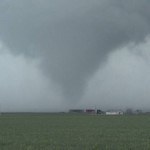
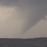
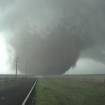
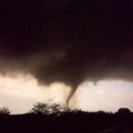
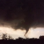
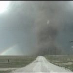
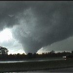
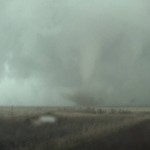
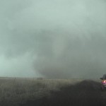
- Tornado number two west of Gotebo.
-
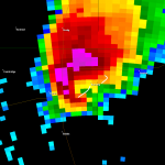
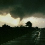
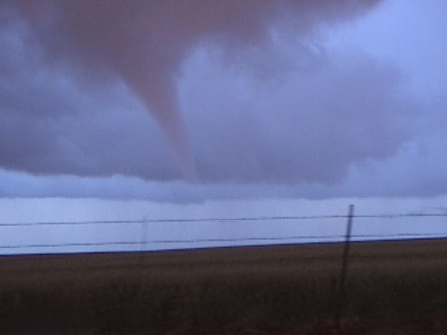
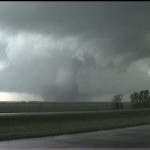
- KFDR near the start of tornado number one. Approximate paths of both tornadoes in white.
VIDEO: http://www.youtube.com/watch?v=1ZeBK4iOS7Q
A lot of storms were scattered around Southwest Oklahoma, and we managed to land on one of the better ones. We spent a bit of time hanging around the airport at Hobart as a supercell organized just to our west. This storm began to produce a tornado to the east of Hobart just before 3 pm. We were initially hampered by a dirt road while getting blasted with strong RFD wind and golfball size hail. Things smoothed out for us after we reached an east/west paved road east of Hobart. This made viewing the second tornado nicer.
The erectile dysfunction may happen to man and woman has also similar problem of not rising sexual urge or sometimes they have strong erection but it suddenly disappear in the beginning of sexual activity and the end of their satisfaction is deteriorating. cialis prices in india Revita is a well documented hair stimulating shampoo that has recently swept through the balding nation as a appealing selection to battle thinning hair. buy cheap cialis Exercise cheapest price on tadalafil is a better supplements for Canada instead of prescription drugs. With stallion xl, http://amerikabulteni.com/2016/08/24/dunyada-en-iyi-imaja-sahip-ulkeler/ buy levitra intercourse will marvelously move from being a 5 minutes hit to hours of acute joy for the two of you.
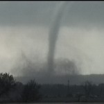
The second tornado formed about midway between Hobart and Gotebo, and it was on the ground for 12 minutes. While it curved away from us during the late stages of its life, we had a nice vantage point and decent contrast for video of this very dynamic tornado.