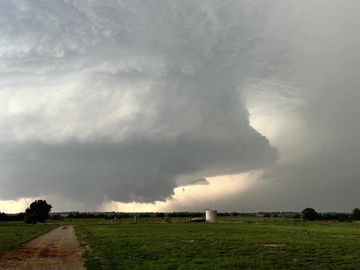
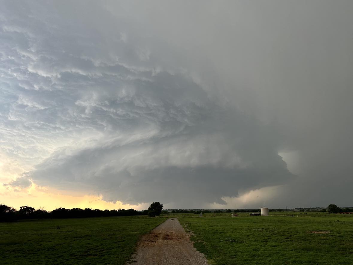
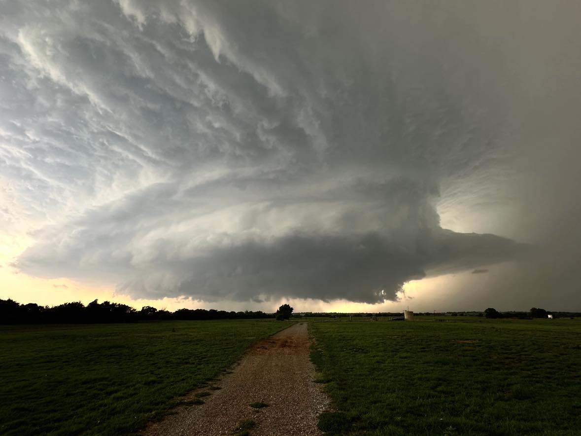
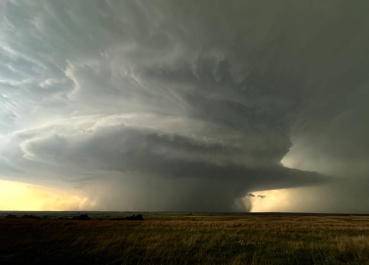
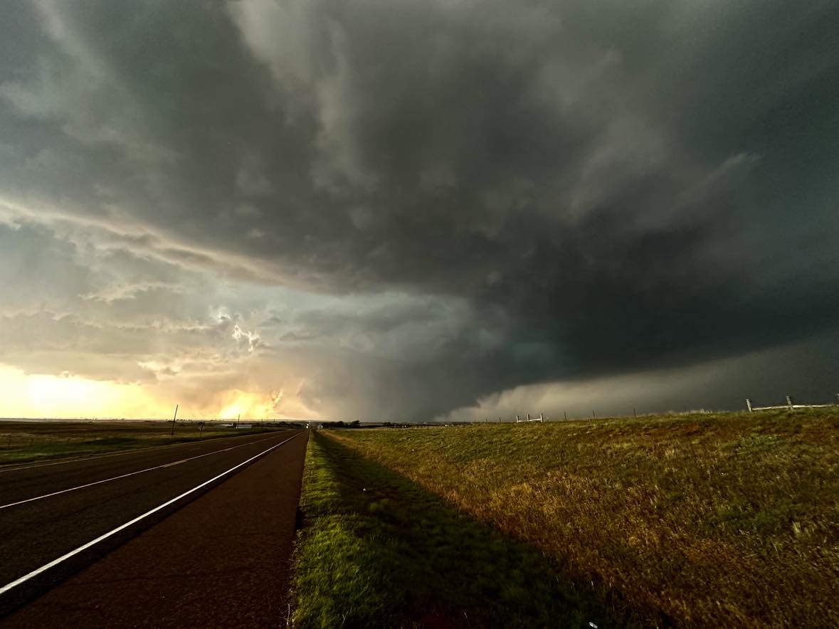
The most significant risk for widespread storms was in Kansas, but our bet on a southern cell being more isolated paid off beginning in northwest Oklahoma. Our target storm developed just west of Oklahoma between Higgins and Allison and quickly organized into a supercell… with rotation noted on radar by the time it reached the border. The beautiful supercell tracked slightly south of due east and the following images were captured from 5 miles east of Roll… looking west… between 5:48 pm CDT and 5:56 pm CDT:
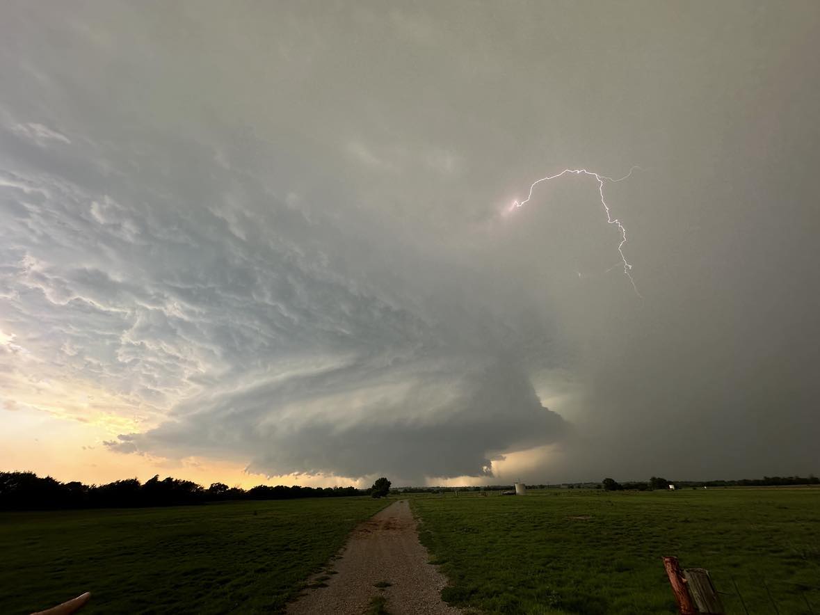
At 5:57 pm, a brief funnel cloud formed:
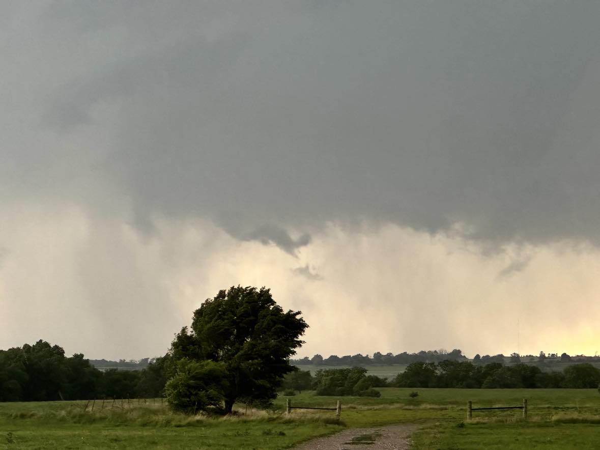

At this location, we could also observe a left moving storm to our south which could have caused issues with our storm, but it managed to stay just east. Looking south at 6:47 pm CDT:
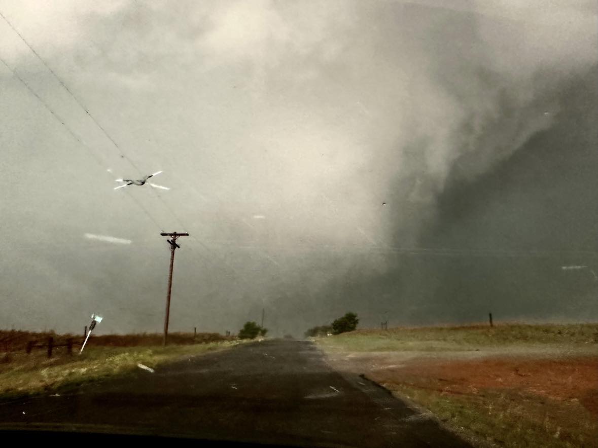
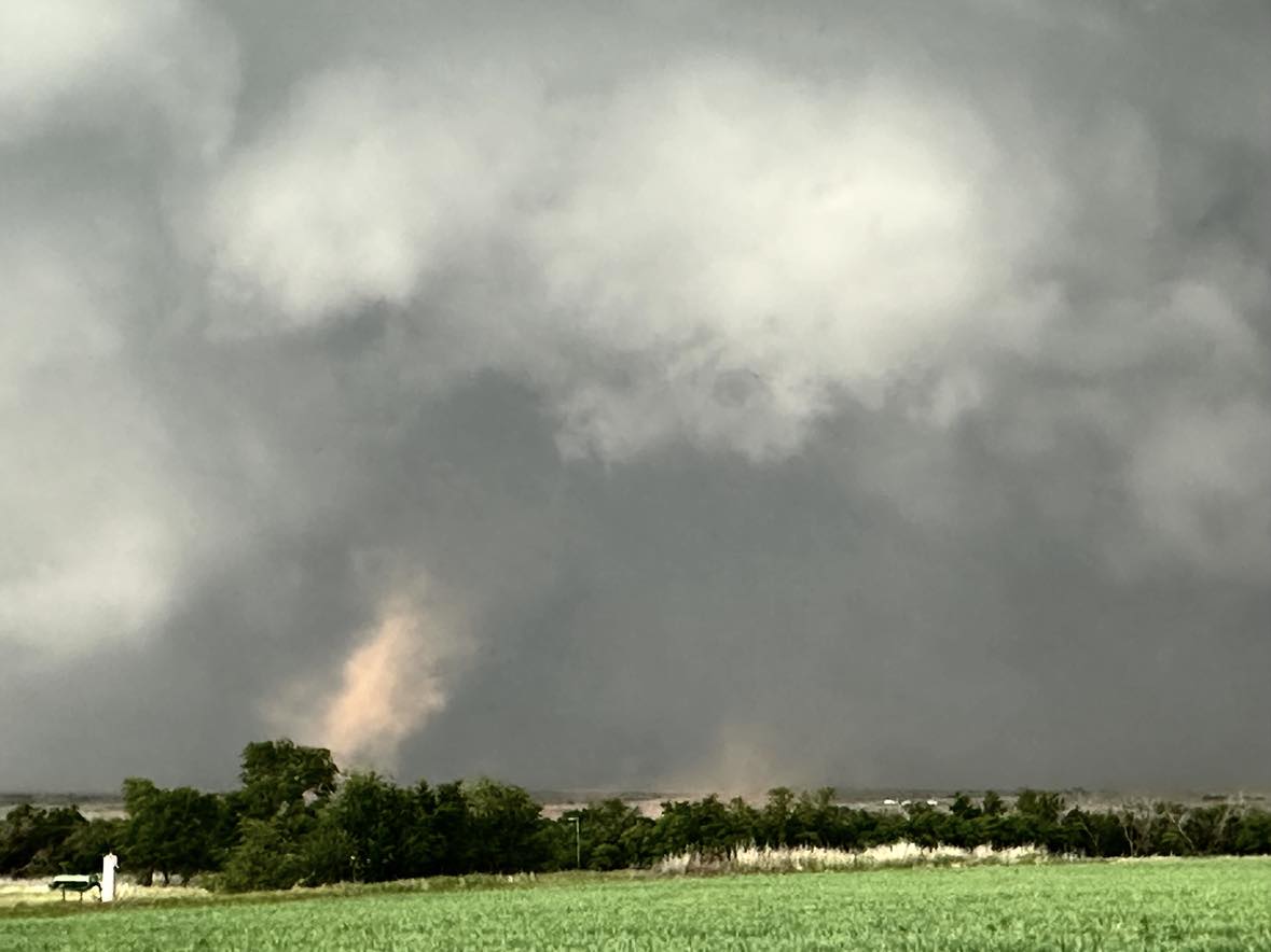
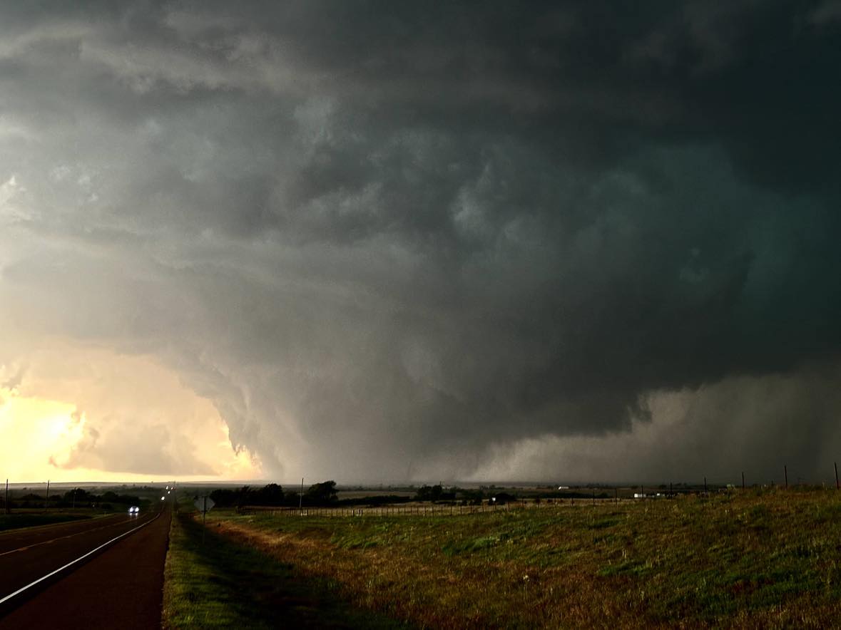
A large tornado ended up forming west of Custer City and we stopped 2 miles west of the town to observe it to our west. Images from between 7:34 and 7:37 pm CDT:
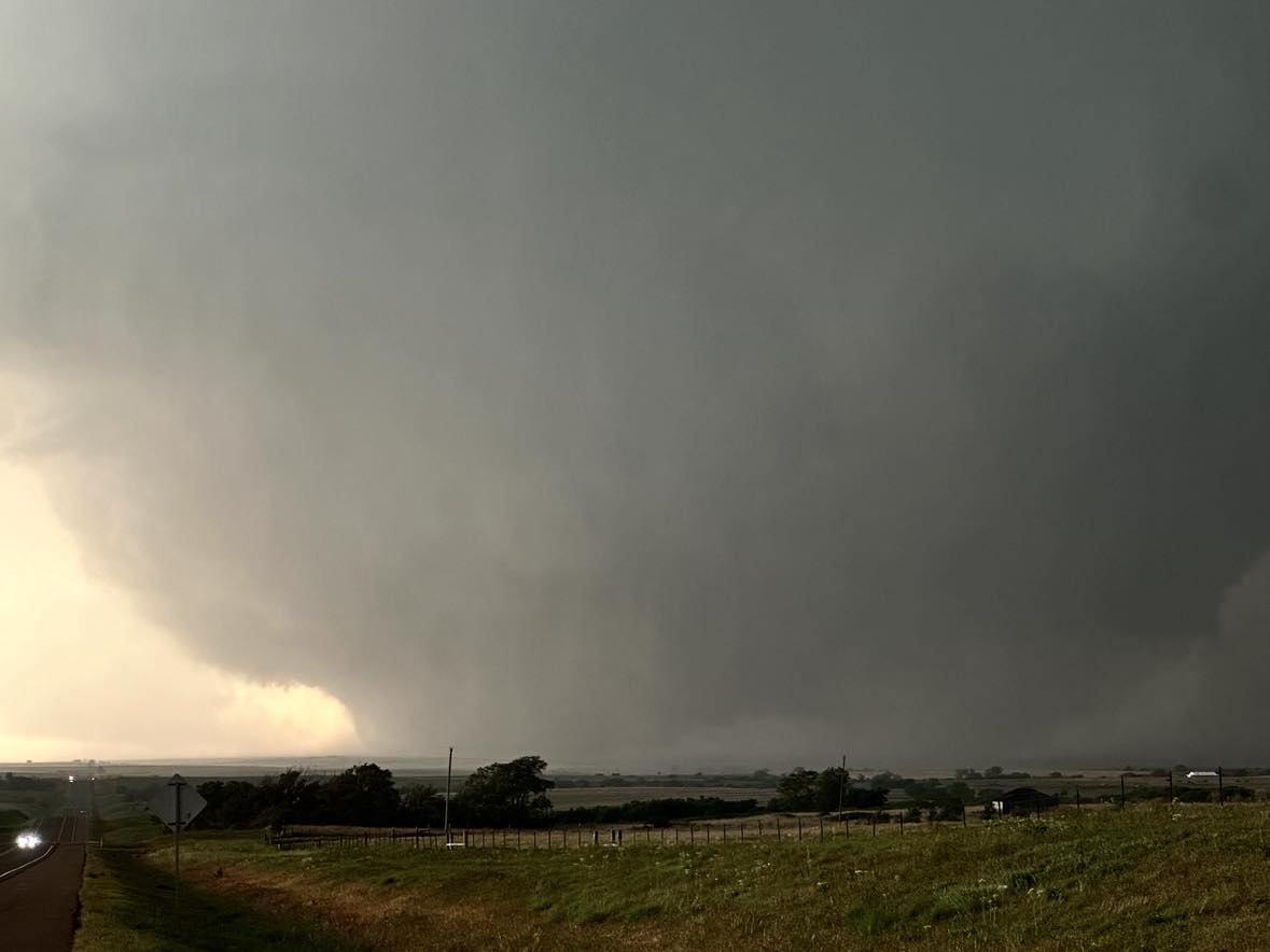
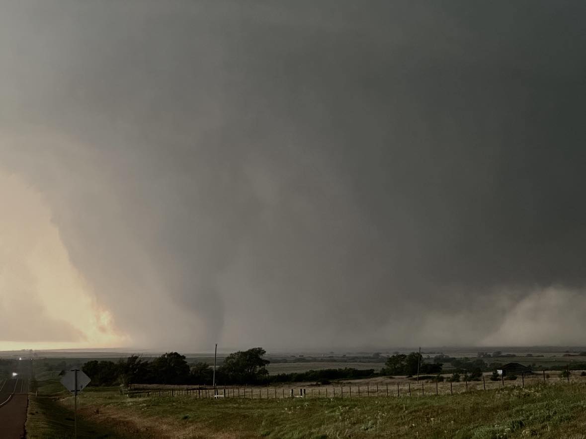
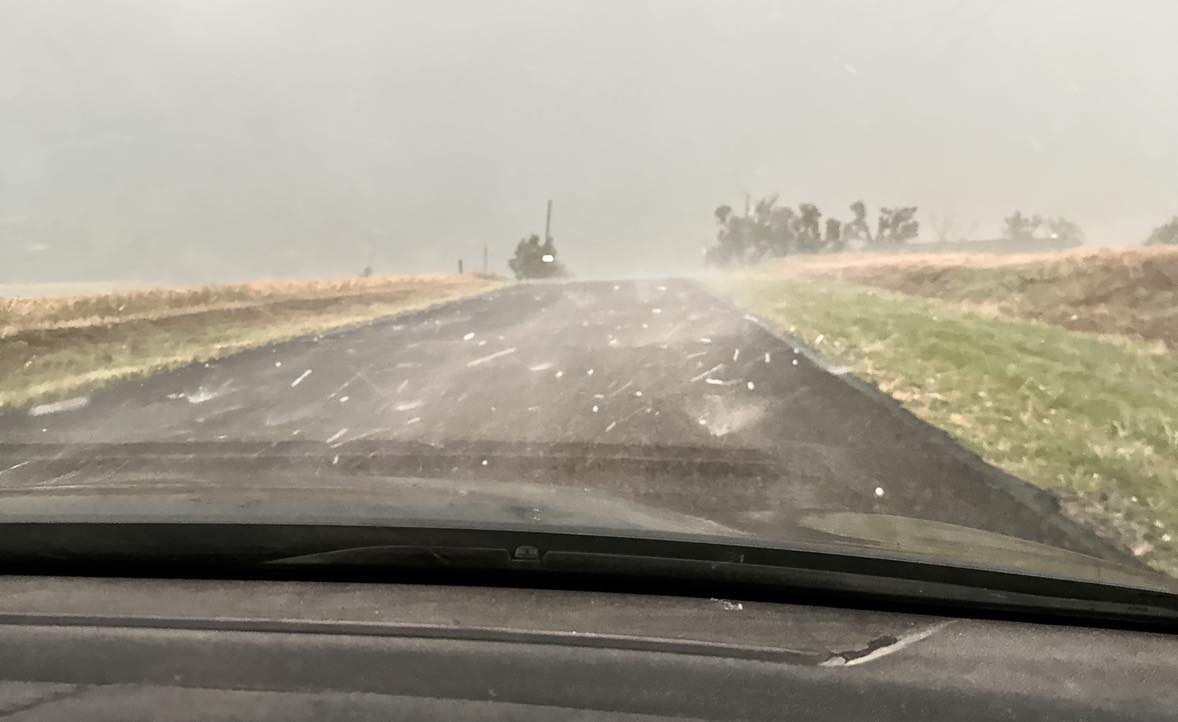
Farther east, we observed another large tornado to the north northwest of Weatherford between 8:05 and 8:10 pm CDT. In the process we took a good beating from hail larger than golfball size. From 6 miles north northwest of Weatherford: